

CAPE
-
Posts
36,283 -
Joined
-
Last visited
Content Type
Profiles
Blogs
Forums
American Weather
Media Demo
Store
Gallery
Everything posted by CAPE
-
He has always had problems locating the ball, but its worse this season. He usually seems to have good coverage- right there to make a play- but doesnt do it or gets a PI. Probably not fixable at this point. He doesnt have the knack.
-
Agree. That's why at range I rely on the mean. Look at the 24 hr precip and temps and 24 hour snow and that gives the best indication of wave timing and ptype, and that's the basis of my earlier posts.
-
For now, the way it looks on the EPS is the storm on the 19-20th may end as snow- but best signal for frozen is to our NW. The following wave for the 21-22 window is by far the stronger signal for frozen in our region. eta- the 6z GFS has the same idea
-
Low of 21 Looks like today will be the first above freezing temp here in a week. 32 is the highest on my station since snow has been otg.
-
Solid signal for the 21-22nd on the latest EPS and GEFS.
-
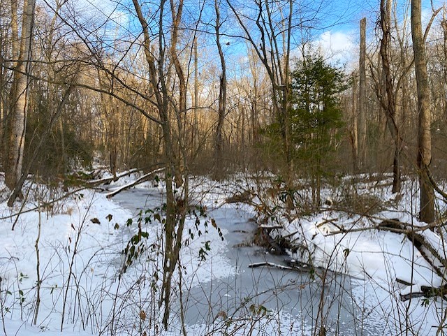
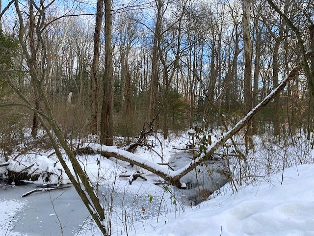
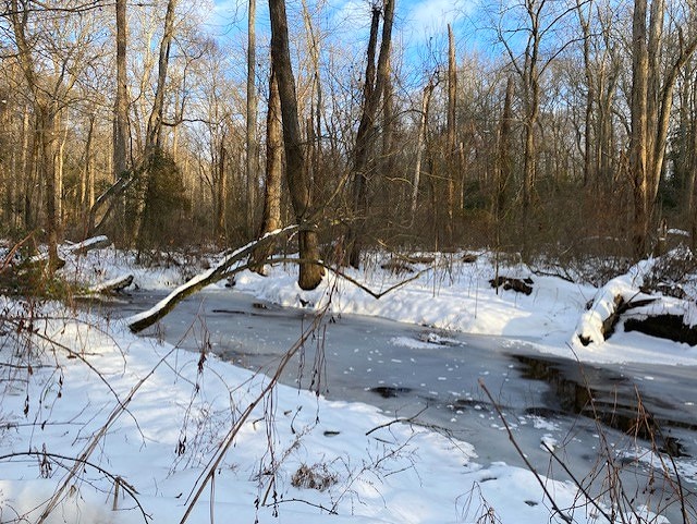
A few pics from a hike at Tuckahoe late Saturday afternoon. Temp was 31 with a stiff wind.
-
Its pretty close to something good on the 21st. And the GEFS has been liking that window.
-
Lucky for us the overwhelming Barney cold look some of the op runs like to advertise at range almost never materializes.
-
The damn avocado is back on the 0z GFS. It loves that shit.
-
He lives in a a rain shadow. A precip killing, dry downsloping hole. I can buy it. Probably does well with big wrapped up coastals with easterly flow when I'm getting rain and sleet.
-
We might need a flizzard/snow squall redux thread for mid week.
-
Most likely going to be at Buffalo next week. I know the Ravens manhandled them in the 4th game of the season, but it wont be so easy this time. Would be really nice to have Zay back.
-
Nice defensive series. O should be able to milk this clock now
-
How about throwing a quick slant or a screen?
-
Wayyyy too conservative in the second half.
-
Yes exactly what the Steelers know they are going to do. Come on dude.
-
Steelers are stacking the LoS knowing the Ravens are just going to run. Bateman has to be like wtf.
-
WTF is Monkon doing here?
-
Ravens offense cant afford to slip up here. Steelers feeling it a bit now.
-
Secondary broke again
-
No more break downs in the secondary please. Saw enough of that shit the first half of the season. Unfortunately there is just no hiding the liabilities of Brandon Stephens.
-
I didn't like how the Ravens offense came out and just ran the ball to start the half. Not quite time to try to milk the clock yet. Now the Steelers D will be inspired.
-
That was way too easy.
-
Henry should get 100 in the second half.
-
I was like DONT TAKE A SACK!!! And ofc he didn't lol


