All Activity
- Past hour
-
Wind Advisory, woo! MDZ509-WVZ501-505-101915- /O.NEW.KLWX.WI.Y.0013.261011T0000Z-261011T1500Z/ Western Garrett-Western Grant-Western Pendleton- Including the cities of Bayard, Mountain Lake Park, Riverton, Oakland, Wilsonia, and Beechwood 146 AM EDT Sat Oct 10 2026 ...WIND ADVISORY IN EFFECT FROM 8 PM THIS EVENING TO 11 AM EDT SUNDAY... * WHAT...East winds 20 to 25 mph with gusts up to 50 mph expected. * WHERE...In Maryland, Western Garrett County. In West Virginia, Western Grant and Western Pendleton Counties. * WHEN...From 8 PM this evening to 11 AM EDT Sunday. * IMPACTS...Gusty winds will blow around unsecured objects. Tree limbs could be blown down and a few power outages may result.
-
It's ridiculous for anyone to make a post like that, a couple of Octobers ago we had a month with ZERO rainfall that was the warmest October I have ever experienced and the warmth lasted right into the first two weeks of November when it hit 80 degrees multiple times even at JFK. That record will be very tough to beat. Chris how is it possible to have frost at 38-39 degrees? That's been the low here the last two mornings and I had a light frost on my roof both mornings. I'll see if I can post some pictures. Edit can't post photos maximum file size allowed 128.78 kb lol. The mornings are cold though and it's too windy duringthe day. I'm still trying to figure out what to set my individual thermostats at to maximize efficiency for heating. I have 17 thermostats here and what I've done so far is to keep the 4 bathrooms the coolest because they require the least amount of heat. Here is my heat map: 2 thermostats at 50 2 thermostats at 60 4 thermostats at 65 4 thermostats at 68 4 thermostats at 70 1 thermostat at 73 That averages out to exactly 65 degrees across 4048 sq ft. That last one is my bedroom thermostat it has to be the warmest! I also have three propane fireplaces downstairs but haven't used them yet. Two of the rooms downstairs are high vaulted ceiling two story rooms so their heat comes upstairs they contain two of the fireplaces. It's extremely difficult to hit 100 in the middle of summer why would it ever happen in February? This is nothing lol I made a special end of season post in the Yankees thread that covered 40 posts. And another one in the MLB thread that covered 15 posts. So that's a total 75 posts in 3.
-
Upper 40s here. No fake. Been nice to use least amount of energy as possible. Haven’t come close to needing heat.
-
Yup, another soaking coming, on a Sunday yet again.
-
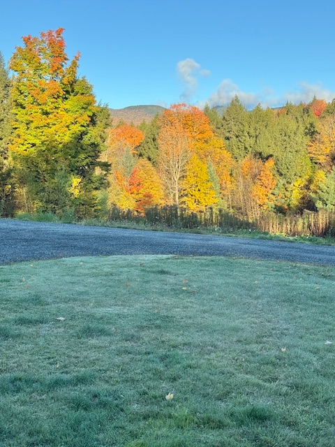
31F with solid frost again. This weather on the holiday weekend, going to be a gong-show in the leaf peeping spots.
-

2026-2027 Fall/Winter Mountain Thread
Rainforrest replied to BlueRidgeFolklore's topic in Southeastern States
Wind is really picking up here along the escarpment. 51 with on and off rain. Picked up .34 so far. -
That was us last week, ha. Evaporational cooling is awesome.
-
 Lopressor dosage strengths: metoprolol side effects first week - metoprolol succinate er
 -
can i take magnesium with gabapentin and medicamento gabapentin para que sirve first time gabapentin high http://www2.pure.cc/~mikimomo/zaccess/acc.cgi?redirect=http://neuroreliefdirect.com gabapentin for radicular pain or http://lenhong.fr/user/qxkdcyrqan/ gabapentin pills [url=http://www.freerepublic.com/~wilik4/links?U=https://neuroreliefdirect.com]gabapentin 100 mg once a day[/url] gabapentin pregabalin equivalent dose or [url=https://kamayegaindia.com/user/wfxahogndz/?um_action=edit]gabapentin manufacture[/url] fluoxetine without rx
-
The only way we see a change to snowier outcomes here is if the tropical forcing changes which may coincide with the shift west of Nino. Otherwise it’s warm all over and around the El Niño regions. Not sure how much it matters if it shifts west as long as the MJO shifts too.
-
can i take magnesium with gabapentin and medicamento gabapentin para que sirve first time gabapentin high http://www2.pure.cc/~mikimomo/zaccess/acc.cgi?redirect=http://neuroreliefdirect.com gabapentin for radicular pain or http://lenhong.fr/user/qxkdcyrqan/ gabapentin pills [url=http://www.freerepublic.com/~wilik4/links?U=https://neuroreliefdirect.com]gabapentin 100 mg once a day[/url] gabapentin pregabalin equivalent dose or [url=https://kamayegaindia.com/user/wfxahogndz/?um_action=edit]gabapentin manufacture[/url] fluoxetine without rx
-
2026-2027 Fall/Winter Mountain Thread
Buckethead replied to BlueRidgeFolklore's topic in Southeastern States
Power outages covering the border from 26 to 19w this morning. Lots of fresh leaves on the ground. Sent from my SM-S948U using Tapatalk -
January on the JMA is vomit worthy.
-
39 was the low here.
-
Could be a good drink tomorrow night. Maybe some thunder south coast.
-
Give it up. Stop clogging this thread.
- Today
-
This one certainly came into the coast stronger than a lot of folks expected, and will still have some some substantial damage across the FL coast (mainly surge impacts as well as wind damage in localized areas). The part of this storm that busted completely is the tornado risk…there were a lot of honks this would have quite a few spin ups associated with the storm…reports are basically nonexistent.
-
37 degrees this morning.
-
Last post I promise- I’ve already derailed the thread enough lol I had nearly a foot of rain and half the homes in our development flooded from Isaias 2020 ( @BlizzardNole remembers this). There were three tornadoes in SOMD that all caused damage too- one was just a few miles north of our house (at the time). I just get angry at the names that are retired or not retired (Gordon still being a name after what it did to Haiti in 1994 is another ridiculous one). Anyway, I hope we get some rain from this. My recently planted grass seed needs it.
-
Looks like Mehsaias.
-
It seems like we always have to beat it into people's skulls during landfalls. It's the maximum sustained winds possible as an estimate over water for a reason. It's a marine storm before it is a land storm, and advisories have to account for what is occurring in real time over the ocean surface for any poor ships/souls that might find themselves in the worst scenario. But due to frictional convergence / drag, you will almost never see those sustained winds over land unless you have a super intense eyewall with embedded multiple mesos rotating around that overcome frictional forces with insane ground level velocities. As a general rule, the highest wind reports over land are always in gusts due to this process. You might get those highest sustained winds right on the immediate beach/shoreline perpendicular to the onshore motion of the inner edge of the eyewall, but the equipment would need to be in the right place at the right time and that is exceedingly difficult placement and timing to pull off. Interestingly, and as no surprise, the instrument anemometers that have been positioned in the right place and at the right time during past landfalls that recorded sustained winds near maximum have generally failed during that event. I also need to add that the reason most immediate advisory packages don't rapidly ramp down maximum sustained winds after landfall is twofold: 1) part of the eyewall or outer eyewall may still be over water, 2) any large estuaries even after landfall may still experience maximum winds. Once the entire circulation is inland, subsequent advisory packages tend to ramp down quickly.
-
Thankfully here in south ATL the winds were not a factor at all. Picked up 3.5 inches of rain so far.
-
-

2026-2027 Fall/Winter Mountain Thread
strongwxnc replied to BlueRidgeFolklore's topic in Southeastern States
GSPAFD 6:53AM Highest values have come down by about an inch, but that isn't enough to substantially change the fcst over the mtns. What is more interesting is the suggestion of a band of northward-training showers and storms will translate slowly east across the fcst area late this afternoon and this evening as Isaias makes the gradual transition to extratropical. -
Pretty solid gusts recorded with this one. 118, 116, 114, 110 were the highest I’ve seen and most of those were from the western edge of the degrading eyewall! Pensacola through Milton to Jay seem to have had a sting jet because they were not in the actual eyewall or at best on the edge and that area all saw gusts over 110. I see the usual discord of land obs not matching operational intensity (not worth arguing with those people after every storm) but this system produced widespread gusts over 100 and several recorded gusts over major hurricane strength. Also, that sustained wind of 92 being recorded is impressive. Overall, Kind of in line with exactly what was forecast…. As for LF pressure as @GaWx shows this thing was rapidly filling in as the actual center crossed the coast. As all of the eyewall was already ashore I don’t think it matters as much here but when the actual center crossed the coast as it was well behind the main convection i doubt Winds over 100 were occurring. We’ll see what surge looks like but the worst is going to be between Destin and Panama City. Panama City measuring 5.6 feet makes me worried there are going to be some 7-9’ areas to the west. Daylight will reveal that. Overall this storm was exceptionally well-forecast by NHC and with a challenging forecast, pretty early on they were advertising a dangerous hurricane at landfall. If anyone doesn’t think seeing wind gusts over 100 with some major gusts over 110 also actually recorded qualifies as a “dangerous” hurricane, not much else to say here.