All Activity
- Past hour
-
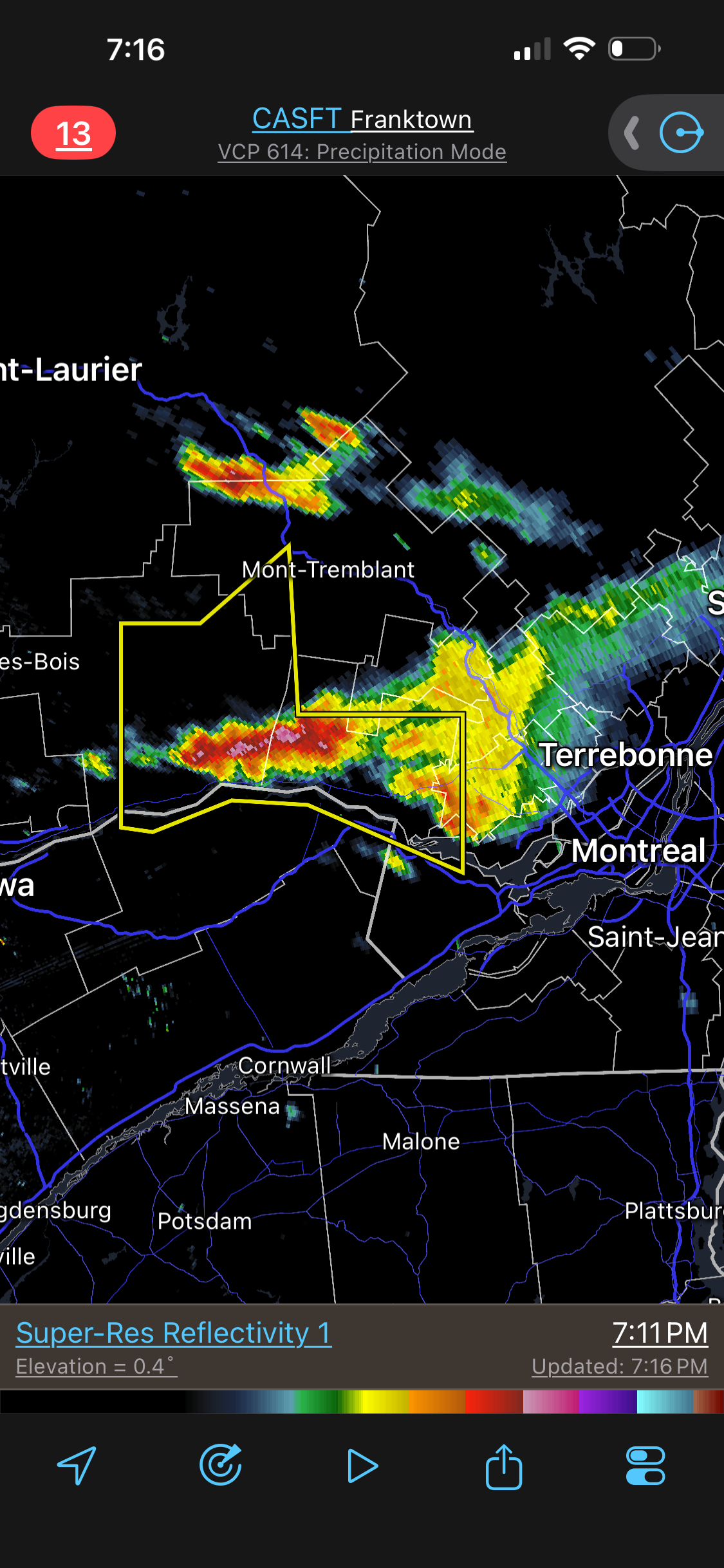
 Firing now. Was modeled to be an evening developer.
 -
.thumb.gif.f92b16c631a1d15d405ed77b33f0710d.gif) What a bust so far; bust bust bust
What a bust so far; bust bust bust - Yesterday
-
92. Nothing special. Doesn't seem to get very hot here. Hottest so far this season is 95.
-
 Yeah he’s the dude up here for on camera Mets.
 -
High of 87, no rain today.
-
 Is Jancock the main TV met up there? When I was as up there traveling they seemed to be the main tv met up. Started they career with Hammer in HFD
 -
Didn’t all the CAMs show more activity in Maine than has happened? It’s ok if it “busts”, no one saw the smoke coming. This has been a pretty hyped day, to the point that people who don’t follow weather have been talking about it up here. We were supposed to be like 90F today and instead low-80s. That has to matter. Our time in VT has always been like 9p-1a though… but like Tyler in the post, I thought Maine would’ve been lit up already.
-
Seems like a ..
-
 I never was a fan of big heat for this week… Granted, I didn’t see smoke being an issue in the day’s running up but I never liked the structure of the ridge and the way it was collapsing like that. It looked like a one afternoon of heat and then we get bullied south. Having said that even that looks like it stepping off a bit Go wonder models were just over amplified
 -
By Indy, do you mean Indianapolis? I don’t think Indiana ever had daylight savings unless they changed that
-
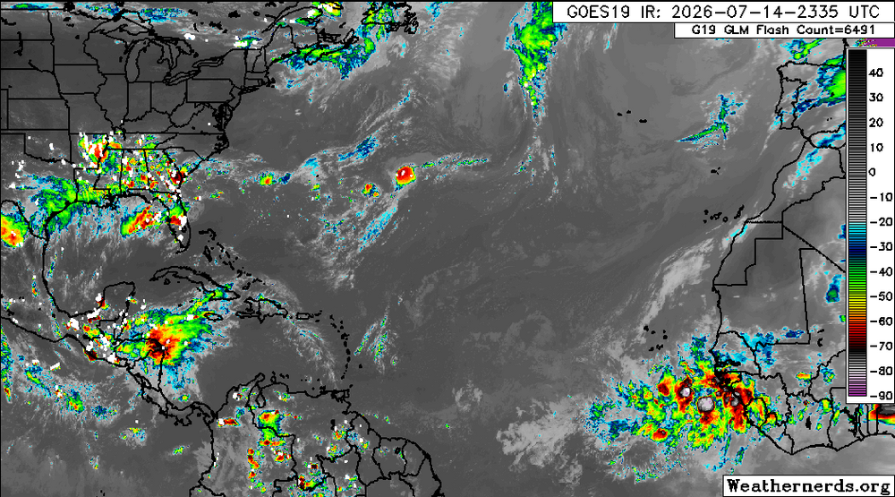
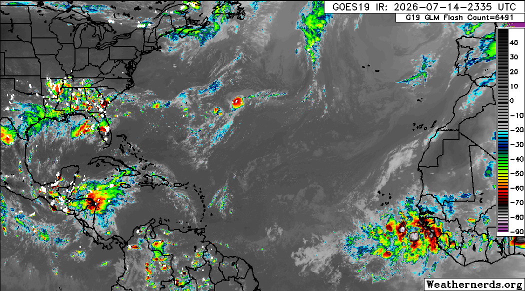
As insignificant as it is, it’s nice to finally see at least for the moment a few clouds surviving off the Africa coast.
-
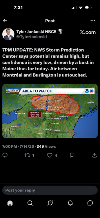
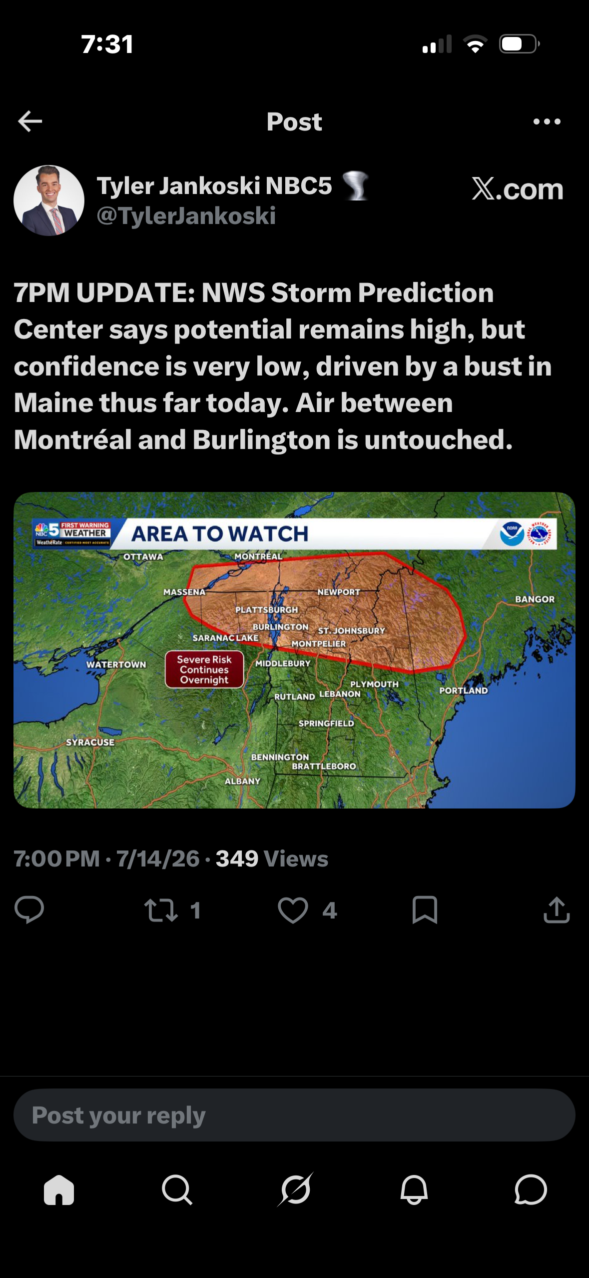
SPC is clearly hedging off though Words like “unclear“ or pretty good indicators that things aren’t really looking the way they were yesterday and how could they be… Might be about time for them to admit they were just as smoke boned as everybody else’s forecast.
-
 Bust in ME? The main show storms were always going to be late in NNE -- 7pm or later, including ME. Just delayed a bit now, either by smoke reduced max temp or just a bit slower forcing overall. The word "bust" is used *far* too often and early when things do not go *exactly* as fcst.
 -
 That stuff really got entrained and concentrated ahead of the front. Surface based stuff may be a loss, but these lapse rates could produce hail all night along with a rogue wind gust.
 -
Jancock unsure
-

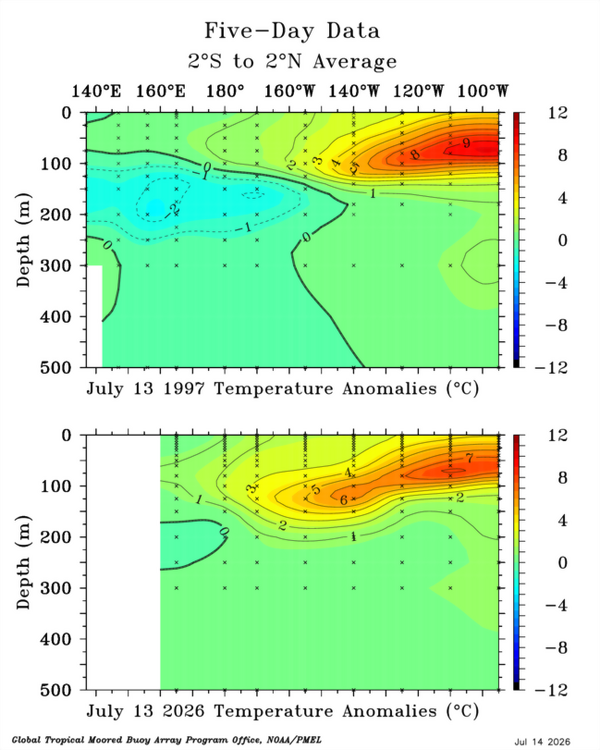
2026-2027 Super El Nino
so_whats_happening replied to Stormchaserchuck1's topic in Weather Forecasting and Discussion
We have had this since about March around here going from 80-85 then accumulating snow the next then back to the low 80s. I would say that is more of a fall feel for this area but here nor there it has been very much back and forth. Setting some record cold lows and highs within the same month. Only thing I have noticed that we are in an increasing el nino state is the lack of tropical activity and the slightest of increase in rainfall over the last 2 months around here. This will ultimately be fun to see what happens with this next subsurface feature. Again that slight distorted look we see in the thermocline is an artifact of the -PDO state still holding. Losing its grip compared to 3 years ago during the last Nino event but still present for now..thumb.gif.fbaadca50649e550ee4525ea3f57d90a.gif)
-
Temperatures will soar into the 90s tomorrow and Thursday. The potential exists for a few locations, including Newark to approach or reach 100° at the height of the short period of heat tomorrow. Smoke could hold down the readings by several degrees. Friday will also be very warm before the temperatures ease for the weekend. Showers and thundershowers are possible during the weekend. The greatest risk is Saturday night and Sunday. The ENSO Region 1+2 anomaly was +3.4°C and the Region 3.4 anomaly was +1.8°C for the week centered around July 1. For the past six weeks, the ENSO Region 1+2 anomaly has averaged +2.80°C and the ENSO Region 3.4 anomaly has averaged +1.52°C. The ongoing strong El Niño will continue to strengthen through the summer. The SOI was -36.56 today. The preliminary Arctic Oscillation (AO) was -0.083 today. Based on sensitivity analysis applied to the latest guidance, there is an implied near 66% probability that New York City will have a warmer than normal July (1991-2020 normal). July will likely finish with a mean temperature near 78.7° (1.2° above normal). Supplemental Information: The projected mean would be 2.2° above the 1981-2010 normal monthly value.
-
Total last 90? I could look on your station , but would rather not
-
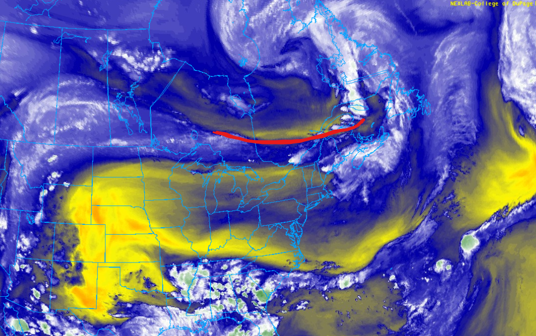
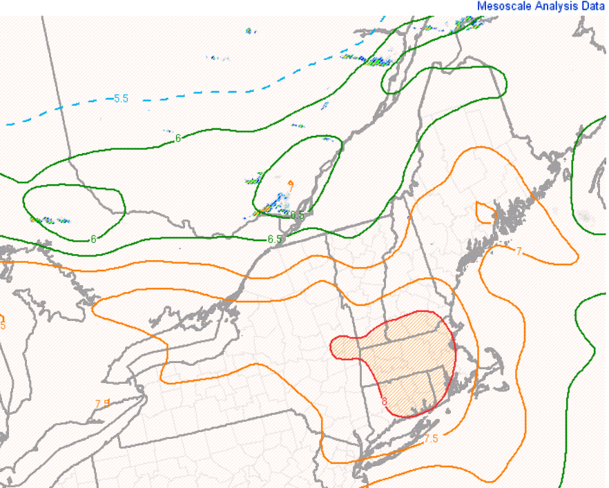
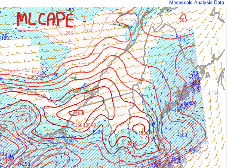
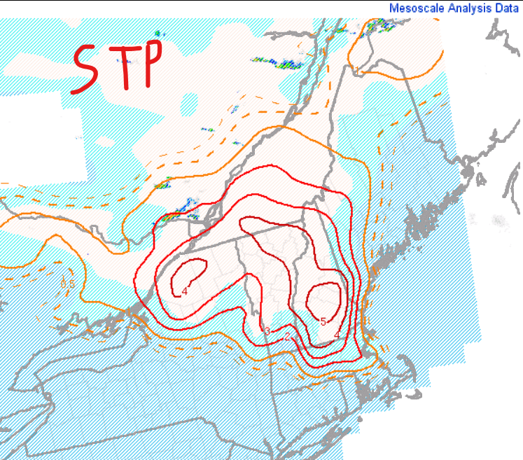
 Front/trough continue advancing south EML shunting south so cap up north so that will help weakening the capping MLCIN all but eroded with values >3000 J/KG Getting activity going...I would think things really begin taking off in the next couple hours. Don't see STP values like this here very often and these may be amongst the highest that would exist in a database if such one existed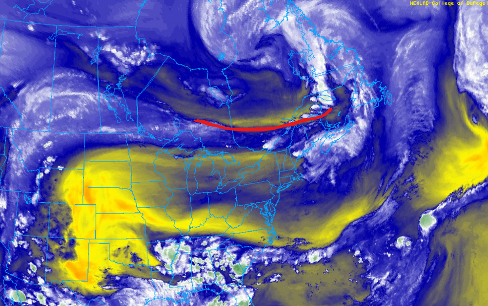
-
Got to 91. I imagine years ago, in the 60s and 70s, things would have been hotter if not for the thick smog and less days with actual clean, clear blue skies.
-
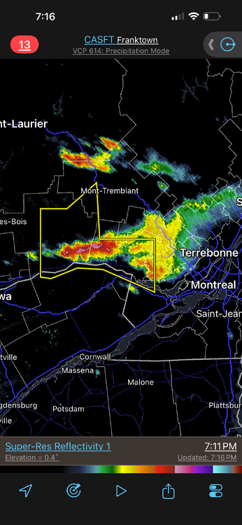
Now finally storms w/ some meat!
-
 Not kidding ..when the issue came up in 2022 the comments section in the Globe was filled people thinking there was going to be an extra hour of daylight lol
 -
 5.61” in June 0.00” in the last 12 days
 -
Never turn you back on an EML in the evening/overnight, esp. when storms fall during the day. This happens countless times in the Plains/Midwest. EML is an EML, doesn't matter where you are.








.gif.7a1f57685c45ddf34b8ee60f840bc28f.gif)