All Activity
- Past hour
-
 They have both been in the data set for at least the last couple years. Made sense to add as they both were sited at about the same location/elevations just a 1.5 mi W of Elverson on the Chesco border. Helps better even out the mix of higher and lower elevation stations.
-
 Hello. I’m looking to head to Pt Pleasant with my family either Wednesday or Thursday this week. Which day looks to be the better day at this time? Thank you!
 -

2025 Spring/Summer Mountain Thread
Met1985 replied to Maggie Valley Steve's topic in Southeastern States
Had a low of 53 degrees this morning. Saw that Mt Mitchell got down to the low 40s... -
That was for D8-14 which was this week
-

2025-2026 ENSO
40/70 Benchmark replied to 40/70 Benchmark's topic in Weather Forecasting and Discussion
Flip the WPO and poof.....it would head south again. I'm talking about on a seasonal level, not a two-week snippet in February. -

2025-2026 ENSO
Stormchaserchuck1 replied to 40/70 Benchmark's topic in Weather Forecasting and Discussion
We hit 80* on Jan 26, 2024, under a -350dm, +3-4 std +NAO. +NAO's were responsible for last Summer's heat too, and you can see how the ridge is under the Greenland trough this Summer as well. If the historical correlation is -0.5 for -NAO and +0.5 for +NAO, it's just recently been -0.2 for -NAO and +0.8 for +NAO.. but the overall flux pos/neg of the earth's circulation remains the same.. the changes aren't that great. -
Never said they are ineffective. But the effective gradient does shift north from where it has been. This is why some areas over the Great Lakes and interior Northeast north of the gradient have done better in the snowfall department than the coastal plain.
-
isn't this a complete flp flop from a week ago?
-
Low was 52.9 degrees here this morning. High was 73.8 degrees, which continues the strange trend of cool temps for the date in the past few years. The record 'cool max' is 69.1 degrees from 2023, then 73.7 in 2020, this 73.8 degrees for today, 74.6 in 2018 and 77.1 in 2016 and 2014. Average for the date is 82/60.
-
Was in Myrtle Beach last week. Had a lot of rain throughout the week. On the drive home, was checking the radar as we were passing through more showers. This system started to form along the front and had started to get the counter-clockwise spin around the low, which I thought was cool and wondered if it would have enough strength to stay together. Looks like we have Dexter this morning!
-
Hazy. More significant than this time yesterday…. Affect of a thin overcast today…big hit to to UVI at the moment….
-
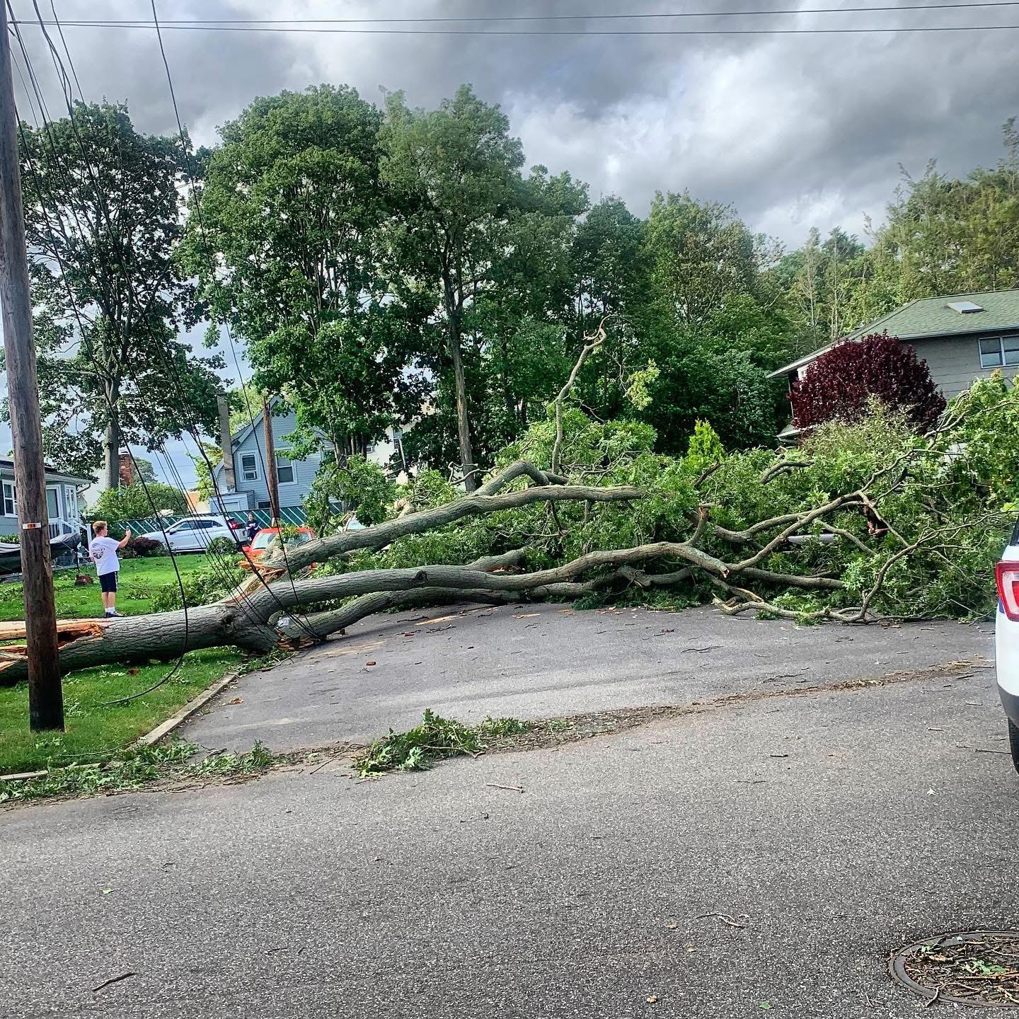
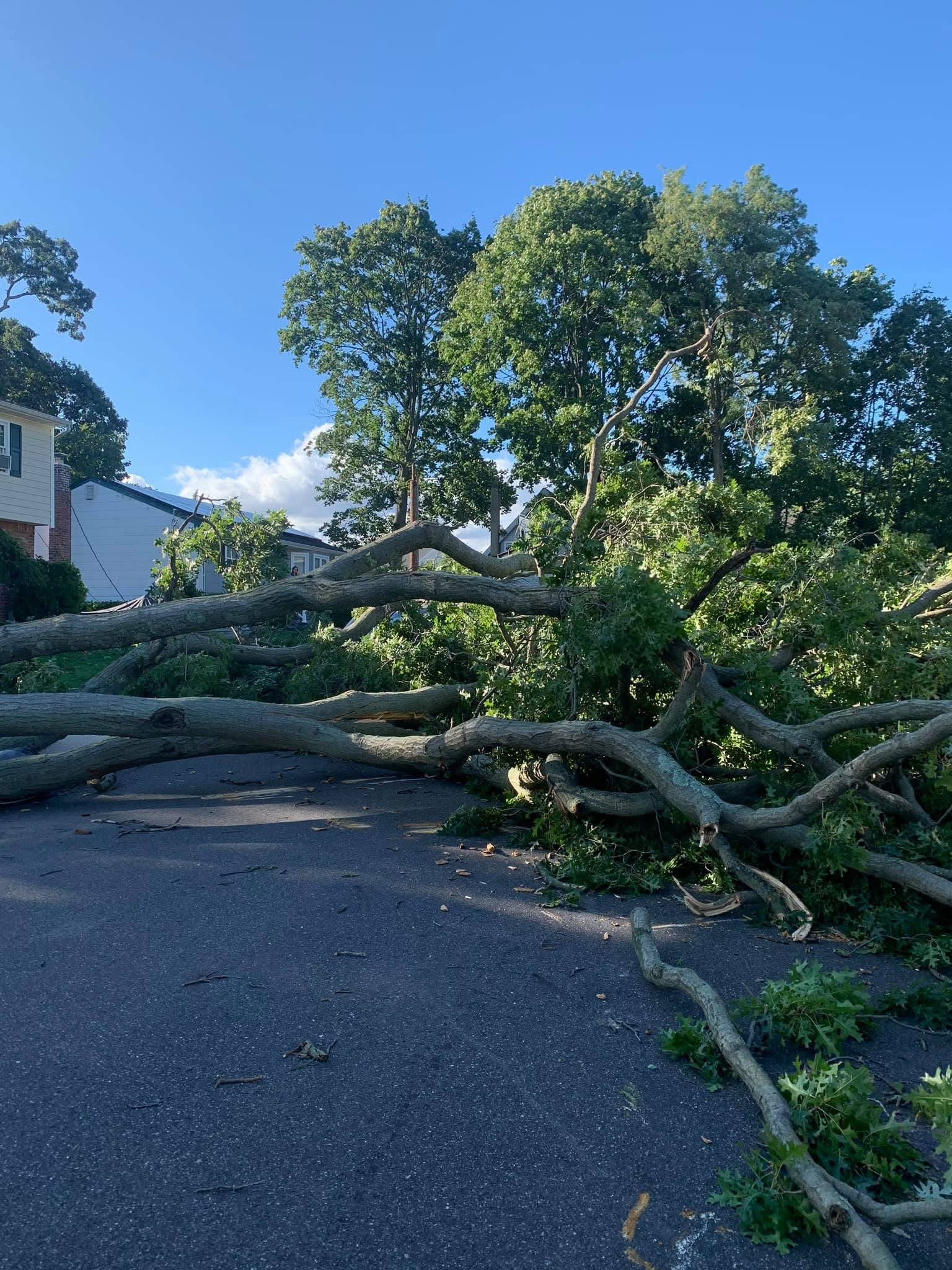
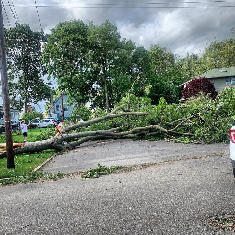
5 years ago today not a fun time we had no power for about 7 days out of state power company had to bring us a new pole because this tree snapped it in half miserable time. the tree was hollow and after it fell my property was covered in carpenter ants.

-
2025-2026 ENSO
40/70 Benchmark replied to 40/70 Benchmark's topic in Weather Forecasting and Discussion
The nuance that I mention is recognizing that although higher latitude teleconnnections may no longer rule the roost, they are not entirely ineffective, either. -
2025-2026 ENSO
Stormchaserchuck1 replied to 40/70 Benchmark's topic in Weather Forecasting and Discussion
Until a October MJO wave messes up the whole system lol -
I fully understand. We all came up in the era when the higher latitude teleconnections ruled the roost and the mid-latitudes generally followed that lead. But we have been seeing more influence from these subtropical ridges over the last decade. So the nuisance you mention is recognizing the larger role for the mid-latitudes. So sometimes the ENSO and higher latitudes take more of a back seat. But everything is having some influence so we can tie together these multiple threads into one coherent pattern.
-
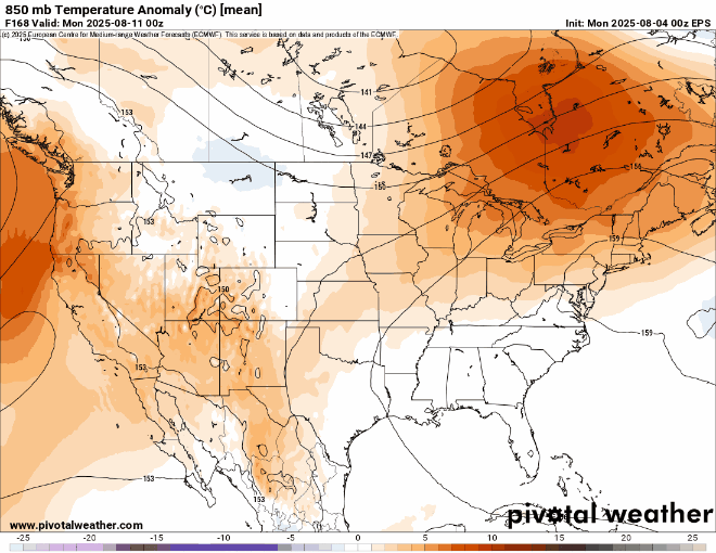
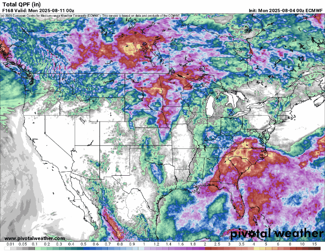
 Looks like a really nice August pattern through next weekend. The warmest departures will miss to our north with onshore flow here. A few warmer days in the low 90s but nothing too extreme. Then other days with the highs in the 80s. Pattern looks pretty dry through at least next weekend.
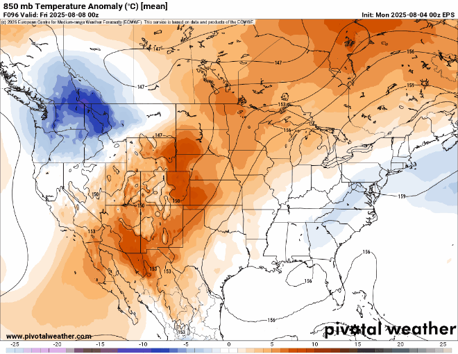
-
2025-2026 ENSO
40/70 Benchmark replied to 40/70 Benchmark's topic in Weather Forecasting and Discussion
The truth is its probably both, but each side struggles to acknowledge nuance, which is why we get the "new climate" and "denier" (I know Chuck isn't denying CC) dichotomy that fuels this eternal/ubiquitous debate. -
it depends on how many beers you drank
-
2025-2026 ENSO
Stormchaserchuck1 replied to 40/70 Benchmark's topic in Weather Forecasting and Discussion
That was a ridiculous -WPO in Feb 2014.. almost +200dm. -
2025-2026 ENSO
40/70 Benchmark replied to 40/70 Benchmark's topic in Weather Forecasting and Discussion
Agreed on both accounts. I'm simply distinguishging between an ostensible La Nina, and an actual event per CPC guidelines. -
 I guess the season is even shorter for the sea-faring lads. Those cold ocean breezes can make a day that is nice inland, miserable on the water?
 -
The higher latitude ridge near Greenland was not any more further north than in the past when had KU snowstorm tracks as the comparison to 2014 snowed. But what changed is that the subtropical ridge was too far north. So the gradient got pushed to our north with the heavy snows.
-
Time to retire...
-
https://phys.org/news/2025-08-broken-japan.html
-
Your reply echoes my comment...