All Activity
- Past hour
-
The Euro doesn't wanna run on wxbell or pivotal lol
-
0z GFS christmas miracle... they sniff the big ones out early lol
-
If we get 5” of snow, I’ll streak around my apt complex.
-
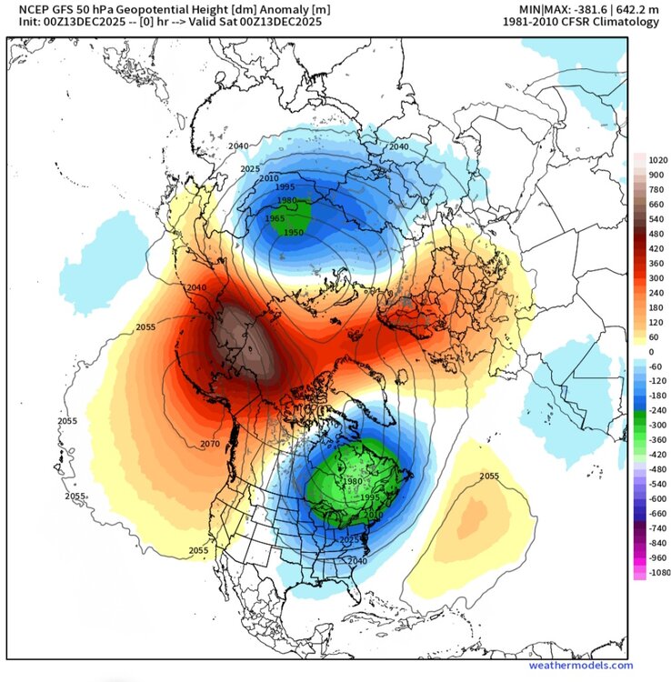
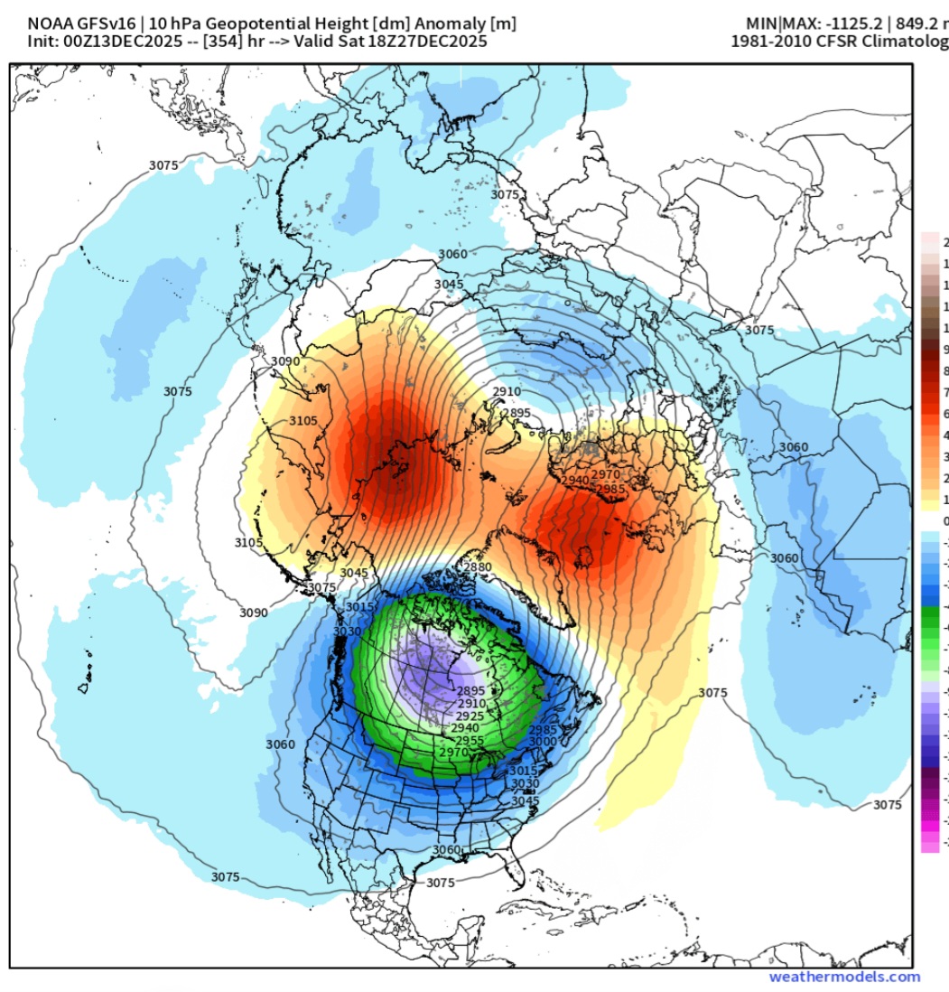
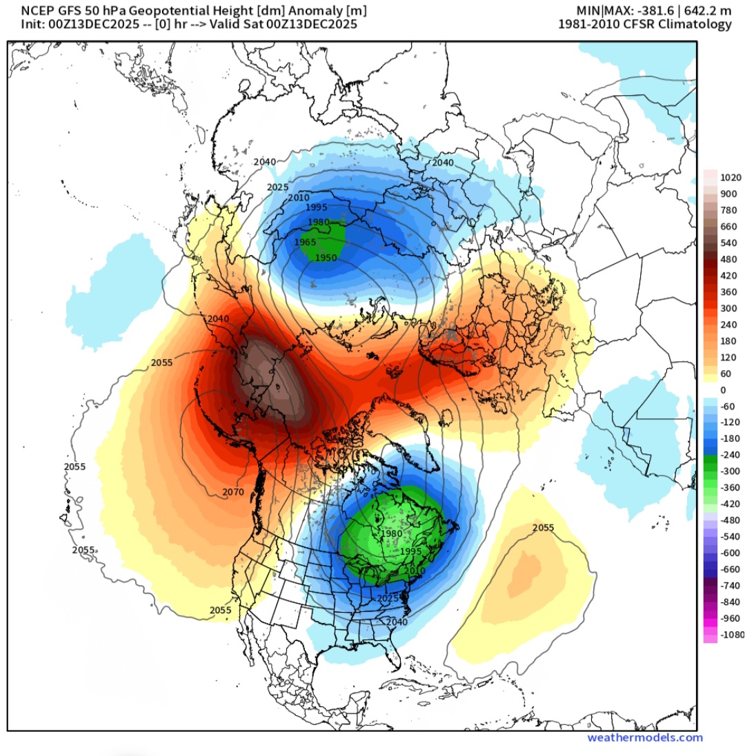
0z model suite...quit the changes. GFS got on board with strat warming event that clearly is the cause for the bridge block late in run as it couples with troposphere: 10mb 50mb I'd say that was the reason the 18z AI -Euro model had a massive bridge blocking:

-

2025-2026 ENSO
Stormchaserchuck1 replied to 40/70 Benchmark's topic in Weather Forecasting and Discussion
I don't think JB moves NG. There is a trend in models tonight for the N. Pacific ridge to be more -EPO. Let's see how that goes, it is the seasonal trend since Aug/Sept. If models keeping progressing from -PNA to -EPO this weekend, NG may open up on Sunday. -
Lol
.thumb.png.866557cd6e41249fa35cf5939049aa97.png)
-
475dm north of New Foundland/570dm in Alaska, it's the 13/14, 14/15 pattern.
-

2025-2026 ENSO
TheClimateChanger replied to 40/70 Benchmark's topic in Weather Forecasting and Discussion
JB coming out with the 1985 analog. What a joke... IIRC, it was something like -20F with a -50F windchill at Cleveland. There is zero chance of that happening. Must be trying to bail out a buddy who's long $NG. -
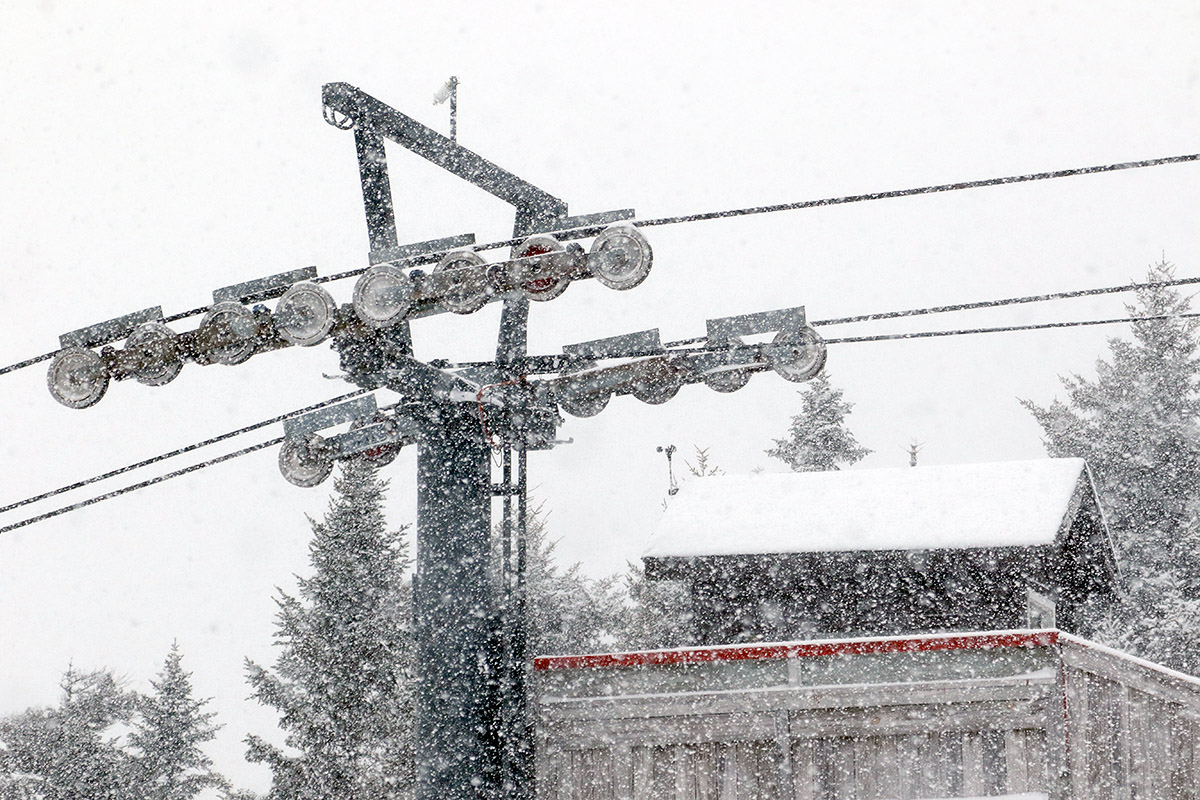
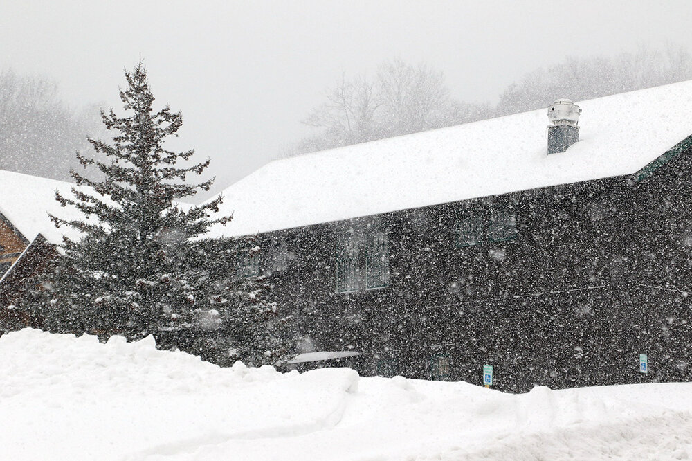
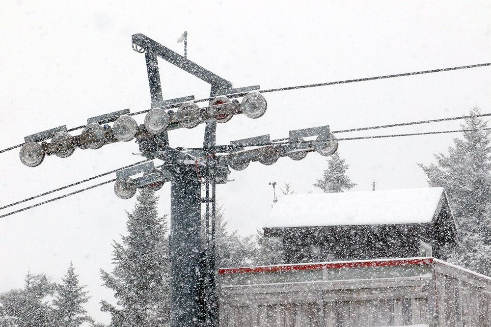
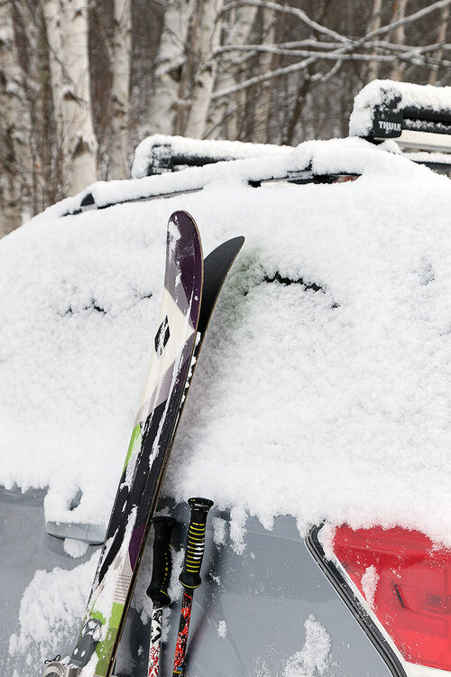
As of yesterday morning, we’d already picked up 7 to 8 inches of snow in the valley from our most recent clipper, and Bolton Valley was reporting 8 inches in the past 48 hours. So, consistent with what PF had mentioned, it didn’t seem like there wasn’t a huge elevation gradient for accumulations up to that point in the storm. We were actually in a snowfall lull at that point – the front side of the storm had wound down, but the back side precipitation was quickly moving into the area. Indeed, as I ascended the Bolton Valley Access Road in the morning, I drove right up into heavy snowfall as the first bands of snow from the back side of the storm were hitting the mountain. I geared up for a tour at the Timberline Base amidst huge flakes of snow falling in the range of 1 to 2 inches/hour. Clothing and gear were getting covered so fast that I was constantly having to shake off the snow. During my previous outing on Monday, I’d found powder depths of roughly 8-12” around 1,500’ at the Timberline Base and 12-16” up near the 2,500’ level. Yesterday I’d say you could tack on a couple more inches to those general powder depths. Even though a lot more snow fell than that, my liquid analyses revealed that we had a solid period of 10-11% H2O snow during the day on Wednesday with all those small flakes, so that would have compressed the existing powder a bit. Fortunately, the density of the snow had dropped down to around 5-6% H2O by Wednesday night, so if there had been any perturbing of the powder grading with that denser snow, it had been largely restored by Thursday morning. Coinciding with that denser snow that fell Wednesday, this most recent storm did have the advantage of bringing more liquid equivalent to the snowpack. Whereas our previous Clipper brough a bit more than a quarter of an inch of liquid equivalent here at our site, this one had already brough a half inch as of yesterday morning, which would likely mean that between a half inch and an inch of liquid equivalent fell in the mountains. So although the powder skiing yesterday wasn’t quite as light and airy as it was on Monday, it was still right-side-up, and the added liquid equivalent more than made up for it with the ability to charge a bit harder on steeper terrain.
-
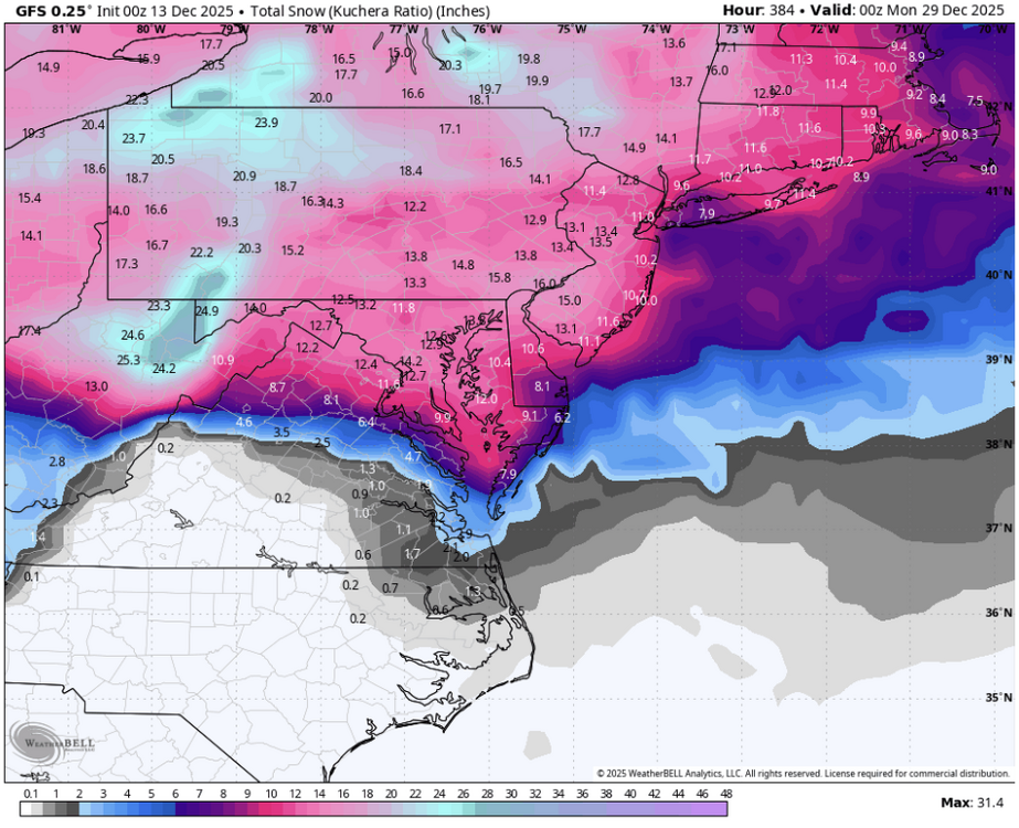
Long range gfs is loltastic. Blasting on Christmas than again 3 days later.
-
12/14: Sunday funday? Will the south win again?
Stormchaserchuck1 replied to TSSN+'s topic in Mid Atlantic
6" snow depth in southern PA on the 03z RAP Models really moistened up tonight. 4" is looking more possible here, if I had to make a guess I'd say 3-3.5" -
I'll stay here for the time being Dont really see any substantial cool down after this one this weekend ,even tho you can see troughs going through East Asia which could cause the pattern to reshuffle more or less but its getting effected by other teleconnections,that Aluetian blocking isn't moving by the EPS OR GEFS, maybe it will change in future runs,but really no signs this is gonna happen anytime soon.We have a better chance of severe upcoming the next couple weeks after this cold snap
-
-

-

December 14th - Snow showers or Plowable snow?
weathafella replied to Sey-Mour Snow's topic in New England
Gfs AI was 2 inches to the pike region. -

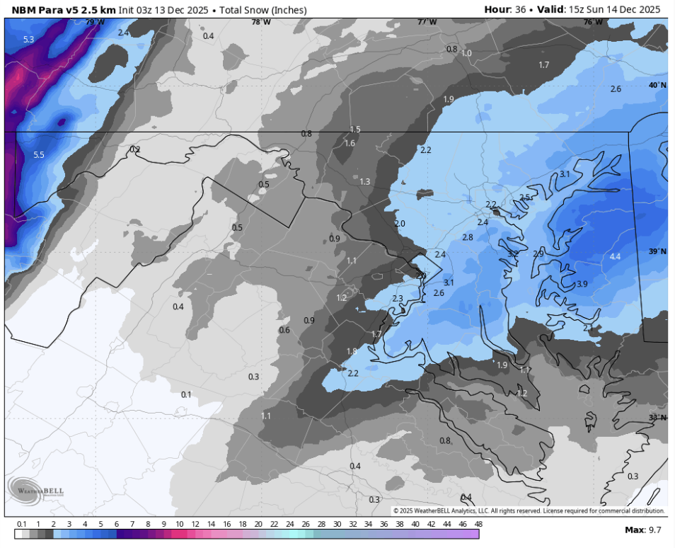
Minor snowfall sunday 12/14/25 1-4” possible
SnowGoose69 replied to WeatherGeek2025's topic in New York City Metro
00Z HREF mean is pretty close to the Euro idea...max is in same zone where it seems to want to go like Dover-Monmouth for the highest amounts https://www.spc.noaa.gov/exper/href/?model=href&product=snowfall_024h_mean§or=ne https://www.spc.noaa.gov/exper/href/?model=href&product=snowfall_024h_max§or=ne -
You know it.. Here come the comments Sign here Lock it up Give me that and call it a winter The big ones are sniffed out early. It all is coming.. Until Dr No or the next run. Lol
-

December 14th - Snow showers or Plowable snow?
CoastalWx replied to Sey-Mour Snow's topic in New England
Euro trimmed back too on the runs today. -
Gfs with the Christmas Miracle again. Start a thread!
-

Saturday night/Sunday 12/13-12/14 Jawn
LVblizzard replied to Ralph Wiggum's topic in Philadelphia Region
I went with 2-4” yesterday for our area and I’m making my final call tomorrow morning. I’m pretty sure I’ll be sticking with that. I expect closer to 2” for most of the area but I can’t rule out banding upping totals to 3-4” for some people. -
What’s the latest NBM blend looking like @CAPE
-
High res > Ukie for this setup for sure
-
.thumb.png.4150b06c63a21f61052e47a612bf1818.png)
December 14th - Snow showers or Plowable snow?
HIPPYVALLEY replied to Sey-Mour Snow's topic in New England
Snow on beaches is very cool. I just can't chase to Falmouth this weekend. -
Jackpot over my house on that one
-
December 14th - Snow showers or Plowable snow?
HIPPYVALLEY replied to Sey-Mour Snow's topic in New England
This could end up a warning event somewhere between Montauk and Provincetown.


.png.27457a894bcfb43ab236172ffb3d6d70.png)