All Activity
- Past hour
-

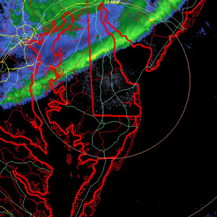
New Years Day 2026 - 1st snows of the new year possible
ORH_wxman replied to Baroclinic Zone's topic in New England
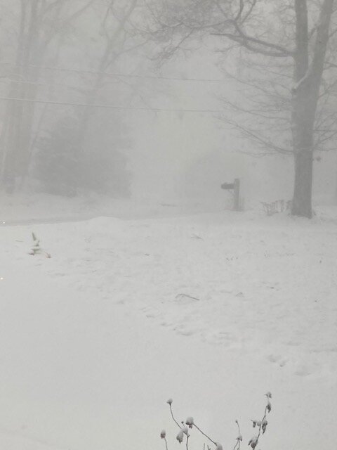
Ghost of Scooter from St John incoming
-
.thumb.jpg.aec747d13df1d95d5fed34574f74d4fd.jpg)
New Years Day 2026 - 1st snows of the new year possible
Vinny Findley replied to Baroclinic Zone's topic in New England
Barely any flakes here in Cranston near 295. Seems anything coming this way is getting sucked up with a dry spung. Left just after midnight for home from Coventry. Radar looked good at the CT RI border. It completely fell apart by the time it made it here. -

New Years Day 2026 - 1st snows of the new year possible
WalpoleJoe replied to Baroclinic Zone's topic in New England
We are going to pick up a couple of inches with this -

New Years Day 2026 - 1st snows of the new year possible
LSC97wxnut replied to Baroclinic Zone's topic in New England
Trying to get to 1/2 S, looks like my area will be just north of the main line. -

New Years Day 2026 - 1st snows of the new year possible
Damage In Tolland replied to Baroclinic Zone's topic in New England
The South Wey is magical -
It snowed lightly for hours. The squall line was cool, like a snow globe with all sorts of flakes types and sizes swirling and tumbling. It was cool to stand in for a few minutes. About a half inch accumulated.
-

New Years Day 2026 - 1st snows of the new year possible
HoarfrostHubb replied to Baroclinic Zone's topic in New England
Yeah. If he has a Ring cam or something it should look impressive there soon. -

12/31-1/1 Possible Snow Showers/Squalls to Start 2026
RickinBaltimore replied to bncho's topic in Mid Atlantic
Woke up to a dusting here. I'm dreaming of a white New Year's apparently. -

New Years Day 2026 - 1st snows of the new year possible
moneypitmike replied to Baroclinic Zone's topic in New England
Norfolk County ftw from this I think. -
New Years Day 2026 - 1st snows of the new year possible
Damage In Tolland replied to Baroclinic Zone's topic in New England
Beeline for Scooters empty house in S Wey -

Central PA Winter 25/26 Discussion and Obs
NepaJames8602 replied to MAG5035's topic in Upstate New York/Pennsylvania
Happy New Year everyone. While I was sound asleep and missed the squall line. There is a good 2-3 inches of snow on the ground here between yesterday's steady but light clipper snow; and the early morning squall line. Impossible to get an accurate reading with all that blowing/drifting from the wind. It's now a very cold 9 degrees outside. -

12/31-1/1 Possible Snow Showers/Squalls to Start 2026
Paleocene replied to bncho's topic in Mid Atlantic
Missed the squall, but happy new years weenies -

New Years Day 2026 - 1st snows of the new year possible
The 4 Seasons replied to Baroclinic Zone's topic in New England
Pretty incredible stuff in S. Middlesex and especially Norfolk county
-
New Years Day 2026 - 1st snows of the new year possible
WalpoleJoe replied to Baroclinic Zone's topic in New England
Was telling my wife there is no wind (I don't think she cares!) but as intensity goes up more, wind starting to blow. Pretty awesome out right now. -

January 2026 Short/Medium Range Thread
Weatheriscool replied to John1122's topic in Tennessee Valley
Good analysis! Like you, I am not sure what value OP models have past 240 the GFS is almost always churning out a different solution with every run. Dont misunderstand, I realize that the physics of the atmosphere are extremely complicated but it does not seem like there should be such wild model swings from run to run -

New Years Day 2026 - 1st snows of the new year possible
Bryan63 replied to Baroclinic Zone's topic in New England
Probably, never hurt anyone though right? -
New Years Day 2026 - 1st snows of the new year possible
moneypitmike replied to Baroclinic Zone's topic in New England
Weenie goggles? -
New Years Day 2026 - 1st snows of the new year possible
LSC97wxnut replied to Baroclinic Zone's topic in New England
Flakes here. Let's see how the northern end ramps up. -
We are definitely at least 2 weeks away from a Brick Tamland sighting at peak climatology. At least Wake Forest scored nearly an inch earlier. I only had 0.3 here a bit north of Leesville. EPS wasn’t a terrible look by the end of the run. It would be good to see all models converge towards ridging in the west with the SE ridge becoming a non factor. We shall see however because nothing good snowfall-wise is coming until this improves.
-

Central PA Winter 25/26 Discussion and Obs
Voyager replied to MAG5035's topic in Upstate New York/Pennsylvania
So this is the video from Monday that I mentioned above. The title says it all... -
New Years Day 2026 - 1st snows of the new year possible
Bryan63 replied to Baroclinic Zone's topic in New England
Looks like the southern part appears to be strengthening up a bit? Hopefully, looks like only chance to see something down this way. -

January 2026 regional war/obs/disco thread
Typhoon Tip replied to Baroclinic Zone's topic in New England
Thaaaat's not what I said. Not speaking for Will... I precisely stated that cold --> warm up of unknown magnitude --> colder pattern works S-E via the natural -EPO evolution. That's the ultra compressed version of all those tl;drs from yesterday from me. If that interim warm-up ends up being muted ... then 'not much at all' will be correct, but I didn't actually assert that as what going to happen. It's still possible that we spend a couple of days above normal, perhaps exotically so to if you believe some of these recent GFS/ens members. In fact, some indicators overnight attempted to go back to the more +PNA look as opposed to the -EPO. Yesterday, all ens means moved en masse toward the -EPO. The new EPS mean is splitting. The only thing we know of higher confidence ( still ) is the breakdown of the mid Pacific ridging/height anomaly, which has been transitively ...well, fucking up the works. It's been conducting the music into a cold melody over the continent over the last several weeks, but the rhythm of the wave spacing has been negatively interfering with storm system genesis. etc... not going over that again. Seeing that breakdown will be a good thing ... in theory. I mean, if we're juggling between -EPO (standard variant) vs +PNA from these ens visions, neither is climo "bad" for winter event enthusiasts. So we got good problems in that sense. But, we have to get on the other side of ~ the 5th-7th, first. By the 8th, the Pacific mode change has completed and the ens systems will prooobably have a better handle on what's happening on the other side of the pattern change door by then. Speculation: It still looks cold above STL-DCA latitudes between the 10th and 20th. If the +PNA ends up more reality than the big -EPO, we may conjure an event entering said PNA phase. If it's the EPO version, we may go (unknown) warm first, than eventually/have to wait that out. -
New Years Day 2026 - 1st snows of the new year possible
ORH_wxman replied to Baroclinic Zone's topic in New England
-
January 2026 regional war/obs/disco thread
Damage In Tolland replied to Baroclinic Zone's topic in New England
Don’t sleep on Sunday / night -
Wow that was an impressive squall line. Would have been cool to see.