All Activity
- Past hour
-
 Will it rain on the chickens?!?
 -
 No it's not its just heavy, nothing we can't handle 2-3" totals so far will probably max out at 3-4 iso 5" over a 4-6 hour window which isn't devastating, just some minor issues I'd imagine. Also looks like steady rain is done in SWCT within the hour.
 -
 Upslope not nearly as big factor this time of year, simply b/c low-level winds from the SE, E, or NE are not as strong, and fetch is much less. Ever notice summer low pressure areas are smaller than the cool season counterparts? Well, there is reason for that and thus you can't treat things synoptically all the same in the summer. Convection plays a much larger role in the summer, so that messed w/ things are well. Swaths from training regardless of topography.
 -
 A few days ago Somewhere someone said congrats NW and NY state
 -
.01!
-
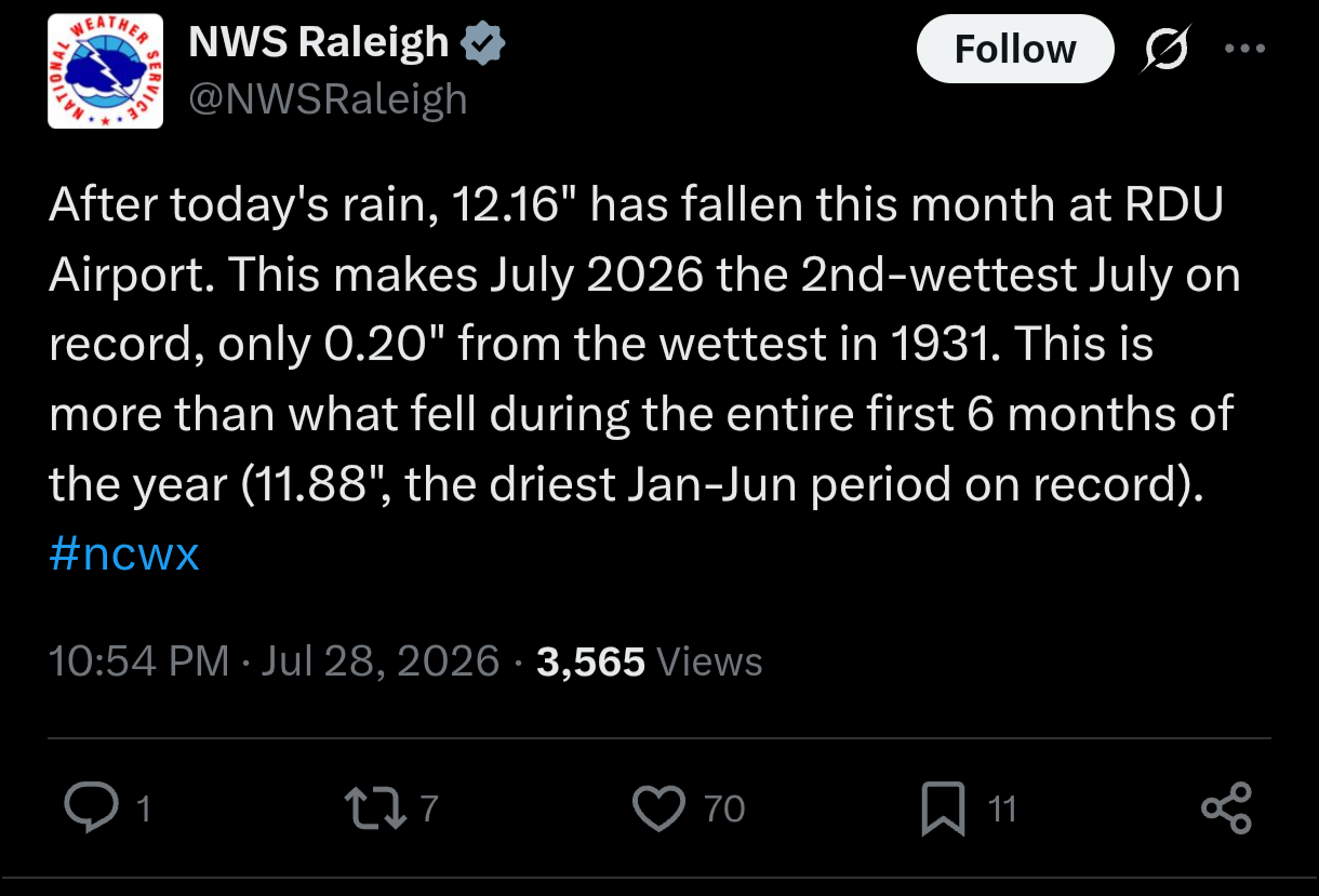
'Only' 1.57" here, 11.41" for the month.
-

E PA/NJ/DE Summer 2026 Obs/Discussion
Hurricane Agnes replied to PhiEaglesfan712's topic in Philadelphia Region
I finished up with 0.39" yesterday after a couple rounds (2-day total 1.29"). Currently a misty 68 with dp 68. -
 Which one is right?
 -
 I will say the rain over Southwest CT is not Uber heavy at least.
 -
Look at the rain returns from BOX versus OKX. It’s quite the difference there.
-
2.1
-
-

2026-2027 Super El Nino
snowman19 replied to Stormchaserchuck1's topic in Weather Forecasting and Discussion
As expected: -
What do you mean..?
-
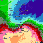
Man why is BOX running so much “hotter” than OKX or any other radar.
-
 How is Central MA looking between now and noon for rain and severe potential? Need to bring my kiddo in to get his wisdom teeth out this morning and wondering we'll be lucky enough to get back home before the worst of the weather gets here.
 -
Picked up 1.8" here from the overnight rains, july monthly total at 7.25" now
-

Chester County PA - Analytical Battle of Actual vs. Altered Climate Data
chubbs replied to ChescoWx's topic in Climate Change
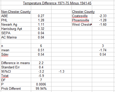
Extended the stat analysis to the 1970s to include the West Chester move. Two comparisons were made: individual years using 1972 minus 1945 as a metric, and a 5-year average using 1971-75 minus 1941-45 as a metric. The results are the same for both metrics: the Chester County COOPs are significantly different statistically from the non-Chesco stations. As was the case for the 1950s there is no overlap between the move and non-move stations. The Chester County COOPs have spurious cooling of over 2F. This analysis and the one above provide strong evidence that the larger NCEI bias adjustments are very robust statistically. This analysis also shows the problems with AI. As Don stated above AI is handy for an initial screening; but, AI is unlikely to give a complete and accurate answer to a complex problem.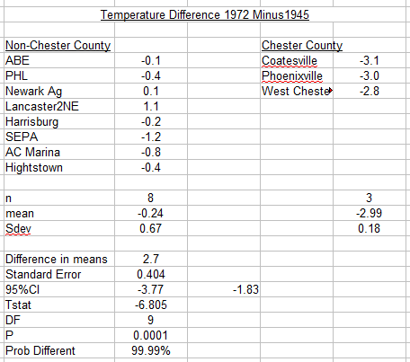
- Today
-
 Kind of surprised that area isn't in a high risk for flash flooding
 -
Check out Albany radar. You can see that the flow just off the deck is coming in from the west north west right towards the Hudson Valley while it’s SE near and SE of Albany. Just a classic convergence corridor wringing out all this rain. Gonna be big-time issues there.
-
That said, they’ll be some enhancement when that moisture does make it into the upslope SE flow zones.
-
6z ICON.has 14 more for eastern NY
-
And Nam too far SE
-
The biggest totals will be west of them I think. I saw a lot of talk from many around here on TV about upslope and all that probably because hi res love to treat every 500’ hill as the Sierra. But it’s all about convergence as we spoke about. That area getting crushed is downsloped on SE flows. Atmosphere don’t care when there is a good convergence zone and moisture conduit off the deck.
-
Latest HRRR is way off with that meso low.. curious to see what it does in future runs