All Activity
- Past hour
-
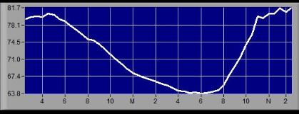
88/73. heat cancel un-cancel
-

E PA/NJ/DE Summer 2025 Obs/Discussion
KamuSnow replied to Hurricane Agnes's topic in Philadelphia Region
Been hearing some thunder from that area to the west of here, but doesn't look like it wants to move east. Sounds nice though, lol.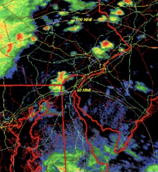
-

Central PA Summer 2025
Mount Joy Snowman replied to Voyager's topic in Upstate New York/Pennsylvania
Are those oranges over you right now doing much? The Meso's were pretty consistent in weakening things as the moved over this way. -
As we feared. CT is cooked. Stein setting up now
-
Time to order the “2400J ML CAPE and all I got was a distant CB” t-shirts.
-
Ineed and Radarman could be in the best of position today
-
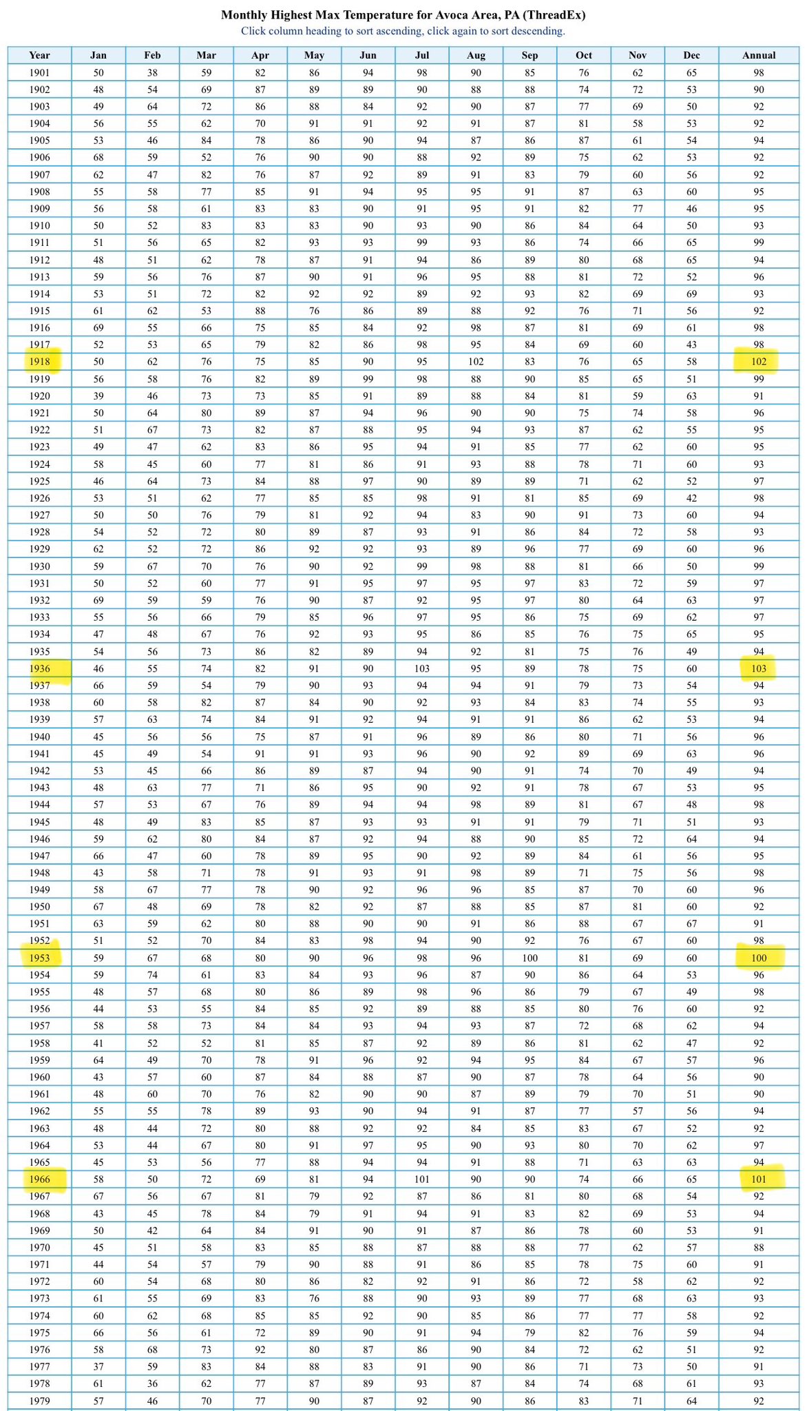
From Meteorologist Mark Margavage "FYI, it reliably hit 100° at least once in a summer every 10-15 years at KAVP for the entire 20th Century up until July 1995, which is the last time the 100° mark was observed in NEPA. It has not hit 100° here in almost 30 years. How does that fit within the catastrophic Global Warming Narrative? It doesn’t." "Let the countdown begin! We are 1 month and 10 days away from from the 30-year anniversary of the last time the Scranton/Wilkes-Barre Area (KAVP) saw a 100°F air temperature. If we make it to July 15th without seeing 100°, we will have to face the reality that 100° temperatures in NEPA might just be a thing of the past…. At the very least, their frequency has not increased over the last 30 years."
-
Light rain is all here as of now. The hills killed it (well sucked out the energy( and it’ll rebuild E toward Lancaster.
-
Camping at Little Bennett in Clarksburg may be interesting.
-
Yeah everything looks way N and W.
-
Saw some really nice cloud to ground strikes from Frederick looking west towards the approaching storms!
-

E PA/NJ/DE Summer 2025 Obs/Discussion
Hurricane Agnes replied to Hurricane Agnes's topic in Philadelphia Region
Getting a pop up that is coming up from the south. Was putting some of my tender annuals out (finally), some near where they will be planted and the others on a table under my patio umbrella that was up. Saw it was getting dark so had to put the umbrella down as it was starting to rain so they could at least get a little water (had watered them when I bought them earlier this week but they need more today). Temp hit 88 earlier today before the rain knocked it back to the current 75 with dp 71.
-
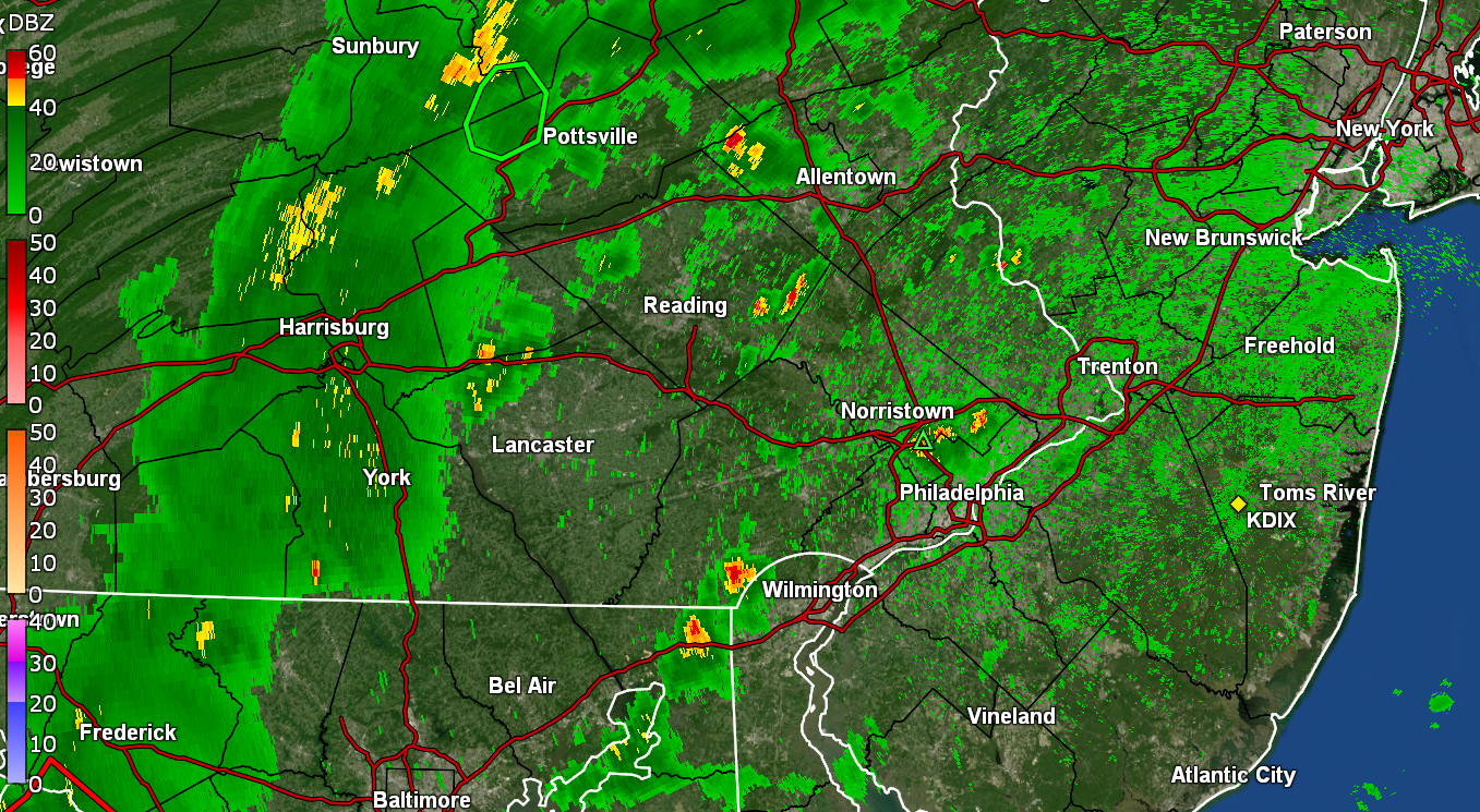
WPC meso’d. Thinks storms probably get to 95 corridor. Heavy rain and flash flooding risk.
-
Heavy thunderstorm rolling through right after I cut the lawn... they just issued a severe thunderstorm warning!!!! Except it said Brunswick, Oregon??!!!
-
Definitely prolific rain makers - but you can see the severe aspect weakening a bit (still some fun thunder and a few lightning I bet) I hear thunder too.
-
storms firing LFG!!
-
okay just one more lol
-
Yeah that checks. :/
-
one more
-
-
high temps were a few hours ago, on the south shore we peaked in the low 80s around 11 am
-
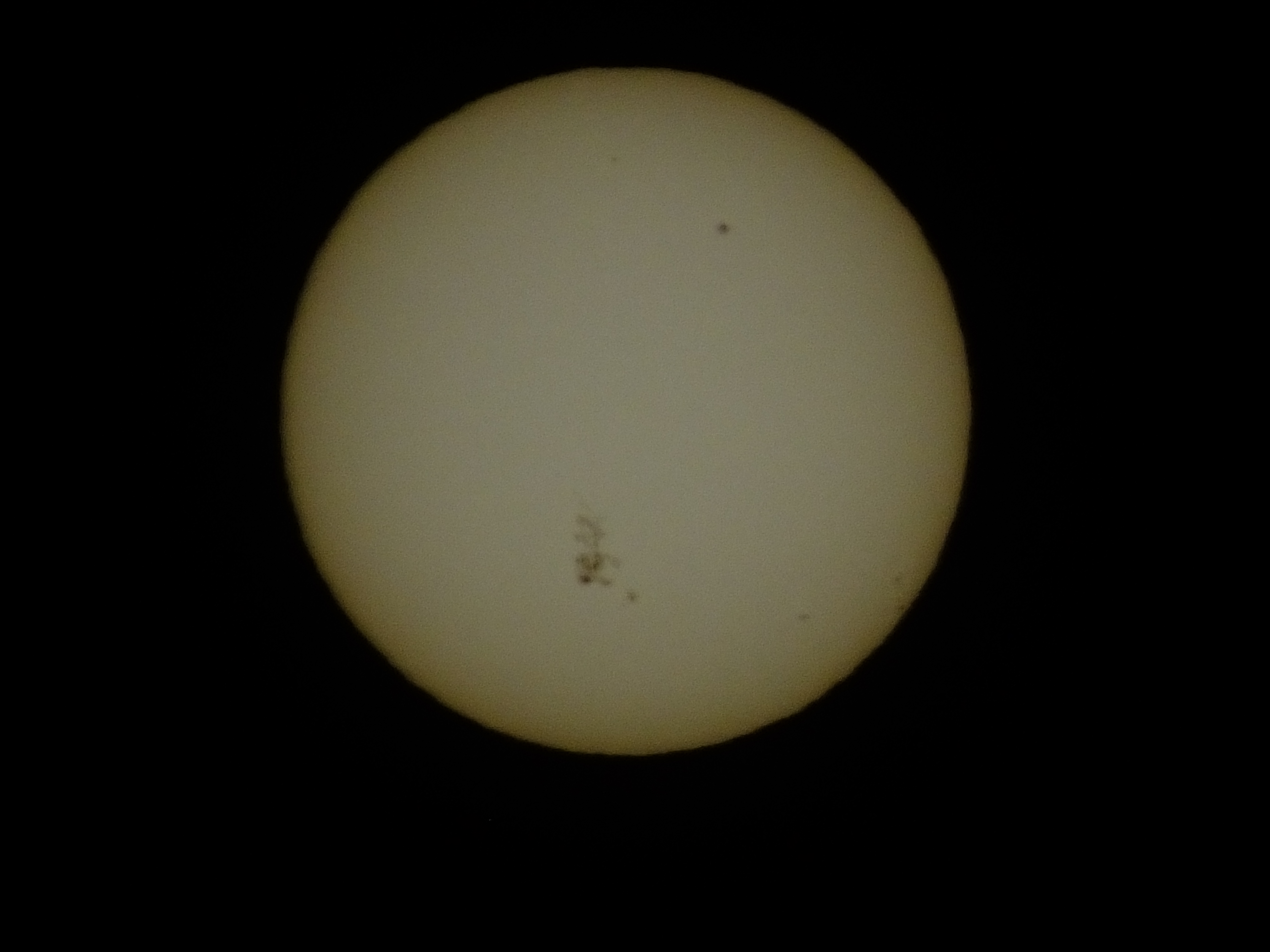
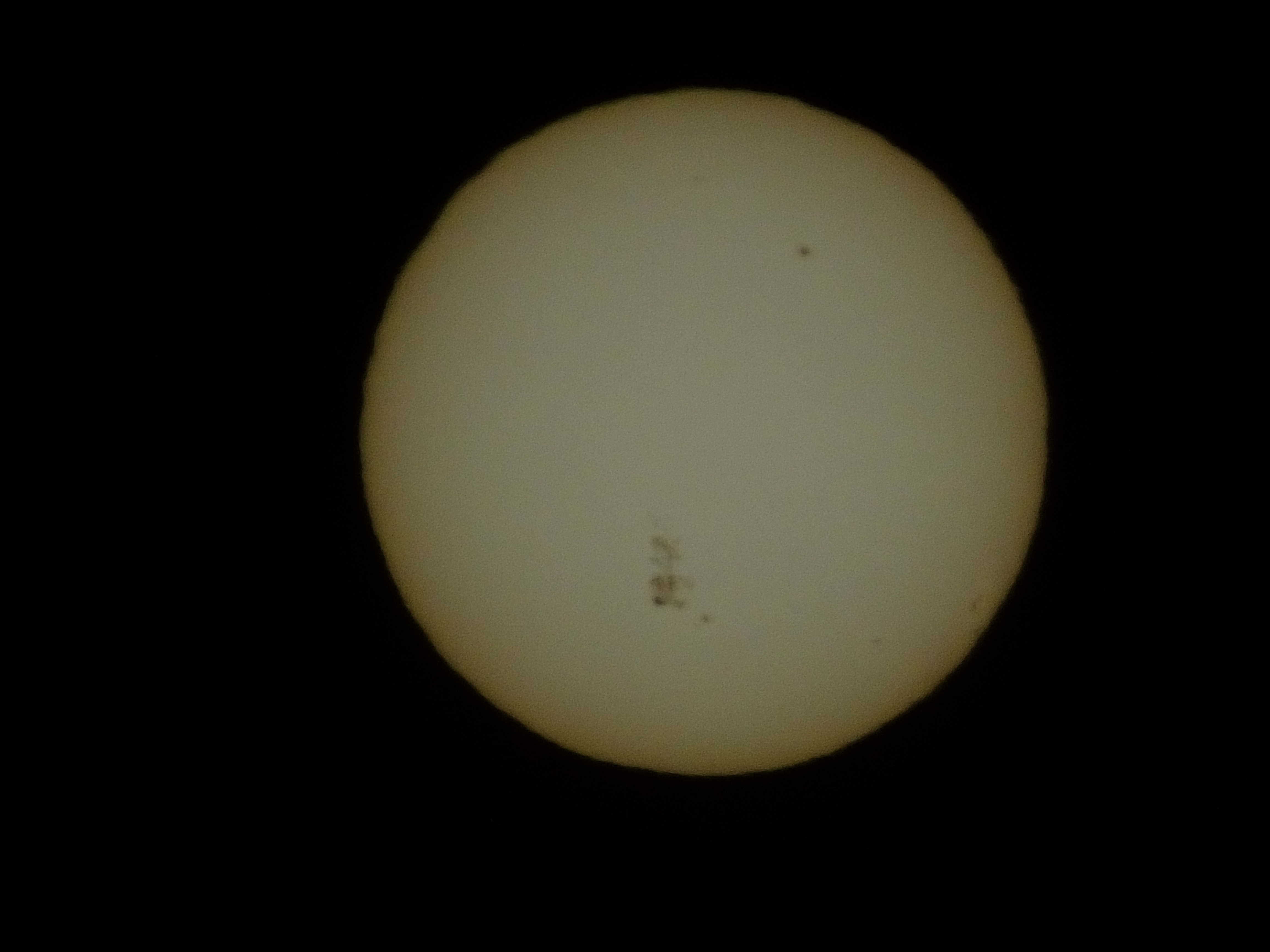
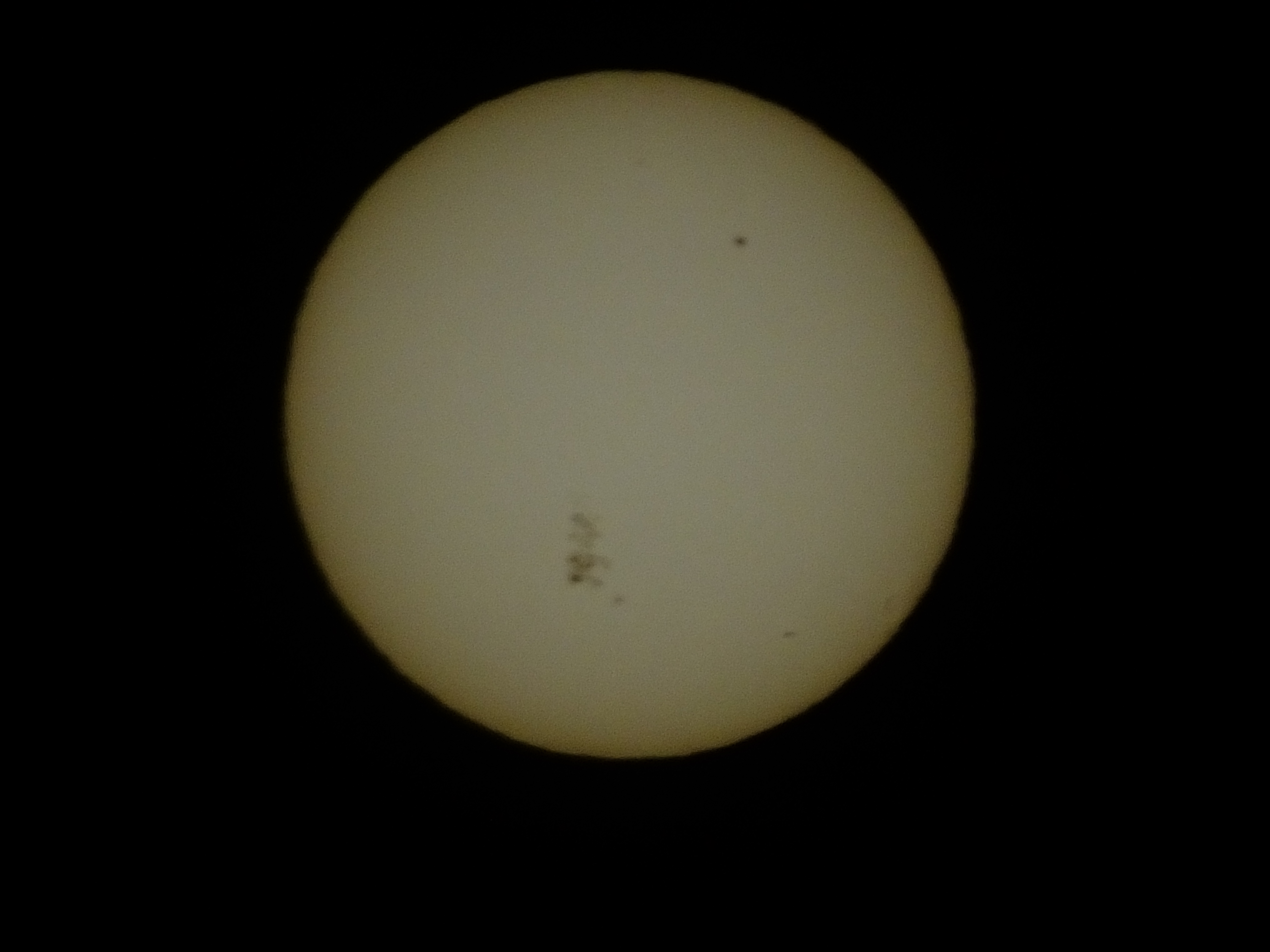
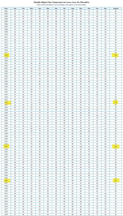
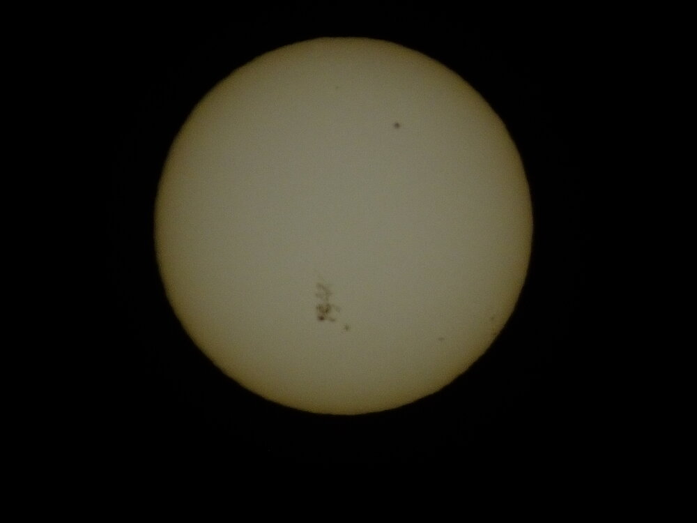
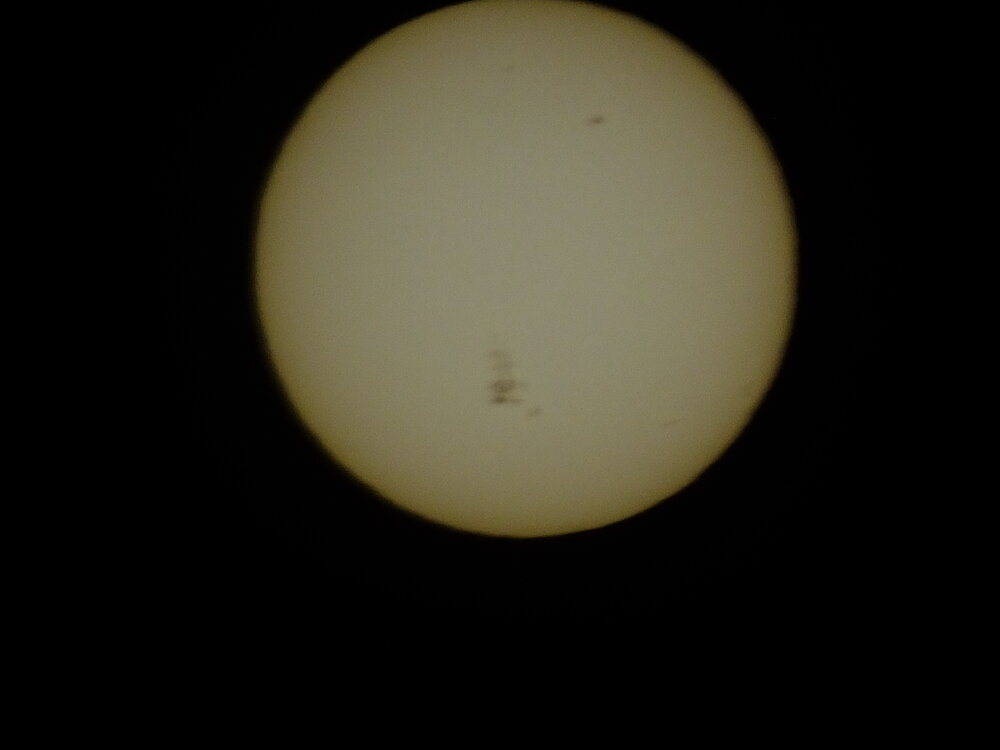
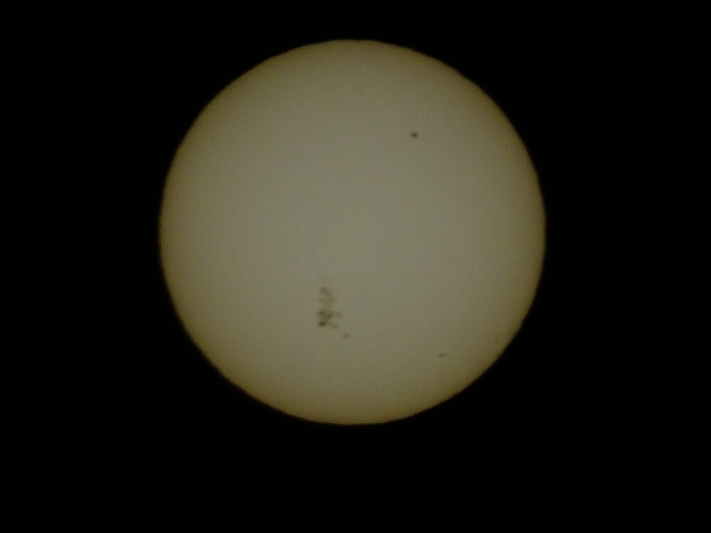
on the camera LCD live view this giant sunspot group looked like a large ant moving around on the sun.
-
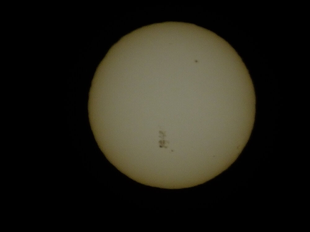
wow thats pretty wild, that sunspot group near the middle is probably the one that caused the solar storm a few days ago and the resulting northern lights display. Here's one of mine from last year in May