All Activity
- Past hour
-

Is we back? February discussion thread
40/70 Benchmark replied to mahk_webstah's topic in New England
Early March was my last window. -
Euro indicating some leaning towards east based, but not obnoxiously so. However, that time frame is for June/July/August and things would likely evolve from that point on (either becoming more east based or migrating more towards a Modoki). Of course, the Euro could be completely off from this juncture.
-
Now that was a blizzard for the Hampton Roads.
-
Jan 3, 2018 was 949 MB
-
Tight gradient in western Suffolk. Babylon got 28-30”. I’m confident Commack was 24” range based on reports from Nws, friends, family. Those snow bands hugged the LIE and maybe 2 miles north of there.
-

Guess The Date Of The Next 12"+ Snowstorm In The OKX Zones
MJO812 replied to bluewave's topic in New York City Metro
You said early February lol -
I still cant believe i won. Thanks everyone.
-
Argh. Can’t be 17” that I missed here vs 24” you missed there. I’ll take the conservative I guess.
-
That would take it to another level. I am running out of places to put snow. Mega piles
-
Bye-Bye peaches and stone fruit in NE.
-
First half of March will be cold and snowy Unfortunately every model has a big warmup towards the middle and ends winter.
-
wow!
-
-
this is insane for March
-
Going to take the under on the likelihood we see a 6-8” thump before we jump to 50 degrees in march.
-
-
Snowy times ahead
-
Sucks I missed this one. Going with local reports of 24” in Commack, so 56.8” of snow on the season. Not bad!
-
-

"Don’t do it" 2026 Blizzard obs, updates and pictures.
Ginx snewx replied to Ginx snewx's topic in New England
https://x.com/i/status/2026088248221581621 Complete radar loop -
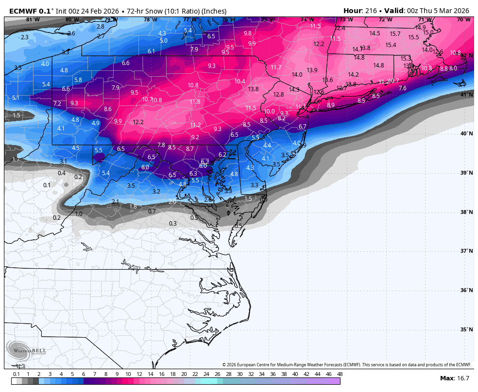
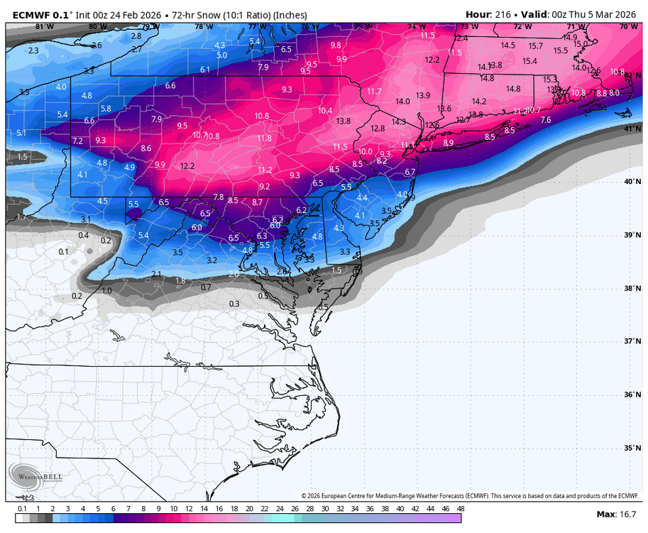
we 0z Euro for next Tuesday!!
-

"Don’t do it" 2026 Blizzard obs, updates and pictures.
dmillz25 replied to Ginx snewx's topic in New England
Oh wow a 20, 30 mile difference and they could have gotten almost double -
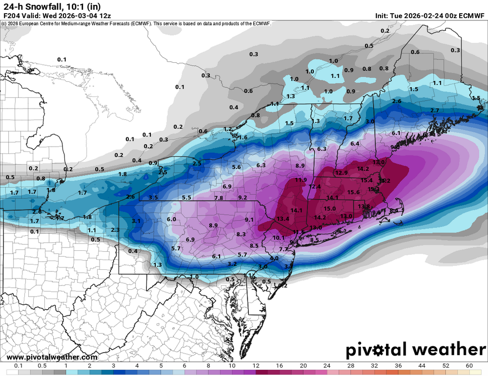
potent snow to rain event on the Euro (it starts at like 24F and goes to 50F, crazy)
-

"Don’t do it" 2026 Blizzard obs, updates and pictures.
Greg replied to Ginx snewx's topic in New England
16.9" -
"Don’t do it" 2026 Blizzard obs, updates and pictures.
dmillz25 replied to Ginx snewx's topic in New England
How much did Boston get?


.thumb.png.4150b06c63a21f61052e47a612bf1818.png)