All Activity
- Past hour
-
They should be safe from Tip's ever-expanding Hadley Cell for another 100 years or so up there...lol
-
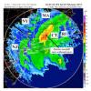
County snowed all day today. They picked up 8-10” ..that’ll shape things up very nicely.
-
Clown range NAM doesn’t look bad.
-
I don't either. And to tell you the truth...the last two years have shown it can still be cold enough to snow. Our fails haven't been because it's too warm (or perhaps that's selective memory, lol). I mean even the threat this week isn't at risk of failing because it's too warm...just little moisture!
-

January 2026 regional war/obs/disco thread
tavwtby replied to Baroclinic Zone's topic in New England
it must have ripped while I was inside with my son at pitching clinic, because everything is coated good when we left and black ice everywhere, with a bad ABS mod, no AWD or 4wd, empty bed, I'm swinging all over the road, fun ride home. -
Wait until tomorrow afternoon.
-
Exactly. DC having better snow than Baltimore north since 2019 makes no sense
-
HAHAHAHAHA the NAM is obviously an Eagles fan and is on a bender after that game.
-
I still don't think we're at the "permanently lost the ability to have 1996,2003,2016 style storms" point yet.
-

January 2026 Medium/Long Range Discussion
NorthArlington101 replied to snowfan's topic in Mid Atlantic
Time for a thread. Idk who wants to own this stinker, but it must be done. We’ve got other things to post here -
But that doesn't explain the precip problems though...how is it that south of Baltimore is doing better when it has been cold enough to snow? I don't get the cut-off that has happened here...that ain't because of temperature is it?
-
-
Yea its entire possible in the next decade we reset to 5"-10" regional snowfall climo. El Ninos will just become cold rain winter.
-
even a broken clock is correct 2 times a day..
-

January 2026 Medium/Long Range Discussion
Stormchaserchuck1 replied to snowfan's topic in Mid Atlantic
It's the NAM, but -
Nam kinda looks nice at the end of the run. Heh
-
NAM is def better at H5 vs 18z, Im at 81...some snow, just above freezing at this frame tho. 84: Precip heavier, still slightly above freezing, still all around kinda sloppy tho
-
I'll be up in Western Maine Weds-Sat, Lock it in.
-
Long range GFS is the things that weenies dreams are made of. But it keeps showing a very active period with a few distinct events for several cycles now. 16th, 19th, 22nd, and 25th, with no breaks in the cold in between. Been quite consistent so you’d think it’s onto something. However; it also had NYC at 8” of snow for the last storm that gave us 4” so maybe not
-

January 2026 regional war/obs/disco thread
moneypitmike replied to Baroclinic Zone's topic in New England
Surprised to see we picked up 1.5” of snow this evening. Not sure if they’ll be any more -
It is. Sort of like the GFS did vs it's 12z run. Stop being positive, it's unsettling.
-

January 2026 Medium/Long Range Discussion
Stormchaserchuck1 replied to snowfan's topic in Mid Atlantic
0z NAM is pushing the energy further west at 57hr vs 18z NAM at 63hr fwiw -
Quick 0.1" from that burst of snow that moved through. Maybe someday I'll get something that actually is up the ruler a ways
-
MJO starts moving into favorable positions by then too.
-

January 2026 Medium/Long Range Discussion
Stormchaserchuck1 replied to snowfan's topic in Mid Atlantic
It's all about the N. Hemisphere 500mb pattern. There are strong patterns in certain places in the hemisphere when DC/Baltimore gets >7" snowstorms. When the pattern is cold, with room to spare, long range threats/patterns are worth following. We have -AO tendency this Winter, December was colder than average in the Northeast and we are probably colder than average in the 2nd half of January. I've been pretty bullish on the Winter pattern general, although the STJ is really dry. The last few days of January has potential, imo. And maybe early February. ENSO subsurface Kelvin wave is occurring, and that historically correlates with more +PNA in the north pacific. Give us -AO running south into a ridge over Greenland, with a 50/50 low under it, and the pattern looks suddenly favorable. Unfortunately it's 15 days out, but it does have support with things actually occurring, like in ENSO, and Winter -AO tendency from -SLP 60-90N this past warm season (correlation good since 2012).


