All Activity
- Past hour
-
Intense storm developed right overhead. In last 25 minutes picked up 1.01” of rain. Temperature down to 69F. .
-
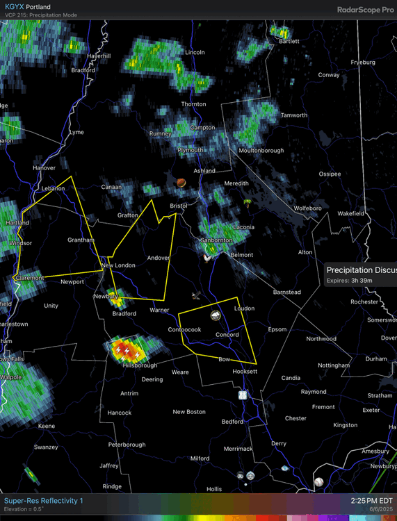
Let’s get them some more with that next cell split going north. Hail on hail.
-
Only 0.02" in the stratus since last night here. Have managed to dodge literally everything.
-
Not bad at all
-
Take some pictures of clouds if you're in an open area. Please.
-
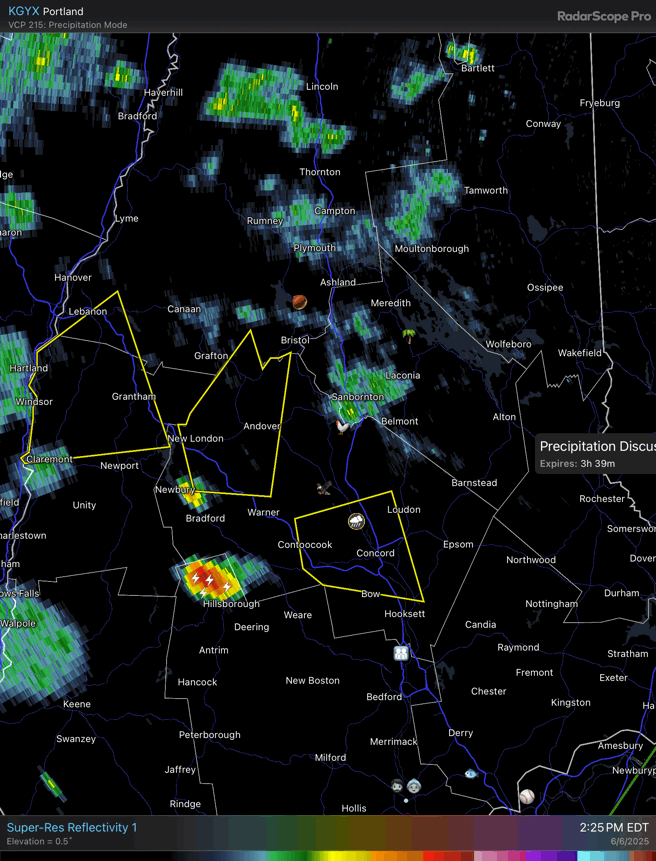
It isn't often you can reach the 50 dBZ Donovan height around these parts, but that storm managed it.
-
A few cells popping near 495/I-90 at the shallow seabreeze convergence(s)
-
Ughhh it fell apart. Ridiculous
-
Summer has arrived
-
1.25-1.5” hail in Henniker
-
Yeah I saw that HRRR. Looks messy though, like maybe a few regular storms and heavy rains but nothing hair-raising
-
Line fell apart. Booo!. Bout to get the scraps.
-
next one behind it looks to do the same thing a bit further south
-
HRRR has some. If we can get some heating, I think some sct stuff will pop.
-

Central PA Summer 2025
Mount Joy Snowman replied to Voyager's topic in Upstate New York/Pennsylvania
It's always the worst when you have an already humid day and then get some late afternoon activity that makes the surface layer even more of a swamp. -
-
that's a clean example of a splitting too
-
Sun's out, it's humid af
-
Yeah you're probably right. I had no expectations for us (E MA) in general so not expecting much tomorrow either. Missed earlier storms while working is a kick in the jewels as well. lol
-
Usually in the form of one big storm. It has juiced up the atmosphere, which is why 2015-16 was snowier than 1982-83 although it was warmer too.
-
Hairs on my head and neck slowly rising up
-
Nice 7-10 cell split
-
Better chance tomorrow aftn.
-
Going to need something to develop near 495 - Marlboro to get us here. Unless storms line out and we catch a rumble later
-
Are the storms in PA supposed to hold together and get us or dissipate? I can't have another softball game canceled!!