All Activity
- Past hour
-

-
And just like that, the Torch Twins return from hiding at the first sign of near normal temperatures. You could set your clock.
-

2025-2026 ENSO
40/70 Benchmark replied to 40/70 Benchmark's topic in Weather Forecasting and Discussion
It's like I have said to you before.....it's folly to generalize ENSO by intensity.....2009-2010 was a different breed than prototypical stronger events...it was a full-fledged Modoki during an arc ending solar cycle just beyond solar min. That is a mid Atlantic wet dream....it's no mystery what it evolved in a favorable fashion. Everyone and their mother was forecasting a blockbuster season that fall...it was obvious. -
I’m guessing my sarcasm was too thick or not thick enough. The winds have been stupid for months and months. A high of 62 degrees here, 57/49 right now and still on the windy side even though it’s been a couple hours since the last shower came through.
-
2025-2026 ENSO
40/70 Benchmark replied to 40/70 Benchmark's topic in Weather Forecasting and Discussion
I would honestly pass on a STJ as strong as 2009-2010 again. -
2025-2026 ENSO
40/70 Benchmark replied to 40/70 Benchmark's topic in Weather Forecasting and Discussion
I agree with you that the baseline jump in temps is permanent, and also agree that we need to wait and see on the storm track. Like I was saying, I think most of our disagreements are just born of inconsistencies in the manner that we articulate ourselves and the points that we stress. We largely agree in a general sense. -
To my untrained eye looks likely it's going to make its way down to New England. Oh well, there goes the summer...
-
2025-2026 ENSO
40/70 Benchmark replied to 40/70 Benchmark's topic in Weather Forecasting and Discussion
Completely agree.....I am open to the idea of CC forcing that pattern, but as I have been saying...I would need to see it persist into the 2030s. -
Looks seasonable, no extended 90's or anything.
-
Nah…Arctic clown maps
-
Ineedcoldraininsummer will disappear for months
-
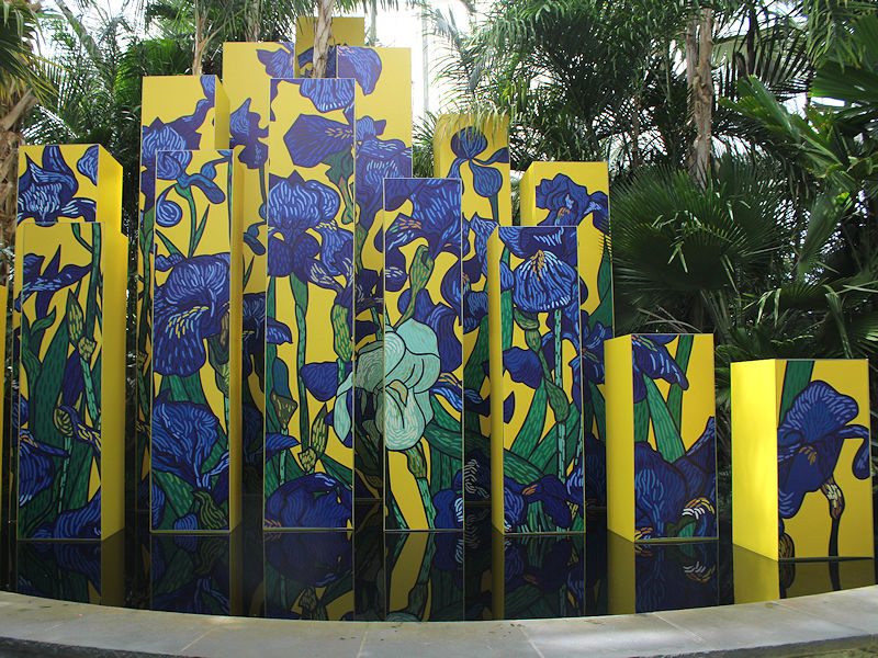
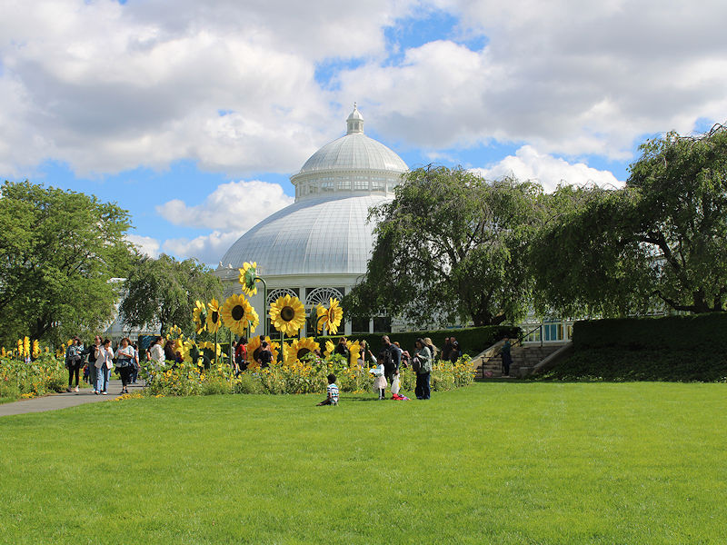
The temperature rose into the lower and middle 60s this afternoon making for a great start to the New York Botanical Garden's "Van Gogh's Flowers" show.

- Today
-
Should be AN finally by the 3rd. Doesn’t look crazy though.
-
Bring it on.
-
Beautiful day
-
it will be close by not sure if it makes it yet though
-
Furnace is close at hand . Oh boy
-
might be south and west of here who knows though.. it will be coming soon enough
-
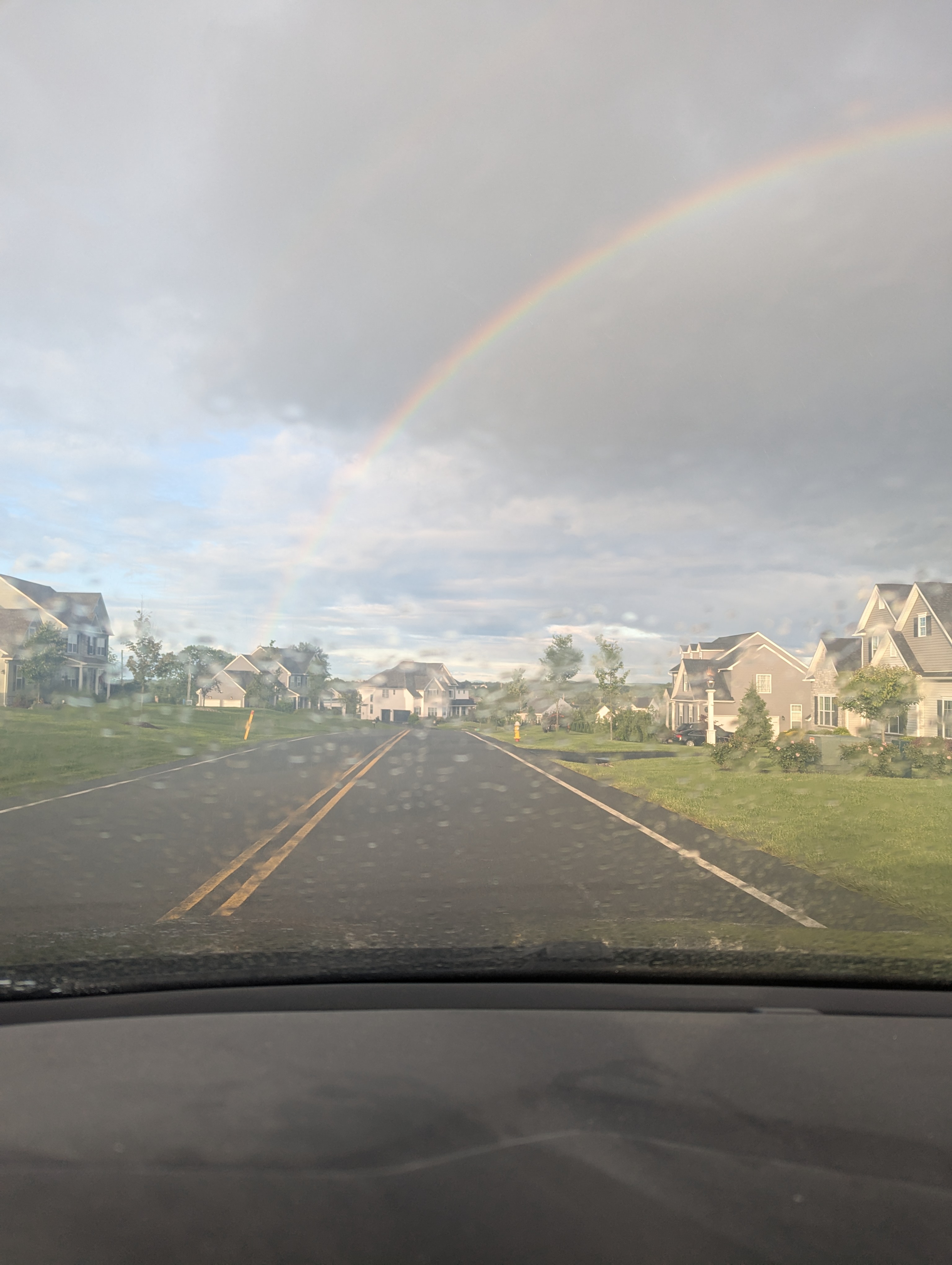
Rainbow weather pop up showers as the ULL spins around
-
First week of June has potential to be quite warm
-
womp womp definitely not as cool as its been and should get a bit more humid though.. but nothing crazy yet Late This Week / Next Weekend: Still a little uncertain when it comes to the day-to-day specifics but as 500 mb ridging transitions to one of longwave troughing, this looks to be yet another unsettled late-week/early-weekend weather pattern as we close out the month of May. Kept PoPs in the Chance range given 500 mb trough axis to our west; though it won`t be raining the whole period of time, there could be a few opportunities at showers/possible storms with southerly flow offering a rather moist airmass. Temps should continue to run around or just above seasonable to close the month, but then start to cool off and we may start the month of June with temps running cooler than normal.
-
Nice, we had a mini airshow here too. Marine One and a couple Osprey for Trump in Bedminster. They shake the house every time.
-
I'm sitting outide, smoking a little weed (I don't drink), drinking some cold brew and listening to music. Life is good sometimes.
-
I feel for you. That's brutal...
-
It will be partly sunny and even milder tomorrow. Temperatures will top out in the upper 60s. Readings will warm further into the lower 70s on Memorial Day. Nevertheless, temperatures will remain somewhat cooler than normal. The below normal temperatures will likely persist into the middle of next week. However,it could turn noticeably warmer during the closing days of the month or opening of June. The ENSO Region 1+2 anomaly was 0.0°C and the Region 3.4 anomaly was +0.1°C for the week centered around May 7. For the past six weeks, the ENSO Region 1+2 anomaly has averaged +0.55°C and the ENSO Region 3.4 anomaly has averaged -0.07°C. Neutral ENSO conditions will likely continue through at least mid summer. Early indications are that summer 2025 will be warmer than normal in the New York City and Philadelphia areas. The potential exists for a much warmer than normal summer (more than 1° above normal). The SOI was +23.38 today. The preliminary Arctic Oscillation (AO) was +1.533 today. Based on sensitivity analysis applied to the latest guidance, there is an implied near 56% probability that New York City will have a cooler than normal May (1991-2020 normal). May will likely finish with a mean temperature near 63.0° (0.2° below normal).