All Activity
- Past hour
-
Came home from a concert in Pikeville KY on the newly opened stretch of the Coalfields Expressway around midnight. Once I crossed over into the VA side the snow was heavy with poor visibility near Breaks Interstate Park. There is a solid dusting on the ground right now. It will be interesting to see if we pick up anymore later.
-
1.2" for the day Had a tenth in the morning and the rest was from the storm last night.
-
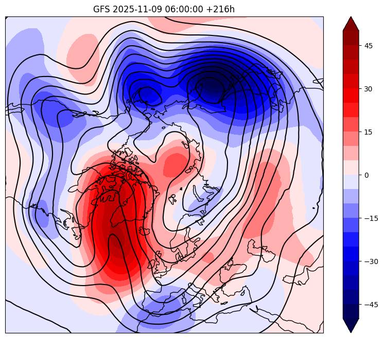
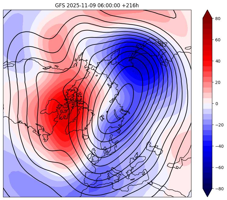
Great signs coming into the later part of November into December. From Eric Webb We're likely in for a long-lived & intense -AO/-NAO/-EPO episode beginning later in Nov & lasting into Dec. The -NAO that develops later this week anchors itself into the lower stratosphere almost immediately Day 9 GEFS mean 500mb height anoms (left) & 100mb height anoms (right) Sent from my SM-G998U using Tapatalk
-

Central PA Fall Discussions and Obs
pawatch replied to ChescoWx's topic in Upstate New York/Pennsylvania
I would set up a manual rain gauge, just to see how they compare. Rainfall totals a mile away can vary. currently 43 degrees. -
Temp down to 25 degrees with light snow currently. Radar is looking good for some heavier rates coming in soon.
-

11/8-11/10 First Snow and Lake Effect Event
TheNiño replied to Geoboy645's topic in Lakes/Ohio Valley
The current situation -

11/8-11/10 First Snow and Lake Effect Event
KeenerWx replied to Geoboy645's topic in Lakes/Ohio Valley
Someone(s) in Lake, Porter, La Porte, St Joe counties will likely net 14-18” based on available reports and what is left with this event. Likely top tier lake driven event for Kankakee county and points southward as well. Less knowledgeable about their local history with LES but I have to imagine it’s limited on noteworthy events. - Today
-
11/8-11/10 First Snow and Lake Effect Event
TheNiño replied to Geoboy645's topic in Lakes/Ohio Valley
We’ve really cashed in the last couple seasons here in Kenosha. I wouldn’t be surprised if it’s 3in/hr right now visibility is basically zero. Pretty surprising I thought the main band would be well south of here but we’re getting hammered.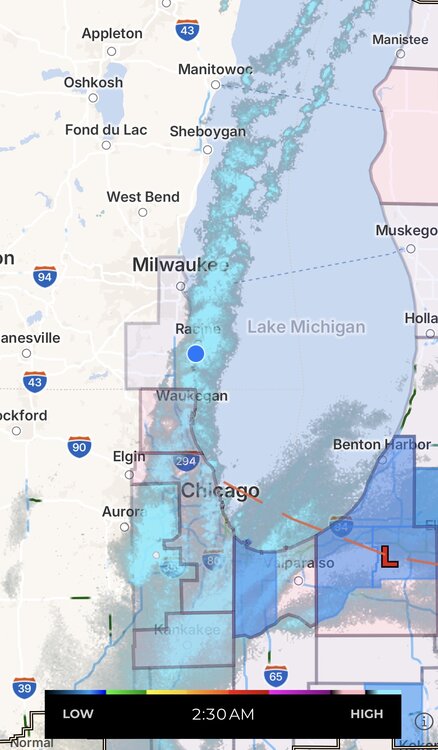
-

11/8-11/10 First Snow and Lake Effect Event
Chicago Storm replied to Geoboy645's topic in Lakes/Ohio Valley
It is looking like downtown, ORD and MDW will miss out on the best of this one. There are two areas of interest for maximum accumulation totals. Location #1 will be from the Gary-Valpo area down to the Kankakee area, where snowfall is maximized on the backside of the meso-low. Location #2 will be from around Kenosha down to around Lake Forest, where the main single band looks to have found it's spot to park for several hours. -
11/8-11/10 First Snow and Lake Effect Event
TheNiño replied to Geoboy645's topic in Lakes/Ohio Valley
It is absolutely spitting here. -
I remember the winter of '76-'77 very well ... I was 25 at the time and living in the D.C. area. It was very cold for a lot more than just one month.
-
11/8-11/10 First Snow and Lake Effect Event
TheNiño replied to Geoboy645's topic in Lakes/Ohio Valley
I command you all to just enjoy it but also keep sending videos of the thunder snow lol. So badass. Went from nothing to intense here in Kenosha in minutes. We won’t be under the main bands but still pretty awesome. LE is wild and fun. -

11/8-11/10 First Snow and Lake Effect Event
migratingwx replied to Geoboy645's topic in Lakes/Ohio Valley
I can confirm as well, a couple rounds of it while I was walking outside. The wind has really picked up, too! -
MRX issued a WWA for the Plateau, and OHX did for their Plateau counties as well. 1-2 inches for 1500+, 1 inch for under 1500.
-

11/8-11/10 First Snow and Lake Effect Event
homedis replied to Geoboy645's topic in Lakes/Ohio Valley
Got two videos of the thundersnow… I can go to sleep in peace now. https://imgur.com/a/pubD2KK https://imgur.com/a/ZYInPQz -

11/8-11/10 First Snow and Lake Effect Event
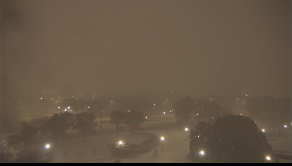
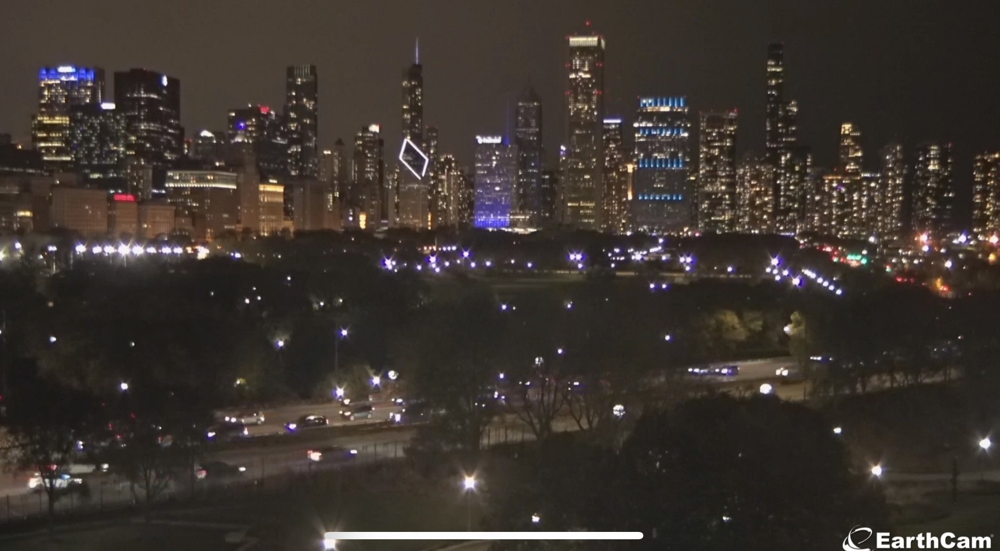
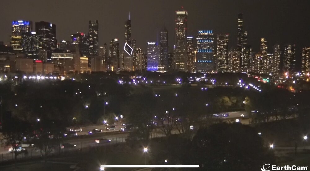
vortex replied to Geoboy645's topic in Lakes/Ohio Valley
Earth Cam from Chicago just now, compared to what it normally looked like earlier in the evening.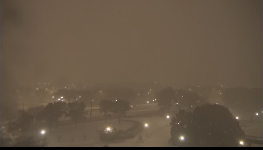
-

11/8-11/10 First Snow and Lake Effect Event
RCNYILWX replied to Geoboy645's topic in Lakes/Ohio Valley
Just leaving a busy evening shift. TAF verified (edit: at MDW, need ORD still) [emoji123] Sent from my SM-S936U using Tapatalk -
11/8-11/10 First Snow and Lake Effect Event
Chicago Storm replied to Geoboy645's topic in Lakes/Ohio Valley
Someone I know has reported graupel. -

11/8-11/10 First Snow and Lake Effect Event
Chicago916 replied to Geoboy645's topic in Lakes/Ohio Valley
Some really high DBZ coming ashore now. Likely graupel/hail and more thunder to come -

11/8-11/10 First Snow and Lake Effect Event
dmillz25 replied to Geoboy645's topic in Lakes/Ohio Valley
My cousin say this is the heaviest snow he’s seen since the 2011 blizzard. Edit and saw the thundersnow -

11/8-11/10 First Snow and Lake Effect Event
skiier04 replied to Geoboy645's topic in Lakes/Ohio Valley
Saw the lightning flash from my hotel room in Chicago river north -
11/8-11/10 First Snow and Lake Effect Event
Chicago Storm replied to Geoboy645's topic in Lakes/Ohio Valley
Right over downtown on the feed. -
11/8-11/10 First Snow and Lake Effect Event
homedis replied to Geoboy645's topic in Lakes/Ohio Valley
THUNDERSNOW!!! -
Quarter or bigger flakes going on out there now, the ground is white. Solid dusting.
-
11/8-11/10 First Snow and Lake Effect Event
homedis replied to Geoboy645's topic in Lakes/Ohio Valley
Quite hard to measure with the wind gusts, but I’m measuring around 2.5” in the past hour. With close to 3” total accumulation thus far in Wicker Park.