All Activity
- Past hour
-
Blocking is strong . I can see the coast changing over to sleet at the very end but this looks like a moderate snowstorm.
-
All day long. Lets do it the GFS way this time.
-
I think the shortwave will ultimately gain enough latitude over the Upper MW its going to be insanely hard to force it so far south we can clear everything at 700/850.
-
These move north at the end so many times. The soundings and 700/850 tracks will matter and whether the snow comes in like a thump or shredded crap. I'm a little hopeful for MBY 30 miles east of Central Park but if this blocking lets up by a hair it's congrats this entire subforum while I drown in sleet. Hopefully there's a way we can all win.
-
what's your reasoning? most models including gfs have all the lows scoot way south of us and it's going to be way colder
-

Central PA Winter 25/26 Discussion and Obs
Blizzard of 93 replied to MAG5035's topic in Upstate New York/Pennsylvania
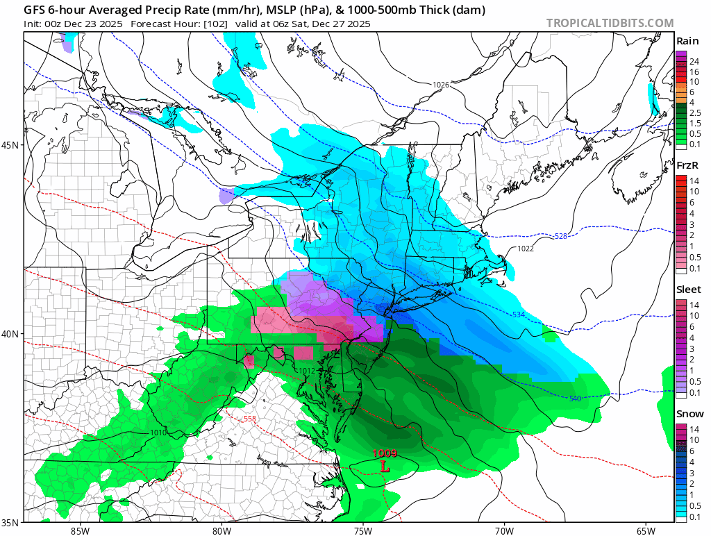
0z GFS shows heavy sleet for most of us on Friday. Warning level snow for northeast PA this run.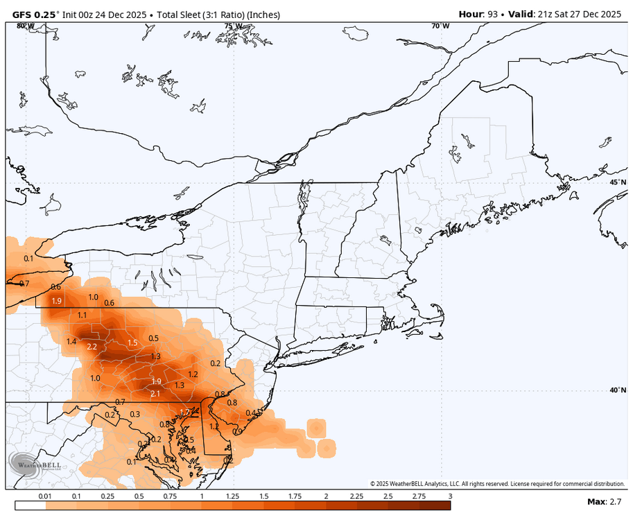

-
I believe in the end the metro changes over to sleet for a decent period with this. Still feel something like the RGEM or slightly NE happens but might get 3 plus before any changeover happens. The model bias game right now based on their positions would argue a line from like WRN LI NW up through NE NJ/SW NY is the bullseye but I think this may shift 30-50 miles NE in the end. If you asked me where I'd go now if I had to pick a spot to get slammed and I cannot move or change my mind once I pick it I'd go with Waterbury CT
-
looks 4-8
-

December 2025 regional war/obs/disco thread
SnowGoose69 replied to Torch Tiger's topic in New England
I felt 48 hours ago the place to be here would be SNE because I felt despite the block the shortwave would gain enough latitude over the Upper Midwest it would be hard to keep this forced that far SW. I still think something like the RGEM may happen and some areas of CT might do well between BDL and HVN and W-SW of there. I am of the belief still NYC changes over to sleet for a decent period and if that happens it probably means CT jackpots. RI/MA need more help than I think we're going to get. -

December 2025 regional war/obs/disco thread
TauntonBlizzard2013 replied to Torch Tiger's topic in New England
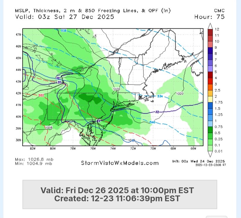
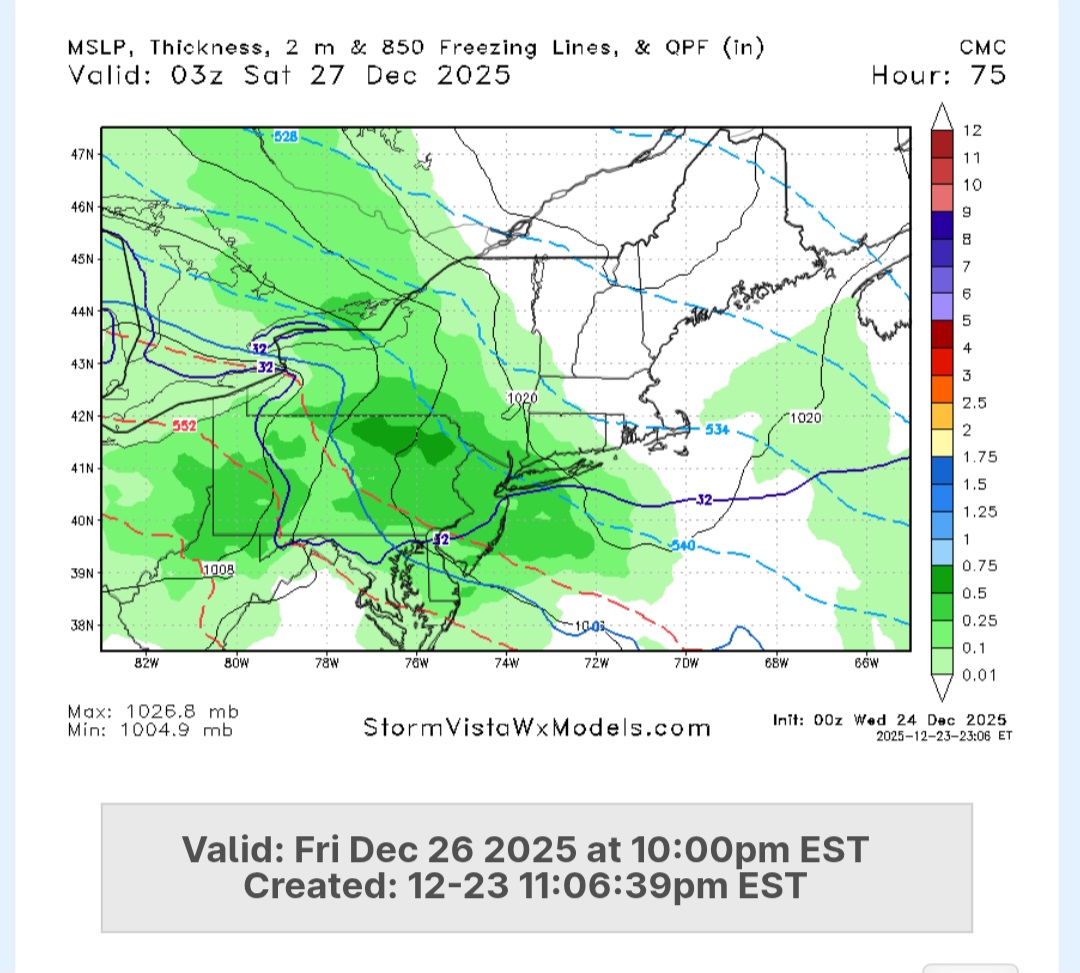
Canadian pretty much unchanged -
Cmc
-
.thumb.png.4150b06c63a21f61052e47a612bf1818.png)
White Christmas Miracle? December 23-24th
HIPPYVALLEY replied to Baroclinic Zone's topic in New England
Wow, you caught the meaty edge of things. My friend in Athol says under 1" there. -
West winds shot the temps up!! 58 degrees. Seeing sheltered spots in the 30s nearby. Crazy stuff
-
Temps stayed in the mid-40’s all afternoon. In the last few hours it’s shot up to 57°.
-

White Christmas Miracle? December 23-24th
radarman replied to Baroclinic Zone's topic in New England
We caught about an inch at the last -
White Christmas Miracle? December 23-24th
HIPPYVALLEY replied to Baroclinic Zone's topic in New England
.25" here, not sure that will last through tomorrow. This could be a rare non-white Christmas here. -
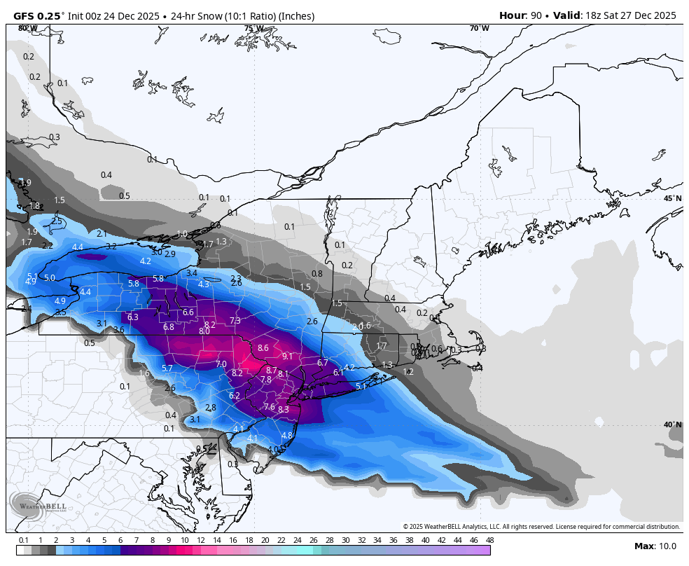
0z GFS decent shift north.
-
It has been consistent. Could still be wrong but other models seem to be trending colder
-
+SN, 23/21°F, 4" down
-
Sign me up
-
i guess that would be the ceiling @Stormlover74great to see. perfect track
-
.thumb.png.3d749c99dda6ed4ad31467cc2d84b633.png)
-

White Christmas Miracle? December 23-24th
ORH_wxman replied to Baroclinic Zone's topic in New England
One of the rare 11th hour breaks we’ve gotten in the last few years. Event somehow got its act together just enough this evening to make it pretty nice. Would be nice if we could get a region-wide good break soon. -
We'll see. That was a good GFS run. If this blocking really happens this can work out and we're getting into reality range.
-

December 2025 regional war/obs/disco thread
Ginx snewx replied to Torch Tiger's topic in New England
Not so small and look at the trend.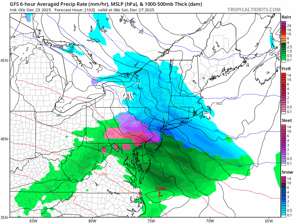


.png.a269561677f831e55186d7d4af42e27b.png)