All Activity
- Past hour
-
We're really starting to see some impressive microclimates emerge. Thurmont dipped to 34 degrees, but just to the northeast Harney at its lower elevation decoupled to 26 degrees.
-

November 2025 general discussions and probable topic derailings ...
dryslot replied to Typhoon Tip's topic in New England
Fake, Doesn't count -
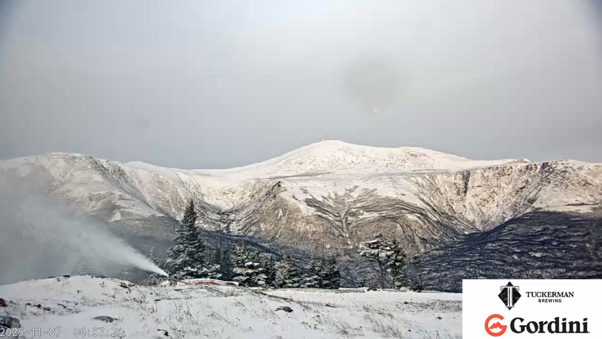
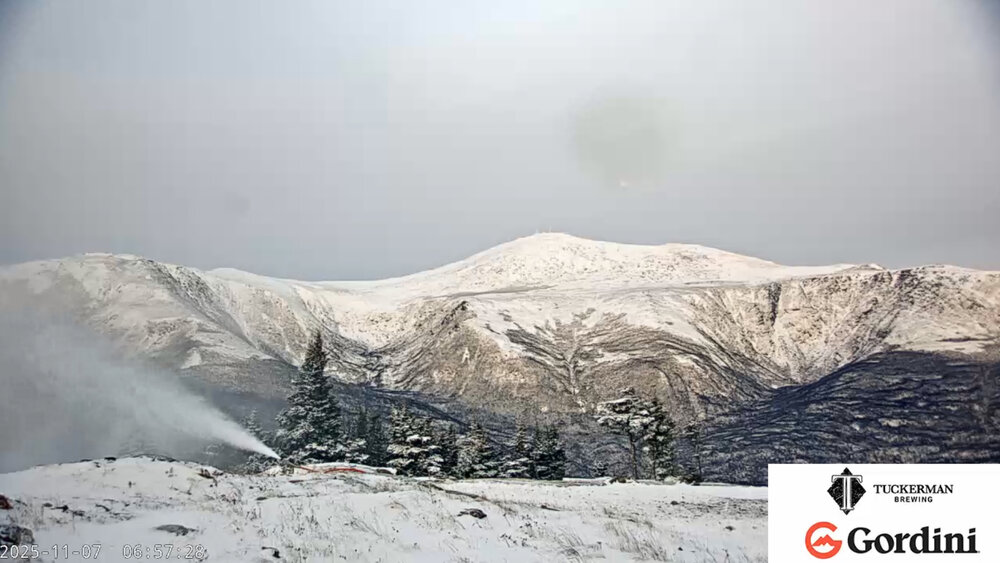
deep winter setting in up in NNE. This mornings webcam view from Wildcat Ski area looking across at the east facing on KMWN where they’ve already received over 14” this month.
-
.thumb.png.4150b06c63a21f61052e47a612bf1818.png)
November 2025 general discussions and probable topic derailings ...
HIPPYVALLEY replied to Typhoon Tip's topic in New England
Was she ever here at all? Low of 28° this morning. I think that’s my seventh time below 30. -
31 here
-
Great post, and a great analog. Pretty amazing to see that type of correlation.
-
November 2025 general discussions and probable topic derailings ...
dryslot replied to Typhoon Tip's topic in New England
She gone? -
More NWS map reports: American Legion Bridge hit 33 Springfield hit 32 Fort Belvoir hit 29
-
29 degree's this morning at work. Crystal clear skies with a beautiful sunrise.
-
A low of 11 at Canaan NWR. A 20+ degree difference from the reporting station on the nearby cabin mountain ridge.
-
 Snuck in a 29.5 first freeze here finally! 7 hours below 32
 -
29 at the closest station to me, all nearby are below 32. First freeze.
-
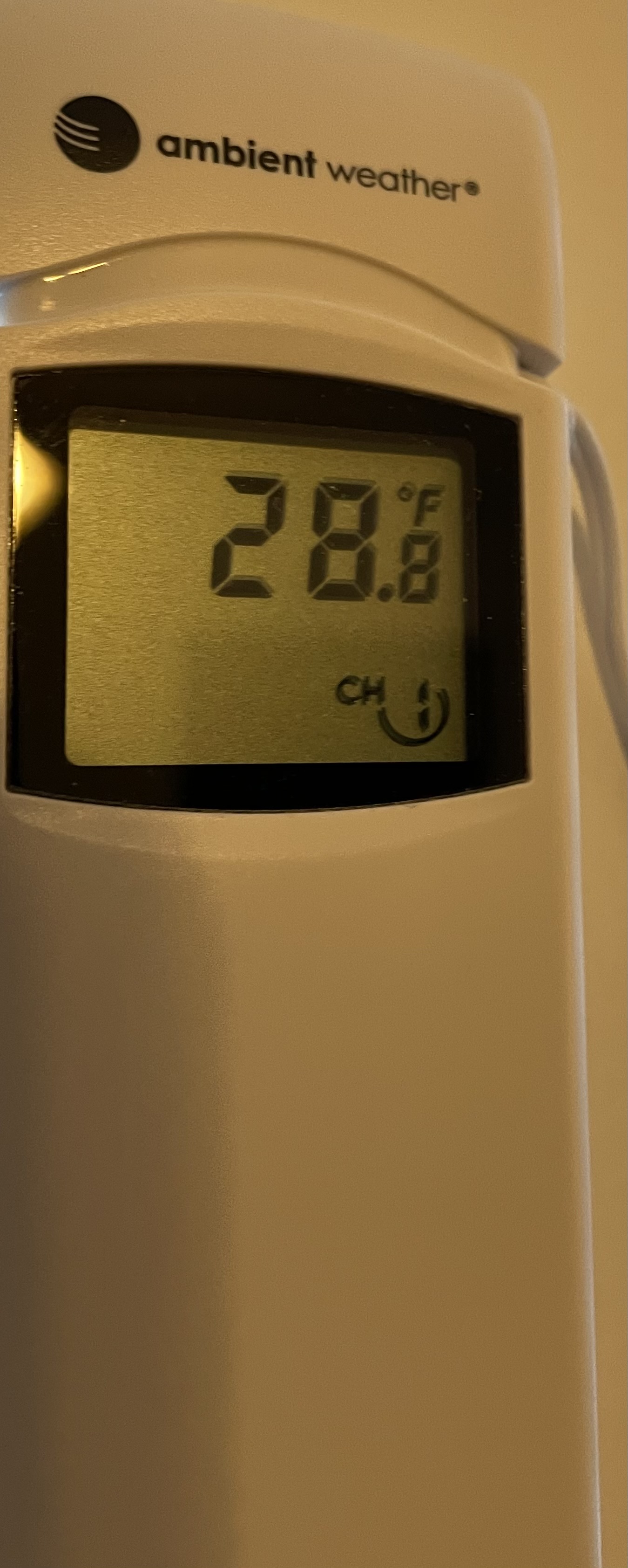
Great radiational cooling here just east of KHVN. This was my first freeze of the season. Down to 28.8° on my new Ambient thermometer.

-
DCA currently at 41 off a low of 37.
-
Airport low readings: DCA 37 BWI 30 IAD 28
-
BWI dropped to 30 briefly.
-
30 degrees with frost
-
28 here. Nice sunrise.
-
My guess is that the blocking and potential warming of the stratosphere is linked to this extreme warmth and lack of sea ice in the Kara and Barents areas. A recent study showed this potential sea ice to stratosphere link. So it’s looking like this will follow the Siberian precursor type of stratosphere event as outlined by Mike Ventrice. We will have to wait and see what the official designation of this potential stratospheric event is. The million dollar question is if this event will have the potential to in some way disrupt the Pacific Jet and lead to more of a benchmark type storm track into early December? https://agupubs.onlinelibrary.wiley.com/doi/full/10.1029/2023GL107221 Key Points Barents-Kara Seas (BKS) sea ice loss modulates the impacts of autumn SPV stretching events on subsequent Siberian cooling Reduced BKS sea ice enhances the upward propagation of waves into the stratosphere over the Euro-Siberian sector Descent of the anomalous stratospheric wave-2 ridge bridges the SPV stretching events and Siberian cooling under low sea ice conditions
-

Central PA Fall Discussions and Obs
pawatch replied to ChescoWx's topic in Upstate New York/Pennsylvania
25 degrees this morning and frost -
 28.1 here.
 -
Coldest of the season! 26.4 degrees for the low in Purcellville
-
https://www.facebook.com/share/p/1HDmZR82yz/ Another very interesting read for this upcoming winter for the Northeast.
-

November 2025 general discussions and probable topic derailings ...
tavwtby replied to Typhoon Tip's topic in New England
bottomed out at 25 even, poor chickens, forgot to plug in the water heater, so they were pecking at ice.. -
First 20s with 29