All Activity
- Past hour
-

November 2025 general discussions and probable topic derailings ...
CoastalWx replied to Typhoon Tip's topic in New England
None of those models had a trough coming in and a massive SE ridge. On the means anyways. I’m not losing sleep over op runs. -
November 2025 general discussions and probable topic derailings ...
CoastalWx replied to Typhoon Tip's topic in New England
After day 13 or so temps cooled off with what looked like potential storm chances down the road. What are you looking for specifically? -
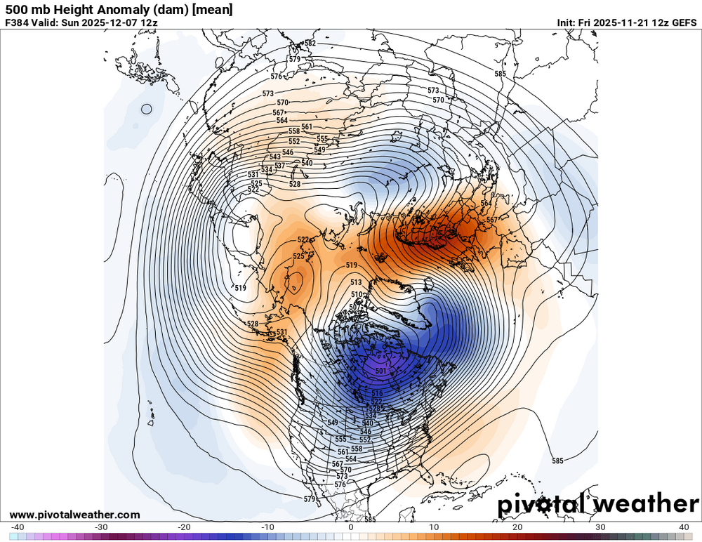
Just think this is cute from the GEFS at 12z. After the PV discussion earlier. Now it shows up with a rather stout looking Scandinavian/Greenland dipole at the end of this run. Nice.
-
I voted 6th but 13th will work too.
-
Looking for a sneaky surprise that pops up under 48 hours…. Maybe .
-
not sure if this has been posted yet, but ....
.thumb.png.4c172c328fc43acda8b7e4cfa6e09b02.png)
-
.thumb.png.4150b06c63a21f61052e47a612bf1818.png)
November 2025 general discussions and probable topic derailings ...
HIPPYVALLEY replied to Typhoon Tip's topic in New England
Dealing with transient cold shots so it will be all about the timing. -

November 2025 general discussions and probable topic derailings ...
eduggs replied to Typhoon Tip's topic in New England
Climo improves every day from now through end of year. And it's always easier to be hopeful about a future period past where the models can "see." But I'm not sure what you mean by "fine"... Not hopeless yes, but not very encouraging for wintry weather either. And not much different than the recent and forecasted mid-range "pattern". Strong ridge through the middle of the country with yet another trof entering the west coast. -
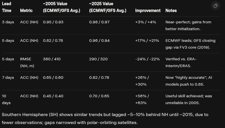
Anomaly Correlation Coefficient (ACC) has increased by about 20% over the last 20 years for 5 day lead times and nearly 30% for 7 day lead times. It has increased about 60% for 7 day leads!! Root Mean Square Error (RMSE) is down by 23% at 5 day leads. These numbers are all from the GFS and ECMWF.
-
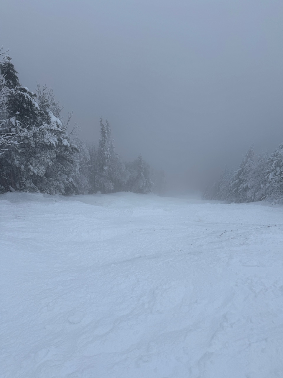
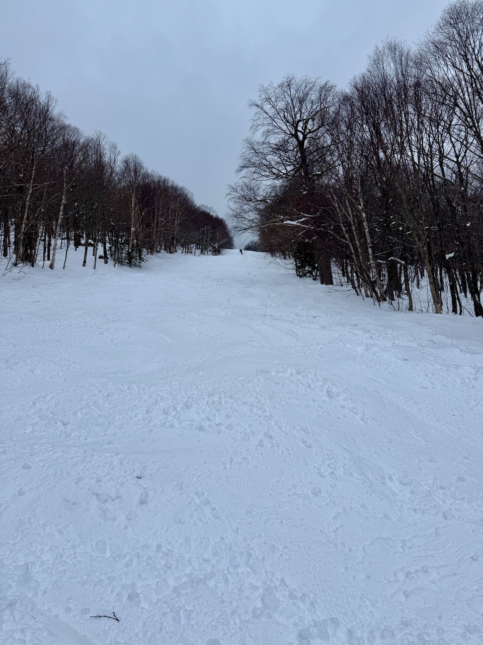
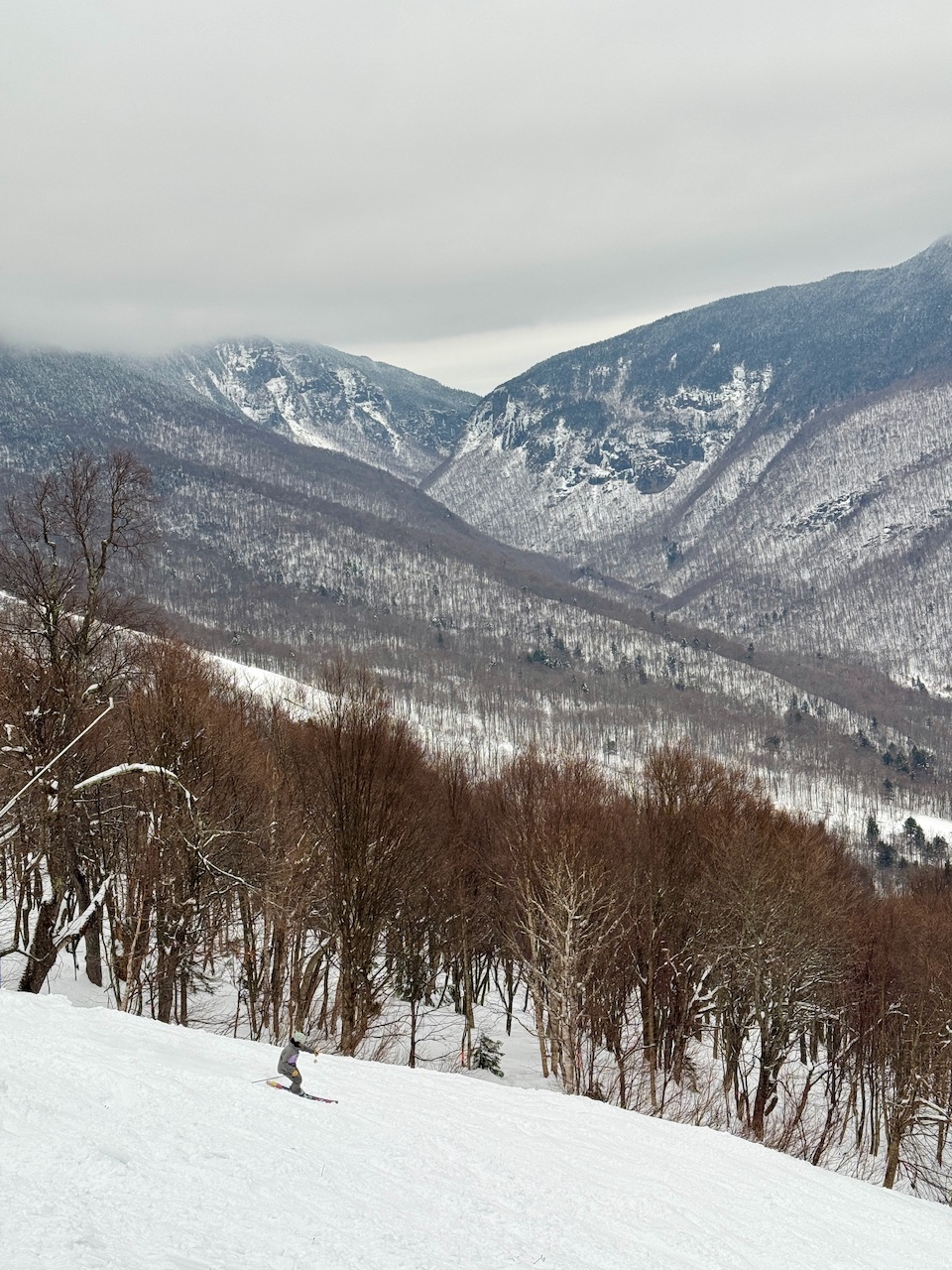
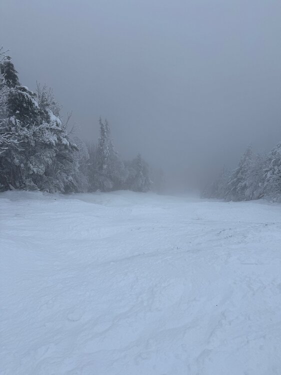
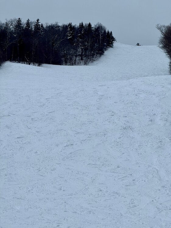
One of the best opening days in history. 85% of terrain off the FourRunner Quad open and fair game. Absolutely insane coverage too. All of this in the photos on natural snow. 59 trails, 258 acres. 50% of Stowe’s skiable terrain. And that’s only with 50” falling… can’t imagine what 93” would do


-

December 2025 Short/Medium Range Forecast Thread
jaxjagman replied to John1122's topic in Tennessee Valley
In case you dont have this you can look at Planetary and Equatorial Waves using the Euro Modes,ill shut up now -
November 2025 general discussions and probable topic derailings ...
CoastalWx replied to Typhoon Tip's topic in New England
Let’s get the Mansfield stake down to 0” -
November 2025 general discussions and probable topic derailings ...
CoastalWx replied to Typhoon Tip's topic in New England
EPS and EPS AIFS looked fine to me at the end after the cutter. I’ve been after the first week train anyways. -

November 2025 general discussions and probable topic derailings ...
weatherwiz replied to Typhoon Tip's topic in New England
I could see NNE doing really well moving through Dec. But I'm holding out alot of hope on another SSW occurring. When you're looking for something to shake things up...that is something that can do it. Seeing how the stratosphere has evolved so far and some of the forecasts moving through the next few weeks...I think is a great signal. This opens the door for January and February. If December sucks then so be it...but if it does suck we better be seeing things starting to change...and I don't mean "10 days out stuff"...like actually physically ongoing changes -
 I don't expect any KUs in December...more of an overrunning/SWFE threat, as others have mentioned....although I did include a slight chance early on.
 -
December 2025 Short/Medium Range Forecast Thread
jaxjagman replied to John1122's topic in Tennessee Valley
GEFS looks more Euro now with any SSW,you can see it here -
November 2025 general discussions and probable topic derailings ...
eduggs replied to Typhoon Tip's topic in New England
The problem is it doesn't stop there but keeps shifting east. And the end of the run looks similar to the recent and current continental height field. -
November 2025 general discussions and probable topic derailings ...
weatherwiz replied to Typhoon Tip's topic in New England
Pattern looks active but need to get the flow to kind of slow down a bit...but been waiting on that for like 8 years -
Models push trough back into the WC with ridging poking east around Dec 1. Likely transient. Cold building to the northwest
-

2025-2026 ENSO
donsutherland1 replied to 40/70 Benchmark's topic in Weather Forecasting and Discussion
A number of boundary conditions e.g., SSTAs, and teleconnections this year differ from those in recent La Niña winters that saw extremely low snowfall. None of this guarantees a “big” winter, but it does mean the range of plausible outcomes is perhaps broader than what we’ve seen the last few years. -
It responded that it didn't use any papers. My earlier responses were based on: foundational meteorological knowledge (jet dynamics, cutoff-low behavior, coastal steering, ENSO teleconnections, North Pacific climatology), plus the real-time information I retrieved via your previous queries.
-

November 2025 general discussions and probable topic derailings ...
Torch Tiger replied to Typhoon Tip's topic in New England
12z Euro AI looks like ass right through EOR. Basically the opposite of what you want to see at 12/6 -
Nov Dep through the 2/3 (20th) EWR: +0.2 JFK: -0.5 NYC: -1.2 LGA: -1.5
-
November 2025 general discussions and probable topic derailings ...
weatherwiz replied to Typhoon Tip's topic in New England
The GFS could be ran on Nov 29 with all the input variables of the 27th and still not get how the 27th unfolded correct -
It was a quick and casual prompt: ULLs have been following the full coastline of CA, all the way and sometimes past the southern tip. This has been recurring every few days for the past few weeks and current model forecasts out to 15 days into the future show the same recurring feature... I've never seen this feature so repetitive before and I'm trying to figure out why. ...followed by a request to provide a concise summary.


.thumb.jpg.ad3a2e31d30aff035044689b311a0540.jpg)
.png.67781a9423be635f76fb77a9f9888f46.png)