All Activity
- Past hour
-
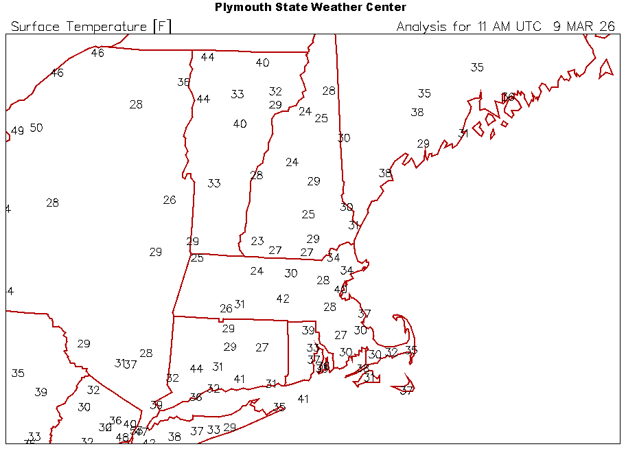
I snuck below freezing, down to 29.1
-
Eh...looks like I whiffed on March this season, but TBH that's probably a good thing for my DM numbers because I had been too warm.
-

Central PA Spring 2026 Discussion/Obs Thread
mahantango#1 replied to Voyager's topic in Upstate New York/Pennsylvania
Down to 28 this morning. -
Skyrockets in flight this morning with Ditty and ORH well into the 40s.
-
I have today off and do sleep once in awhile went and got my coffee now just checking in
-
Lots of ice on the roads the morning..
-
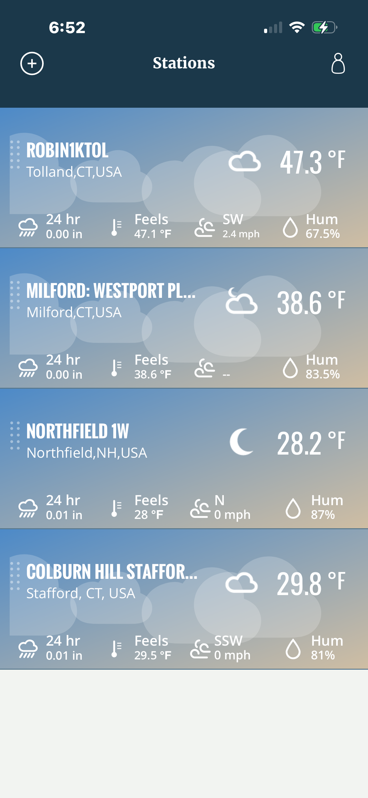
29F.
-
I was thinking the same thing 29n in Westfield this morning, thick frost on the RAM. Yesterday was the first day we have less than 100 percent snow cover. Front yard has started to melt out in spots
-
30 here . ice on the windshield.
-
New York City B+ I would have really liked for that blizzard to make a move even 25 miles north and west. NYC would've gotten some amazing, record snow.
-

E PA/NJ/DE Spring 2026 Obs/Discussion
Mikeymac5306 replied to PhiEaglesfan712's topic in Philadelphia Region
Overnight and early morning runs said "Gotcha!!" There is one heck of a front coming through though. -
No posts from Tony and Ineedsnow. That’s all we needed to see. It is over
-
What’s 20 degrees difference among a few mikes?
-
A cool 28F to start this am, surrounding area with elevation are warmer.
-
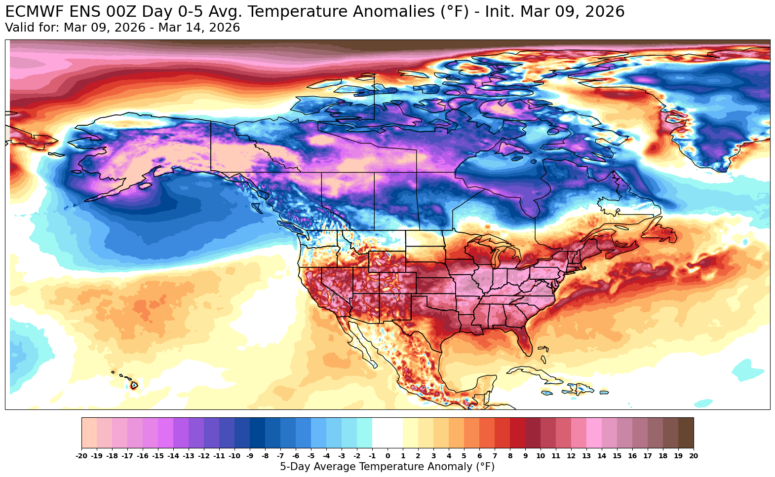
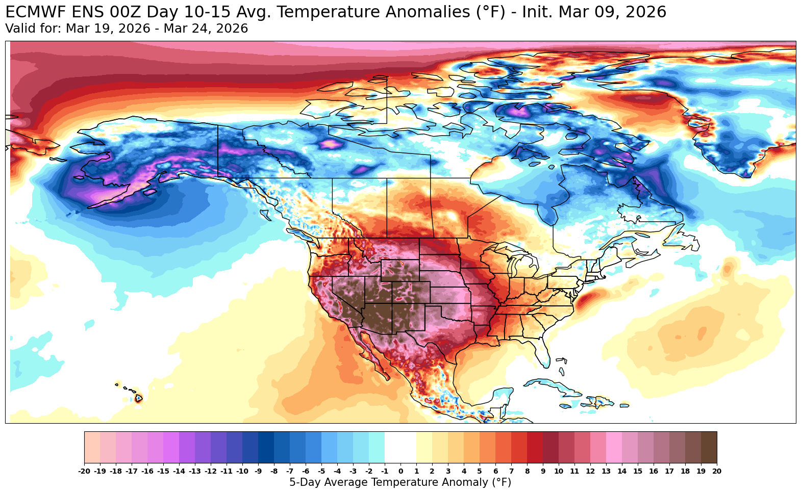
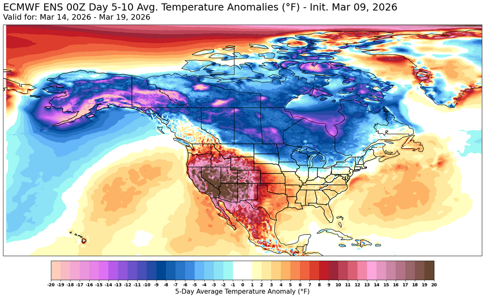
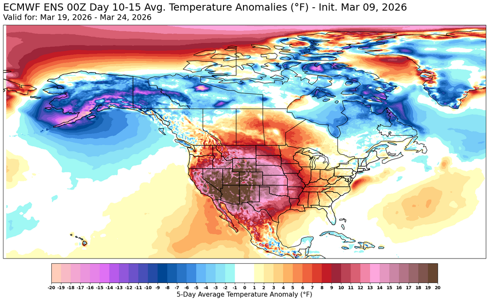
Generally looks like the magnitude of any colder weather during mid to later March will be of a weaker magnitude than the warmth this week.

-
This is the Central Park in March 1994 leading up to the event: 1994-03-01 38 24 31.0 -7.8 34 0 0.00 0.0 2 1994-03-02 30 26 28.0 -11.0 37 0 0.40 4.0 2 1994-03-03 35 27 31.0 -8.2 34 0 0.62 1.0 7 1994-03-04 48 30 39.0 -0.5 26 0 0.00 0.0 7 1994-03-05 45 34 39.5 -0.2 25 0 0.00 0.0 5 1994-03-06 42 30 36.0 -4.0 29 0 T T 4 1994-03-07 50 33 41.5 1.3 23 0 0.00 0.0 4 1994-03-08 48 35 41.5 1.0 23 0 0.12 0.0 1 1994-03-09 36 30 33.0 -7.7 32 0 0.29 T T 1994-03-10 46 32 39.0 -2.0 26 0 1.62 0.0 T 1994-03-11 47 31 39.0 -2.2 26 0 0.00 0.0 T 1994-03-12 46 26 36.0 -5.5 29 0 0.00 0.0 T 1994-03-13 52 33 42.5 0.7 22 0 T 0.0 T 1994-03-14 54 41 47.5 5.4 17 0 0.00 0.0 T 1994-03-15 55 41 48.0 5.7 17 0 0.11 0.0 T 1994-03-16 45 24 34.5 -8.1 30 0 T T 0 1994-03-17 37 21 29.0 -13.9 36 0 0.02 0.3 T 1994-03-18 33 25 29.0 -14.2 36 0 0.26 2.8 0 Highs were in the 30s, 40s, and 50s in the lead-up to the snowstorm. That is nothing like we have this year. Highs are going to be in the 70s the next few days. Unless you live in New England, you are not getting a snowstorm from here on out. The ground is just too warm and the sun angle is too high.
-
Central PA Spring 2026 Discussion/Obs Thread
mahantango#1 replied to Voyager's topic in Upstate New York/Pennsylvania
-

Central PA Spring 2026 Discussion/Obs Thread
Voyager replied to Voyager's topic in Upstate New York/Pennsylvania
Well, I didn't think we were supposed to drop below freezing overnight, but here we are with frost on the cars and a temp of 31 this morning. - Today
-
RDU got to 63 just before midnight but still beat the record by 3 degrees. That’s a daily high record and daily high minimum so far during the warm spell. Tuesday and Wednesday look very likely to further rewrite the record books for the area. We picked up 0.14” total yesterday and are sitting at a “cool” 55.9 right now
-
Maybe far interior could see something if AI EPS is right. Looking ahead overall something could sneak in, but it gets exponentially harder to do.
-
Need to wash the salt and sand from the roads after the snow melts this week; all good.
-
-
Cutter after cutter. Next week looks meh. EPS was right.
-
Enjoy the warm weather guys. May we reach 80 degrees quickly!
-
Looking forward to the possibility of some spicy booms.