All Activity
- Past hour
-

“Cory’s in LA! Let’s MECS!” Jan. 24-26 Disco
bristolri_wx replied to TheSnowman's topic in New England
"governing voice" -
Have been thinking and doing some prep since Wednesday, have a small generator that can run some things but not an electric heater. Have a wood fireplace so stocked there. Had an indoor propane heater on order for delivery today, but got notice yesterday, out of stock and order cancelled. Think I might be out of luck trying to find a Mr. Buddy portable propane heater around town.
-

Possible Record Breaking Cold + Snow Sunday 1/25 - Tuesday 1/27
Voyager replied to TriPol's topic in New York City Metro
Yup. Right or wrong, we're getting to the time where I pay more attention to the mesos over the globals. -

“Cory’s in LA! Let’s MECS!” Jan. 24-26 Disco
WxWatcher007 replied to TheSnowman's topic in New England
We take. Excellent trends up our way. -
This is going to be in the 14-15:1 range up here for most of the duration.
-
Possible Record Breaking Cold + Snow Sunday 1/25 - Tuesday 1/27
jm1220 replied to TriPol's topic in New York City Metro
I’m sure they’ll adjust further today. Hopefully the models are done with the warm shifts but the confluence needs to hold as long as it can. -

“Cory’s in LA! Let’s MECS!” Jan. 24-26 Disco
Damage In Tolland replied to TheSnowman's topic in New England
Subtle undertones? Not sure what you’re insinuating. Just making a valid observation. No more , no less . -
If it starts sooner it will end sooner too, Its all relevant with the duration.
-
“Cory’s in LA! Let’s MECS!” Jan. 24-26 Disco
mahk_webstah replied to TheSnowman's topic in New England
I find the office up here, GYX, it’s pretty darn good. Sometimes I think they’re going to be way off and then in the end their forecast is usually on target -

“Cory’s in LA! Let’s MECS!” Jan. 24-26 Disco
moneypitmike replied to TheSnowman's topic in New England
What a weenie run. Shoud we be uding the kuch? J never knoe when ine us more useful than the ither. Can you pist a qpf one? Tia -

“Cory’s in LA! Let’s MECS!” Jan. 24-26 Disco
Damage In Tolland replied to TheSnowman's topic in New England
National Blend Of Models. It takes certain models and blends them all together -

January 24-26: Miracle or Mirage JV/Banter Thread!
dailylurker replied to SnowenOutThere's topic in Mid Atlantic
I want to apologize for a few unhinged post lol. The transition from clean storm to dirty storm was frustrating. Now that were settling into it I'm getting excited for heavy snow and dumping sleet. I had to do a little self reflection this morning to clean up my perspective on this. LFG! -

Central PA Winter 25/26 Discussion and Obs
Voyager replied to MAG5035's topic in Upstate New York/Pennsylvania
Good question. Maybe they're a bit unsure of when accumulating snow ends. If they took that map to 1am, it would probably be 4-6 inches higher. -

“Cory’s in LA! Let’s MECS!” Jan. 24-26 Disco
mahk_webstah replied to TheSnowman's topic in New England
Also looks like the duration has increased. Last night they were saying a start here at 5 PM and now they’re saying 3 PM. But I think it’s gonna be more like 12 or one because that usually happens with these kinds of storms. But they have it snowing until early evening Monday so they are thinking more than 24 hours. I imagine along the coast or closer to the coast where you are, the duration could be even longer. -

Possible Record Breaking Cold + Snow Sunday 1/25 - Tuesday 1/27
Stormlover74 replied to TriPol's topic in New York City Metro
Upton says I'm all snow through 10 pm Sunday -
GregRups21 started following Possible Record Breaking Cold + Snow Sunday 1/25 - Tuesday 1/27
-
-
I hope it works out for everyone!
-

“Cory’s in LA! Let’s MECS!” Jan. 24-26 Disco
bristolri_wx replied to TheSnowman's topic in New England
Why do you bring this up every single time NWS/NOAA is discussed? They are a group of mets like any other, putting out a forecast. Your criticism is valid, but the subtle undertones of your wording are noted. -

January 24-26: Miracle or Mirage JV/Banter Thread!
snowfan replied to SnowenOutThere's topic in Mid Atlantic
Thankfully, cantore went to nyc. Phew -
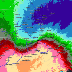
It has the last 3 runs of all modeling.
-
“Cory’s in LA! Let’s MECS!” Jan. 24-26 Disco
wx_observer replied to TheSnowman's topic in New England
I'm not a met and I'm not nearly as knowledgeable as most in here. But for me, NWS has historically been what I considered the most objective forecast source, not focused on ratings or hype or profit. They took the data and made a forecast based on an educated interpretation of that data, and explain their rationale in the discussions. What is the NBM? The discussions I read seem like they are written and signed by specific employees. -
January 24-26: Miracle or Mirage Thread 2
SomeguyfromTakomaPark replied to mappy's topic in Mid Atlantic
Most of our mixing events over the years are snow to sleet to rain to 40+ degrees. This is a pretty cool and unique event with a very anomalous arctic airmass. The fact that plain rain isn’t even in the discussion is cool. Even if we “only” get 4-5 inches in dc and then ice and then arctic cold it’s still going to be awesome. True deep winter stuff coming. -
Effin' A. Where do I sign?
-

“Cory’s in LA! Let’s MECS!” Jan. 24-26 Disco
mahk_webstah replied to TheSnowman's topic in New England
Wow, that seems to have gotten dramatically better for Maine.


