All Activity
- Past hour
-
to be fair today and tomorrow aren't going to be mostly overcast, the sun looks like it's about to come out right now as a matter of fact. and we got the sun back yesterday around 6 pm and it was a gorgeous sunset.
-
17,000 people had to relocate because of Canadian wildfires, regardless of the cause this is bad stuff. I hope that smoke doesn't make it here, it's already forecast to get into the central part of the country. It would be ironic if we had a nice dry sunny stretch and it was that crap that ruined our clear blue skies and held down temperatures (though they'd still at least be in the 70s as long as we get sunshine.)
-
Once we flip it usually stays but we'll see
-
It has been a pretty crappy month for my solar, but last month was near an all-time high month, so I guess it evened out.
-
Best is east Saturday. To the east my brother, to the east.
-
Yeah, thinking last night was the last time until Fall that I'll be sleeping with the windows open and the blankets up.
-
Yup. Whole thing has bumped NW with heavy rains
-
Exactly-this week was supposed to be decent and it's been mainly overcast for the last 10 days
-
Someone could get a tornado tornado today east of I-95. Not sold on the flood risk.
-
Saturday still going north?
-
That convection will drop over 1" in spots in ern areas for sure.
-
We shall see..seems like each day it gets pushed back..wash rinse repeat with this abhorrent weather
-
"This will be a soaker with the most rain west where there can be 1-3”+. The least across eastern MA where likely 0.50” will do it. I’m watching the trends…the latest HRRR has pushed heavier rain a bit farther east. " Eweather
-
Verbatim we are probably looking at 2-5"; (6" locally) of rain collocated with the mountainous areas of the far interior. Berks, southern greens, monads look like hardest hit areas.
-
Yup Farther north across VA/MD/DE, confidence regarding storm mode is lower, with some guidance suggesting the potential for discrete/semi-discrete supercells ahead of the front. These storms would have the potential for severe wind/hail, and potentially pose a tornado risk with stronger/more sustained storms. If confidence increases regarding the expected coverage of severe storms in this area, then higher severe probabilities may be warranted with the 1630z Convective Outlook.
-
the weather is going to be dry and sunny most of next week with temperatures in the low 80s, which is great.
-
but this is normal, our first heatwave usually happens around June 20th. Once it starts it won't be just one day of 90 either.
-
@Ellinwood - on board and good for tornado potential
-
it's not last minute, aside from the fringe models, this was well predicted
-
Sunshine? - Check Shear? - Present-ish CAPE? - Present-ish MLLR? - Nope. @Eskimo Joe - Thoughts?
-
Tbh the mid level synoptics are nuclear for May 31. If system this had even a slight tropical connection it would be a doozie. Gonna be flirting with 970's as it passing our region. Pretty damn difficult to do this time of year without the tropics involved.
-
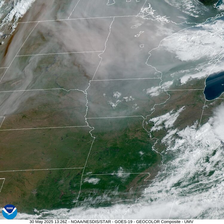
Really heavy smoke today across the NC US. Nasty skies this am.
-
you must love fungus and weeds
-
"Longer read:" Do you have another variety in your toolbox?
-
Yea. This is obvious. How many inches?


