All Activity
- Past hour
-
Every model agrees on a super ridge in the east. There's no way we're escaping this. Trust me I'd love nothing more. If this verifies someone is recording 110F.
-
Last year the Euro a few times showed all-time record highs (109) for Philly in mid-long range, only for Philly never to reach 100, so I'll hang my hat on that until it gets to day 3, then I'll believe it much more
-
Well at least by then we'll be getting one day closer to winter lol
-

2025 Short Range Severe Weather Discussion
Stebo replied to Chicago Storm's topic in Lakes/Ohio Valley
Wednesday -

2025 Short Range Severe Weather Discussion
Chicago Storm replied to Chicago Storm's topic in Lakes/Ohio Valley
which day? -
I tend to agree. We'll see. I think the message is that it will be hot with probably the hottest heatwave since 2010. Maybe we are locked into at least 5 consecutive days of mid 90s+. And I would look for the hottest days to top out probably between 102-104 if we do in fact exceed 100. Lots of time for the 100s to become unraveled here. It can all be messed up with backdoor fronts, onshore winds, or thunderstorms. WX/PT
-
Abbreviated translation…… hotter and humid than he’ll summer coming for the next 3 months with no breaks.
-
From this range you assume the standard corrections. As Scott was saying, the NW flow is likely to offset - this appears to be ( at this time...) trying to take a S/W plateau slab of desert kinetic air and sending over top. This is not initially a Bermuda/Gulf delivery. 99/63-ish more so than 89/76. The other aspect that I think Brian hit on is that normal model magnification may normalize some. A standard heat wave is still going to be a score for modeling and recognition from this range. We'll see how things evolve in guidance I will say though that the ensemble means of all 3 remain impressively amplified, above 594 circumvallate 500 mb ... in fact, it's not even clear it ends but really just loses coherence by virtue of normal member meandering way out in time - there's still arguably vestiges of it there beyond 300 hours.
-

2025 Short Range Severe Weather Discussion
King James replied to Chicago Storm's topic in Lakes/Ohio Valley
Will be camping in Maple City MI this weekend. Bring the sky booms -
Might actually squeeze out a nice weekend for once
-
Everyone should get a good tank of gas next Monday
-
why not GFS is only a few degrees lower
-
Well, you won’t be needing a blanket.
-
HI at 11:45 am is bigger than 4pm
-
Damn only hit 69 here
-
these euro temps will not verify...
-
Today the Thursday severe threat is still there but the worst looks to be in the eastern 1/3 of the state due to timing issues out west.
-
106.
- Today
-

June 2025 discussion-obs: Summerlike
LongBeachSurfFreak replied to wdrag's topic in New York City Metro
95 with the incredible vegetation growth this spring. It’s as deep and dark into the foliage as it’s ever been. I would love to see JFK and LGA hit like 105 and the park is 95. -
Yeah. This is pretty great. But for next week, wouldn’t mind some 92/58 type stuff.
-
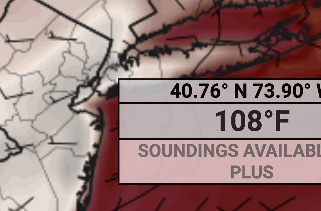
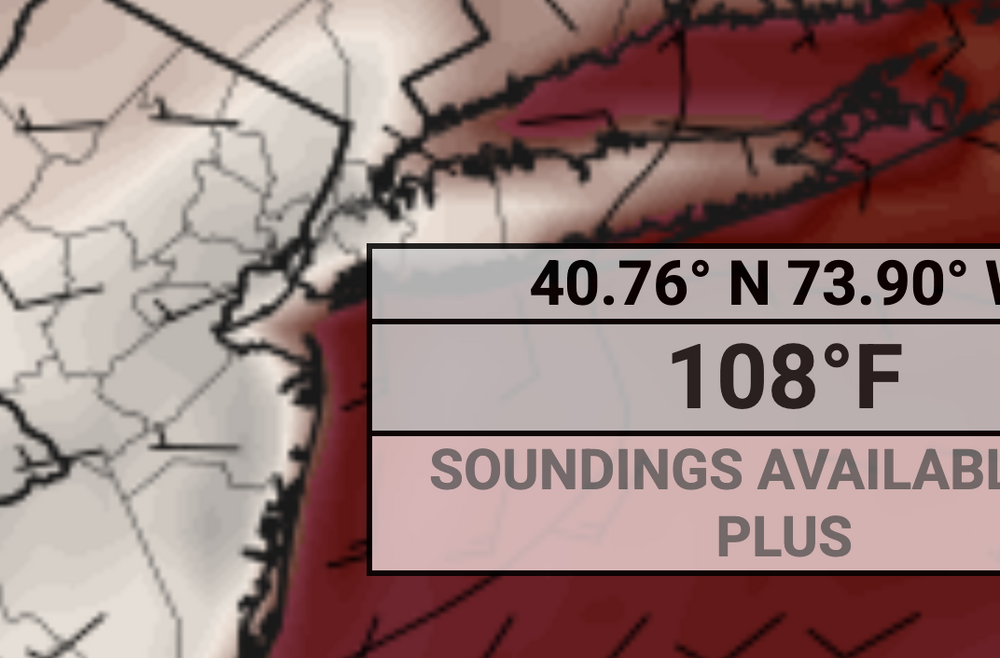
Euro has 107F, 105F, and 108F next Tuesday, Wednesday and Thursday lol. Here is Thursday:
-
Today ended up sun and near 80. Certainly none of the doom and gloom TFlizz was calling for yesterday
-
Pretty nice one out there today.
-
Love me some heat with low humidity. Alas, that probably won’t verify for very long.