All Activity
- Past hour
-

January 2026 regional war/obs/disco thread
weathafella replied to Baroclinic Zone's topic in New England
Show me where 2-4 is modeled outside of a few locations and don’t include NNE. tonight 1-2 as a long shot. Sunday night flurries. Mid week is 7 days away. Why would you want a this with very little water in the snow and as such much more meltable vs a meaty SWFE? -

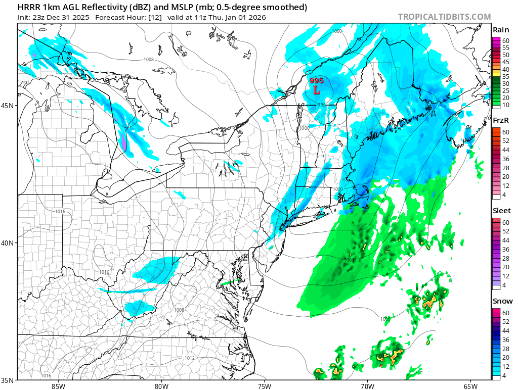
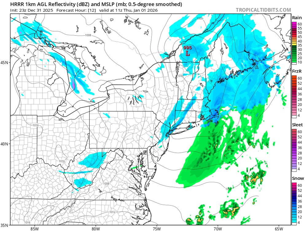
New Years Day 2026 - 1st snows of the new year possible
Damage In Tolland replied to Baroclinic Zone's topic in New England
He drew it wearing nothing but his white hotel Teri cloth robe -
We're so close.
-
Ball drop and squall line
-

New Years Day 2026 - 1st snows of the new year possible
CoastalWx replied to Baroclinic Zone's topic in New England
oh haha. I did. It see that. -

Central PA Winter 25/26 Discussion and Obs
pawatch replied to MAG5035's topic in Upstate New York/Pennsylvania
27° Some moderate snow here. Nothing melting that’s for sure. Everything is covered cars, roads. Maybe take a measurement in a little while. -

January 2026 Medium/Long Range Discussion
Stormchaserchuck1 replied to snowfan's topic in Mid Atlantic
And with the 1st of January projected to be very warm, they are going with a big pattern change for the 2nd half of the month: PNA has been negative every day this Winter since Dec 1st. LR models have it going positive for the 2nd half of January: If the CPC is right, it could actually get very cold Jan 20-30. -

New Years Day 2026 - 1st snows of the new year possible
Sey-Mour Snow replied to Baroclinic Zone's topic in New England
Beautiful enjoy! I just saw a 4-8” for map for all of ENE on twitter so I figured you saw it.. -

New Years Day 2026 - 1st snows of the new year possible
Kitz Craver replied to Baroclinic Zone's topic in New England
Saaaaweeet! -

Pittsburgh/Western PA WINTER ‘25/‘26
colonel717 replied to Burghblizz's topic in Upstate New York/Pennsylvania
Come on down. watching the football game. -
New Years Day 2026 - 1st snows of the new year possible
CoastalWx replied to Baroclinic Zone's topic in New England
Beer for me?
-
New Years Day 2026 - 1st snows of the new year possible
Kitz Craver replied to Baroclinic Zone's topic in New England
My yellow has a fond taste for rabbit pellets… mmmmm, yum -
Pittsburgh/Western PA WINTER ‘25/‘26
colonel717 replied to Burghblizz's topic in Upstate New York/Pennsylvania
Just shoveled an inch. Only snowing very lightly. Just doesn't have a big snow feel out there. Unless rates really increase getting maybe 1/3 inch per hour rates won't get me to 4 inches. -
New Years Day 2026 - 1st snows of the new year possible
Sey-Mour Snow replied to Baroclinic Zone's topic in New England
Twitter? -

Pittsburgh/Western PA WINTER ‘25/‘26
blackngoldrules replied to Burghblizz's topic in Upstate New York/Pennsylvania
We really do live close to each other! I could probably walk to your house. Lol Sent from my SM-S931U using Tapatalk -
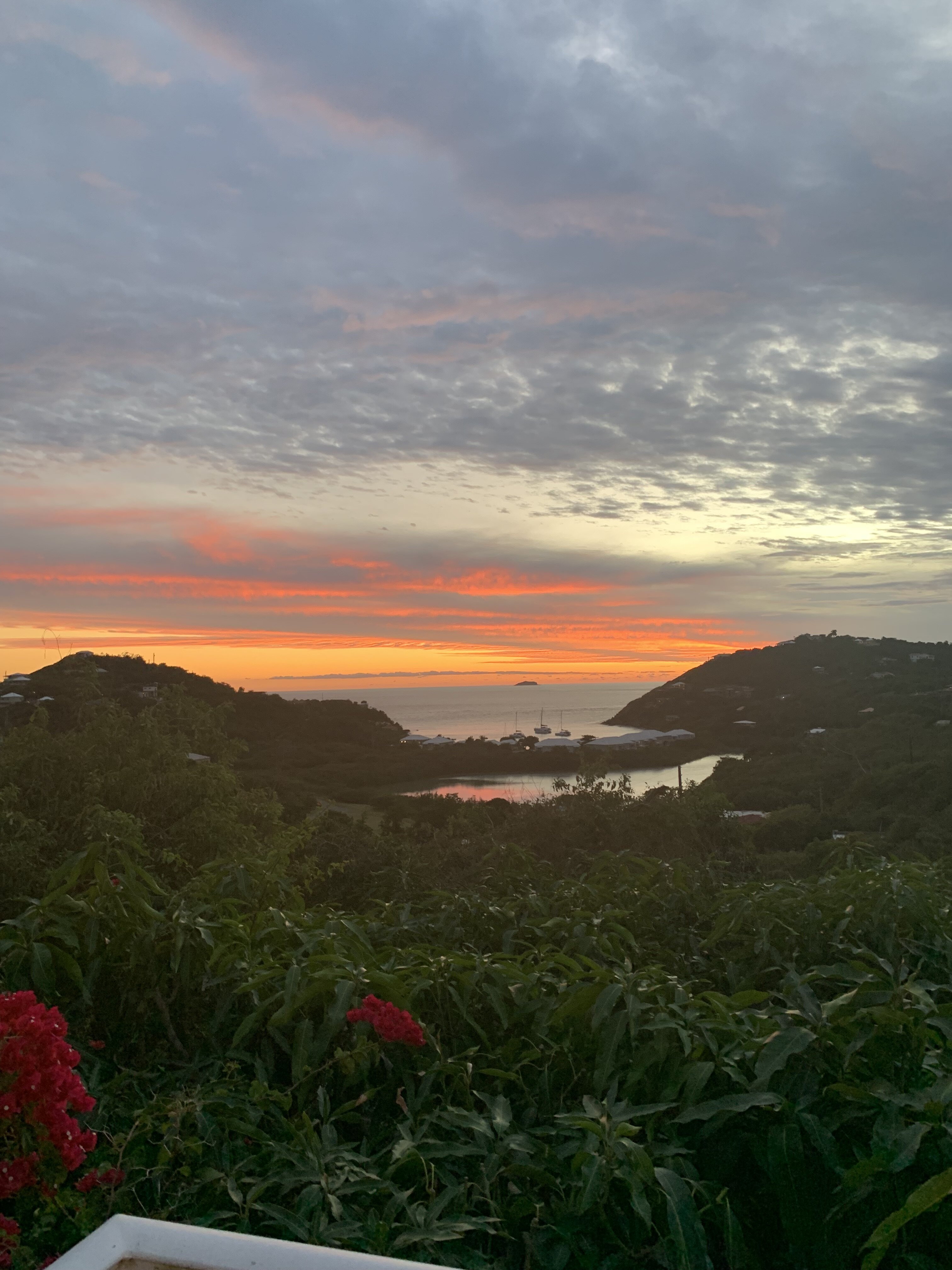
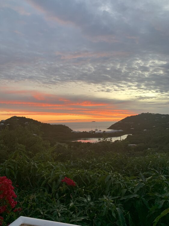
Happy NY from St John
-
New Years Day 2026 - 1st snows of the new year possible
CoastalWx replied to Baroclinic Zone's topic in New England
4-8? -
Happy New Years weenies. 2025 sucked for me so here’s to a good 2026. Same to you all.
-
It’s unfortunate there just isn’t enough cold air around Saturday because that slider has trended significantly wetter with a very favorable track for a cross state NC storm. Sad really
-

Central PA Winter 25/26 Discussion and Obs
MAG5035 replied to MAG5035's topic in Upstate New York/Pennsylvania
27ºF and steady snow arrived here in the last hour, with a fresh coating so far. We usually do pretty good with these kind of events here right off the ridgeline. CTP expects about 2” here in Altoona and I think that should be pretty attainable between the steady snow and the expected snow squall line. -
Actually I agree with you. The NYC event trended north in the last day or so, putting the max just NE of the city instead of directly over and south of it.
-
 Phoenix experienced its warmest December on record for the second consecutive year. Last year, the December mean surpassed a record that held since 1980. That record was beaten this year with Phoenix experiencing, by far, its warmest average low temperatures on record for December.
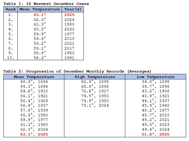
-
Short on time? we still have plenty of time with the way these models are lol.
-
January 2026 regional war/obs/disco thread
Damage In Tolland replied to Baroclinic Zone's topic in New England
Tonight / Sunday night into Monday / Mid week It is -

Pittsburgh/Western PA WINTER ‘25/‘26
RitualOfTheTrout replied to Burghblizz's topic in Upstate New York/Pennsylvania
Radar looks to be filling in, getting moderate snow here. Probably closing in on an inch and forecast was 3-5 so I think its still on track. It does look like areas that got more from the snow bands to the SW of the city are missing some of the better rates at the moment though.