All Activity
- Past hour
-

Invest 92L--70% Two Day & 70% Seven Day Odds
GaWx replied to WxWatcher007's topic in Tropical Headquarters
They’re going with a TD rather than STD as of the 5 PM/initial advisory: NHC will initiate advisories on Tropical Depression Three, located in the Atlantic Ocean offshore of the southeastern United States, at 500 PM EDT (2100 UTC). -

2025-2026 ENSO
Stormchaserchuck1 replied to 40/70 Benchmark's topic in Weather Forecasting and Discussion
SST feedback doesn't make sense to me. Seems like kind of a simple answer. The tropics have recently shown a good SST correlation though with tropical systems. It works in the tropics, but not really in the upper latitudes. -

Invest 92L--70% Two Day & 70% Seven Day Odds
NorthHillsWx replied to WxWatcher007's topic in Tropical Headquarters
Satellite imagery is a bit deceiving as the MLC is well east of surface circulation and surface center is diffuse. Will be interesting what NHC goes with at 5, but it’s not far off from a name. IMO this very likely gets named and areas east of landfall have a nasty weekend -

July 2025 Obs/Disco ... possible historic month for heat
BrianW replied to Typhoon Tip's topic in New England

-
July 2025 Obs/Disco ... possible historic month for heat
BrianW replied to Typhoon Tip's topic in New England
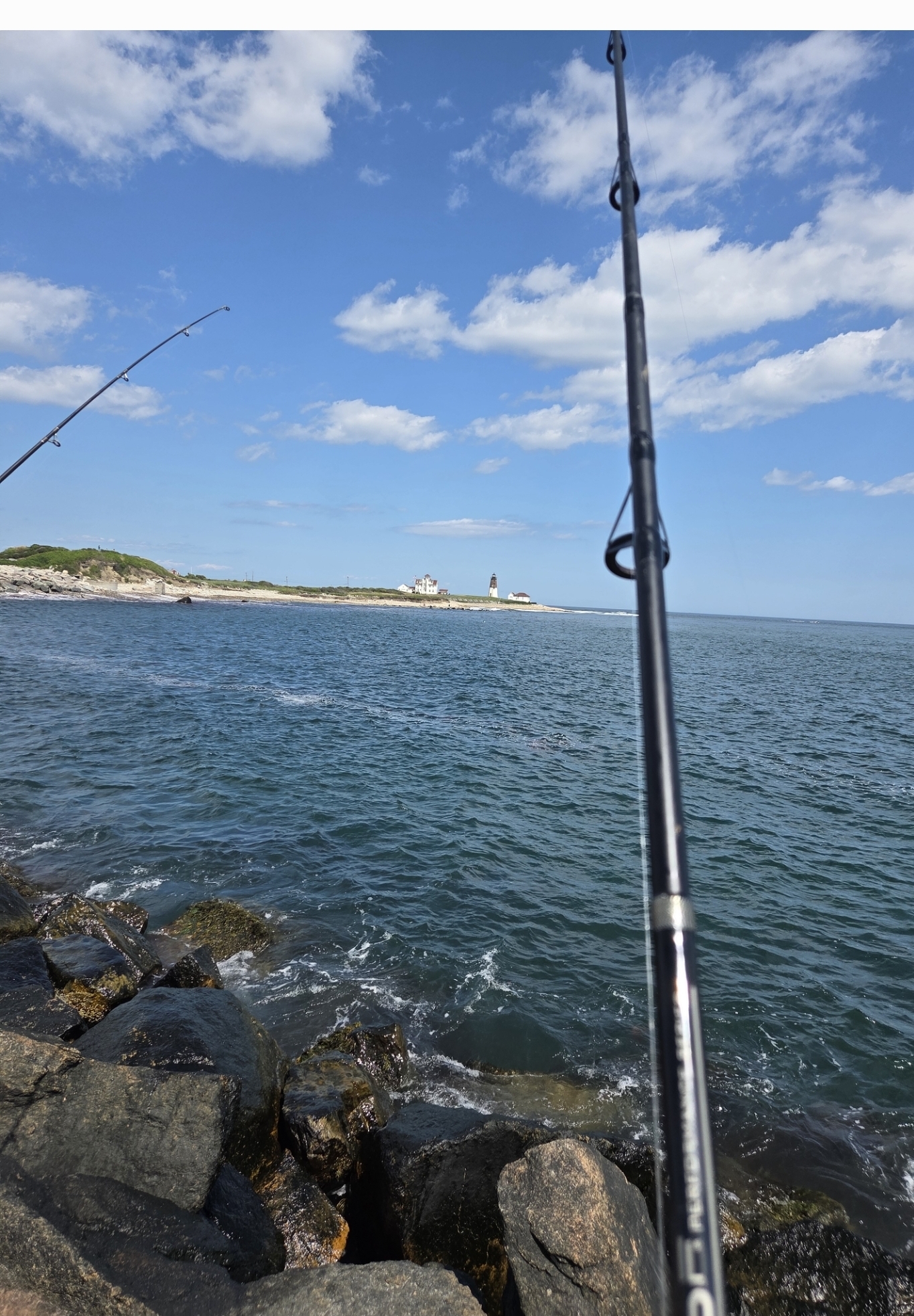
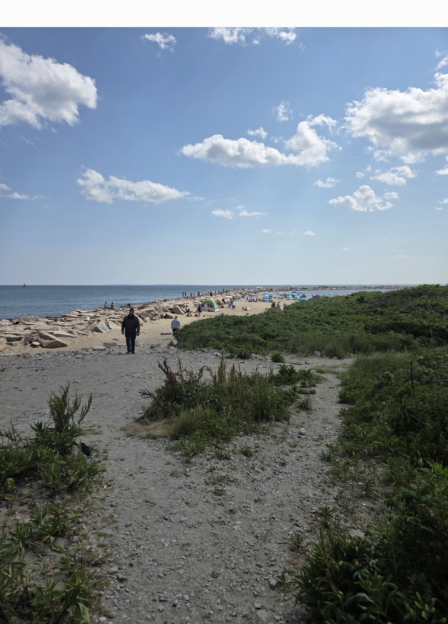
What a day out on Pt Judith fishing with my Nephew. Low 70's and a nice sea breeze.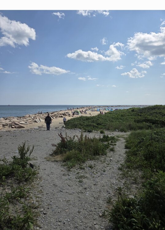
-

July 2025 Discussion-OBS - seasonable summer variability
Stormlover74 replied to wdrag's topic in New York City Metro
-
Invest 92L--70% Two Day & 70% Seven Day Odds
GaWx replied to WxWatcher007's topic in Tropical Headquarters
I just saw this, which suggests the NHC may be going with a 30 knot subtropical depression perhaps due to the center being too broad for TD status: AL, 92, 2025070418, , BEST, 0, 309N, 790W, 30, 1012, SD Also, note the 79.0W longitude, which suggests it’s a little E of the 79.5W longitude that the LLC was earlier supposedly near. -

July 2025 Discussion-OBS - seasonable summer variability
steve392 replied to wdrag's topic in New York City Metro
79 degree's out. Gorgeous. Only been outside once at work and that was to check on the cook for the bbq we're having. Got bbq hook up outside to natural gas when we built this place. Lots of food. Ready for nap. -

E PA/NJ/DE Summer 2025 Obs/Discussion
mattinpa replied to Hurricane Agnes's topic in Philadelphia Region
Exactly - not much middle ground. -
We have been seeing these lulls in recent years when the subtropical warming has increased faster than the tropics. But often by later in the season SST anomalies between the tropics and subtropics balance out. So the tropics sit quietly gaining record amounts of heat through the season with suppressed convection. But when the hurricanes do finally form later on, we get these rapidly intensifying hurricanes becoming majors right before landfall on the Gulf Coast. Different from the old days when most hurricanes seemed to weaken right before landfalling.
-
86/56. Doesn’t get much better in July
-

Invest 92L--70% Two Day & 70% Seven Day Odds
WxWatcher007 replied to WxWatcher007's topic in Tropical Headquarters
Looks too broad based on what we have right now, but they need to sample that north side. -

July 2025 Discussion-OBS - seasonable summer variability
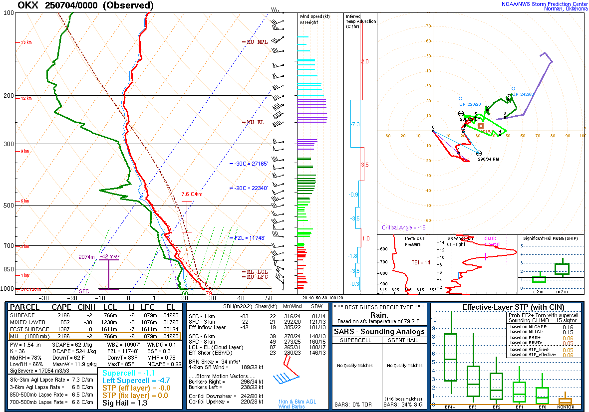
bluewave replied to wdrag's topic in New York City Metro
Severe storms usually overperform when we have steep lapse rates and such unstable soundings.
- Today
-
2025-2026 ENSO
Stormchaserchuck1 replied to 40/70 Benchmark's topic in Weather Forecasting and Discussion
Why are the mid-latitudes warming though? It might just be a pattern that fluxes up and down, with general global warming. -

July 2025 Discussion-OBS - seasonable summer variability
Dark Star replied to wdrag's topic in New York City Metro
I actually sat outside all morning, and occasionally a few times this afternoon. Unbelievable! -
Invest 92L--70% Two Day & 70% Seven Day Odds
GaWx replied to WxWatcher007's topic in Tropical Headquarters
The winds are high enough but is the circulation tight enough to be classified as a TD+? Based on images with wind barbs, it seems kind of broad. Opinions? -

July 2025 Obs/Disco ... possible historic month for heat
dendrite replied to Typhoon Tip's topic in New England
2009 rainy and raw 2007 chilly start 2001 chilly 7/4/92 nastiest 4th ever -

July 2025 Obs/Disco ... possible historic month for heat
weatherwiz replied to Typhoon Tip's topic in New England
I love that Big Y. Even when its busy, its manageable to get around the store and I don't think I've ever had to wait more than 2-3 minutes to get a self checkout register. -
The record WPAC warm pool and Aleutian Ridge are much more amplified than we typically see from +WPO patterns. Same goes for the new way the -PDO has played out in the 2020s. So the hemispheric expansion of the subtropical ridges are creating their own pattern.
-
July 2025 Discussion-OBS - seasonable summer variability
Stormlover74 replied to wdrag's topic in New York City Metro
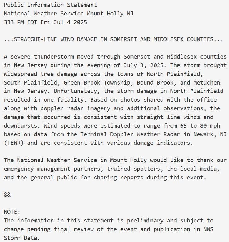
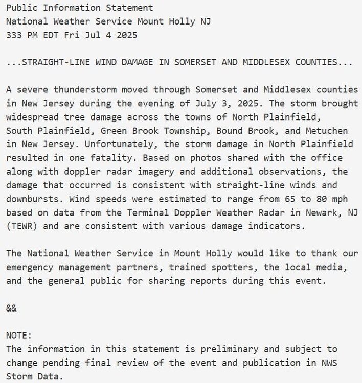
https://partnerservices.nws.noaa.gov/products/7c55db9f01d7329acb2717f2a485c8bc?fbclid=IwQ0xDSwLVBgRjbGNrAtUF02V4dG4DYWVtAjExAAEeOPuZLPYb_URFXsFrzVHLuYih3Ej026AZRkmmqR8aolTWqUNr29rd2tgHKrc_aem_YdTn038-IAEpYKwapOwphQ -

July 2025 Obs/Disco ... possible historic month for heat
HoarfrostHubb replied to Typhoon Tip's topic in New England
I do recall some miserable cold and rainy ones around 10-15 years ago I also remember a very hot one in 1999 I think? -

July 2025 Obs/Disco ... possible historic month for heat
kdxken replied to Typhoon Tip's topic in New England
What was the 19th hottest of the top of your head if it's so memorable? -
July 2025 Obs/Disco ... possible historic month for heat
kdxken replied to Typhoon Tip's topic in New England
Happy 4th of July. -

July 2025 Discussion-OBS - seasonable summer variability
nycwinter replied to wdrag's topic in New York City Metro
could not get a more perfect day for the fourth of july comfortable temps very low humidity and a gentle breeze it felt great outside.. -
July 2025 Discussion-OBS - seasonable summer variability
Stormlover74 replied to wdrag's topic in New York City Metro
I know. Never expected even looking at radar that it would be that bad. Didn't even feel like a typical severe day