All Activity
- Past hour
-
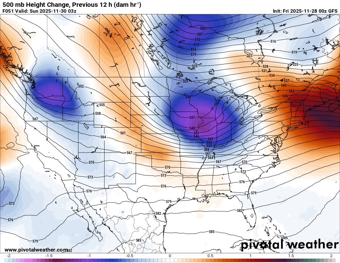
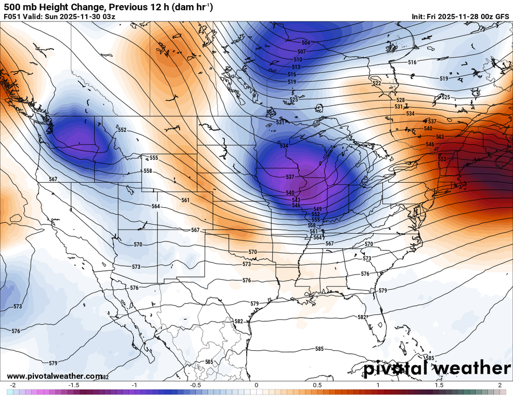
It's difficult to know how significant it is that the GFS op is significantly wetter and further west compared to the GEFS mean. The GEPS and EPS are also a bit southeast and drier. Obviously the averaging-effect decreases the mean precipitation the more you go out in forecast time. But the majority of the individual ensemble members are also well east of the GFS. The op also appears to be a bit faster than ensemble consensus... maybe in response to the sharp Great Lakes shortwave/vortmax that is at the leading edge of the trof. I suspect the op (maybe higher resolution?) is more accurately resolving the shortwave progression than the ensembles. I expect the ensembles to play catchup, and I don't think we're done trending yet.
-

December 2025 regional war/obs/disco thread
PhiEaglesfan712 replied to Torch Tiger's topic in New England
How much snow for EWR on Tuesday? -

December 2025 regional war/obs/disco thread
Torch Tiger replied to Torch Tiger's topic in New England
NNE
-
i would wait to call 12/2-3 dead until the nov 30 storm happens. 36 hours out from then and there's still lots discrepancy between models. indy doesn't know whether they're going to get 8 inches of snow or just plain rain rn
-
Ukie is a light event, but I didn't bother to look how it got there.
.thumb.png.4812fe0f095c28815ba44e6261abb376.png)
-
We're back to: it's over.
-

December 2025 regional war/obs/disco thread
WxWatcher007 replied to Torch Tiger's topic in New England
It was solid for tropical season but there were big misses too. Obviously a different season we’re tracking now so we’ll see. -

December 2025 regional war/obs/disco thread
CT Valley Snowman replied to Torch Tiger's topic in New England
I'm not crazy with the trend with the high placement and strength.on some of the modeling. Definitely makes it more challenging for those of us further south as the warmer air aloft surges northward. We're threading the needle as we want a more dynamic system vs a weak shredded POS but with a track and high placement that will help keep the cold air in place longer. -

Nov 28-30th Post Turkey Day Wintry Potential
sbnwx85 replied to Chicago Storm's topic in Lakes/Ohio Valley
HRRR/RAP dry slot me but put down 11” of snow before that happens. That’s probably overdone. Final call: 9” -
The surface features aren't driving this outcome. The position and strength of the surface highs and lows follow the upper levels. The trend over the past 2 days is for the shortwave to not "dig" as far south. The vortmax that passes through the Great Lakes is becoming increasingly prominent. The path of this shortwave and vorticity advection ends up tracking pretty similarly to Sunday's wave that precedes it. That leads to a stronger surface reflection (primary) near Western PA and southeasterly low level flow that quickly changes snow to rain along the coastal plain. The hope is that maybe guidance is keying on the wrong packet of vorticity and that the models will shift back towards a more favorable trof evolution. As of now this is transitioning towards a SWFE-type event that favors the interior, particularly New England. But it's still close to a wintry outcome... and highly trackable.
-
Not sure how to score it yet on events, I guess we will find out this season.
-

Nov 28-30th Post Turkey Day Wintry Potential
hlcater replied to Chicago Storm's topic in Lakes/Ohio Valley
Dont really see anything to dislike on the 00z runs. Gonna go with a potentially conservative guess of 8". -

December 2025 regional war/obs/disco thread
TauntonBlizzard2013 replied to Torch Tiger's topic in New England
I know we’re 5 days out, but the differences are comical. -
Yep weird
-
The Euro AI has been well east every run.
-
Same as Euro AI
-

Nov 28-30th Post Turkey Day Wintry Potential
Radtechwxman replied to Chicago Storm's topic in Lakes/Ohio Valley
Definitely worried about how north some hi res guidance is. Especially the hrrr/rap. It still has decent totals here but question snow quality especially in the latter part of the storm as low passes close or over. Hrrr/rap drag the mixing line north of me. Gfs/euro/nam keep it south. Tomorrow is the day to watch for trends. Hoping this doesn't start a north trend now. I think QC up to Chicago really going to cash in but a little nervous down here on I74 corridor. -
If it's not the Pacific being against us, it's the Atlantic. Within 12 hours everything goes poof. Winter just doesn't have the punch it used to have.
-
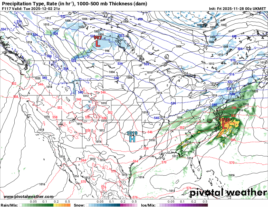
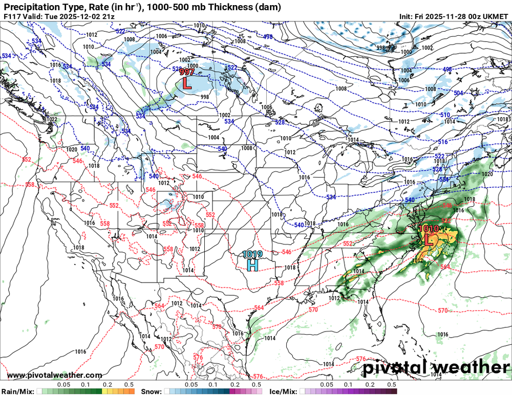
UKIE 500 mi SE of 12z..................., Earned its drunk uncle status.
-
I saw that, but there's always one that clings on to a fantasy. That said, still time to salvage something, but we better start seeing hints of our salvation sooner than later.
-

Nov 28-30th Post Turkey Day Wintry Potential
andyhb replied to Chicago Storm's topic in Lakes/Ohio Valley
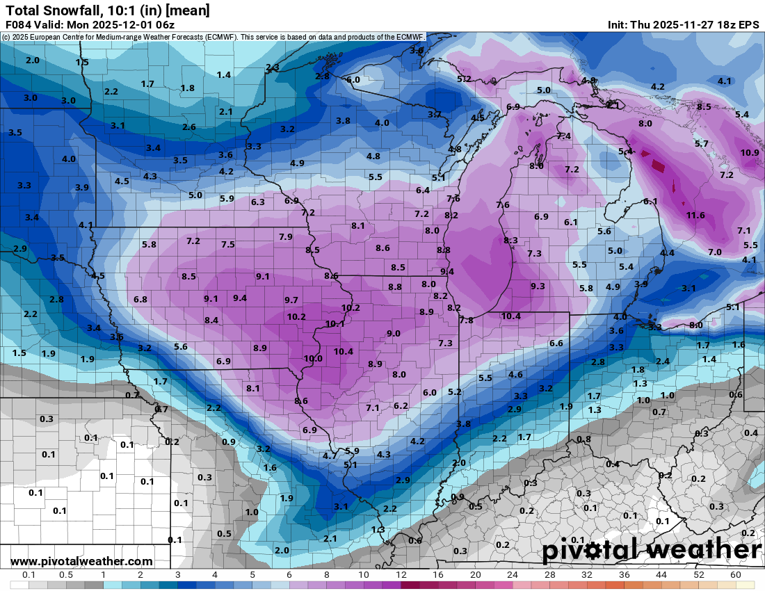
18z EPS mean is 10" for the QC even at 10:1 ratios, pretty impressive considering I'd expect the ratios to be better than that through a good chunk of the storm. This will punch above its weight class SLP depth wise given the favorable dynamics aloft and very strong LLJ/WAA minus a lot of strong convection in the warm sector. Height falls look excellent on the 00z GFS.
-
Not CNE ski areas, but the worm is turning
-
Ukie LOL
-
Never fails that the models show a decent event upcoming, they invariably advertise additional events down the road. Then when the first threat fizzles, all the rest of the threats go with it. Tonight's Gfs is a perfect example, at least thru 240hrs.
-
Canadian still hanging on to a front end thump


.png.cbda9aba5c3ec516af82028ddfdf16b6.png)