All Activity
- Past hour
-
Absolutely TORRENTIAL rain with this thin little line coming through NYC holy smokes
-
Sun is peeking out at 7pm. That instantly puts today in the top half of nice days this spring.
-
That’s a lot of smoke in E Canada and our region on viz. Tomorrow will be a smoke out
-
Boy does it look awful outside... so brown and smokey.
-
okay now sunny here again, I guess we're moving in and out of clouds, it's mostly sunny here now.
-
Followed by increasing temperatures aloft Wednesday to Friday, deep mixing to 850mb, and able to tap into the +13C to +15C. Result are highs in the low to middle 80s. Dewpoints are elevated leading to humid conditions
-
getting cloudy here now too unfortunately now I'm seeing tomorrow morning into early afternoon will be at least partly sunny?
-
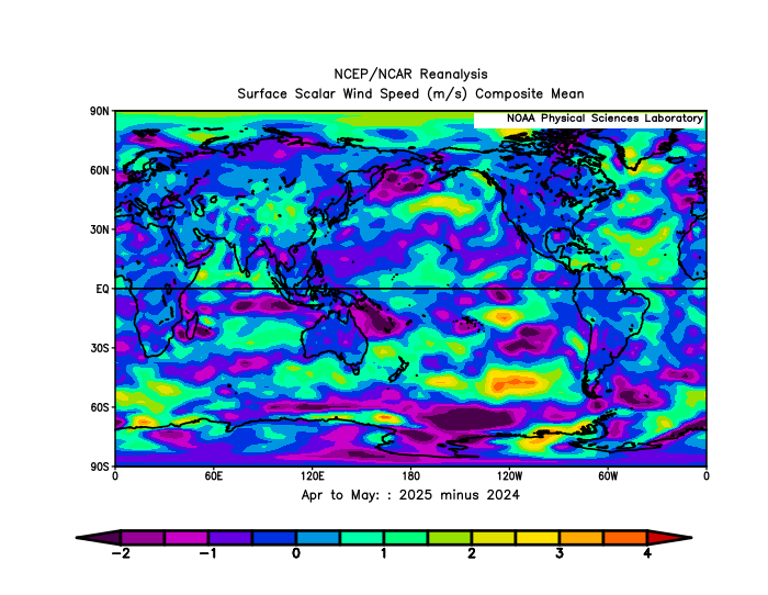
I missed the Atlantic focus. One factor in cooling the tropical Atlantic are higher surface wind speeds this year vs last.
-
Temps going down now. Still gross and cloudy
-
0.90” yest 1.17” today 2.07” 2 day total for the math challenged
-
Boundary approaching
-
Feels amazing out! Going to be like this for awhile now.. comfortable days and nights. The way it should be
-
Lucked out and had a quick cloudburst just water my garden for me. Few nice rumbles thrown in the mix too.
-
been almost completely sunny since 4 pm here and the skies are some of the bluest I've ever seen with temps in the mid 80s.
-
Sun came out but getting a heavy downpour now
-
the skies are the bluest I've ever seen them here, almost violet, I wonder what's going on? I do see a bank of billowing clouds to my north and northeast though. The temperature peaked at 85 here at 5:51 pm. I had to turn on my a/c again as my house inside temp was at 87.
-
Tomorrow will be partly to mostly cloudy with highs in the middle 70s. Temperatures will continue to top out in the lower and middle 70s through Tuesday. By the middle of the week, it will turn warmer with temperatures again rising into the 80s. The ENSO Region 1+2 anomaly was +0.8°C and the Region 3.4 anomaly was -0.1°C for the week centered around May 28. For the past six weeks, the ENSO Region 1+2 anomaly has averaged +0.17°C and the ENSO Region 3.4 anomaly has averaged -0.07°C. Neutral ENSO conditions will likely continue through at least mid summer. The SOI was -1.41 today. The preliminary Arctic Oscillation (AO) was +1.931 today. Based on sensitivity analysis applied to the latest guidance, there is an implied 62% probability that New York City will have a warmer than normal June (1991-2020 normal). June will likely finish with a mean temperature near 73.3° (1.3° above normal).
-

E PA/NJ/DE Summer 2025 Obs/Discussion
BBasile replied to Hurricane Agnes's topic in Philadelphia Region
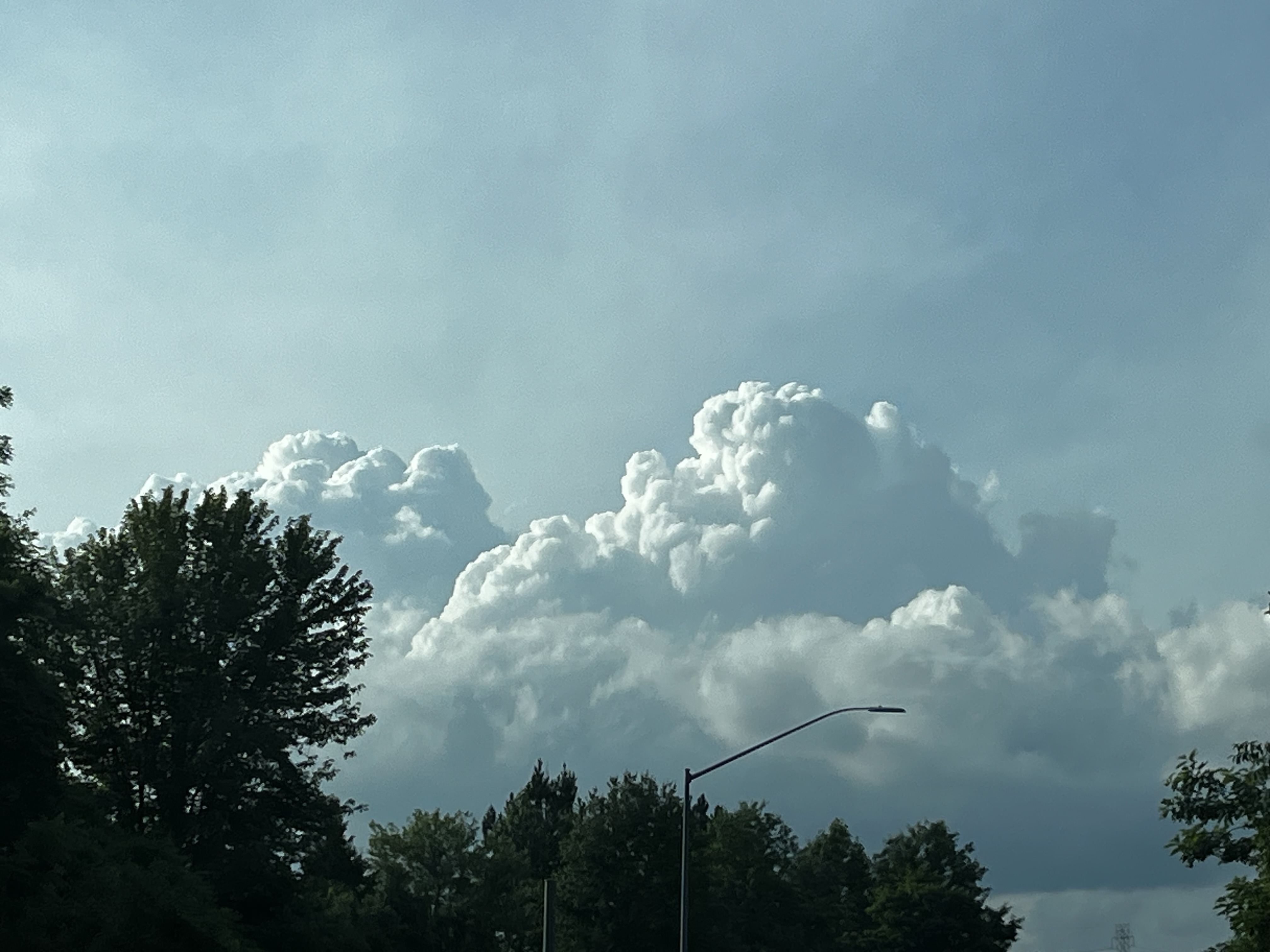
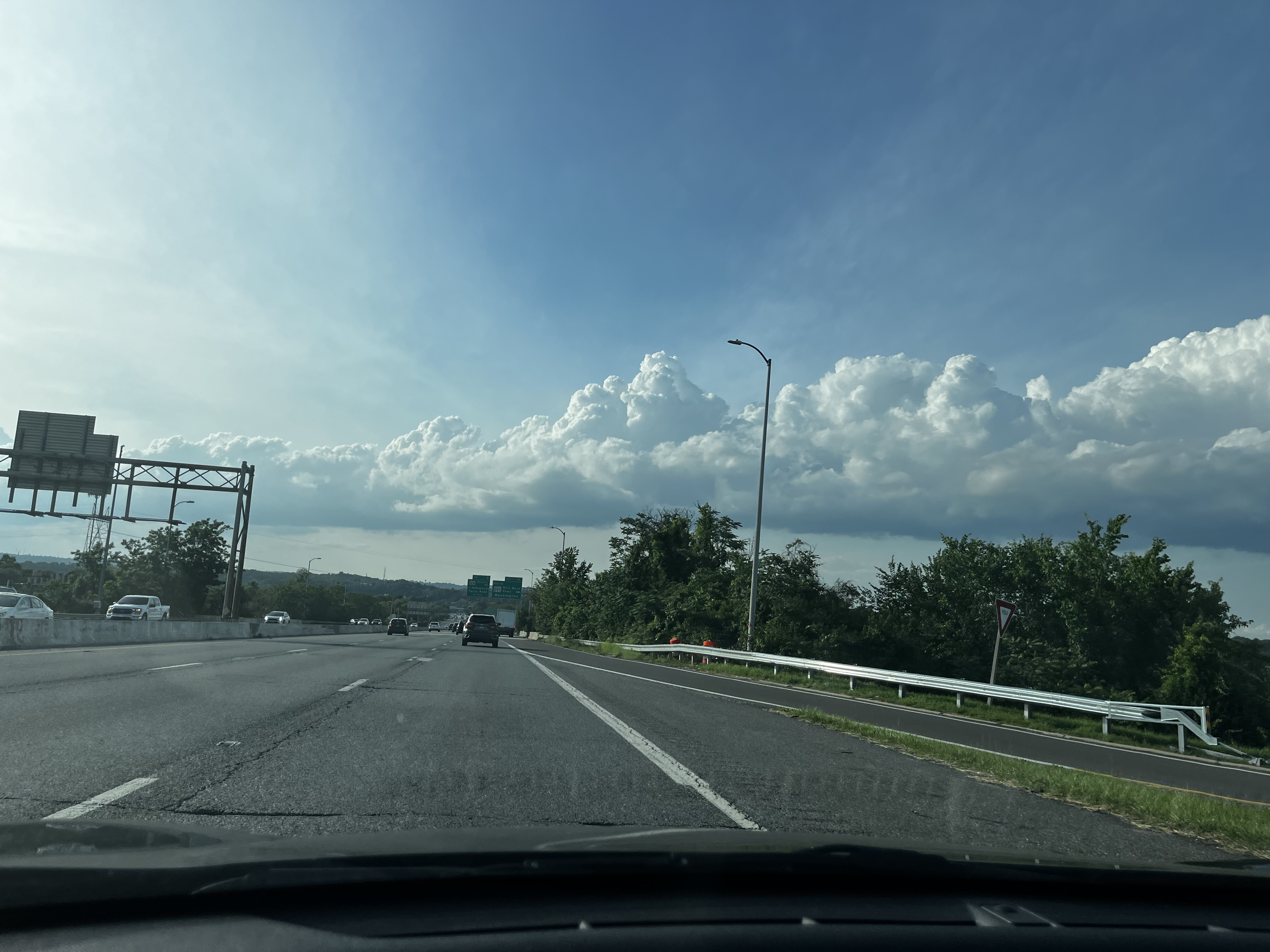
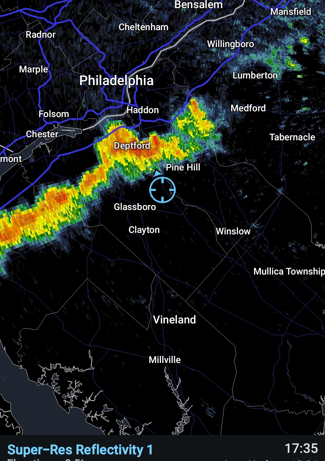
Picked up 0.11" in a short time. Nothing crazy, but it looked good from the air.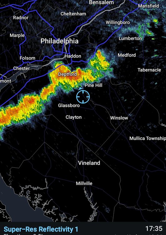
-
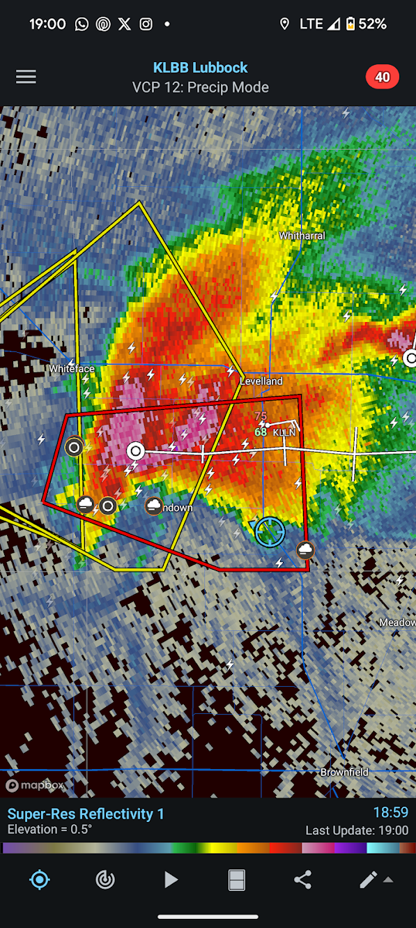
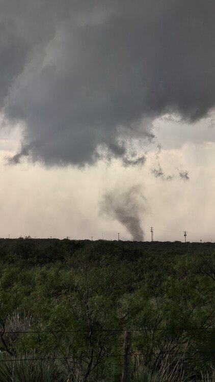
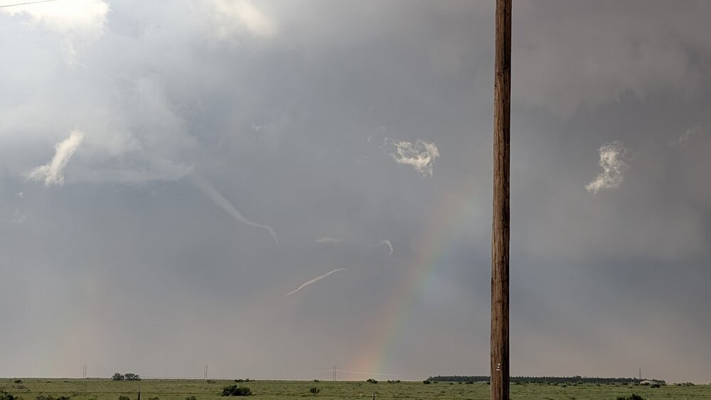
saw my 1st and 2nd tornadoes yesterday while operating on a storm west of lubbock! first wasn't fully condensed, but a vigorous/persistent dust circulation on the ground underneath the meso. second, we saw as it roped out to our east, and there was a circulation obviously still on the ground as evidenced by the dust being kicked up. this somewhat (not really) makes up for missing the massive dusty wedge in morton on thursday

- Today
-
Thank you dear Lord for beer
-
I dont know where you are…but its been raining in Westchester all afternoon. Just had cells move in with torrential rains
-
Am I seeing another washout next weekend in forecasts 15 weeks of summer beach season and this weekend is third one that is no Bueno with another on the way #yearwithoutasummer
-
Could be worse.
-
1.82” here so far today. 2 day total over 3 inches.