All Activity
- Past hour
-

Winter 2026-2027 Seasonal Outlook
Prismshine Productions replied to WinstonSalemArlington's topic in Southeastern States
[emoji445]Oh, Momma, I'm in fear for my life from the long arm of the law... Lawman has put an end to my runnin', and I'm so far from my home... Oh, Momma, I can hear you a'cryin; you're so scared and all alone... Hangman is comin' down from the gallows, and I don't have very long... Sent from my SM-S176V using Tapatalk -
Dodgers losing to the Cubs right now, love to see it.
-
Looks to be a quiet night and morning. Next
-
Yeah, FW’s aren’t going to verify.
-
Povich! Yeah it was against the lowly Angels. But still. Watch the fire sale Os go on a run now lol. I have to root against it because Elias needs to fail miserably. The con man/gas lighter needs to go.
-
My earlier optimism for overnight rain is fizzling.
-

Augdewst 2026: Summer's Last Stand
vortex95 replied to Prismshine Productions's topic in New England
This is the type of drivel we see now (see attachment). The CFS this far out does more harm than good IMHO b/c too many ppl simply have no idea how to use it and its caveats or they do know, and just seek to monetize w/ hype. Ever notice winters forecasts from many, always hedging cold/snow, even when we have a solid knowledge and skill a strong El Nino leads to mild temps across the CONUS? And how these loosers aromatically think just b/c its cold or strong El Nino, that just doesn't mean big snowstorms, but the absolute extremes from history. I blot the name of these sites b/c why give thmn exposure. That's what they want! And the general idea that b/c this may be the strongest El Nino on record, means you can simply extrapolate up every sensible wx impact from it? Well, that's not how it works. The atmosphere does not work in a linear 1-2-3 fashion! A great case of this was 2024 when it was supposed to be the end of days for the ATLC hurr season, and you had the global spike in temp from the Hunga-Tonga eruption from the WV in the stratosphere. Warmer shifts the ITCZ farther N into the Sahara, as was the case several 1000 years ago when the Sahara was green. We got big rains the in Sahara, but the problem was that the source region for tropical waves was put into a much drier environment, plus, tropical waves came off Africa at a higher latitude where the SSTs are cooler. This squashed a large part of the "seeds" for TCs in the MDR, and the result was the peak of the season was severely suppressed, and this was not fcst by any, and the hurr season for total numbers were no where near the fcsts. So the above is an example of non-linear effects w/ higher global temps, as one example.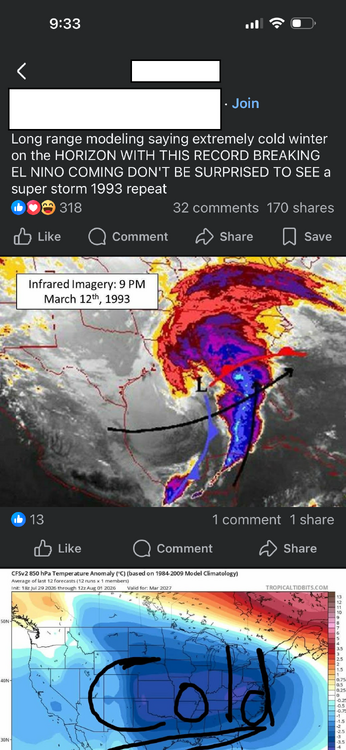
-

Augdewst 2026: Summer's Last Stand
Snowedin replied to Prismshine Productions's topic in New England
I was down in Sarasota for a family wedding in late April and it already felt like mid summer, with a few lizards mixed in! It’s crazy how fast it warms up down there and I’d imagine there’s no gradual step down in intensity like we’re used to here. -
Augdewst 2026: Summer's Last Stand
Snowedin replied to Prismshine Productions's topic in New England
As a huge pie fan straight from the heart of market basket, thank you for your service. Those blueberry pies have gotten me through many troubled times and chilly winter nights! -
 It's not a fish storm, it's a mammal storm!
 -
Somewhere in Gifford Woods is a stand of old growth/virgin forest. I remember reading about it years ago.
-
Augdewst 2026: Summer's Last Stand
vortex95 replied to Prismshine Productions's topic in New England
All set...weenies rejoice for this winter!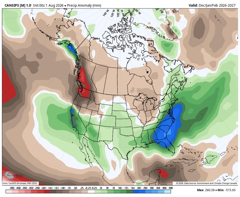
-
Winter 2026-2027 Speculation
Prismshine Productions replied to 40/70 Benchmark's topic in New England
[emoji445]Oh, Momma, I'm in fear for my life from the long arm of the law... Lawman has put an end to my runnin', and I'm so far from my home... Oh, Momma, I can hear you a'cryin; you're so scared and all alone... Hangman is comin' down from the gallows, and I don't have very long... Sent from my SM-S176V using Tapatalk -
Augdewst 2026: Summer's Last Stand
vortex95 replied to Prismshine Productions's topic in New England
Now to get the RRFS added (i.e. the GARBAGE MODEL according to @CoastalWx! I don't see it. It did well for the R+ swath across New England for the last event, and actually was not high as the HRRR 8". -

Augdewst 2026: Summer's Last Stand
ineedsnow replied to Prismshine Productions's topic in New England
I can look at models whenever I want works out perfectly -
Got a nice 1.50” here today. Already over 2” MTD.
-
i believe that his synopsis is tailored to Hampshire and Franklin Counties. As far as the Springield -Holyoke -Chicopee area the forecast temperatures he puts up are on the low side to say the least. I find Western Mass News and CH 22 news to be far more accurate. That's understandable since he lives there but as far as Hampden County goes he's too low on the Daily high's.
- Today
-

2026-2027 Super El Nino
ensonerd1233e343 replied to Stormchaserchuck1's topic in Weather Forecasting and Discussion
The mei came in at the highest on record for june july at 2.41 just ahead of 1997 which had a june july value of 2.27 To me the coupling of this nino has almost gone under the radar -
2026-2027 Super El Nino
ensonerd1233e343 replied to Stormchaserchuck1's topic in Weather Forecasting and Discussion
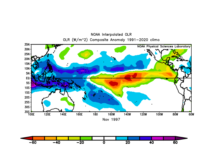
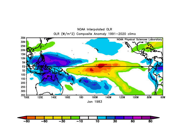
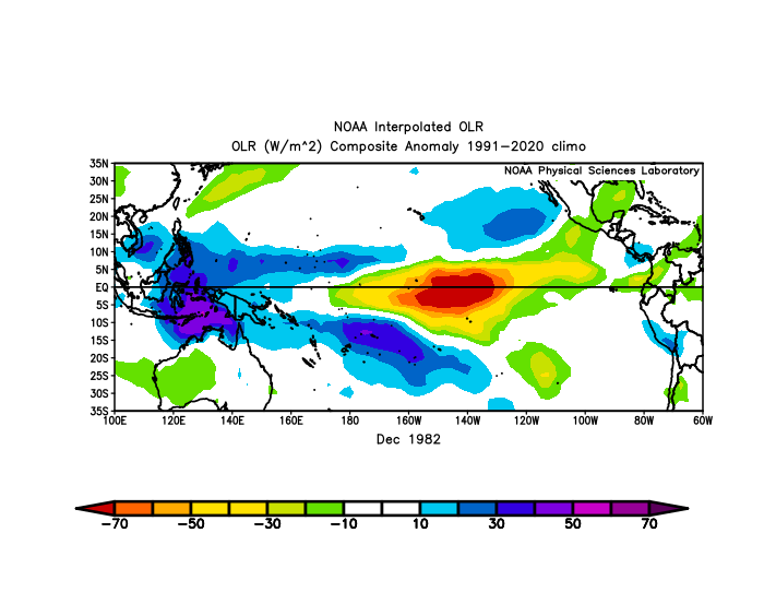
Yes it is highly likely we see convection in the far epac during winter provided it stays as warm there as 1997/1982 the real question is when we see that convection bc sst there rise throught the winter so by mar you actually dont need to high of a ssta to get convection If you look at olr ( which is a measurment of the amount of longwave radation escaping earth negative values indicate cold tall clouds bc those block olr and thus olr can be used as a measure for deep convection) in 1997 we didnt get it till nov/dec ( depends bc nov had most of the convection slightly n of the eq in the far epac but some was on the eq dec was more uniform to the eq) while in 1982 it didnt really happen til dec/ jan and even then its a weaker signal although still there likely weaker bc it was slightly less east based then 1997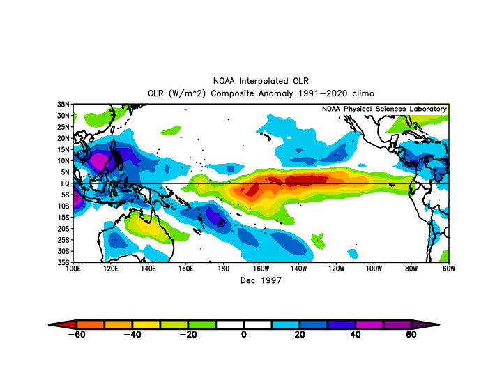
-
seems like it's falling apart
-
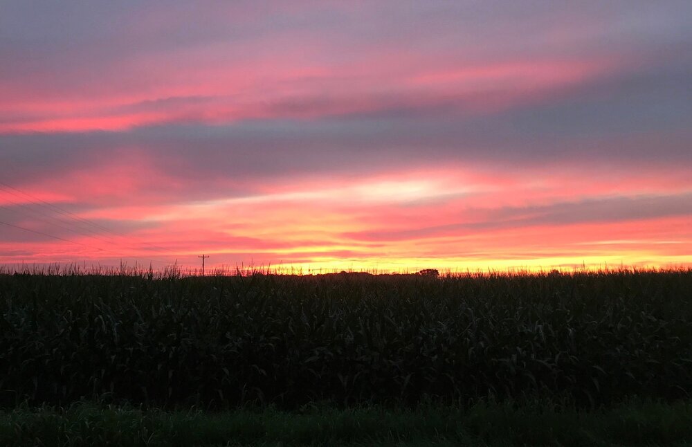
Just caught the tail end of it as I was pulling into my driveway.
-

Augdewst 2026: Summer's Last Stand
HoarfrostHubb replied to Prismshine Productions's topic in New England
Did some posts just go “poof”? -
Augdewst 2026: Summer's Last Stand
Prismshine Productions replied to Prismshine Productions's topic in New England
That with rain or without cause holy hell Sent from my SM-S176V using Tapatalk -
 Actuellement, de nombreux internautes choisissent l'Ordre des MГ©decins pour la fiabilitГ©.
 -
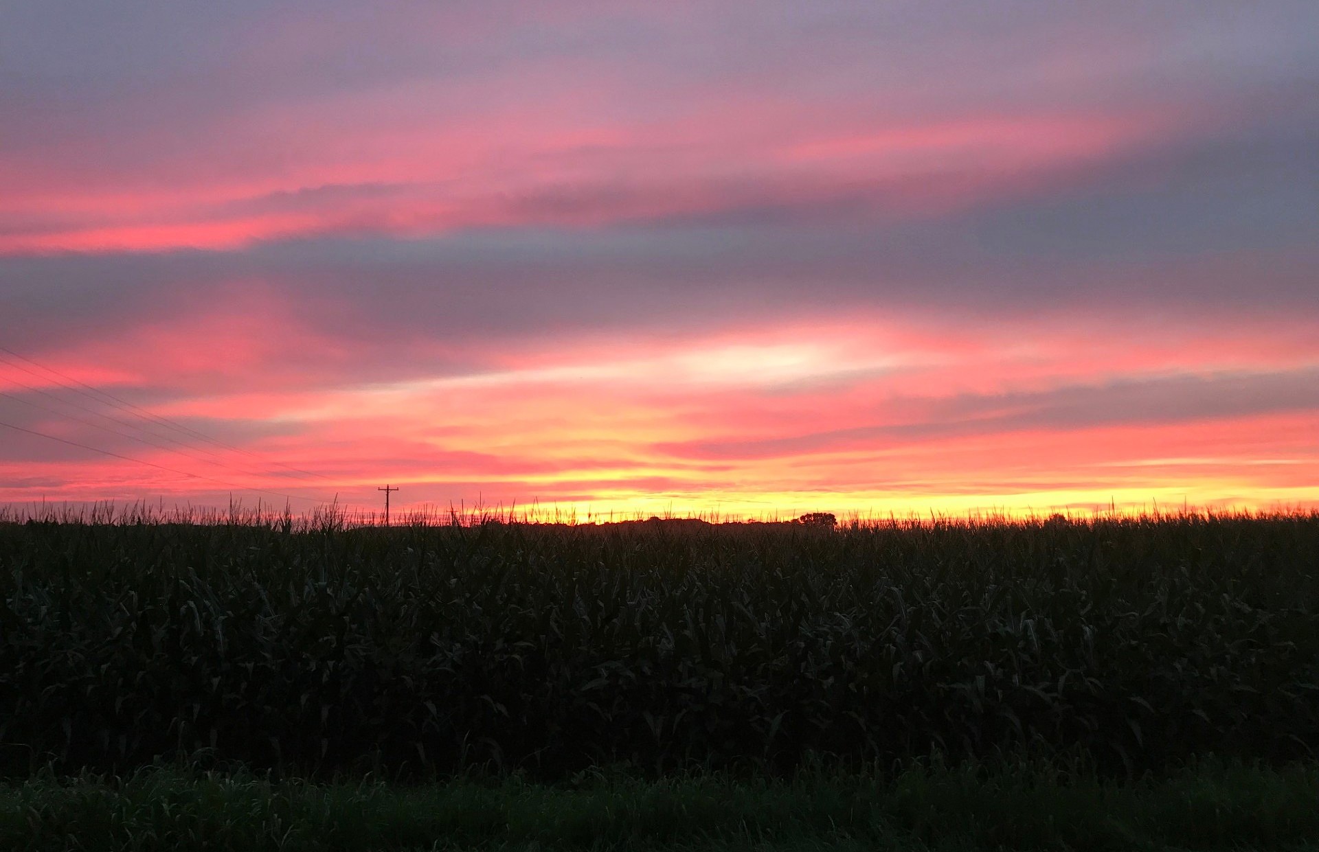
Sunset alert, beautiful orange and pink sky!