All Activity
- Past hour
-

Big Heat (and storms?) Week into July 4th Weekend
nw baltimore wx replied to yoda's topic in Mid Atlantic
Man, this is summer evening for the ages. Hopefully some of these storms deliver, but it’s totally awesome outside. -
 Ah yes, the classic pre-summer downpour wind drop off+subsequent jump in humidity. It never fails!
 -
 Another warning for here that at worst will drop light rain . That makes 3 in the last 4 days
 -

Central PA Summer 2026 Discussion/Obs Thread
Superstorm replied to Voyager's topic in Upstate New York/Pennsylvania
Ugly situation. . -
Hammer gonna get crushed in WeHa
-
Big marginal risk out for tomorrow for day 2 shaped like a hockey stick that is diagonally also a hockey puck marginal risk up in the northern plains just a 5 percent for wind and hail but in mid Atlantic is slight risk for 15-30 percent wind and 5 percent hail nm Tx ls ms north al middle and east tn east ky wv Virgina parts of carolinas ga ok parts of southern New England parts of New England and mid Atlantic in slight risk .
-
 Hearing thunder from the stuff around west Hartford
 -

Big Heat (and storms?) Week into July 4th Weekend
AnEndlessMaze replied to yoda's topic in Mid Atlantic
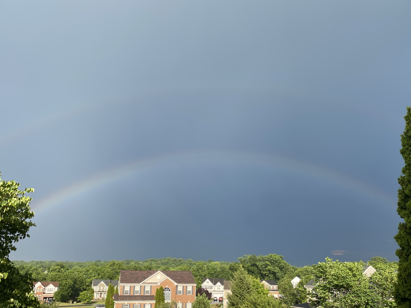
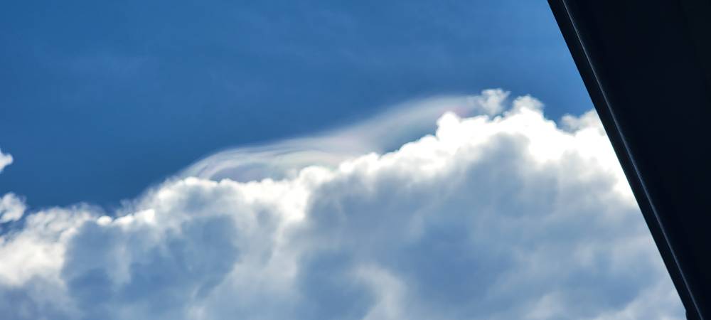
0.98" and a double rainbow
-
.thumb.jpg.6a4895b2a43f87359e4e7d04a6fa0d14.jpg)
Central PA Summer 2026 Discussion/Obs Thread
Yardstickgozinya replied to Voyager's topic in Upstate New York/Pennsylvania
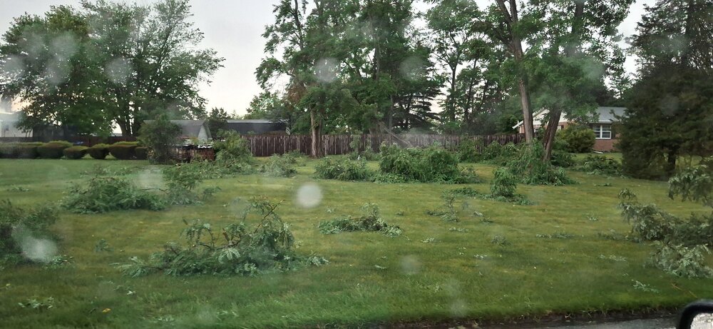
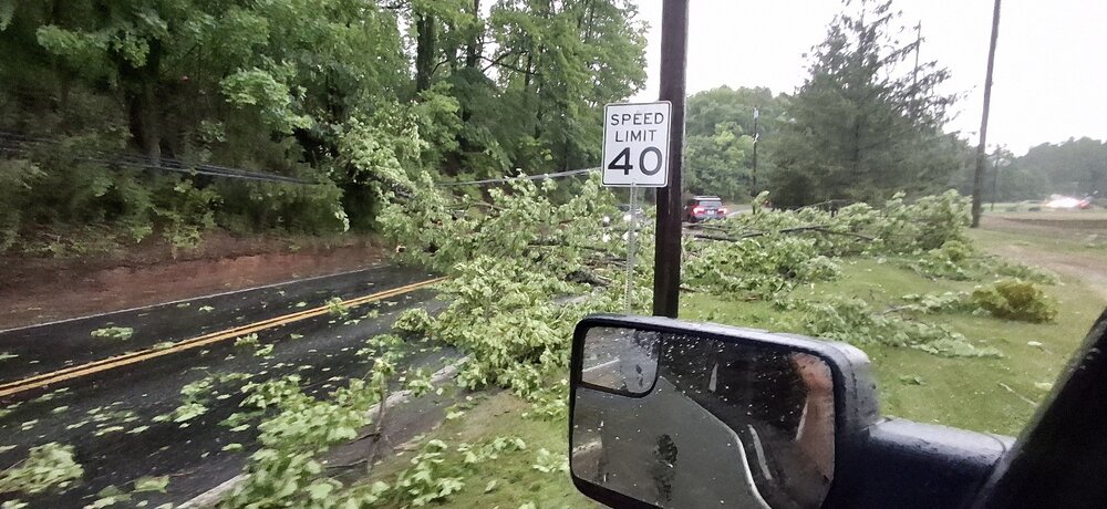
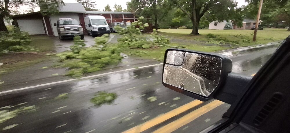
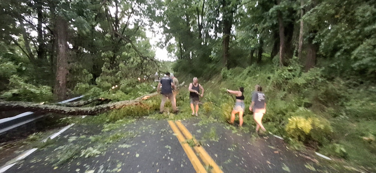
This is the third time i've encountered.We've had to clear the roads more picks coming boys, we're stuck at this one.I'm not getting home absolutely pummeled out here as I get towards fairview township -
Central PA Summer 2026 Discussion/Obs Thread
Yardstickgozinya replied to Voyager's topic in Upstate New York/Pennsylvania
This is the third time i've encountered.We've had to clear the roads more picks coming boys, we're stuck at this one.I'm not getting home absolutely pummeled out here as I get towards fairview township -
Getting some pretty gusty outflow from the storm to my west, a few small tree limbs coming down.
-

E PA/NJ/DE Summer 2026 Obs/Discussion
Birds~69 replied to PhiEaglesfan712's topic in Philadelphia Region
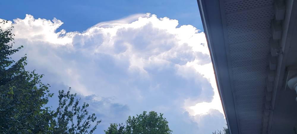
This is somewhat promising...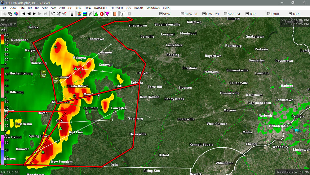
-

Big Heat (and storms?) Week into July 4th Weekend
NorthArlington101 replied to yoda's topic in Mid Atlantic
Stuff off to the west looks like small potatoes at the moment. Guess we’ll see. -
Central PA Summer 2026 Discussion/Obs Thread
Yardstickgozinya replied to Voyager's topic in Upstate New York/Pennsylvania

-
Radar seems to indicate their luck is slowly running out.
-
Big Heat (and storms?) Week into July 4th Weekend
NorthArlington101 replied to yoda's topic in Mid Atlantic
I don’t necessarily want it to storm in DC (I like planes and fireworks) but it’s amazing it hasn’t. It seems inevitable it at least rains, but lucky for the event planners so far… -

Big Heat (and storms?) Week into July 4th Weekend
jac_not_in_dc replied to yoda's topic in Mid Atlantic
They're telling people to get off the Mall,and the program is delayed. Might be a bit, though? -
Today, JFK Airport reached 100° for the third consecutive day. That ties the record for the longest such streak, which was set during July 2-4, 1966. Thunderstorms are possible this evening. Tomorrow will be noticeably cooler with highs reaching the upper 70s or lower 80s. A soaking rain is likely Monday into Tuesday. The potential exists for a general 0.50"-1.50" rainfall with locally higher amounts. Highs will reach the middle and upper 70s on both days. It will turn warmer to end the week. No excessive heat appears likely through mid-month. The ENSO Region 1+2 anomaly was +3.1°C and the Region 3.4 anomaly was +1.8°C for the week centered around June 24. For the past six weeks, the ENSO Region 1+2 anomaly has averaged +2.60°C and the ENSO Region 3.4 anomaly has averaged +1.37°C. The ongoing El Niño will continue to strengthen through the summer. The SOI is not available due to data feed issues. The preliminary Arctic Oscillation (AO) was +0.855 today.
-
String of storms developing nw of dc.
-
Saw one here too on the storm that went through Frederick Sent from my SM-G998U using Tapatalk

-
 Just came through. Felt nice for a few minutes.
 -
It may clip HFD if it holds together
-

Central PA Summer 2026 Discussion/Obs Thread
canderson replied to Voyager's topic in Upstate New York/Pennsylvania
Had a 68 mph wind gust here -

Big Heat (and storms?) Week into July 4th Weekend
ThePhotoGuy replied to yoda's topic in Mid Atlantic
About a dozen so far of fire calls for separate trees or wires down in the Severn and Glen Burnie areas. -
Central PA Summer 2026 Discussion/Obs Thread
Yardstickgozinya replied to Voyager's topic in Upstate New York/Pennsylvania
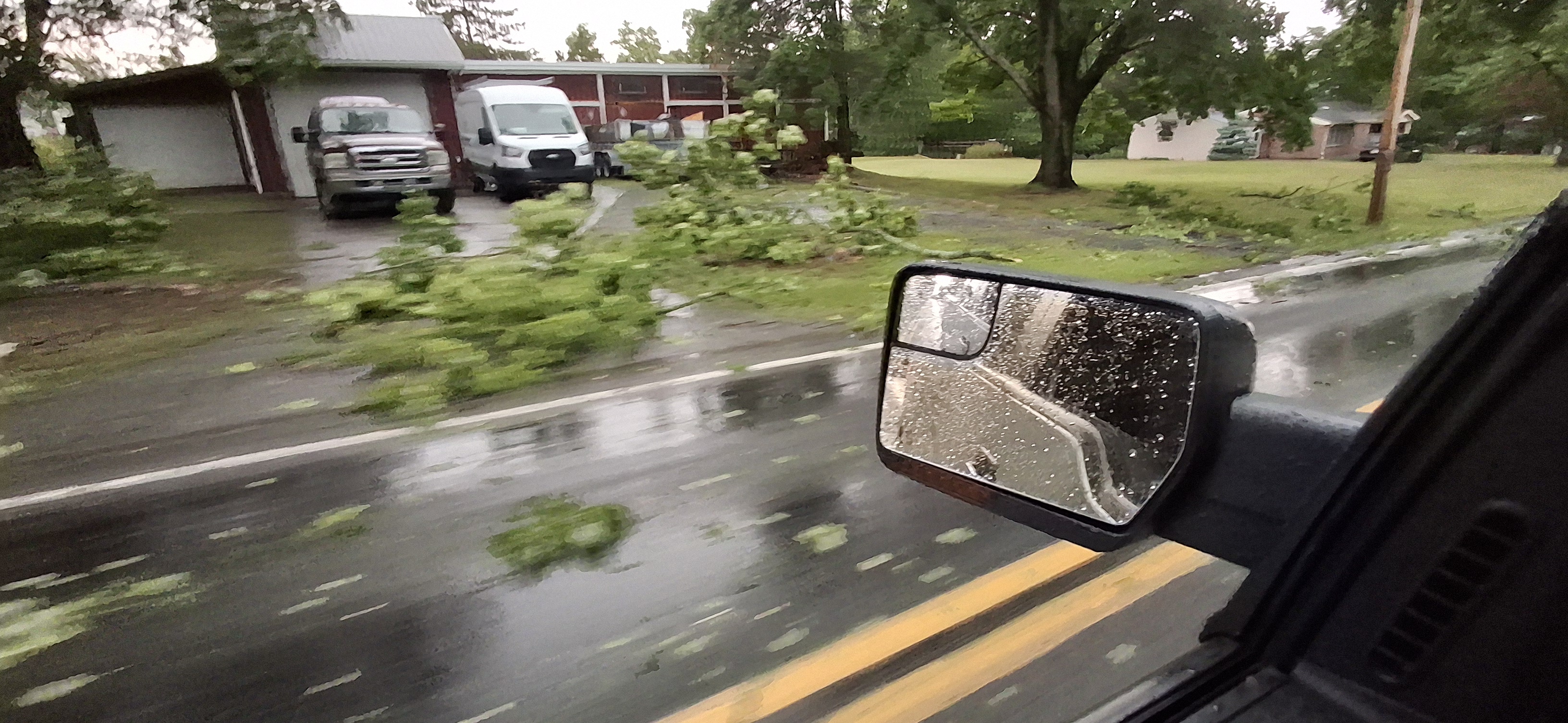
Debris all along the way, but so far, Lisburn seems to got the worst of what i've driven through.