All Activity
- Past hour
-

February 22-23 Storm Thread/OBS
MickeyTim6533 replied to Mikeymac5306's topic in Philadelphia Region
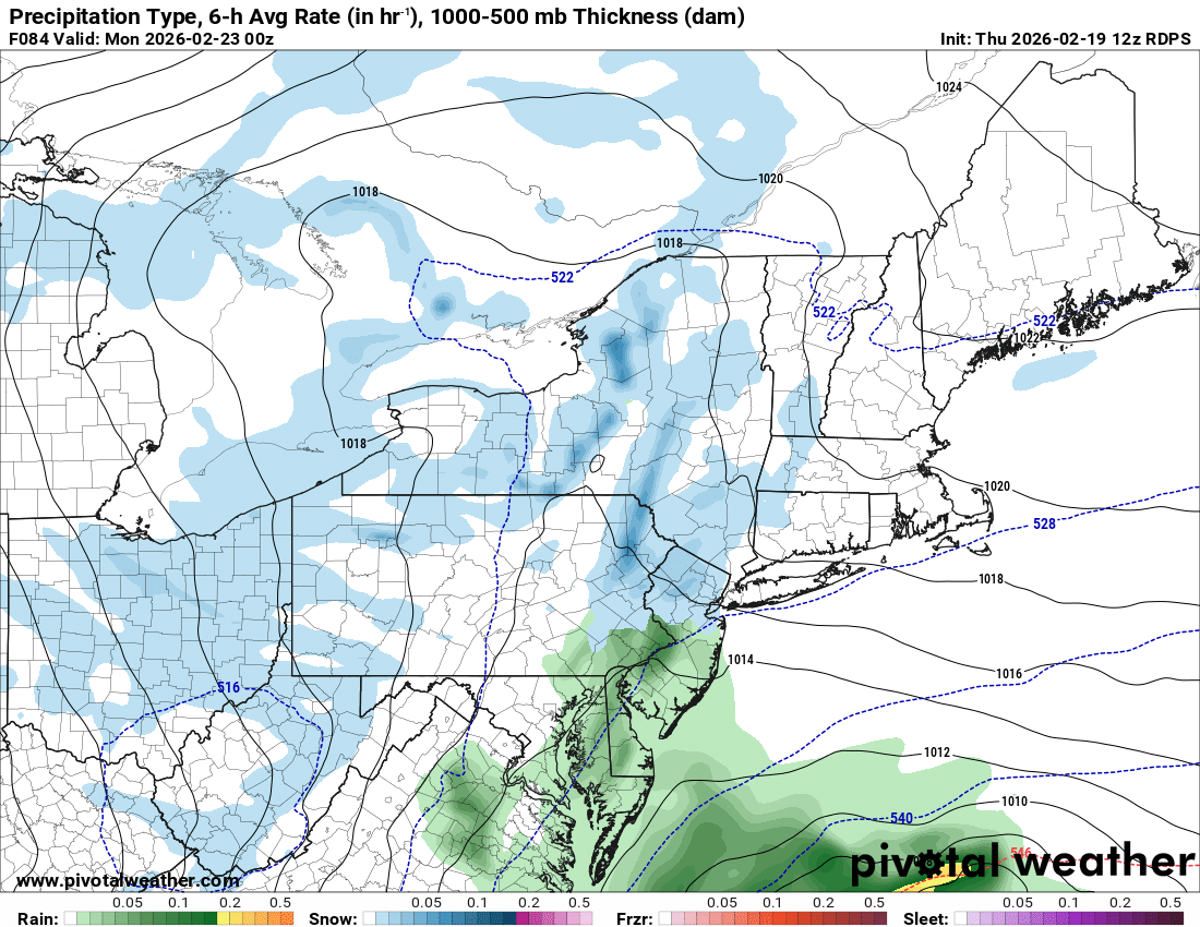
RGEM ugly. GFS will cave most likely -
how? The storm hasn't happened and we're still 80 hours away from the actual event? lmao
-
Are you related to Ji in any sort of way? 37F/Overcast/Dripping sounds of melting stuff off rooftops, down gutter. Sewer drains running water sounds...
-
miss south
-
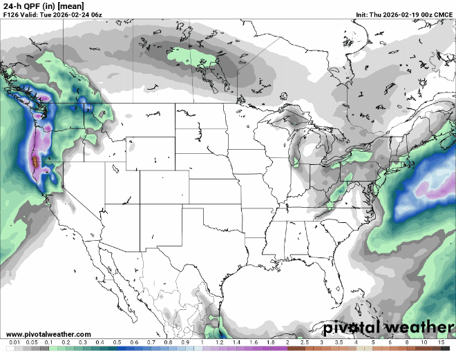
I agree with you. Ignoring trends, this looks like a graze verbatim. Most ensemble means (I think Ryan posted probabilities earlier) barely, if at all, get the 24hr-QPF 0.5" contour to the Cape/Islands. Definitely keep expectations low, for now.
-

Feb 22nd/23rd "There's no way..." Storm Thread
baltosquid replied to Maestrobjwa's topic in Mid Atlantic
lol RRFS A was better. Doesn’t mean much. -
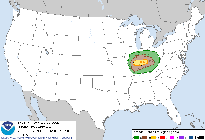
Day 1 Convective Outlook NWS Storm Prediction Center Norman OK 0700 AM CST Thu Feb 19 2026 Valid 191300Z - 201200Z ...THERE IS AN ENHANCED RISK OF SEVERE THUNDERSTORMS ACROSS SOUTHERN ILLINOIS AND SOUTHERN INDIANA... ...SUMMARY... Severe thunderstorms including a few tornadoes, large hail and damaging wind gusts are expected across parts of the Midwest and lower Ohio Valley today. Elsewhere, storms may produce strong wind gusts over parts of coastal south-central California early today. ...Midwest/Ohio Valley... A strong belt (80-100 kt at 500 mb) of cyclonically influenced westerlies will extend from the Southwest Deserts to the Ohio and Tennessee Valleys, with modest late-day trough amplification over the central Plains and Lower Missouri Valley. A related surface low will transition east-northeastward across the Lower Missouri Valley toward southern Lake Michigan tonight. A modestly moist warm sector will become increasingly established, characterized by mostly 50s F surface dewpoints, northward from the Mid-South across most of Illinois/Indiana into western/southern Ohio by early evening. A steady strengthening of southwesterly winds aloft will occur today, increasingly atop/coincident with the modestly moist warm-sector boundary layer. Long hodographs will be prevalent with upwards of 50-60 kt effective shear by afternoon. Around 200-350 m2/s2 0-1 km SRH is expected to be maximized on the southeast periphery of the surface low and in vicinity of the warm front, with the favorable zone including southern Illinois, southern Indiana and northern Kentucky. Increasing storm development should occur by late morning/midday across eastern Missouri, with maturing/increasingly surface-based storms near and just north of the I-70 corridor in southern Illinois by early afternoon. A semi-focused zone of peak severe/tornado potential may unfold generally near I-70, southward to near I-64, across southern Illinois and southern Indiana this afternoon through early/mid-evening. Sufficient forcing and boundary layer warming/mixing should allow for at least isolated semi-discrete development southward into the warm sector, and if so, relatively long-lived multi-hour supercells are plausible, with all hazards possible, but notably including heightened tornado potential, a few of which could be strong (EF2+). Given the limited early season moisture, the boundary layer will tend to become more hostile to surface-based storms and overall severe potential into mid/late evening. ...Coastal South-Central California... Bands of shallow convection will continue to move inland this morning. Weak destabilization, along with moderate mean boundary-layer winds just off the surface, could allow for locally strong to damaging gusts as the front progresses southeastward. ..Guyer/Grams.. 02/19/2026
-

“Cory’s in NYC! Let’s HECS!” Feb. 22-24 Disco
Kitz Craver replied to TheSnowman's topic in New England
Cut it back to 12z/0z -
We need a pacific reversal.
-
Icon still a miss but did bump n/w a bit
-
Ok its hanging by a thread
-
Feb 22nd/23rd "There's no way..." Storm Thread
baltosquid replied to Maestrobjwa's topic in Mid Atlantic
Yeah it has a better h5 pass but still all IVT over a narrow strip. A bit NW in low placement. -

Feb 22nd/23rd "There's no way..." Storm Thread
Cobalt replied to Maestrobjwa's topic in Mid Atlantic
Apples and bowling balls compared to the GFS but the ICON is slightly improved from its (disastrous) 6z iteration. Probably just translates to more IVT love. -
go with the seasonal trend of nothing when it comes to coastals and you'd be right
-
Not believing the GFS’s solution is one thing Saying the threat is over/dead/gone is another
-
There's no pessimism. It's a recognition of pattern, seasonal trends and two other things, when the Euro locks in on a solution for days despite some of its flaws it's usually best to roll with it and when the GFS is an outlier it's best to ignore it.
-
Feb 22nd/23rd "There's no way..." Storm Thread
baltosquid replied to Maestrobjwa's topic in Mid Atlantic
Just can’t get the thing to tilt in time. Verbatim a little stronger at h5 but it’s just not wrapping up. Need a cleaner look. Which we probably won’t get. -
RGEM doesn't look great either per MA Forums. Yea GFS gonna cave at some point today.
-
Catching up this morning feels like...everyone chipped in and bought a custom pinata labeled "GFS', and then gathered round and beat the crap out of it (not sure what would be inside the pinata in this analogy. let's say sawdust.)
-

“Cory’s in NYC! Let’s HECS!” Feb. 22-24 Disco
RUNNAWAYICEBERG replied to TheSnowman's topic in New England
It is. Now we have AI versions to add to the noise. Too many models run too many times per day. Great for winter crack addictions though… -

Feb 22nd/23rd "There's no way..." Storm Thread
Duca892 replied to Maestrobjwa's topic in Mid Atlantic
Yeaaaa GFS gonna cave at some point today. Not going to shock me at all if that happens in the next 30mins -
Feb 22nd/23rd "There's no way..." Storm Thread
Cobalt replied to Maestrobjwa's topic in Mid Atlantic
It will always have Jan 3rd 2022. And last year's Feb storm. And Snowquester I think? Gee, what a run the gfs has been on this past decade and a half. -
Wow steve D will be right again
-
Getting closer (trough).

-
This winter putting on a clinic on how to tease us with a big dog but then not produce. The mid range(Day6-3) has been a disaster. Yikes. I expect more precision being 2026 but here we are. Perhaps too many models is a bad thing?