All Activity
- Past hour
-
Well into the 60s despite solid overcast…but getting some breaks up here now. Looks like eastern sections will still push 70° with sun.
-

2026-2027 Record-breaking El Nino
stadiumwave replied to Stormchaserchuck1's topic in Weather Forecasting and Discussion
https://x.com/Statisticizer/status/2117490059796484274?a=37IteOi_Ly62Baqdd2I&s=19 -
 order medicine from mexico [url=https://botica24.com/#]Botica 24[/url] mexico meds
-
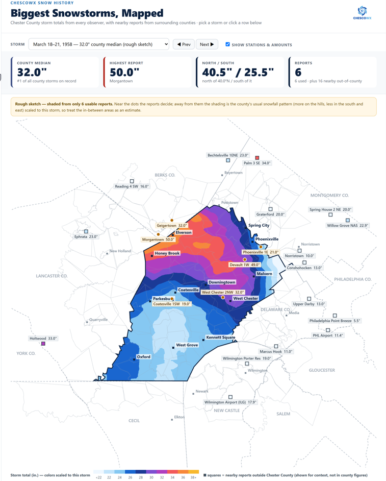
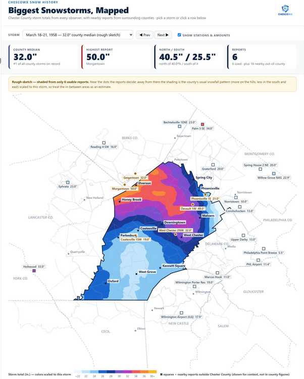
For those on Team Snow I have launched a new historical snowstorm mapping feature on the website that produces a snow accumulation map across the area including all surrounding counties and Philadelphia. This includes our 50 largest snowstorms since the 1890's. https://chescowx.com/snowstorm-maps/ below is the great March 1958 snowstorm.
-

E PA/NJ/DE Autumn 2026 Obs/Discussion
ChescoWx replied to PhiEaglesfan712's topic in Philadelphia Region
For those on Team Snow I have launched a new historical snowstorm mapping feature on the website that produces a snow accumulation map across the area including all surrounding counties and Philadelphia. This includes our 50 largest snowstorms since the 1890's. https://chescowx.com/snowstorm-maps/ below is the great March 1958 snowstorm.
-
http://vesperarx.com/# canadian pharmacy comparison
-
What went wrong?
-

2026-2027 Record-breaking El Nino
PhiEaglesfan712 replied to Stormchaserchuck1's topic in Weather Forecasting and Discussion
Our last strong la nina (2010-11) had a great snow season, though. -

2026-2027 Record-breaking El Nino
bluewave replied to Stormchaserchuck1's topic in Weather Forecasting and Discussion
Any cooler conditions in the Southeast will mostly be a function of all the clouds and rain keeping the high temperatures down. The eastward displaced Pacific vortex and the frequent jet extensions will flood North America with mild Pacific air. Those climatology packages beyond 15 days are defaulting to general El Niño climatology. This event is much more extreme than general El Niño climatology. -
Classic GFS S and E bias
-
Summer-type of morning and day here today. Woke up to low 60s and the DP will hover in the low 60s all day with a temp in the low 70s. Barring something unforeseen the record high MIN will be smashed!
-

2026-2027 Record-breaking El Nino
GaWx replied to Stormchaserchuck1's topic in Weather Forecasting and Discussion
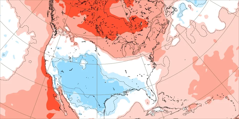
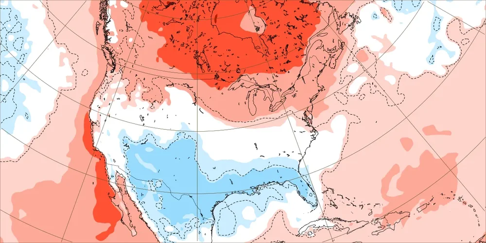
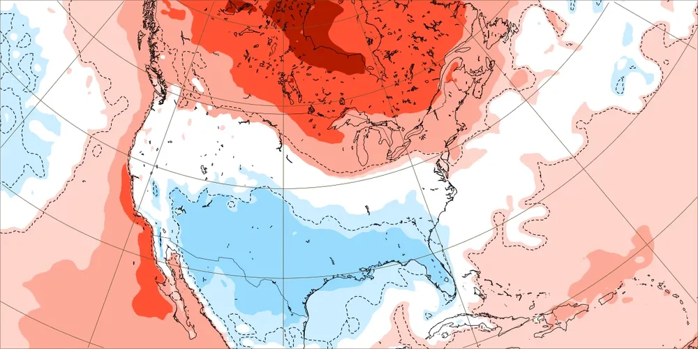
They may or they may not. That remains to be seen. There is no certainty about this. Yes, Nov 1-22 (weeks 1-3) is coming in warmer than was being shown earlier. But that doesn’t mean that weeks 4-6 (Nov 23-Dec 13) will definitely do the same. I’ll add that should the current SSW actually lead to colder, that wouldn’t per @Stormchaserchuck1be expected to happen for 30-35+ days afterward, which isn’t even til early to mid Dec (weeks 5-6 on the EW). OTOH, it often is warm in the E US near and for a couple of weeks after SSWs. This is a forecasting discussion, not a crystal ball discussion. -
a difference of opinion
-
Single fluke run? It hasn’t rained in 3 weeks and doesn’t look to besides some light stuff for foreseeable future. But sure
-
2026-2027 Record-breaking El Nino
bluewave replied to Stormchaserchuck1's topic in Weather Forecasting and Discussion
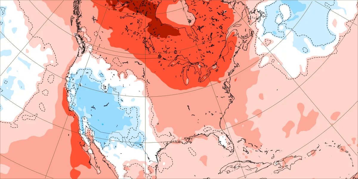
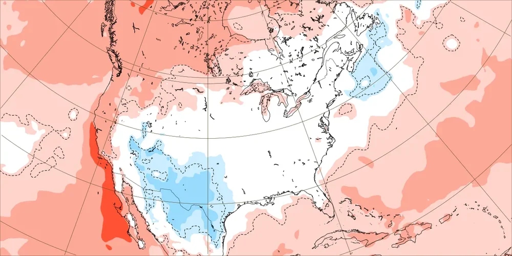
Those long range runs beyond 15 days will correct much much warmer the closer in time we get to the forecast period like they did for this week. New run November 2-9 Old run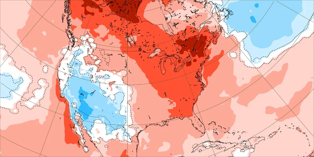
-
may be a passive/diffused warm boundary extending S Ont thru upstate NY helping to generate and fan some of this contaminated sky...
- Today
-
2026-2027 Record-breaking El Nino
40/70 Benchmark replied to Stormchaserchuck1's topic in Weather Forecasting and Discussion
I wasn't rebutting your insight, just offering my own.... talking to you, not at you. -
I'm wondering if today might bust a little cooler than it could have been ...sort of thing, because these clouds - I had figured today for a continuation of sunnier. It's completely cast' over here and holding T's down it seems. Sometimes these mid ceilings will agglomerate at mid morning like this did...it was sunny here at 8... But then open back up ... not sure if that's happening but if it stays this way, it's a modest bust.
-
2026-2027 Record-breaking El Nino
GaWx replied to Stormchaserchuck1's topic in Weather Forecasting and Discussion
I’m not talking about snow in the NE US or snow anywhere for that matter. The CWG post also said nothing about snow. We’re all talking about temperature anomalies. It was referring to a “very warm pattern”, which weeks 4-6 are literally not on the EW run to which they were referring. -
It’s a magnificent morning
-
2026-2027 Record-breaking El Nino
40/70 Benchmark replied to Stormchaserchuck1's topic in Weather Forecasting and Discussion
I would describe that is a shitty pattern that while not prohibitively warm, per se, isn't good enough for the coast...especially early in the season. -
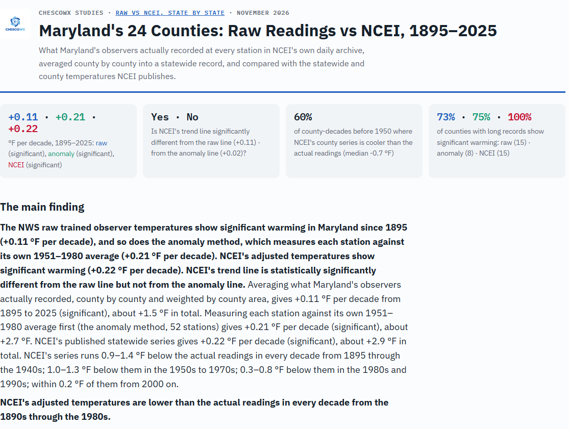
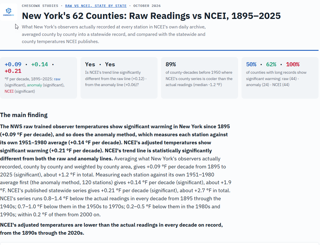
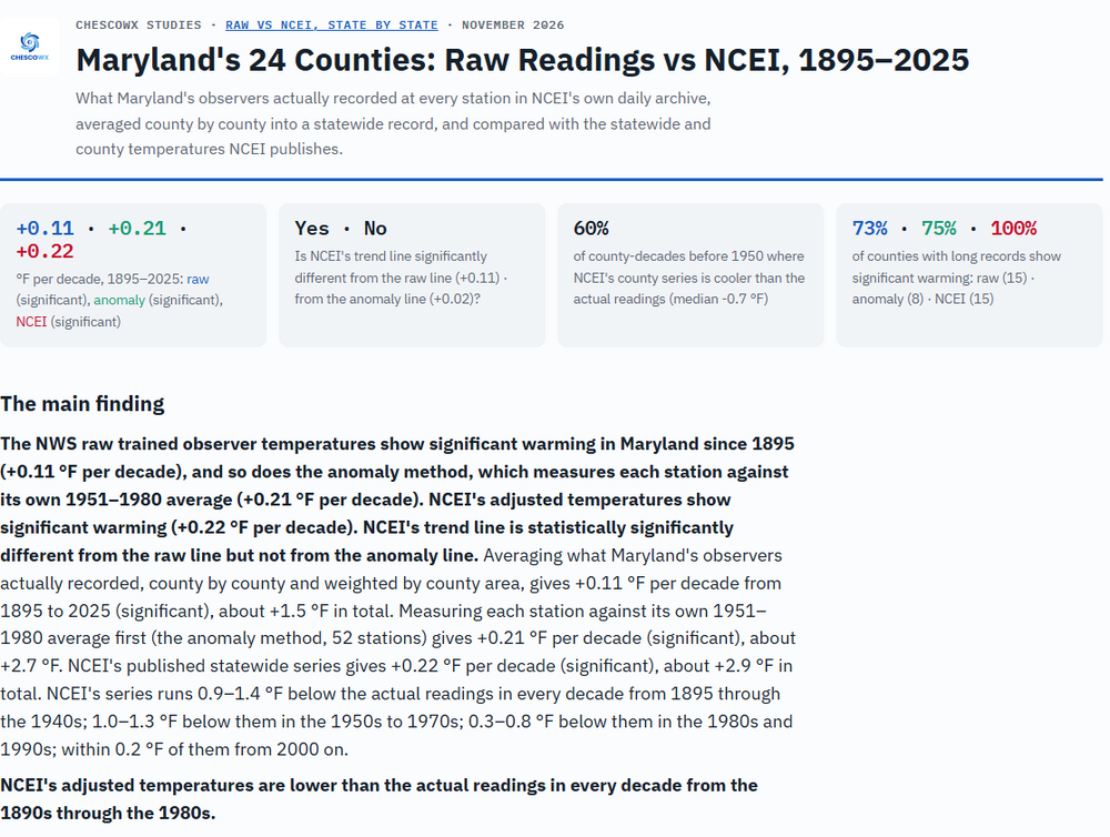
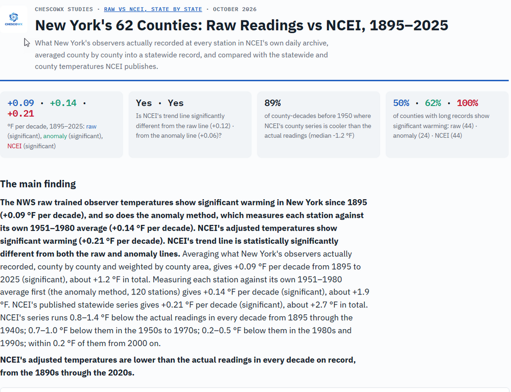
Below is both Maryland and New York State in our latest study release under the Actual vs. Adjusted Data Research Report https://chescowx.com/raw-vs-ncei-maryland/ https://chescowx.com/raw-vs-ncei-new-york/
-
2026-2027 Record-breaking El Nino
GaWx replied to Stormchaserchuck1's topic in Weather Forecasting and Discussion
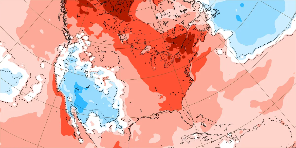
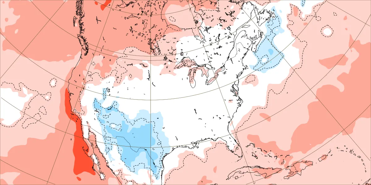
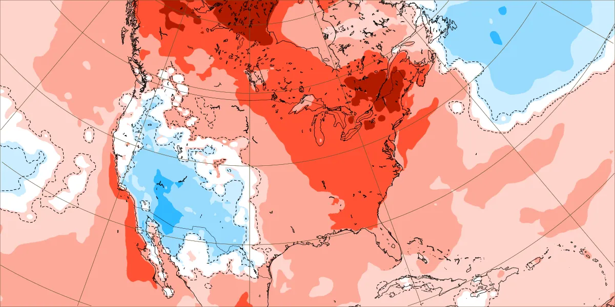
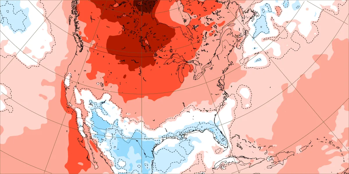
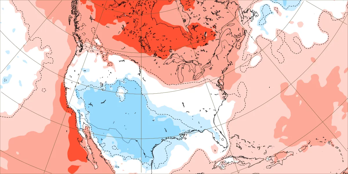
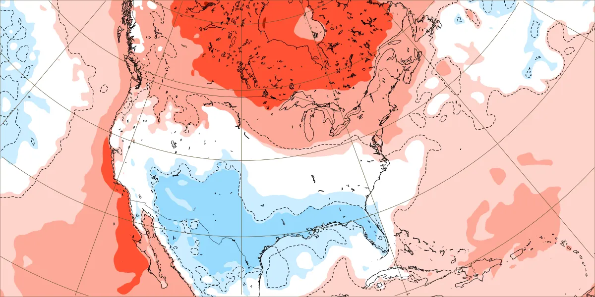
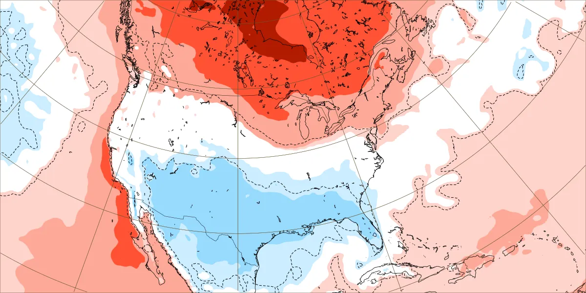
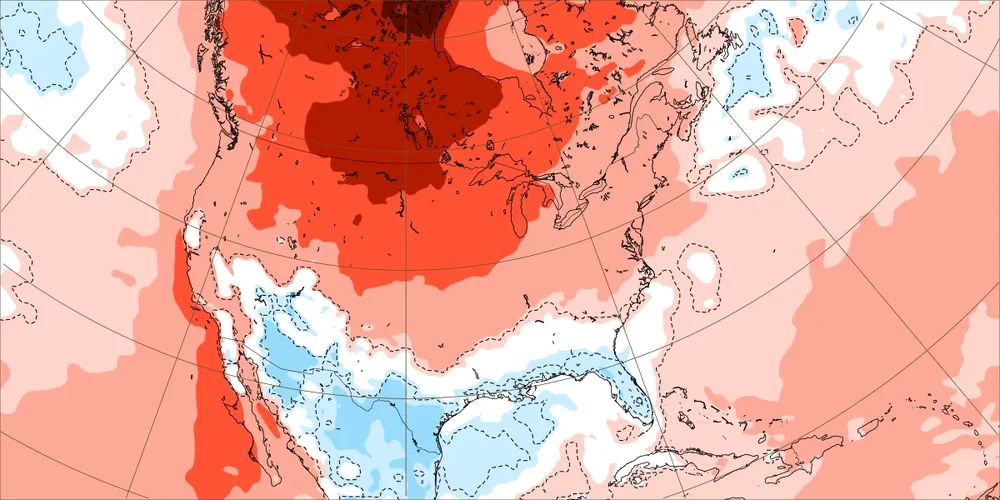
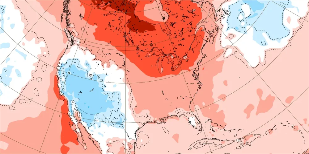
^These on this EW run are very warm weeks in much of the U.S., weeks 1-3: OTOH: These (weeks 4-6) are not very warm weeks in much of the U.S. as the very warm is restricted mainly to Canada and the entire S 2/3 is literally NN to slightly BN: see the difference? Calling these 3 weeks “very warm” on the model is incorrect: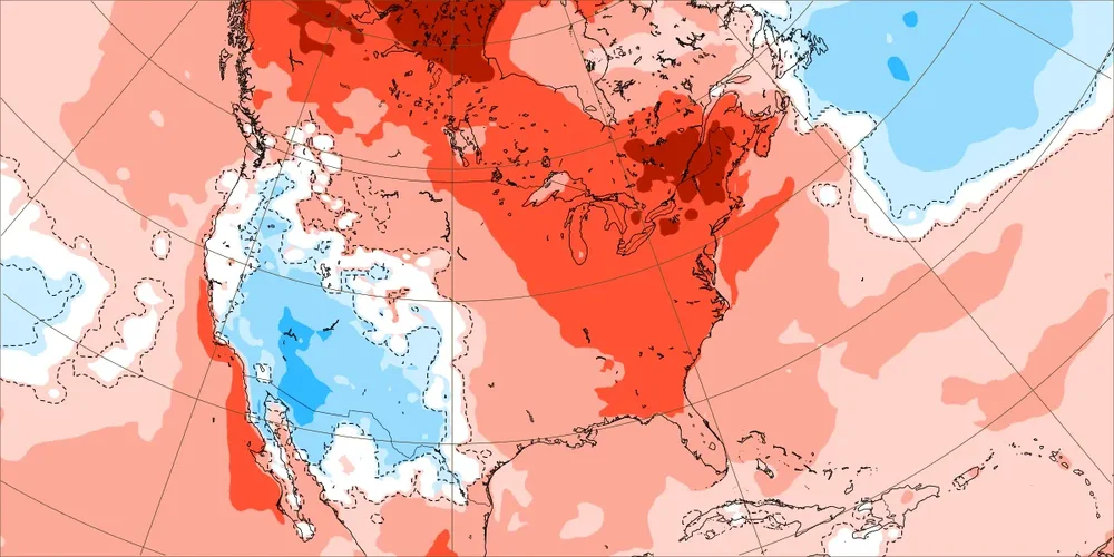
-
Another busted sunny forecast-looks cloudy most of the day
-
Don't know if this was mentioned in here already... but FYI from our forum re REFS/RRFS