All Activity
- Past hour
-
I went to visit my son at ETSU today. Amazing that the trees are already changing in this area. I believe an early fall is on tap. Looks like we finally got some good rains in middle TN. Hopefully this is the beginning of the drought being eroded away for middle & hopefully west TN.
-
Have an outdoor wedding to attend this evening in Baltimore. Woo storms?
-
I want hard , fast dongs galore.
-
Dews around 70 make for an amazing Saturday.
-
Models don't see that enthusiastic about rain today. I hope what does fall, falls where it's needed and not here again. Stephen City can have my rain.
-

E PA/NJ/DE Autumn 2025 Obs/Discussion
BBasile replied to PhiEaglesfan712's topic in Philadelphia Region
Yes, looking forward to a little more action today... And the dew points that follow. -
Looks like decent rain chances tomorrow too.
-
Then again hrrr likes north it seems
-
Think you bang hard and fast later
-
Bring the extra roll today.
-
I swear, seasonal patterns DO repeat themselves. This has been the story for most of the summer of 2025. SEPA through northern NJ gets the goods, and I miss everything as it all comes together too late for the Skook.
-
Blah. Would love some thunder later.
-
Deep fog and low clouds.
-

September 2025 OBS-Discussion centered NYC subforum
bluewave replied to wdrag's topic in New York City Metro
This weekend will probably be the last shot for a while to get some much needed heavier rains. Models have us drying out again next few weeks in the is very erratic rainfall pattern with only lighter events possible. The warm spots will make a run on 90° today. Then a cooler pattern next week. 90° heat starts building to our west mid-month. So it’s possible we see more upper 80s and lower 90s again mid to late month. SEP 8-15 SEP 15-22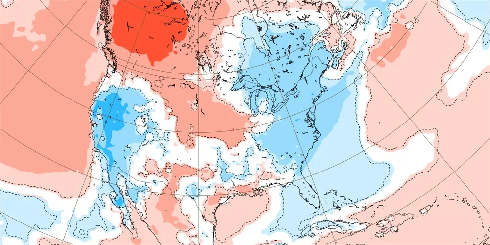

-
Smoke plume out there. Let’s kill the CAPE.
-

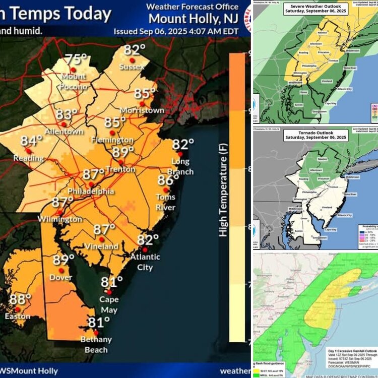
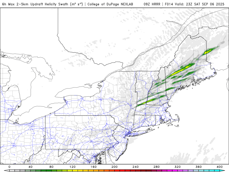
Saturday 9/6 Strong/Severe storm potential
moneypitmike replied to Torch Tiger's topic in New England
Despite being outside the green by some distance, I have severe in both my p/c and zfp. Please. -

September 2025 OBS-Discussion centered NYC subforum
wdrag replied to wdrag's topic in New York City Metro
Family activity so any NOW thread for SVR-iso FF delayed til 830. Looks good for 1-3" I95 corridor iso 4. Few SVR 2P-8P. Welcomed rain a little further east than Friday. - Today
-
Please. The lawn is toast at Pit2.
-
let’s go
-
-
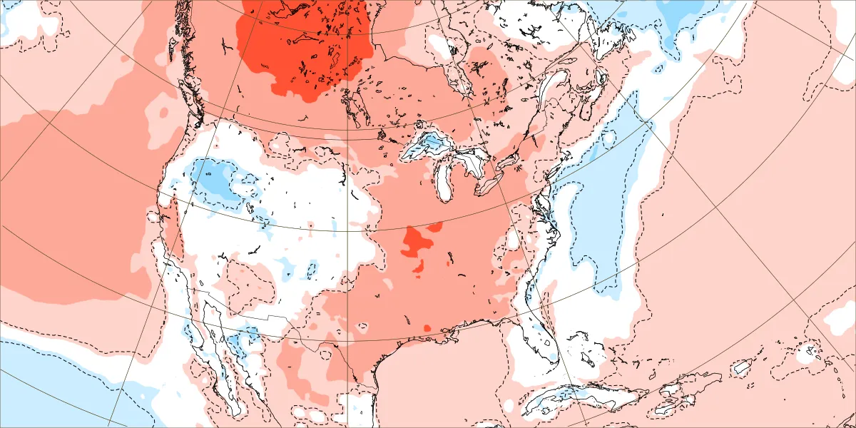
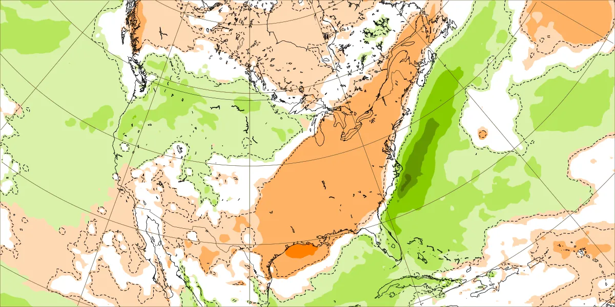
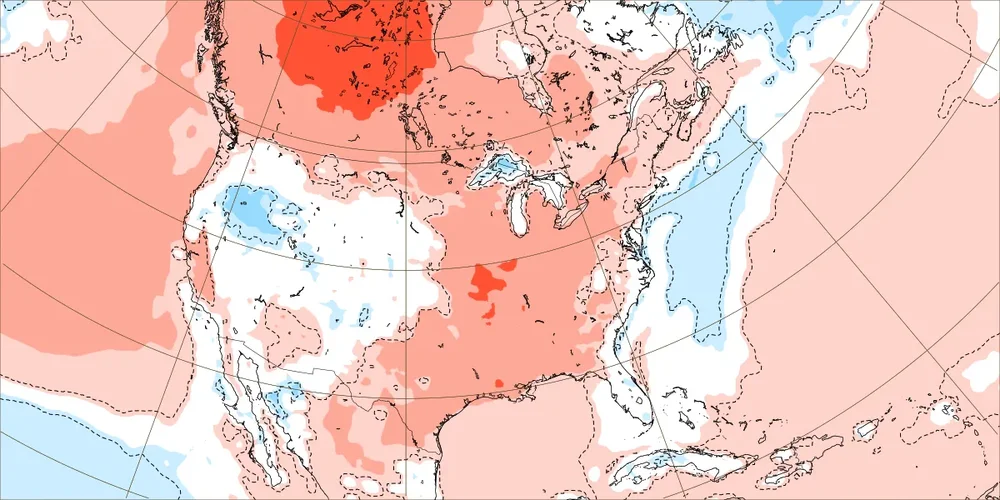
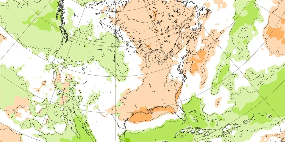
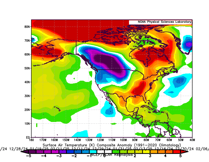
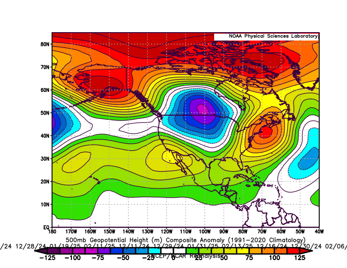
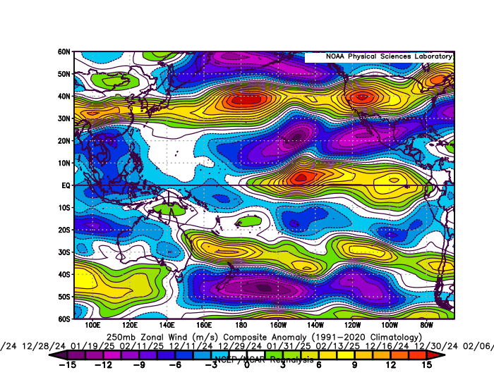
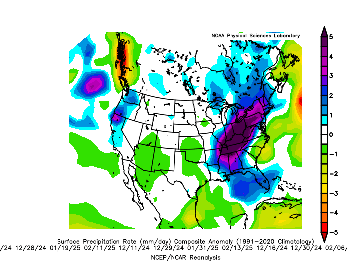
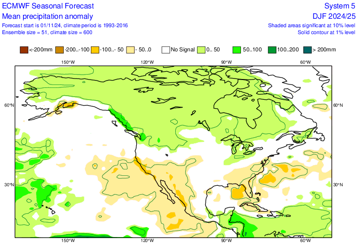
But the storm track matched the warm winter pattern it was forecasting. The composites below are for the 20 days that .20+ of precipitation fell from Philly to Boston. The average temperature at Philly to NYC on these days was in the low 40s. So it was too warm for much snow with the storm track to the west of the I-95 corridor. The Euro seasonal precipitation forecast had above average near the Eastern Great Lakes matching the warmer storm track which verified. Plus there was major flooding in areas like West Virginia along this storm track. The Southeast ridge on the days when the wettest storms occurred was even more amplified than what the general seasonal forecast from the Euro was. Plus the warm departure on the heaviest storm days was significantly warmer than the seasonal temperature forecast. So in effect a warmer version of the seasonal forecast did occur through the storm track. The Pacific Jet was too strong and warm for much snowfall from Philly to Boston relative to the means. This has been a common theme leading to the record low snowfall near I-95 since 2018-2019.
-

Saturday 9/6 Strong/Severe storm potential
Torch Tiger replied to Torch Tiger's topic in New England
Looks and feels like a big day -

Saturday 9/6 Strong/Severe storm potential
Damage In Tolland replied to Torch Tiger's topic in New England
Deep summer 5 miler this morning.Felt great just the way most like it -
9/7/23 was ok
-
Early September is a mini-peak for severe, often as good as it gets around here. 9/7/98 is a great example