All Activity
- Past hour
-
it hasn't meant much since the PDO flipped negative long-term in the early 2020s
-
Just like for all runs before, 12Z UK is again staying OTS from US with this run not as close to FL on its closest approach (175 miles offshore) vs last few runs: TROPICAL DEPRESSION 09L ANALYSED POSITION : 22.0N 77.3W ATCF IDENTIFIER : AL092025 LEAD CENTRAL MAXIMUM WIND VERIFYING TIME TIME POSITION PRESSURE (MB) SPEED (KNOTS) -------------- ---- -------- ------------- ------------- 1200UTC 27.09.2025 0 22.0N 77.3W 1007 28 0000UTC 28.09.2025 12 21.3N 77.3W 1006 26 1200UTC 28.09.2025 24 23.4N 77.1W 1005 34 0000UTC 29.09.2025 36 24.7N 77.1W 1003 30 1200UTC 29.09.2025 48 26.2N 77.1W 1003 43 0000UTC 30.09.2025 60 27.5N 77.5W 1000 39 1200UTC 30.09.2025 72 28.3N 76.6W 997 35 0000UTC 01.10.2025 84 28.6N 74.6W 994 39 1200UTC 01.10.2025 96 34.6N 69.7W 977 69 0000UTC 02.10.2025 108 CEASED TRACKING —————— *Edit: Note the initialization as of 12Z at 22.0N, 77.3W: how is that compared to where it really was at 8AM?
-

September 2025 OBS-Discussion centered NYC subforum
Sundog replied to wdrag's topic in New York City Metro
Most people that aren't low IQ have moved on from the argument that we aren't warming and have now embraced the "the cause is anything and everything BUT anthropogenic greenhouse gas emissions" defense. Sadly there is a HUGE portion of the population that also thinks that the USA is the sole party responsible for fixing climate change when we account for only 10% of global emissions. -
Definitely seems like actual landfall is off the table thankfully. Still some uncertainty, but most models in agreement with it getting close, and then moving further off the coast. Coast still could get alot of rain though.
-
I defer to the real tree expert here.
-
I’ve been looking at the main tropical thread and posts from the people behind CWG. It’s looking like it’s a pipe dream, screwed over again.
-
JB just posted and of course likes the EURO solution of Imelda getting trapped under the ridge and threatening NC northward.
-

September 2025 OBS-Discussion centered NYC subforum
LibertyBell replied to wdrag's topic in New York City Metro
Most of us finished neutral, inland it was warmer. ISP too for some reason as well as HVN. -
Man we have missed out on everything. Just 0.09” so far
-
and the summer birds have departed early
-
I think seasonal snowfall is bound to decline as the 20 year period from 2000-2020 benefitted from the increased moisture from CC, while still being cold enough to snow. We're no longer reliably cold enough to snow anymore so we should expect the long term seasonal average in the city to go from 25" ish to maybe 15". At the same time we have been stuck in a particularly unlucky pattern since 18-19 as bluewave says.
-
I had that pleasure when I went to Iceland last November. Landing mere miles away from a volcano erupting was a literal dream come true. Sent from my SM-G970U1 using Tapatalk
-
Getting back to today if your area gets underneath one of these storms today you might be in a flash flood area because these storms aren't moving at all. They are just training over the same areas. TN is getting hammered currently because of this.
-
The big (24" x 90') red oak near the house still thinks it's August. Nearby white ash are almost bare, red maples near full color (even away from the swamps) while sugar maple is just beginning to color.
-
12Z Icon stays OTS from US
-

September 2025 OBS-Discussion centered NYC subforum
bluewave replied to wdrag's topic in New York City Metro
Several stations had a warmer departure than Newark did this month. HVN…+2.2 PHL….+2.1 FWN….+2.0 ISP…….+1.7 SMQ…..+1.4 MPO….+1.4 EWR…..+1.3 HPN…..+1.1 TTN…..+0.6 POU…..+0.5 NYC……+0.3 JFK……..0.0 LGA…….-0.4 BDR…….-0.5 -
Lucy’d with rain… We better get a true prolonged wet pattern after the Niña breaks…
-
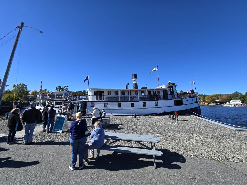
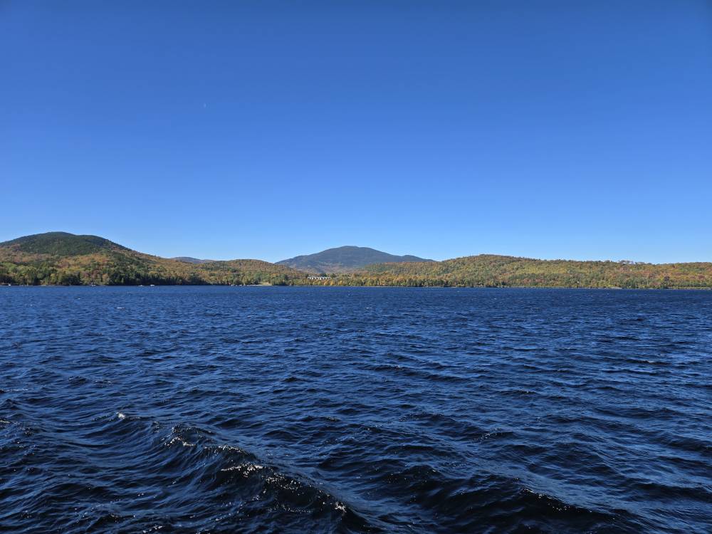
Out on the Katahdin on Moosehead. A bit brisk with NW wind but not a cloud in the sky. Sent from my SM-S921U using Tapatalk
-

2025-2026 ENSO
donsutherland1 replied to 40/70 Benchmark's topic in Weather Forecasting and Discussion
The New York City area can still see both big snowstorms and snowy winters and that will be the case for decades to come even if/as seasonal snowfall declines. -

September 2025 OBS-Discussion centered NYC subforum
anthonymm replied to wdrag's topic in New York City Metro
Yup even with 91-20 normals. I don't even understand how anyone can deny the reality at this point. -
2025-2026 ENSO
donsutherland1 replied to 40/70 Benchmark's topic in Weather Forecasting and Discussion
It has a very weak correlation. I don't think it's of much predictive value. It should also be noted that some more recent research suggests that it is lower September-October Siberian snow cover that translates into a weaker polar vortex during late winter and early spring while increased Siberian snow cover (September–October) leads to a stronger polar vortex in late winter and early spring. For example: The reduced snow cover benefits a deceleration of the circumpolar westerlies, the sea ice loss in the Barents-Kara Seas, the positive Pacific-North American pattern, and the negative Aleutian-Icelandic Low Seesaw pattern, which amplify the intensity of planetary waves propagating upward into the stratosphere. The enhanced planetary waves are characterized by the stratospheric dipole-like pattern during the preceding October and December and contribute to the continuous weakening of the polar vortex from January to March. https://www.sciencedirect.com/science/article/pii/S0169809524002898 -
Looks like he was on Little Moose Mt, and that area has a lot more spruce and fir than pine/hemlock, also very little oak. Beech tends to tarry in coloring (unless it's diseased) and some sugar maple turns significantly later than most of that species.
-
Mine produced a ton this year. Probably the most in the 9 years ive been here.
-
Very nasty bad luck over and over. Right on, if FL can score 9" KU's in this new climate regime it's OBVIOUSLY not over for the tristate.
-
Time will certainly tell, with regard to AI integration. Part of me is fearful that it will become "too good," eliminating the mystery and continuation of scientific analysis in forecasting. Maybe another thread for this topic. I'm fascinated by the current forecast evolution of this particular complex setup. This week will probably take the gold medal for most dynamic tropical forecast (regardless of land interaction,) in perhaps the past 2 seasons. Fujiwara is a thread the needle interaction with actual tropical core systems. Attempting to learn as much as I can over the next 72+ hours. This was worth the wait.


