All Activity
- Past hour
-
 Was this the storm that had a crazy narrow solid line of CGs that spanned almost all of MA WSW to ENE?
 -
90/72 HI 98
-
 Storms dying as they approach the border.
 -
Soon after I said that some blue sky is trying to break through and you feel the difference with that brighter sun at times. It should still be widespread low 90s, with the Park the usual wildcard
-
Not 10% in ME though, right?
-
It’s absolutely awful outside. You can smell the smoke. None of which helps me in dealing with my Parkinson’s. Breathing has become an issue in itself, and now this! Calgon take me away! 86 and putrid in Brightwaters
-
I do not think so, but 10% tor as an area SPC uses did not exist prior to the mid 2010s, just like ENH and MRGL did not. I think the tor probs used to go 2, 5, 15, etc. Yet you get these hype-masters going, "first time ev-A 10% tor prob in ME!" (same for ENH). Well, yes, but you are leaving out the short history here. Omitting key details that would otherwise deflate their hype. That being said, I do not recall any svr day w/ such a high risk for supercell/tors for NW ME. In fact, I do not think there has been a F3/EF3+ tor in ME/NH/VT, at least using the SPC database that goes back to 1950. Using the Tornado Project, only F3/EF3+ for NNE is the Sep 1821 cntrl NH tor. However, given the sparse population of NNE, esp. NW ME, sig tors, along w/ many weak tors, have unquestionably been missed.
-
headlines aren’t for temperatures.
-
100 isn’t happening today. Many models are over-mixing once again, just as they did with the last heat wave prior to the 4th. However, this time it’s worse.
-
 It's those tick bites. Clearly you have Sublyme disease. I'll see myself out....
 -
89 here right now. I figured mid 90s today, but obviously temps are several degrees lower due to the smoke.
-
 I went outside and my hands felt like two balloons.
 -
no mention of the smoke in their AFD which is odd, just the same forecast discussion from this AM which is not going to verify in many spots
-
 And the biggest windthrow events since we moved to Maine in 1973 were straight line winds. In November of 1974, about 12" of wet snow followed by strong NW gales flattened about 3,000 acres on the SW corner of Baxter Park. Because Governor Baxter's deeds of trust, the only salvage permitted was along the park roads for safety reasons. In 1977 all that well-seasoned wood was consumed by a wildfire. The other 3,000-acre blowdown was only 10-15 miles northwest from the Baxter damage - a powerful southeast storm (we had gusts to 50 at Fort Kent) in late October 1980 tipped the spruce-fir stands on T4R11 (mostly); I saw that area from the air in June of 1981 and it looked like a giant version of oats lodged by an August downpour. Essentially all that wood was salvaged by Great Northern.
 -
Definitely has that orange-ish tint now like a few years ago.
-
 Whenever I come back inside I have a strange craving for chips.
 -
Yup…had brief milky blue mixing in and warmed up to 82°. Now dark and yellow again and dropping.
-
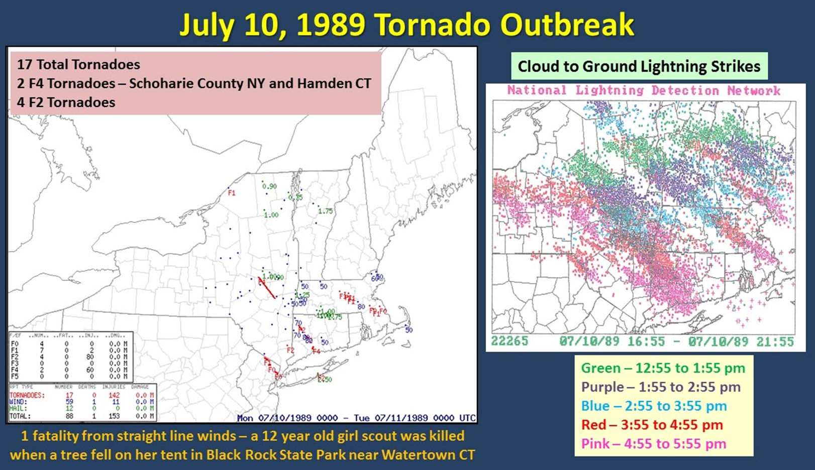
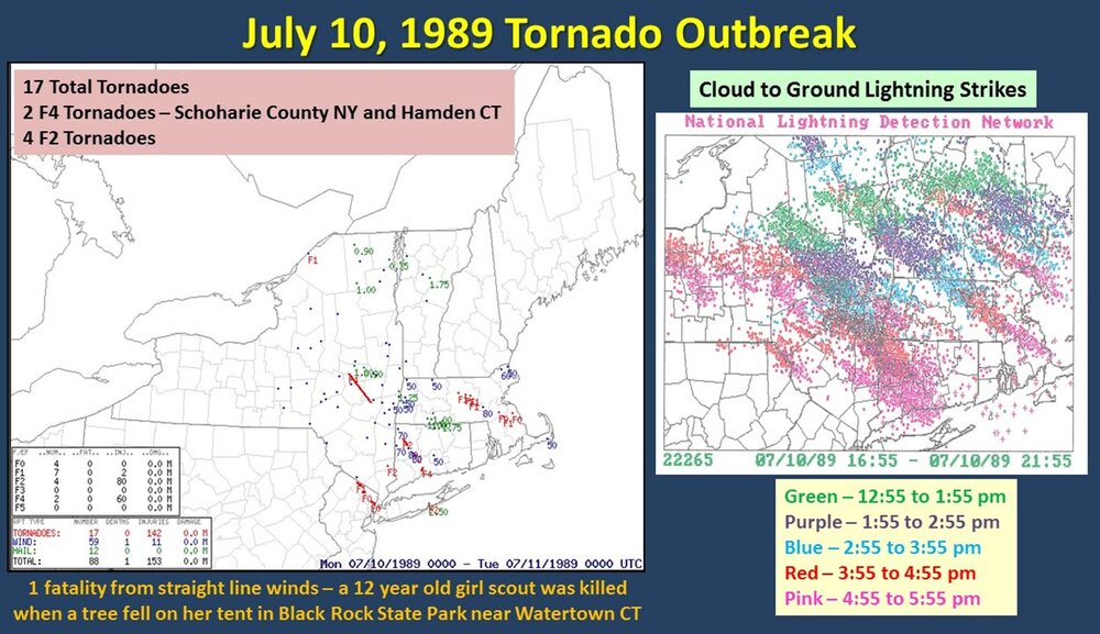
Incredible LTG show incoming tonight! EML FTW! 7/1 was good in that you have CONS flickering LTGIC esp. in the mid and upper part of the CBs, but CG and CC LTG overall was about avg. This situation is more potent, so the LTG should be high-end for all types! The tornadic HP monster that tracked from W of ALB to LI on July 10, 1989 had 12,500 CGs in it first 5 hr of existence. Here is a CG plot from that day (WxWiz - "I will treasure this image FOREVER!:).
-
Looks like this smoke has origins in Moosup CT. Has a slight skunk smell to it.
-
 Yeah tons of clouds and smoke here in Maine. Temps are underperforming.
 -

2026-2027 Super El Nino
bluewave replied to Stormchaserchuck1's topic in Weather Forecasting and Discussion
That relaxation of the ridge and heat has been the pattern since May following these periods of record heat and ridging. If the ridge returns again in early August, then we’ll know the pattern is continuing. But if the trough can hold on, then it would look more like a traditional developing super El Niño mid-latitude summer pattern in the East. It would be nice to get an extended break from these periods of record warmth and ridging. The shear across the Caribbean with this record breaking super El Niño is more like what they see in December. -
Yep smoke
-
That would be cool. Still looks active starting Saturday and continuing a while afterwards. We cool off and then maybe another heatwave early August looking at model clusters. Meanwhile, I believe I bserve smoke overhead. Skies are milky white. Currently here Current conditions at Wilmington Airport (KILG) Lat: 39.67°NLon: 75.61°WElev: 72ft. Fair 88°F 31°C Humidity 55% Wind Speed W 10 G 17 mph Barometer 30.12 in (1019.9 mb) Dewpoint 70°F (21°C) Visibility 10.00 mi Heat Index 93°F (34°C) Last update 14 Jul 12:51 pm EDT
-
When the dynamics/forcing are strong and an EML present, diurnal heating is less important. Not that it does not matter at all, it does, esp. for sig tor, but I will tell you, on July 10, 1989, after the AM tstms w/ the warm front in region, it remained mostly cloudy (thick high OVC) over much of the region, and this did not impede things at all w/ 3 discrete supercells -- SE NH, central MA (CoastalWx got it in Brockton eventually!), and the monster HP that tracked from W of ALB to LI (WxWiz's dream storm!!!). BDL was something 68/66 when the warm front passed July 10, 1989, and a few hours later 86/74, this was w/ lots of clouds present. Strong WA and moisture advection overcame the lack of insolation.
-
Yeah its not that hot at all. Warm but as far as comfort goes you could say its a better than average mid July afternoon. Quite breezy, tolerable humidity, with bright but very obscured sun. Most pleasant heat advisory I've felt.