All Activity
- Past hour
-
Strong gradient like pattern. Some models showing Arctic ridging. If the gradient can slip south every now and then for latter Dec and Jan then it could get interesting. I'd feel better being north though
-

Minor snowfall sunday 12/14/25 1-4” possible
SnoSki14 replied to WeatherGeek2025's topic in New York City Metro
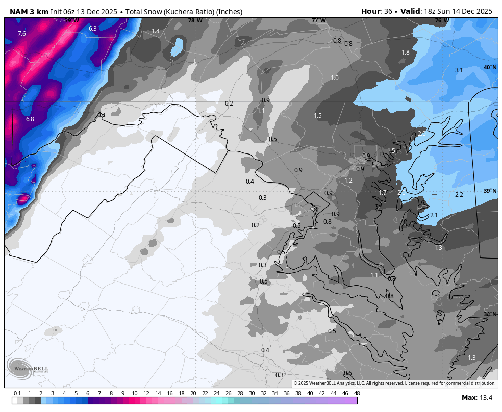
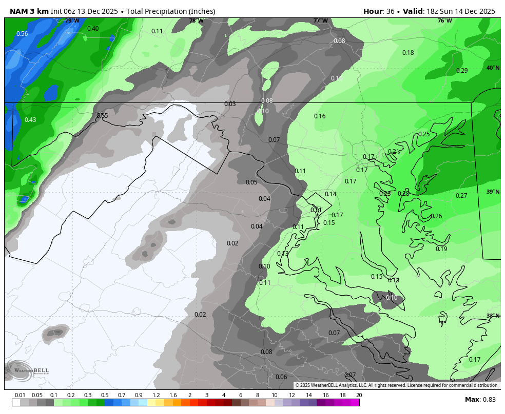
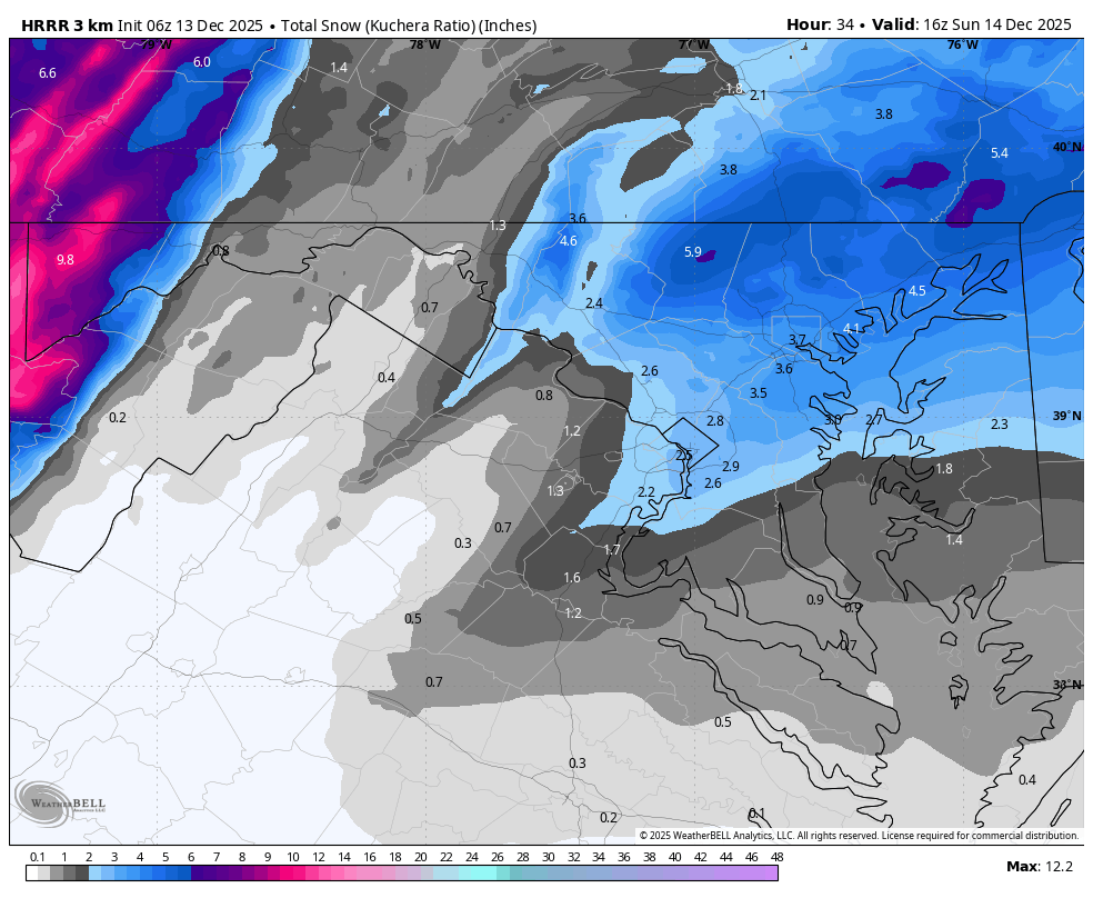
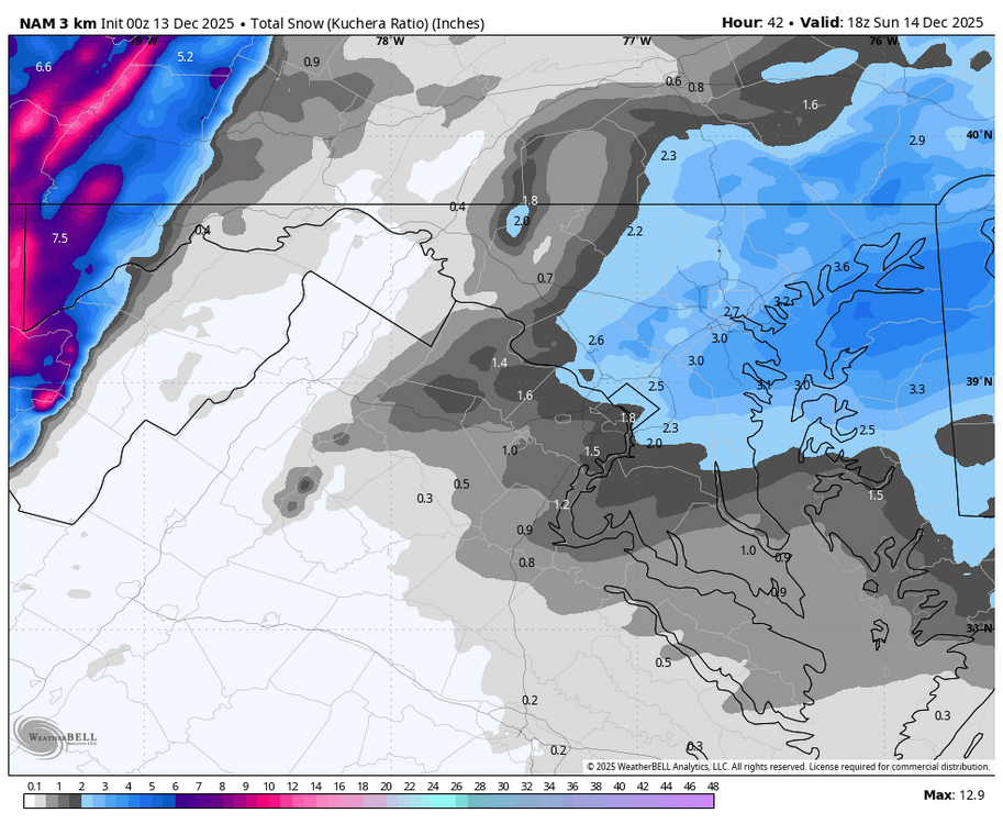
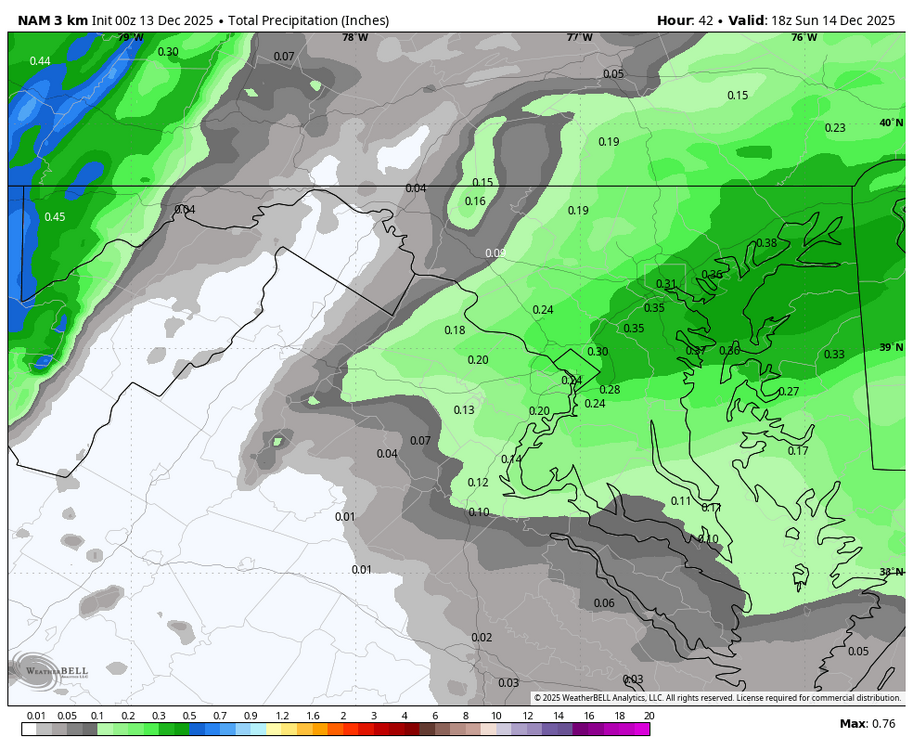
This mornings Nam got better compared to 0z. Think 3-5" looking better and better. Some areas may even approach 6" in South Central NJ. -
Holding steady at 15F here, nice cold ground ahead of this little event. Looks like SEMA is gonna pick up the most in NE and I’m happy for those guys, they’ve been getting screwed as much as the NYC area lately. Hopefully this is a nice little event for everyone. I think LI down to my area should do pretty solid, hopefully it ticks up for NYC also.
-

Minor snowfall sunday 12/14/25 1-4” possible
RU848789 replied to WeatherGeek2025's topic in New York City Metro
Best RFFS run yet. It must be correct, lol. -

12/14: Sunday funday? Will the south win again?
MN Transplant replied to TSSN+'s topic in Mid Atlantic
It snows for maybe 2 hours IMBY on the 6z 3k. - Today
-

12/14: Sunday funday? Will the south win again?
Weather Will replied to TSSN+'s topic in Mid Atlantic
WB 6Z 3K NAM stinks compared to 0Z.

-

Central PA Winter 25/26 Discussion and Obs
Ruin replied to MAG5035's topic in Upstate New York/Pennsylvania
they heavily pre treated the roads around me very surprised. also a side note tomorrow high now is saying 40??? thats a shock but its all ready down to 18 im supposed to believe it gets to 40 under cloud cover tomorrow? -
Sweet deal
-
Minor snowfall sunday 12/14/25 1-4” possible
RU848789 replied to WeatherGeek2025's topic in New York City Metro
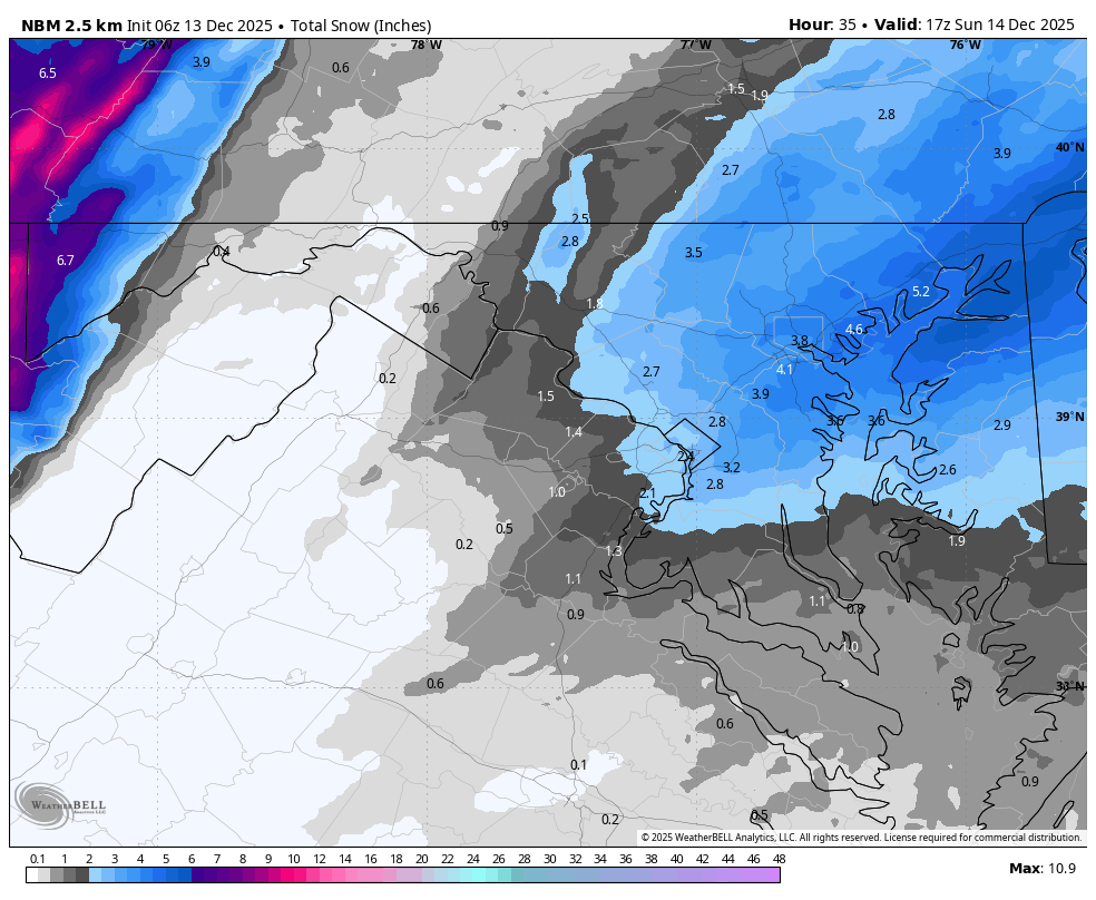
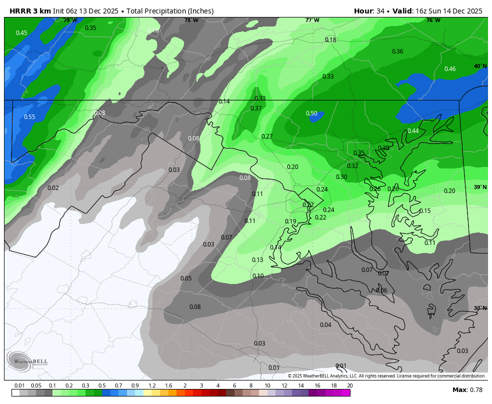
Almost every model showed improvement at 0Z for almost everyone near/along 95 from DC to NYC and even NW of 95 and the NBM shows NYC with >3" for the first time (3.1") and the NWS has responded with upping their snowfall map across the board for most, as well as increasing their WWA's to 3-5" for many areas from 95 to the coast and adding in quite a few counties for 2-4" of snow well NW of 95 and N of 78. It's been a good evening. Here is the updated NWS map and the latest NBM and the NWS WWAs. Getting excited. -
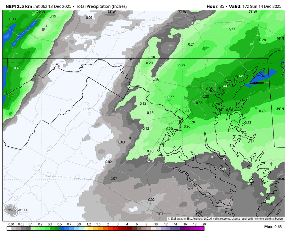
12/14: Sunday funday? Will the south win again?
Weather Will replied to TSSN+'s topic in Mid Atlantic
WB 6Z NBM
-
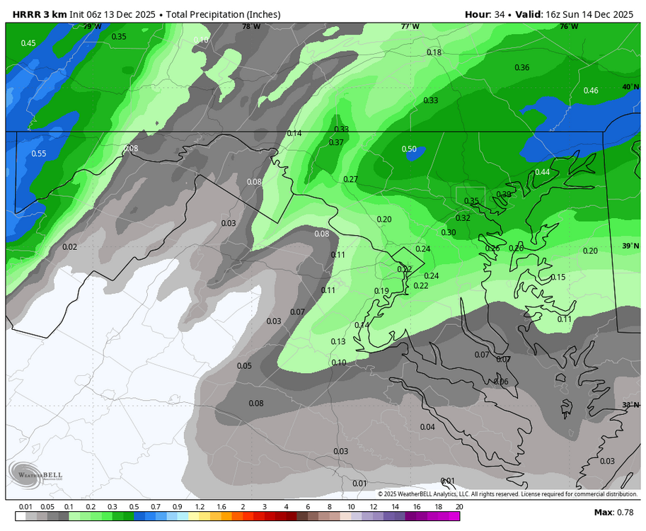
12/14: Sunday funday? Will the south win again?
Weather Will replied to TSSN+'s topic in Mid Atlantic
WB 6Z HRRR looks good!
-
I believe that, especially since it’s still so early in the season, but it’s not just at DTW, the NWS and surrounding areas in the hills get more snow than Flint Bishop, MBS in Saginaw county, and probably Ann Arbor. It’s honestly what sparked my interest in weather growing up in southeast Michigan.
-

Central PA Winter 25/26 Discussion and Obs
Blizzard of 93 replied to MAG5035's topic in Upstate New York/Pennsylvania
Winter Weather Advisory URGENT - WINTER WEATHER MESSAGE National Weather Service State College PA 1114 PM EST Fri Dec 12 2025 PAZ065-066-131700- /O.EXB.KCTP.WW.Y.0025.251214T0000Z-251214T1800Z/ York-Lancaster- Including the cities of Lancaster and York 1114 PM EST Fri Dec 12 2025 ...WINTER WEATHER ADVISORY IN EFFECT FROM 7 PM SATURDAY TO 1 PM EST SUNDAY... * WHAT...Snow expected. Total snow accumulations between 2 and 3 inches. Locally higher spot amounts are possible. * WHERE...Lancaster and York Counties. * WHEN...From 7 PM Saturday to 1 PM EST Sunday. * IMPACTS...Plan on slippery road conditions. The hazardous conditions could impact the Monday morning commute. -

12/14: Sunday funday? Will the south win again?
Stormchaserchuck1 replied to TSSN+'s topic in Mid Atlantic
-

12/14: Sunday funday? Will the south win again?
stormtracker replied to TSSN+'s topic in Mid Atlantic
Go to bed. -
12/14: Sunday funday? Will the south win again?
Stormchaserchuck1 replied to TSSN+'s topic in Mid Atlantic
I'm pulling an all nighter, getting ready for the all nigher tomm night! 6z Hrr looks north, but a solid 4" here -

12/14: Sunday funday? Will the south win again?
Maestrobjwa replied to TSSN+'s topic in Mid Atlantic
After all this time they ain't updated those graphics? Lol -
12/14: Sunday funday? Will the south win again?
stormtracker replied to TSSN+'s topic in Mid Atlantic
Yall sleep? Who can sleep the eve before the Blizzard? -
12/14: Sunday funday? Will the south win again?
stormtracker replied to TSSN+'s topic in Mid Atlantic
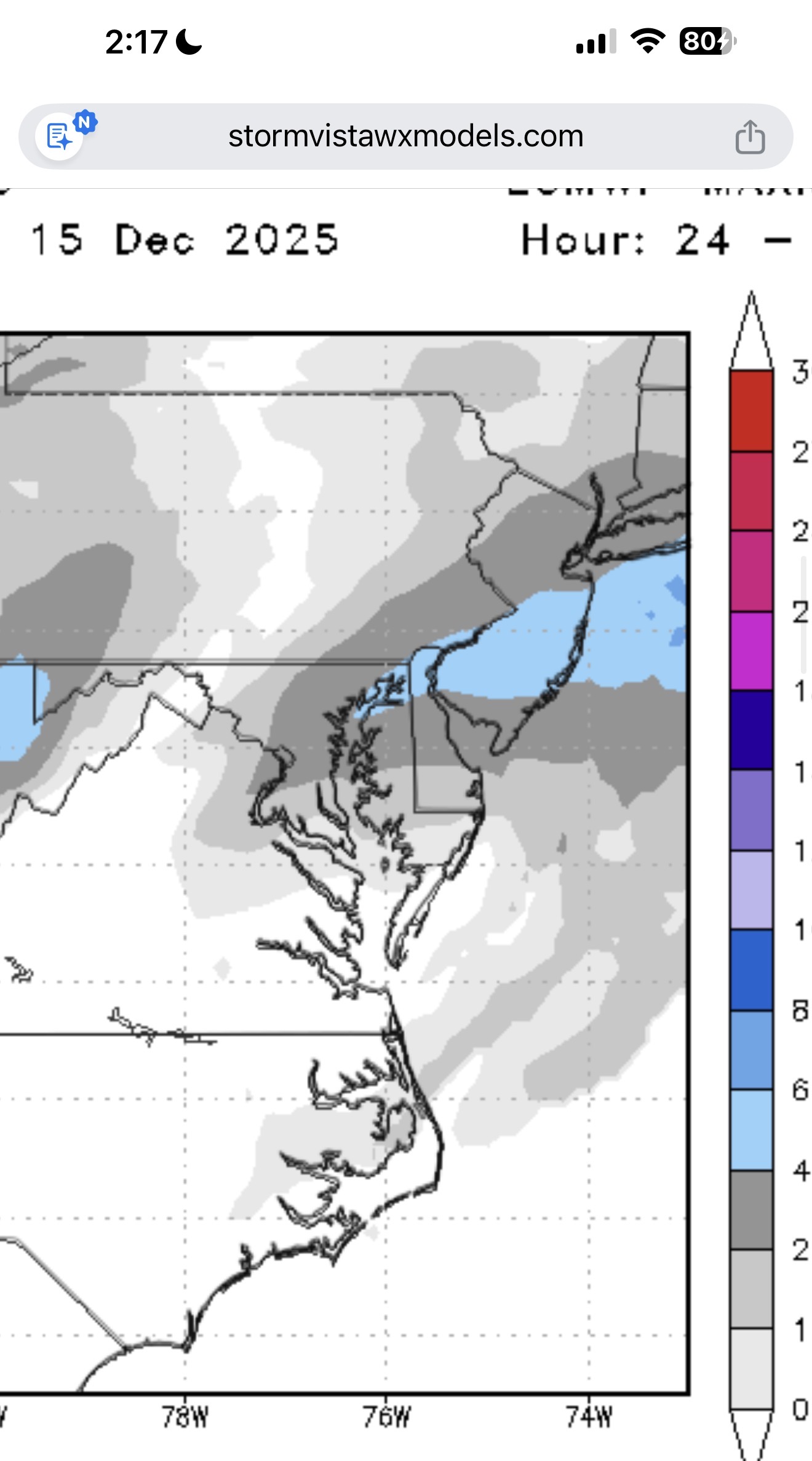
Euro looks good. Don’t know how it compares to 18z. But 2-4 down this way. Similar precip axis like the others. SV graphics are made in Minecraft
-
12/14: Sunday funday? Will the south win again?
Maestrobjwa replied to TSSN+'s topic in Mid Atlantic
I'm up at 2am 90% of the time anyway, so...yep! -

December 11th-14th Double Banger Clippers
KeenerWx replied to Jackstraw's topic in Lakes/Ohio Valley
Yep! I don’t need to get the jack on this one. Would be perfectly content with an inch or two refresher. -
Why the hell not, I was all for starting a thread for a random date in winter and gassing it up for no reason
-

12/14: Sunday funday? Will the south win again?
SnowenOutThere replied to TSSN+'s topic in Mid Atlantic
Bro go to bed -
so anybody staying up until 2am lol
-
https://media.tenor.com/2739Fe1Wj-QAAAAM/whomp-whomp.gif