All Activity
- Past hour
-

Augdewst 2026: Summer's Last Stand
dendrite replied to Prismshine Productions's topic in New England
Min 68.8° A very safe 0.00” here -
Picked up 1.35" rainfall from yesterday's T-Storm. Total over the last 7 days 4.34". Since 6/1/26: 18.84" Since 7/1/26: 13.33"
-
 Sildenafil 100mg price cheap viagra - cheap viagra
 -
https://sildoliko.com/# cheapest viagra
-
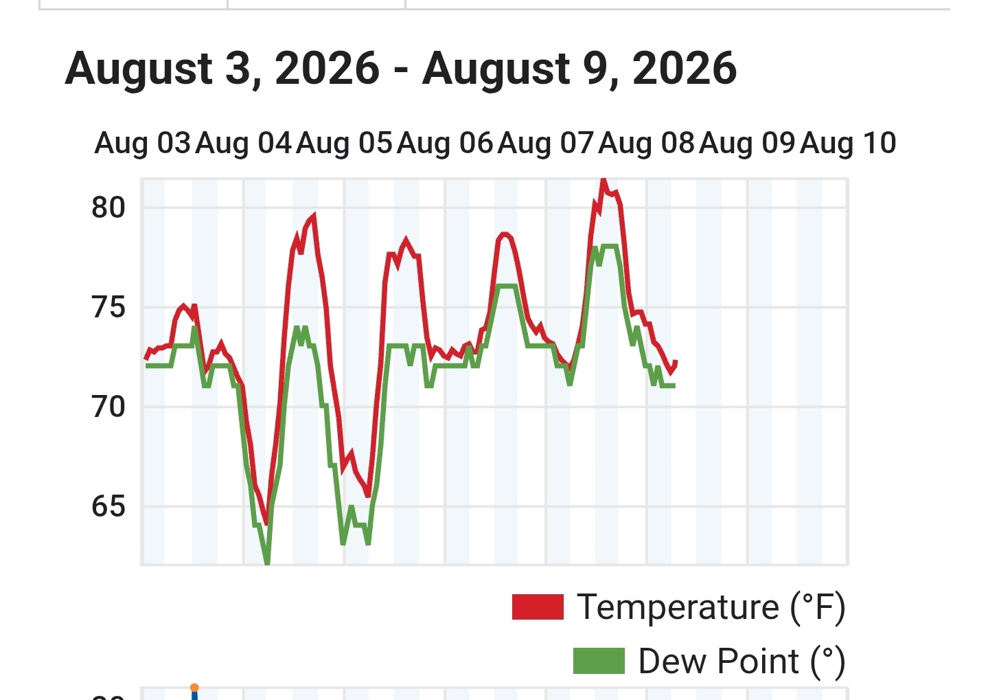
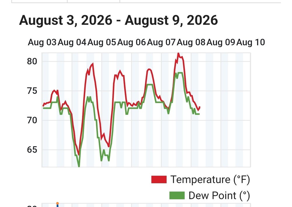
Yeah. Was out on Pt Judith all week at my sister's beach house. Yesterday was the only day it got above 80. I set this station at my sisters a few years ago. Didn't there used to be a coop station or something out on PT Judith back in the day? Probably one of coolest non island spots in New England. Last above 80 reading was July 15th. https://www.wunderground.com/dashboard/pws/KRINARRA66
-

Central PA Summer 2026 Discussion/Obs Thread
Mount Joy Snowman replied to Voyager's topic in Upstate New York/Pennsylvania
Um holy crap guys. Carrying my gauge in this morning I quickly realized that I way under estimated how much I got. After meticulously measuring it all out, the total came to 7.52”! I was truly in the heart of the most intense action and believe this to be the highest total in the state yesterday. I’ve not yet found anything on NWS, WU, or Cocorahs even approaching this amount. Please let me know if you find any totals this high. Wow, what a day! -

2026-2027 Record-breaking El Nino
bluewave replied to Stormchaserchuck1's topic in Weather Forecasting and Discussion
You have to realize that this forum goes well beyond IMBY type posts. In order to understand the local IMBY weather patterns, you have to see the bigger picture. One of the key reasons our area wasn’t able to experience a repeat of 1995-1996 this past winter was the overpowering nature of the ridges and warmth to our West. So the cold and upper trough wasn’t strong enough to reproduce the historic outcome of 1995-1996. That warmth came east in March preventing the heavy March and April 1996 snows from repeating. Our weather patterns have greatly shifted warmer since the 2015-2016 super El Niño. So the areas where the strongest 500mb ridges have set up produced these +10 extremes which weren’t forecast ahead of time. There has never been an 11 year period since 1895 with 17 months this extreme. You can find a scattering of isolated cases back over time. Plus we are doing it with the warmest 30 year climate normals in record making it even more impressive. -

Central PA Summer 2026 Discussion/Obs Thread
pawatch replied to Voyager's topic in Upstate New York/Pennsylvania
70 degrees this morning, light rain showers. Picked .40” of rain overnight, will have to go out and check my manual rain gauge later on. -
The actual tornado was in Brooklyn. But since the rotation remained so strong on radar into SW Nassau, the NWS maintained the tornado warmings out of an abundance of caution. I was glad there was no tornado when it got to Long Beach. But it was really cool to see the swirl in the clouds directly overhead when the weakened supercell moved over my area. September 1998 was the strongest tornado near the South Shore in my time living there. The Labor Day Derecho caused the sky to go dark between 2-3 in the afternoon. Then I had my only .75 hail and severe gusts from a single storm on the South Shore. The actual tornado was in Lynbrook and the damage path was clearly visible near the neighborhood close to Sunrise Highway.
-

Augdewst 2026: Summer's Last Stand
Damage In Tolland replied to Prismshine Productions's topic in New England
There was no DIT storm. 4th severe warning of summer with no storm . Picked up .18 in a gentle shower -

2026-2027 Record-breaking El Nino
PhiEaglesfan712 replied to Stormchaserchuck1's topic in Weather Forecasting and Discussion
You know, I really don't give a rats arse about the months that produced a +10 in the West, like Dec 2024, or Dec 2025-Feb 2026, especially when it was cold in my area. Plus, there were more months than March 2012 and January 2006 that had +10 departures. I bet I could find months before January 2006 that had +10 departures. In the East, we had January 1890, 1932-33 (the Dust Bowl years, I'm sure you've heard of that), and 1950. -

Central PA Summer 2026 Discussion/Obs Thread
mahantango#1 replied to Voyager's topic in Upstate New York/Pennsylvania
US National Weather Service State College PA A batch of showers is moving across Western PA and may bring some morning showers/isolated thunder to Central PA. Development of thunderstorms is once again expected in the afternoon, which brings a Marginal (level 1/5) risk for severe weather and excessive rainfall. -
Central PA Summer 2026 Discussion/Obs Thread
mahantango#1 replied to Voyager's topic in Upstate New York/Pennsylvania
Only .14 rain here. Had a lightning strike here yesterday somewhere very close to the house that shook the house. while the sun was out just as those thunderstorms were forming. The creek reflects the flash flood warning that was posted just to the east of me yesterday afternoon. -

E PA/NJ/DE Summer 2026 Obs/Discussion
Hurricane Agnes replied to PhiEaglesfan712's topic in Philadelphia Region
From the 2 rounds of rain yesterday, I got 0.49" from round 1 and an additional 0.04" from round 2 for 0.53" total. My high was 93 before rnd 1 knocked it down to 85 and rnd 2 all the way down yo 73. Looks like the next few days will be Wash. Rinse. Repeat. Currently 73 with dp 73. - Today
-
2026-2027 Record-breaking El Nino
bluewave replied to Stormchaserchuck1's topic in Weather Forecasting and Discussion
It also goes beyond what phase the ENSO is in. But the warmest actual departure was +17.5 at FAR in the Feb 2024 super El Niño. This past winter was a weak La Niña with each month from December to March producing a +10 at some stations in the CONUS. No seasonal model forecast this. So we have a total of 17 months since the 2015-2016 super El Niño increased the baseline temperatures with +10 departures at some CONUS stations. None of the seasonal models forecast these either. Prior to 2015-2016 there were only a few +10 or greater months across the CONUS. These were March 2012 and January 2006. The list below includes the 17 months and the station close to warmest departures during each month. So there were numerous other stations over the+10 level during these months. DEC…2015….NYC….+13.3 MAR…2016…MOT….+10.5 JAN…2017….BTV…..+11.0 FEB….2017….ORD….+10.3 FEB…..2018…ATL….+10.6 FEB….2019…MGM….+10.5 JAN….2020…YAM….+9.8 DEC….2021….DFW….+13.2 JAN….2023….DXR….+12.3 FEB….2023…..SSI…..+9.8 DEC….2023….INL…..+15.8 FEB…..2024….FAR…..+17.5 DEC….2024…..LND…..+11.3 DEC….2025….CPR…..+12.1 JAN….2026….RIW……+10.2 FEB…..2026….LND…..+11.3 MAR….2026….PHX…..+12.5 -
Cheapest Sildenafil online Buy Viagra online cheap - over the counter sildenafil
-

Augdewst 2026: Summer's Last Stand
CoastalWx replied to Prismshine Productions's topic in New England
They fell apart before they even got near him -
buy Viagra over the counter [url=https://sildoliko.shop/#]sildenafil over the counter[/url] Order Viagra 50 mg online
-

Chester County PA - Analytical Battle of Actual vs. Altered Climate Data
chubbs replied to ChescoWx's topic in Climate Change
You understand what I did correctly. Yes it would be easy to use the stable portions of the Chesco station data to test the others. That's essentially what NCEI does (and other groups). The NCEI adjustments are based on raw temperature data not station information. NCEI also uses data from outside of Chester County to determine Chesco bias adjustments, taking advantage of the fact that weather data is correlated over hundreds of miles. That's one of the reasons I found your Coatesville analysis interesting. The NCEI adjustments match the detailed site information you developed very well; and. for the periods where your site information was more complete and accurate than NCDCs, the match between the site info and the bias adjustments improved. Interesting that the West Chester site has data from before 1894. Can you obtain the data? -
DIT storms fell apart at my doorstep, not a drop; however a great light show.
-
I will once we get closer to winter .
-
Augdewst 2026: Summer's Last Stand
CoastalWx replied to Prismshine Productions's topic in New England
Looked like it skipped you? Rain anyways. Big cluster offshore right now. The skip was well modeled. -

Central PA Summer 2026 Discussion/Obs Thread
Voyager replied to Voyager's topic in Upstate New York/Pennsylvania
Got 1.31" from yesterday's storms. The rain was incredibly intense at times in that afternoon storm. Windshield wipers on high speed couldn't keep up. I got the truck parked before the worst hit (I still got soaked going from the truck to the shop and then the car, though), but the ride home in the car was intense with the rain and the flooded roads. -
over the counter sildenafil Viagra Tablet price - Viagra Tablet price
-
https://tadaliko.shop/# Tadaliko