All Activity
- Past hour
-
59 / 46 looking like upper 60s to mid 70s across the board. Weekend split again nice Saturday mimic of Friday and a wet Sunday into Monday 1-2 inches of rain. Overall warmer 10/13-14 then cooling down by meid month towards and below nomal.
-
The odds this maintains cat 3 into landfall are not low. Also the fast forward motion is going to aid in gusts. Very serious situation unfolding now. Hope everyone took evacuation orders seriously
-
Its out of the south by Sunday
-

2026-2027 Fall/Winter Mountain Thread
strongwxnc replied to BlueRidgeFolklore's topic in Southeastern States
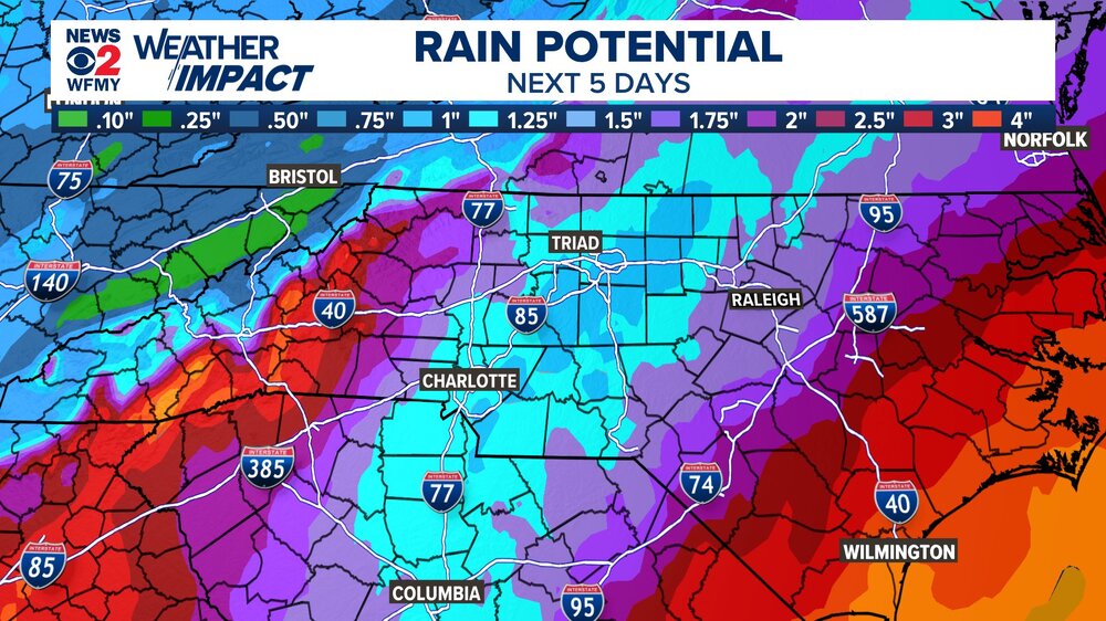
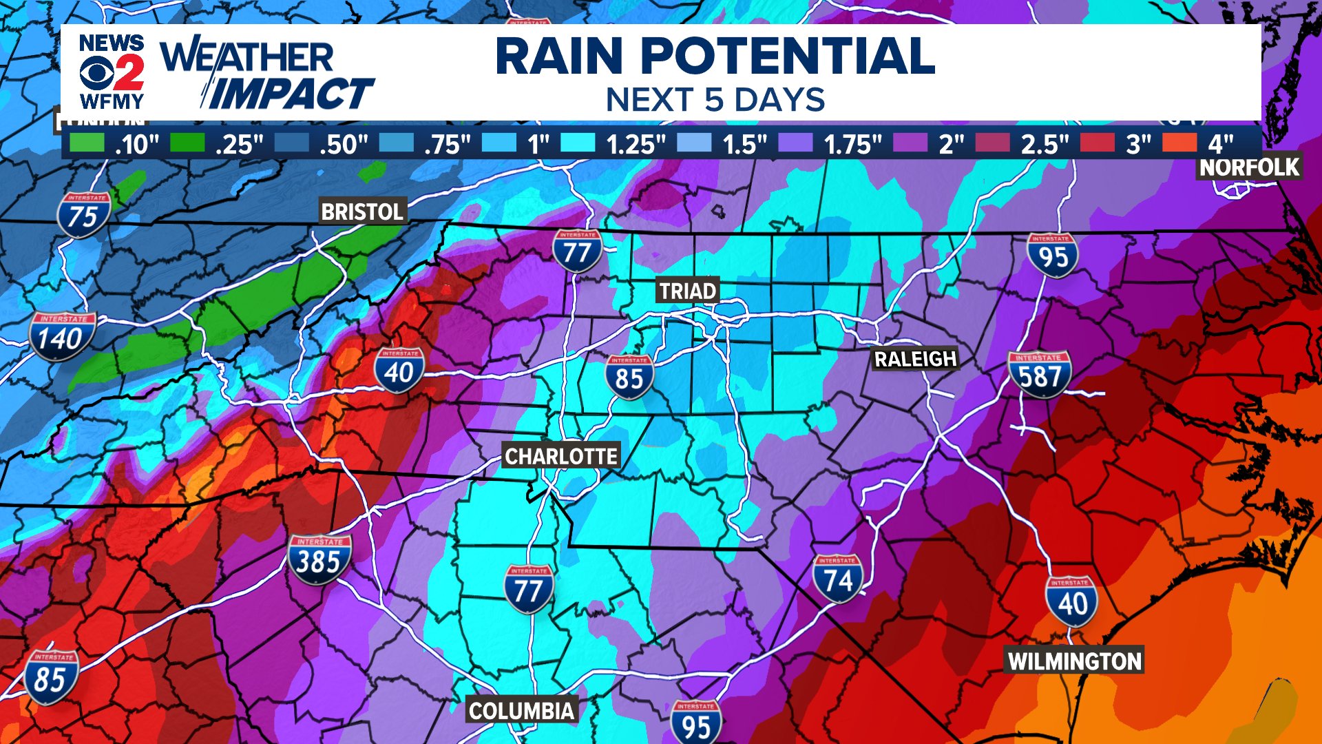
From the AFD at 6:45 from GSP "In fact, the trend in the model QPF is upward on this cycle, but the question remains if the amounts will be enough to raise more of a flooding threat." "Confidence is 50/50 as to whether or not this will be enough to trigger flooding to warrant issuing a Watch this early, so we are leaning away from it and prefer to wait one more forecast cycle." -
I’ll be wearing waders for the app game. We’re really lucky it hasn’t been super wet lately. The inland wind threat with this increases every model run.
-
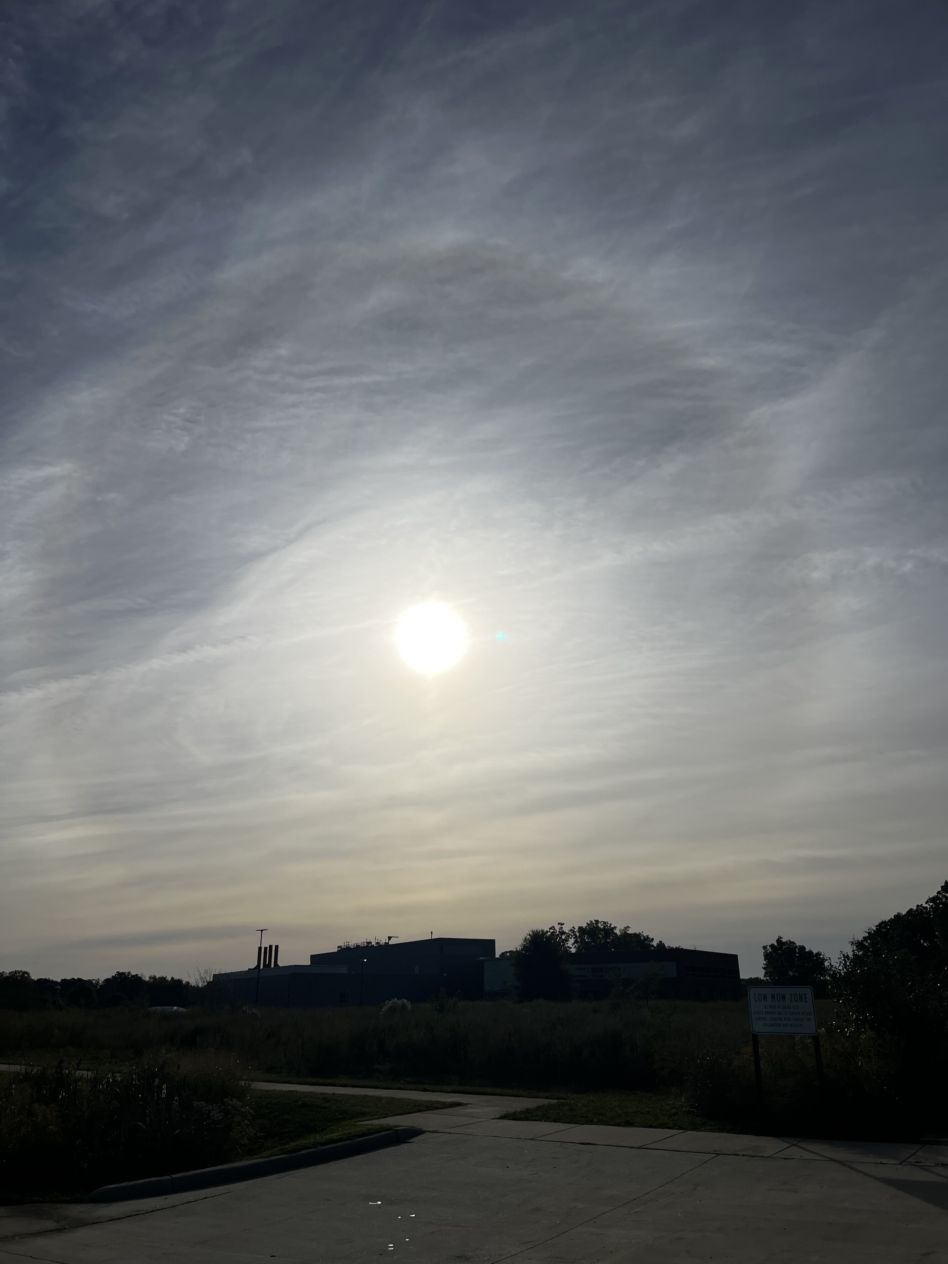
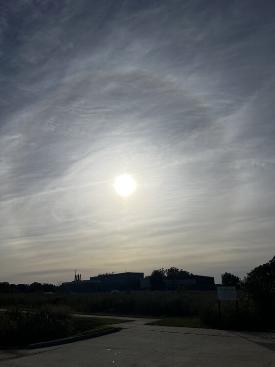
Got a nice 22 degree halo right now
-
I need to drive from Charlotte NC to Miami and realize that is NOT happening Saturday but do you guys think I will be much better on Sunday or should I just do the drive on Monday instead ? Thanks for any input
-
Red sky in the morning, sailors warning.
-
free libertybell
-
GDM models absolutely destroyed the physics based models on this storm. How those euro and GFS runs where they had a weak TS still sitting off the Yucatán at this timeframe looking now?
-

2026-2027 Fall/Winter Mountain Thread
Maggie Valley Steve replied to BlueRidgeFolklore's topic in Southeastern States
They were holding off for another cycle of guidance to address the potential of a Flood Watch. They started that it was too early to address the wind threat with a Wind Advisory in their morning disco. Always too conservative in my opinion, but it is what it is. -
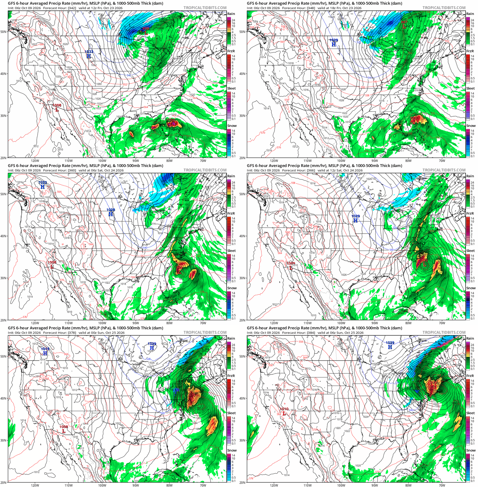
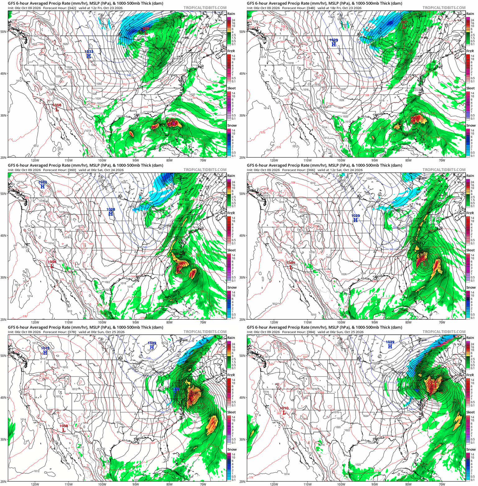
This looks like the type of scenario I can see playing out this winter. A Close race between a cold shot and a big storm.
-
Idalia should have still been retired. Lesser storms have been retired. Not having a retired storm for 2023 feels wrong. That was probably the most active strong el nino season ever. My guess is that they are probably running out of I names, and they probably won't retire one unless they absolutely have to. Then again, Emily not getting retired after 2005 shows how inconsistent name retirement is.
-
Cross posting here from the Mid-Atl subform. Crazy the scale of this storm with the jet streak induced diffluence aloft.

-

2026-2027 Fall/Winter Mountain Thread
ncjoaquin replied to BlueRidgeFolklore's topic in Southeastern States
I have noticed, too, that GSP never uses the Hazardous Weather outlook. If this doesn't warrant a watch, you would think that they would at least issue a Hazardous Weather outlook. Other forecast offices have. -
It might be earlier than that. Keeps bumping up landfall time each run. We’re not working with a ton of time for this to fall apart and it doesn’t matter when the center crosses because that eyewall is obviously out ahead of it. Dangerous situation saw they increased max surge from 7 to 9 feet, not insignificant at all especially with the population center this is plowing into
-
Managed to get my (now major) hurricane sunrise this morning! Some low clouds blocked it a bit, but still well worth the early morning.
-
First light
-
Google DM brings this in around 7 to 8PM. Majority of the models have the pressure bottoming out around 1PM. That give us about a 6 hour window to weaken before landfall. Not much time there to work with at all. Better hope it doesn't strengthen much more this Morning.
-

2026-2027 Fall/Winter Mountain Thread
Tyler Penland replied to BlueRidgeFolklore's topic in Southeastern States
BTW, has anybody checked on GSP? They have yet to issue a single watch or advisory for this. Getting on my nerves having counties in my area of Georgia under a Flood/High Wind Watch right next door under FFC but nothing at all from GSP. -
I feel like that guy who does those Dos Equis commercials. ISSY once took on 60kt. shear and became a CAT3. When your wrong, your wrong and admit it. Surprised but not shocked. "Stay thirsty my friends." LOL
-
Recon is heading in for another pass.
-
65 to 80 mph gusts as far inland as la grange GA???? That definitely seems overdone.
-
Models accurately forecasted the 10-15 mb drop as it traversed the loop current eddy overnight.
-