All Activity
- Past hour
-
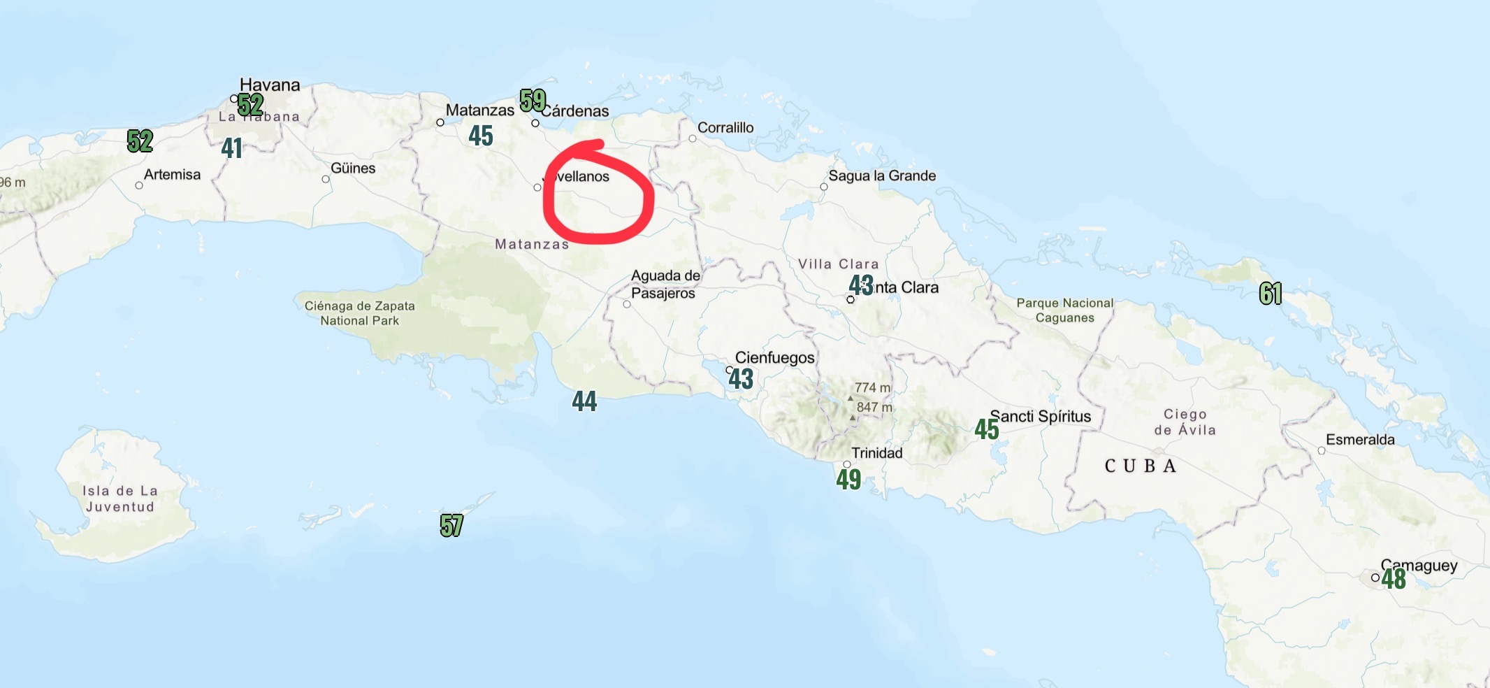
 There’s a lot of junk reported obs here too. Here’s the mins from the morning of the 3rdand about where that location seems to be.
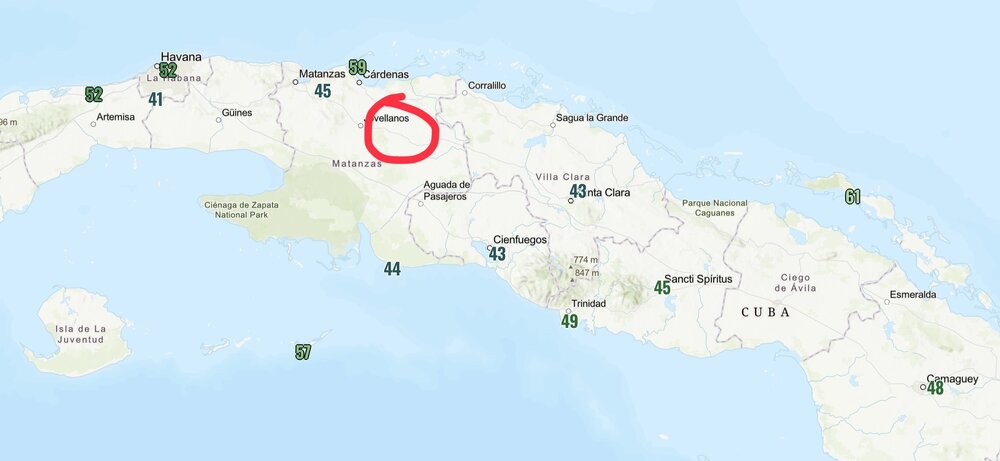
-
137 AM EST WED FEB 4 2026 ...WINTER WEATHER ADVISORY IN EFFECT FROM 6 PM THIS EVENING TO 10 AM EST THURSDAY... * WHAT...MIXED PRECIPITATION EXPECTED. TOTAL SNOW ACCUMULATIONS UP TO ONE INCH AND ICE ACCUMULATIONS AROUND A LIGHT GLAZE. * WHERE...A PORTION OF CENTRAL NORTH CAROLINA. * WHEN...FROM 6 PM THIS EVENING TO 10 AM EST THURSDAY. * IMPACTS...ROADS, AND ESPECIALLY BRIDGES AND OVERPASSES, WILL LIKELY BECOME SLICK AND HAZARDOUS. * ADDITIONAL DETAILS...RAIN IS EXPECTED TO CHANGE TO LIGHT SNOW OVER THE PIEDMONT TRIAD EAST ALONG AND NORTH OF INTERSTATE 85 LATE THIS AFTERNOON AND EVENING. THE SNOW ACCUMULATIONS WILL BE LIGHT, MAINLY LESS THAN 1 INCH. ELSEWHERE, A CHANGE TO A MIXTURE OF LIGHT FREEZING RAIN AND DRIZZLE WILL OCCUR THIS EVENING. TEMPERATURES WILL RAPIDLY FALL BELOW FREEZING OVERNIGHT CREATING HAZARDOUS TRAVEL IN THE ADVISORY AREA.
-
It's odd because we had reports in our RICONN wx observation network from PVD
-
Is that Salem 3.6SE you on cocorahs? its almost in the exact same spot you described
-
No Jan 94?
-

Predict the cold contest (for Feb 7-9)
NorthShoreWx replied to Roger Smith's topic in New York City Metro
Max 16⁰ ... Min 6⁰ ... Snow : 0.4" -
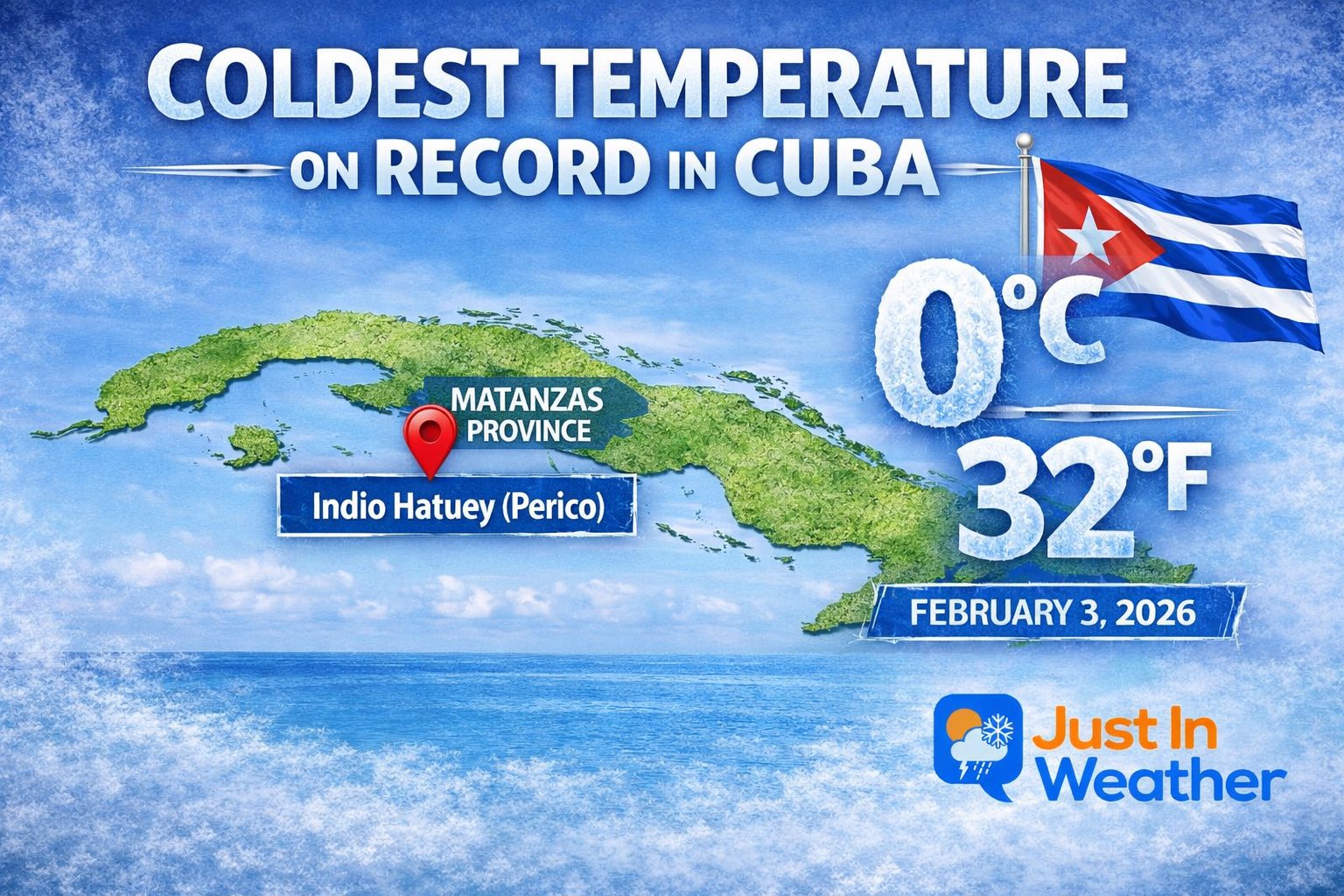
 Of course you will but it's from a certified wx station sanctioned by Cuba wx service so there is that
 -
-
Lol I will toss that.
-
Quite an impressive stretch you have to admit since Jan 27 w/ widespread lows in the single numbers in New England w/ many cold spots below zero. ORE has been as low as -18 F and OWD -16 F. And this going to continue right trough Fri, a break Sat, then Sun-Tue again. CoastalWx *should* like this cold b/c it preserves his "white gold." LOL.
-
Lol

-
Yeah, that’s better for NC than your area. But you should like this next one better for your area but it’s from a followup system, not the system this thread is addressing:

-
Friday February 6 FROPA / WINDEX small event
Ginx snewx replied to HoarfrostHubb's topic in New England
Let's 40 to 1 J.SPIN style and call it a day.png.104d5e2f87c061acb5efef9da44648da.png)
- Today
-
34.3 and that rain that you know that wants to be snow.
-

E PA/NJ/DE Winter 2025-26 Obs/Discussion
KamuSnow replied to LVblizzard's topic in Philadelphia Region
A few flakes of snow here, 29°F. Made it to 35 here today, but didn't really lose any snowpack. We discussed taking a shot at sledding on the sleet pack later this week, lol. -
Max 18 Min 7 Snow 0.8 Sent from my SM-S926U1 using Tapatalk
-
-
Max 21 min 9 snow trace
-
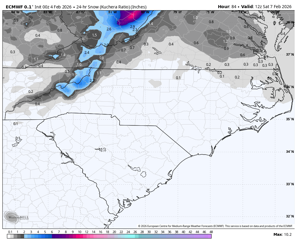
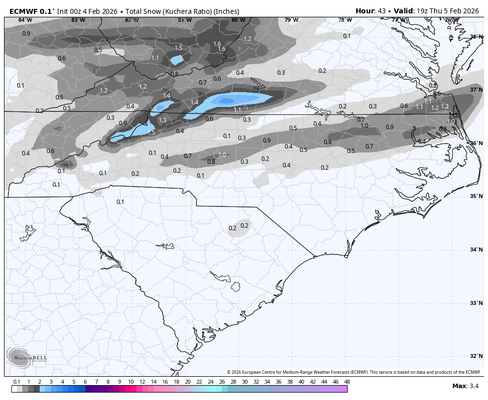
0Z Euro:

-
Wakefield NWS is saying maybe an inch tomorrow and into tomorrow night. We shall see.
-

Feb 4-5 significant SE snow threat
WinstonSalemArlington replied to GaWx's topic in Southeastern States
-
Welp the fix was in, the low came in a little more spicy and spiked me with advection after radiative heating. Ultimately although temperatures did crash DP was already above freezing and it wasn't enough I was 3F too warm. This is a win for the NAM and GFS over the Euro and Canadian solutions. Perhaps something to take into account weighing nodels for overrunning events. 33.5 as of now.
-

Richmond Metro/Hampton Roads Area Discussion
overcautionisbad replied to RIC Airport's topic in Mid Atlantic
Water fell from the sky tonight. Not sure what that was about -

Richmond Metro/Hampton Roads Area Discussion
wasnow215 replied to RIC Airport's topic in Mid Atlantic
Friday clipper could be juiced. And then cold and very windy Saturday -
Just stepped outside. It's 34.1 with a rain sleet mix. Could turn to snow.