All Activity
- Past hour
-

Central PA Winter 25/26 Discussion and Obs
Blizzard of 93 replied to MAG5035's topic in Upstate New York/Pennsylvania
That’s great to hear! Many of us on here were thinking of you & rooting for your recovery! I’m looking forward to tracking our next snow chance on here with you! -

December 2025 regional war/obs/disco thread
SouthCoastMA replied to Torch Tiger's topic in New England
Grinch status would be moot if we get a couple on 24th, 25th -
Central PA Winter 25/26 Discussion and Obs
Blizzard of 93 replied to MAG5035's topic in Upstate New York/Pennsylvania
It’s going to be tough to get wintry precip before Christmas with the advertised pattern. Temps should be relatively seasonable after our few day warm up later this week. The period between just after Christmas & before New Year’s showed some potential for chances on the 0z GFS. It looks potentially active, so hopefully we are on the right side of the boundary.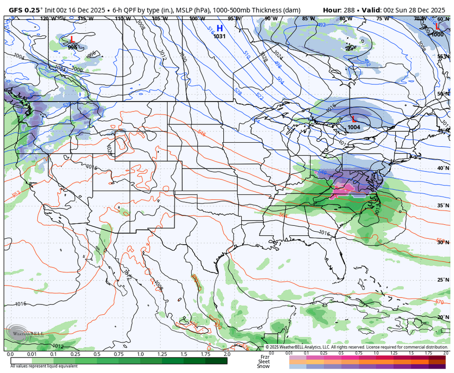
-

December 2025 regional war/obs/disco thread
Ginx snewx replied to Torch Tiger's topic in New England
Damn Kev lay of the IPAs https://youtu.be/czmjOvR6O5E?si=Ei9YCn4RNqI8vcLQ -

December 2025 regional war/obs/disco thread
WinterWolf replied to Torch Tiger's topic in New England
I’m shocked that you feel that way…would have never thought that coming from you. Your beloved op runs looked decent…where’s your comments on them this morning? I guess they didn’t look bad enough this morning for some real negativity huh. -
December 2025 regional war/obs/disco thread
SouthCoastMA replied to Torch Tiger's topic in New England
qualifies here, for sure -

Central PA Winter 25/26 Discussion and Obs
paweather replied to MAG5035's topic in Upstate New York/Pennsylvania
Doing better thanks Blizz. Treatment is done and now hope is that it never comes back. -
December 2025 regional war/obs/disco thread
Ginx snewx replied to Torch Tiger's topic in New England
53 will be your high. Lock it up -
The big pond at my farm in Franklin county has completely frozen over. It catches a lot of sunlight and doesn’t typically freeze solid but maybe once or twice a year. Low sun angle and no wind Monday morning likely contributed but this is the first time it’s frozen in December since 2018. Farm bottomed out at 22 last night and 12.6 Monday morning. High only reached 32 there yesterday. Pretty good start to winter regardless of the upcoming pattern reset
-
Our airport had a low of 25 for the 2nd morning in a row. My lowest was likely ~30 vs 26.6 yesterday. But the freeze last night was radiational rather than advective/windy with a much longer duration of ~9 hours.
-
December 2025 regional war/obs/disco thread
WinterWolf replied to Torch Tiger's topic in New England
We’ll in SNE for sure…NNE will be fine. but being 6 days away from the holiday, and if we can grab(it’s tenuous but not zero) a little something on 12/24 or 12/25, is it a true grinch? Maybe a hybrid grinch? -
13f low. DP 12
-

December 2025 regional war/obs/disco thread
TauntonBlizzard2013 replied to Torch Tiger's topic in New England
Definitely a grinch within a week of Christmas. -
December 2025 regional war/obs/disco thread
Ginx snewx replied to Torch Tiger's topic in New England
Hmm not really -

December 2025 regional war/obs/disco thread
moneypitmike replied to Torch Tiger's topic in New England
Caught this sighting this morning. Better winter indicator than squirrels.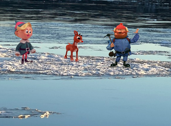
-

December 2025 regional war/obs/disco thread
Snowcrazed71 replied to Torch Tiger's topic in New England
So, you may be correct thus far. But just because it's not been snowmageddon for the first half of December does not make the pattern trash. Winter officially starts next week. Your take on things are always shyte. Let's talk about it in March when winter is coming to a close and see where we're at then. -

December 2025 regional war/obs/disco thread
40/70 Benchmark replied to Torch Tiger's topic in New England
I think it is...it wipes everyone out. -
Central PA Winter 25/26 Discussion and Obs
Blizzard of 93 replied to MAG5035's topic in Upstate New York/Pennsylvania
Great to hear from you! How are you doing? -
Central PA Winter 25/26 Discussion and Obs
paweather replied to MAG5035's topic in Upstate New York/Pennsylvania
Thanks Tim went through treatments doing OK and hope it never comes back. -
December 2025 regional war/obs/disco thread
WinterWolf replied to Torch Tiger's topic in New England
I don’t know if I’d call Fridays Storm a grinch…at 6 days away from Xmas, a little to far away from Xmas imo. But just my opinion. -
This is what I mean when I say I am a winter weather weenie. Morning temperatures in the teens even here in the Urban heat island. Snow cover that sticks around for 48 plus hours and it's before December 21st. Invigorating!
-

December 2025 regional war/obs/disco thread
weatherwiz replied to Torch Tiger's topic in New England
I would love to pull off one major storm before my next semester starts so I can at least enjoy it alot more. Keep em ripping after that but will be harder to enjoy/dig deep into the forecasting pocket for. I am cautiously optimistic for early January...the pattern may not be entirely supportive for a biggie but it could be active. We also may introduce some southern stream involvement...I don't see the southern stream being active, but if the southern stream can shoot some energy our way and phase up with a northern piece...there's our biggie potential -
December 2025 regional war/obs/disco thread
40/70 Benchmark replied to Torch Tiger's topic in New England
I was just noticing small bodies of water frozen over around Boston on the drive in this AM. -
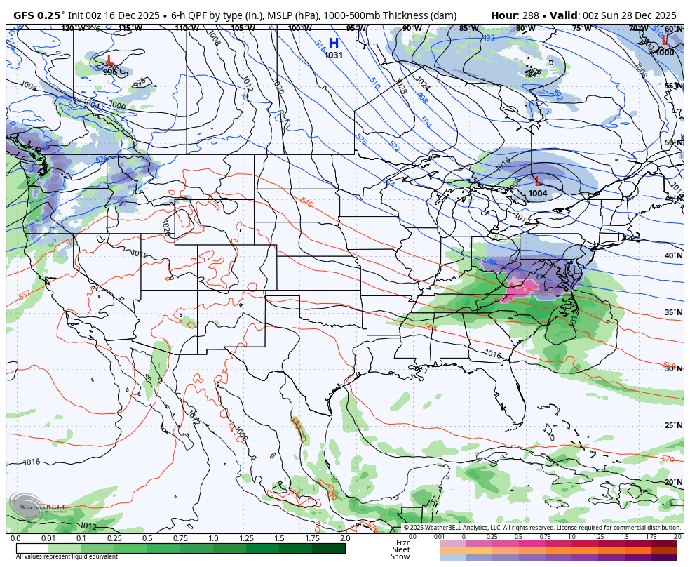
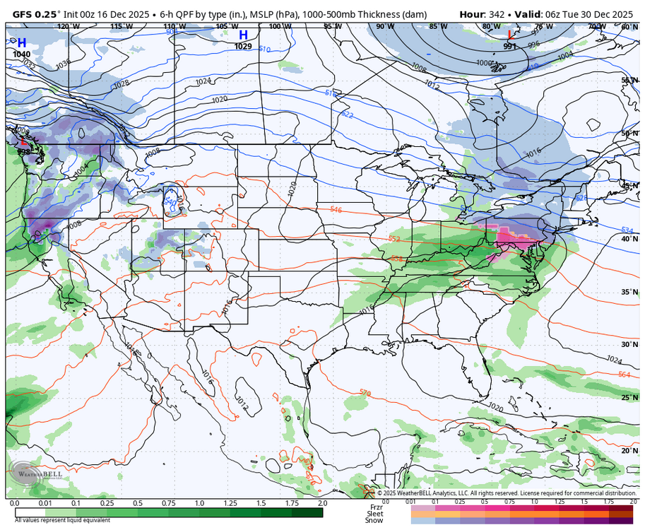
The end of the 06z GFS run is how I would hope to see things evolve and seems like a realistic evolution. Not every detail of course. Significant GL block develops, it takes several cutters and NS systems to feed the developing 50/50ish low. Eventually, the vortex trapped under the GL block becomes the dominant low compared to the one in the GOA/west coast. I don't see the GOA low vanishing but with ebbs and flows we get PNA spikes of varying degrees.
-
Saw that. We need that trough NW of Oregon to get pinched off and shoved to the west allowing the ridges in western Alaska and the American SW to link.