All Activity
- Past hour
-
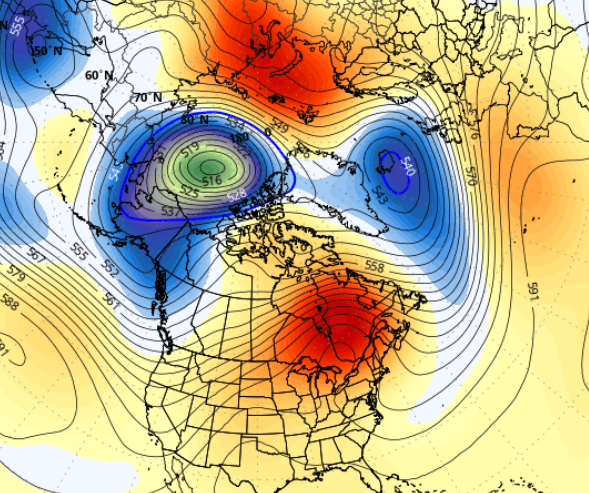
You're one of the one's that can relate to my interest in monitoring heat in the summer ... heh, I mean shit. It's not like it's part of weather, huh But 12z EPS mean, centered on June 9, came in yet a little more impressive with the over top heat look. Weather this is a flash (pun intended), a heatwave per se, or evolves to something else are obviously notwithstanding at this range, but it's being monitored.
-
Some of it was the stable air when the wedge lasted a lot longer than expected.
-
Yeah true...going forward looks great though. No looking back
-
May 2026 finished exactly 1.0F above the long term average in Minneapolis. 2.24” of precipitation which is -1.67” below average. There was a late freeze on May 6th. The somewhat surprising 0.37” we received yesterday couldn’t have been timed better.
-
haha... I'd say at least not totally sucking prison balls at shiv point -
-

2026-2027 Strong/Super El Nino
brooklynwx99 replied to Stormchaserchuck1's topic in Weather Forecasting and Discussion
waiting until the spring barrier passes to make an ENSO forecast is pretty standard. I said a couple weeks ago that we are probably getting a super event and that a strong event was likely in early April. not sure what the issue is there -
Spring 2026 finished as the 8th warmest spring on record in Chicago. Warmest Spring Temperature Rankings 1. 56.6° - 2012 2. 56.2° - 1977 3. 53.9° - 1921 4. 53.8° - 2024 5. 52.7° - 2010 5. 52.7° - 1991 5. 52.7° - 1955 8. 52.6° - 2026 9. 52.1° - 2021 10. 51.7° - 1946
-

Chicago Weather Records Tracking
Chicago Storm replied to Chicago Storm's topic in Lakes/Ohio Valley
Spring 2026 finished as the 8th warmest spring on record in Chicago. Warmest Spring Temperature Rankings 1. 56.6° - 2012 2. 56.2° - 1977 3. 53.9° - 1921 4. 53.8° - 2024 5. 52.7° - 2010 5. 52.7° - 1991 5. 52.7° - 1955 8. 52.6° - 2026 9. 52.1° - 2021 10. 51.7° - 1946 -

2026-2027 Strong/Super El Nino
MarcmmKU replied to Stormchaserchuck1's topic in Weather Forecasting and Discussion
Cold snow > Cold dry > warm dry > warm wet. -
Everything is awesome!
-
May 2026 finished as the 10th driest May on record in Chicago. Driest May Rankings 1. 0.30" - 1992 2. 0.58" - 1994 3. 0.67" - 1934 4. 0.71" - 2023 5. 0.78" - 1950 6. 0.80" - 1921 7. 0.84" - 1897 8. 0.93" - 1903 9. 1.00" - 1886 10. 1.17" - 2026
-
Chicago Weather Records Tracking
Chicago Storm replied to Chicago Storm's topic in Lakes/Ohio Valley
May 2026 finished as the 10th driest May on record in Chicago. Driest May Rankings 1. 0.30" - 1992 2. 0.58" - 1994 3. 0.67" - 1934 4. 0.71" - 2023 5. 0.78" - 1950 6. 0.80" - 1921 7. 0.84" - 1897 8. 0.93" - 1903 9. 1.00" - 1886 10. 1.17" - 2026 -
Looks like the base state still includes a northerly wind component, which is outstanding if you like persistent drought conditions. Seems like the last several years humidity has been the exception to the rule.
-

2026-2027 Strong/Super El Nino
LakePaste25 replied to Stormchaserchuck1's topic in Weather Forecasting and Discussion
My opinion is the east based nature of 97-98 did not prevent a big snowstorm from occurring. 82-83 was east based and produced a big snowstorm in the northeast and mid atlantic, and 72-73 produced a big snowstorm in the south. So whether it is east based or basin wide such as 15-16, there is still usually an opportunity or two. -
64, mainly sun sky with post-card cu utterly opposite condition to this morning, whence it was 48 and light rain.
-

2026-2027 Strong/Super El Nino
GaWx replied to Stormchaserchuck1's topic in Weather Forecasting and Discussion
Isn’t the primary key in winter assuming you're far enough north usually the storm tracks? -
Back to cold and windy
-
2026-2027 Strong/Super El Nino
LakePaste25 replied to Stormchaserchuck1's topic in Weather Forecasting and Discussion
Does the difference matter at that temp? 97-98 could’ve easily produced a blizzard just like 15-16. Maybe just less cold shots. -

2026-2027 Strong/Super El Nino
forkyfork replied to Stormchaserchuck1's topic in Weather Forecasting and Discussion
there's also the fact that the snow people have driven almost everyone else off the forum -
2026-2027 Strong/Super El Nino
LakePaste25 replied to Stormchaserchuck1's topic in Weather Forecasting and Discussion
this gave me a good laugh:
-

2026-2027 Strong/Super El Nino
TheClimateChanger replied to Stormchaserchuck1's topic in Weather Forecasting and Discussion
The hypothetical only works by assuming the entire tropical ocean belt is +3.3°C above recent climatology, which is physically impossible. But yeah, in theory, if ONI were +3.3°C and RONI were 0°C, that would not mean “monster El Niño.” It would mean the entire tropical ocean was so absurdly warm that Niño 3.4 no longer stood out. -
2026-2027 Strong/Super El Nino
forkyfork replied to Stormchaserchuck1's topic in Weather Forecasting and Discussion
it would be less annoying if you people could be objective about it. you didn't even think this would reach super a few months ago -
2026-2027 Strong/Super El Nino
GaWx replied to Stormchaserchuck1's topic in Weather Forecasting and Discussion
I’ll give an extreme hypothetical case. Let’s say ONI were +3.3C and RONI were 0C because the tropical oceans were insanely warm. So, in other words, everything in and also around Nino 3.4 as well as the other tropical waters is insanely warm. Then wouldn’t that mean essentially no Nino SST pattern/no contrast vs surrounding waters existing to then lead to typical Nino atmospheric responses? That’s my understanding about the RONI idea. -
lol
-
Oh yeah, I forgot: we’re only allowed to suggest modern readings may be biased warm. It is apparently anathema to point out that some sensor/site discrepancies could cut the other way — especially when the daily highs line up better than the lows.


.thumb.gif.f92b16c631a1d15d405ed77b33f0710d.gif)


