All Activity
- Past hour
-

Winter 26-27’ Speculation Thread
KakashiHatake2000 replied to Carvers Gap's topic in Tennessee Valley
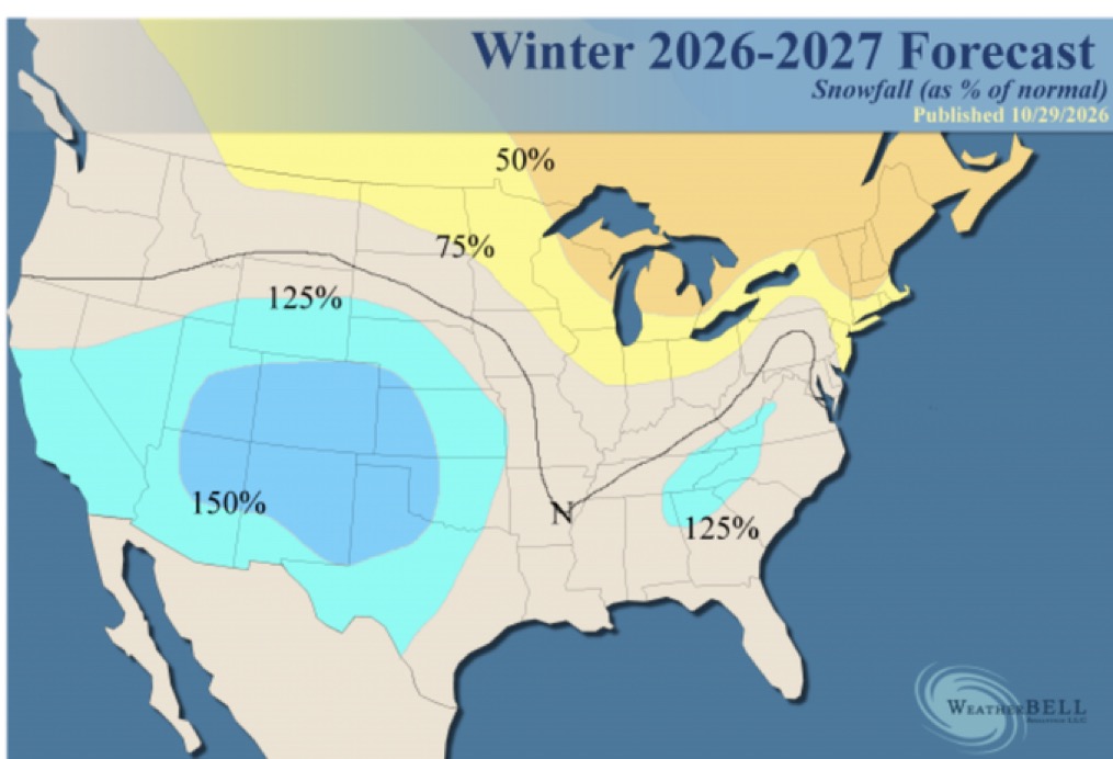
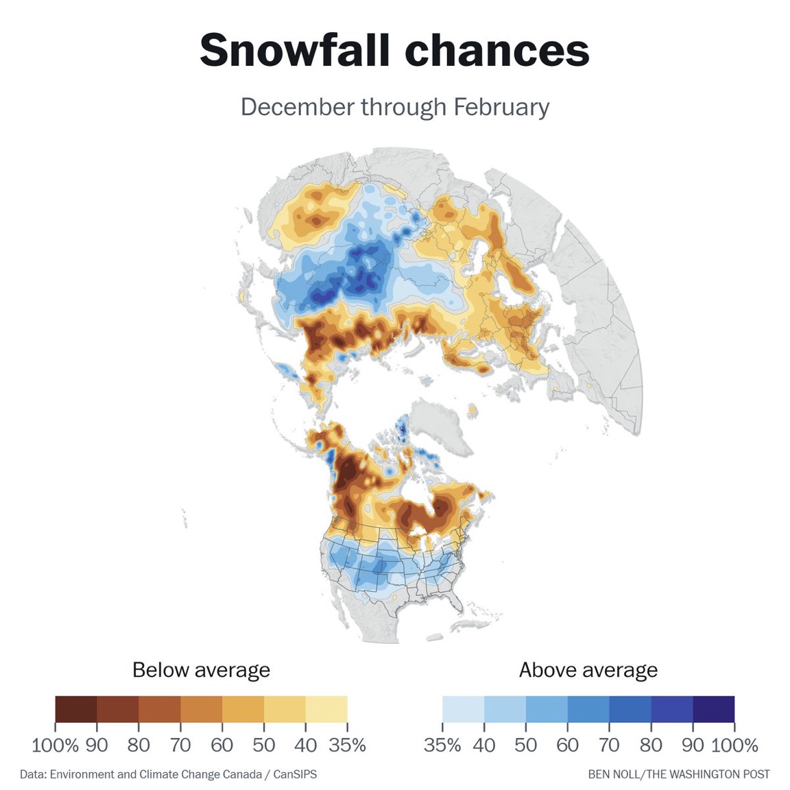
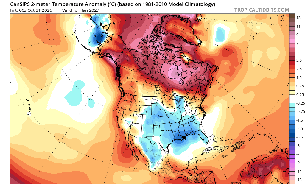
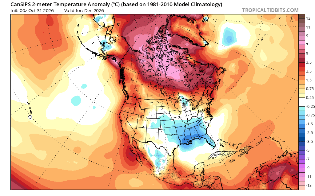
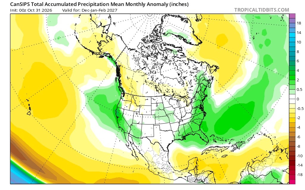
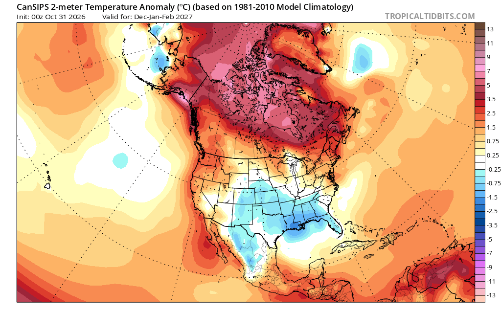
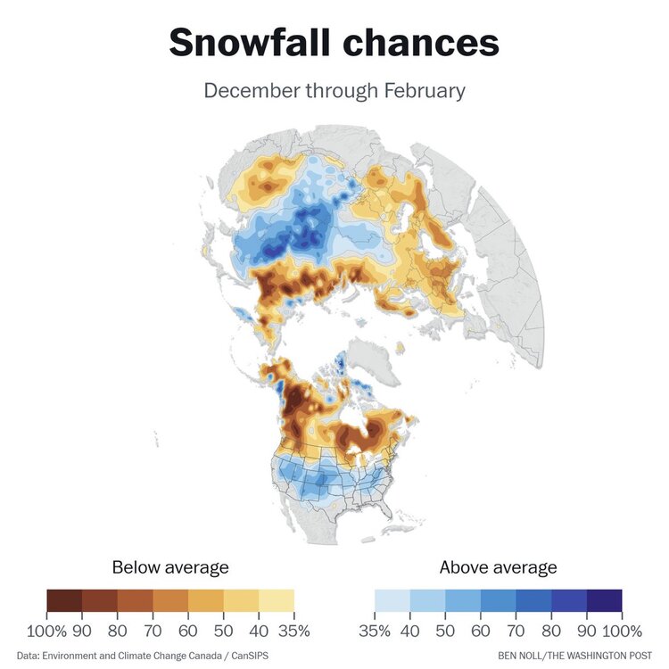
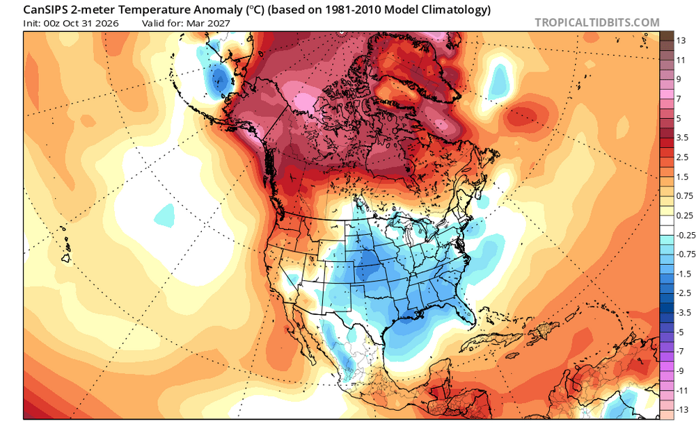
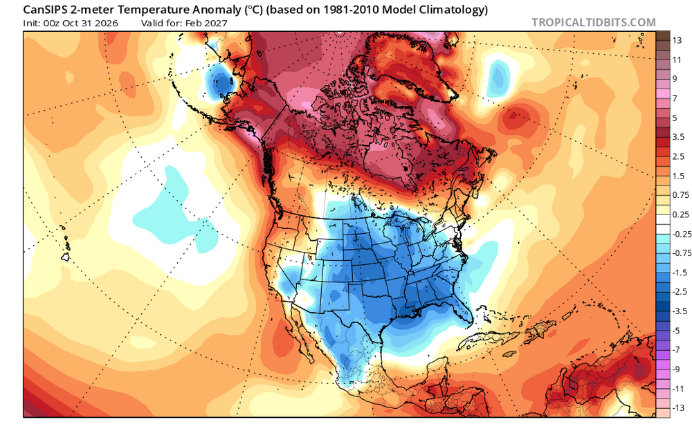
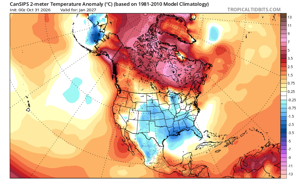
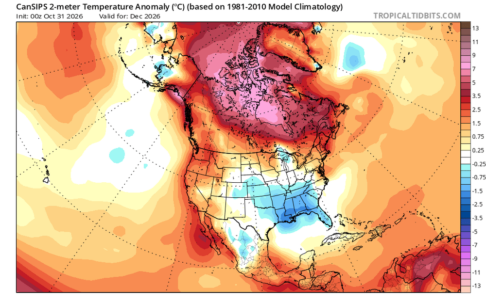
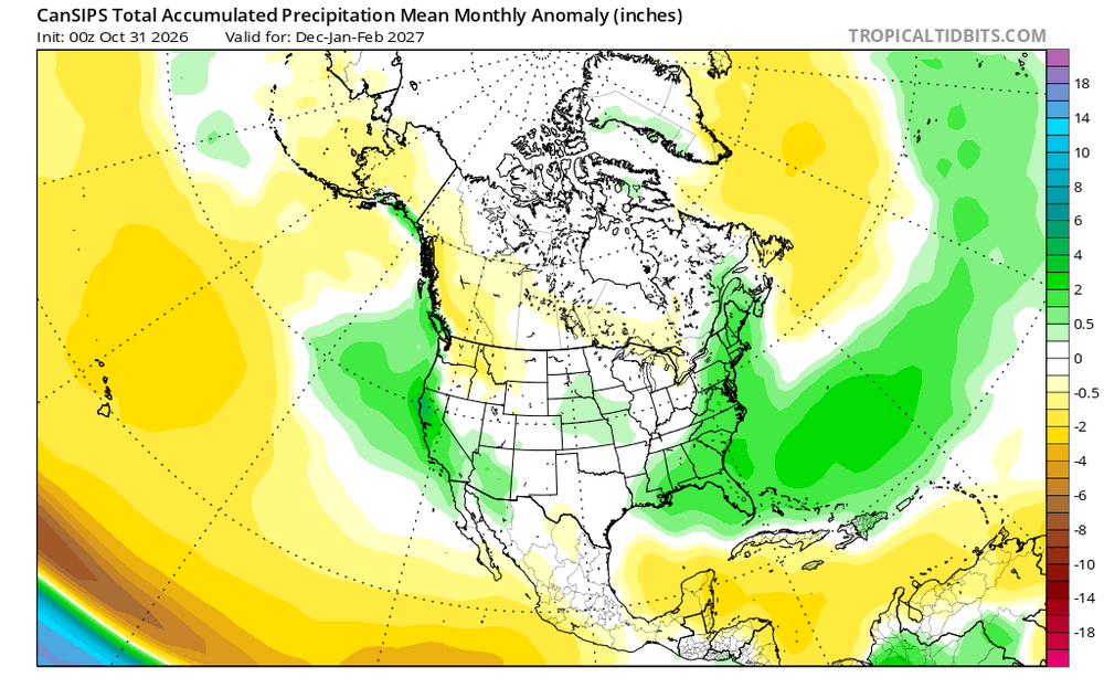
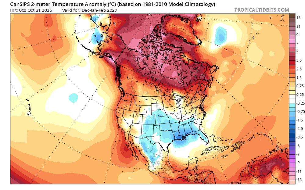
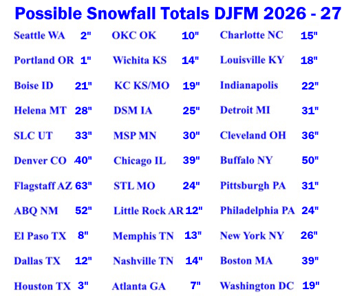
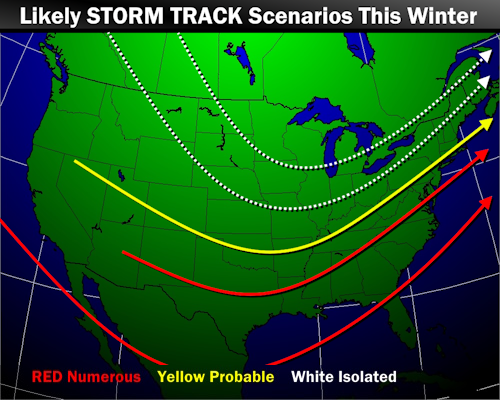
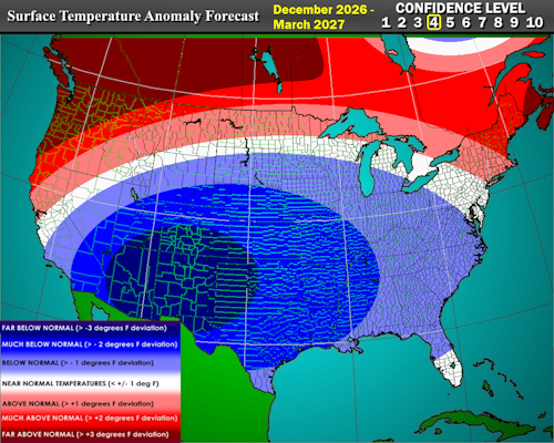
Not sure if this was posted here but it’s from tnwx not saying I disagree with everything posted above I think they were also posted over a span of a day or two so could have also changed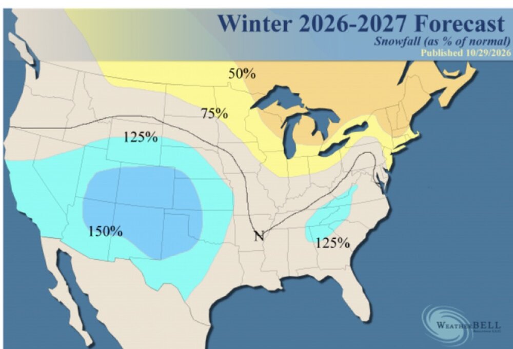
-
-
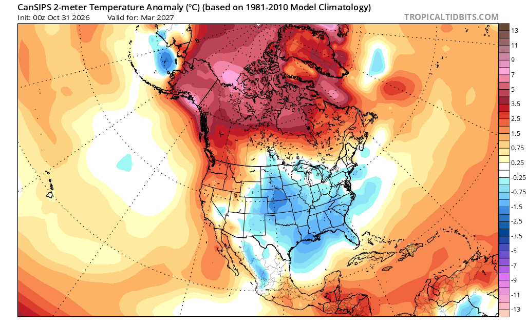
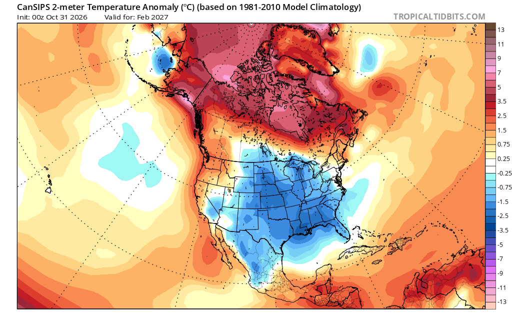
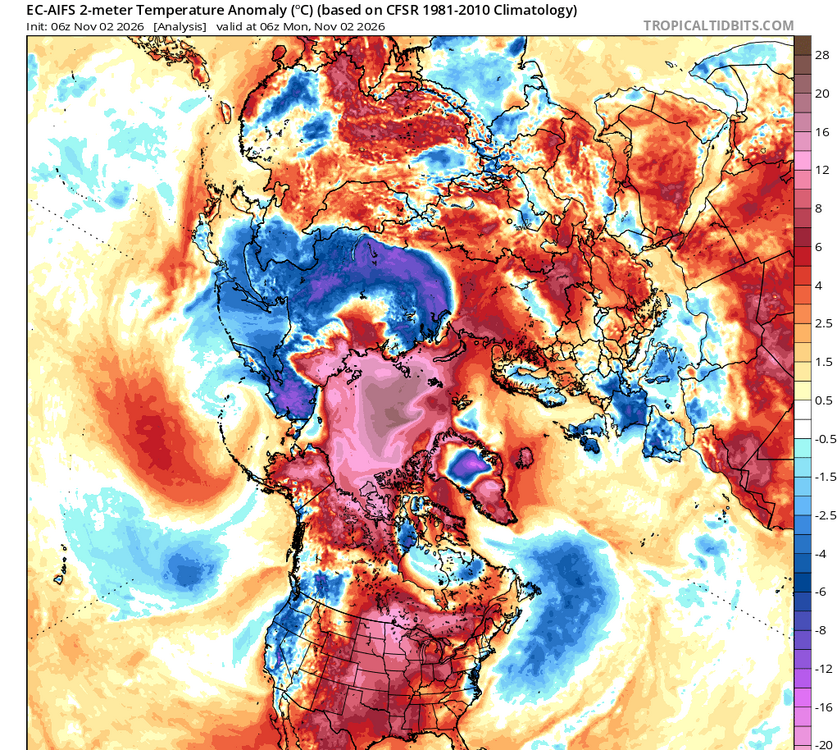
Deep extended about as locked in as it gets
-

Fall 2026 Medium/Long Range Pattern Thread
Carvers Gap replied to John1122's topic in Tennessee Valley
The last in a flurry of posts. There is some continuity(over particularly NA) between the EURO LR Ext and the 12z CFS 30d maps for mid Nov to mid Dec....western and central Europe are obviously different. -
A lot of things claim that have never happened before, HAVE! Yes, we use the continuous POR from climo sites, but we do have records prior to, say 1872, for BOS when the official climate record begins. And some climate site are quite short, like IAD, which began in 1960. CAR starts in 1939. And you can take it one step further. I've seen statements prior about dozens of sites in TX have their warmest month or highest temp, and I looked and the long-term climate sites like DFW or HOU did not. Well, that stat came from all the new AWOS METAR sites installed since 2001 in the state, and there have been well over 100 and still sites are been added to this day, so you have a POR 25 years or less for all these sites, so of course records are broken easier for not so extreme temps! But that part of it is left out of the narrative! And this is the case for a lot of the U.S. Over 1000 AWOS sites installed starting in the early 90s for many states. And add in all the state mesonet networks now. OK was the first, and many have followed. And for rainfall, the CoCoRaHS network, which was not a thing until 1998.
-
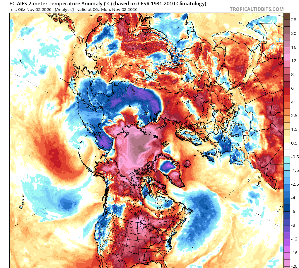
I don't think we'd really see a ton of temperature rug pulls. Instead, our "shit the blinds" pattern will be one where we watch storms take a perfect track but have no cold air on the continent. The pattern means it won't be a particular surprise when they fail. Just look at that storm as an example. Where would the cold air come from? There's not even a 540 height line near the precipitation. Now, if you get a shot of cold air from a favorable PNA phase then you can get your classic rug pulls (storm track, precipitation, north trend, etc). Didn't post the temperature map but it has most of western VA at 35 degrees and we've experienced 2 degrees fahrenheit of warming. Wonder if it would've been a snowstorm in the before times.
-

Central PA Autumn 2026
Itstrainingtime replied to canderson's topic in Upstate New York/Pennsylvania
MU Winter Forecast is out: Temps at least 4 to 7 degrees AN in December. Temps 2 to 4 degrees AN in January and February. Enhanced chance of a big dog winter storm between 1/20 and 2/20. Total snowfall in Lanco: 20-30". -

2026-2027 Record-breaking El Nino
csnavywx replied to Stormchaserchuck1's topic in Weather Forecasting and Discussion
Not even close. Just asking to get your face ripped off trying to short sell that.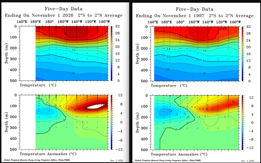
-
Fall 2026 Medium/Long Range Pattern Thread
Carvers Gap replied to John1122's topic in Tennessee Valley
On the plus side, I do think these summer time temps are gone after this week until next season. I had hopes that extended summer was not going to prevail this year, but it certainly did!!!! The SSW could certainly delay the typical winter analog pattern(El Nino) from taking over. If the El Nino crashes mid-winter, then I would say, "Buckle up." Chaos might be inbound, but we will see. FWIW, chaos can be good or bad. -
2026-2027 Record-breaking El Nino
csnavywx replied to Stormchaserchuck1's topic in Weather Forecasting and Discussion
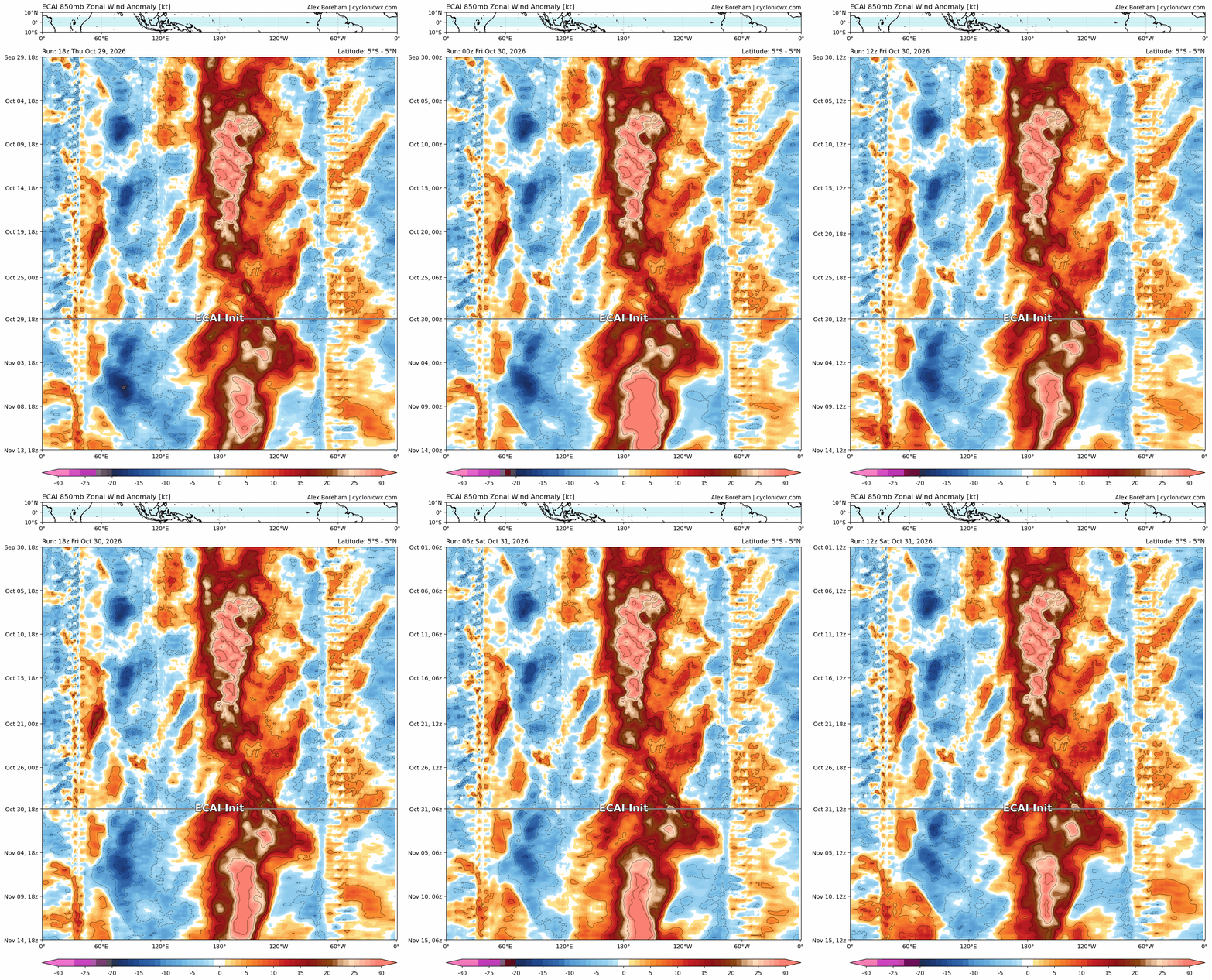
One way train the entire year.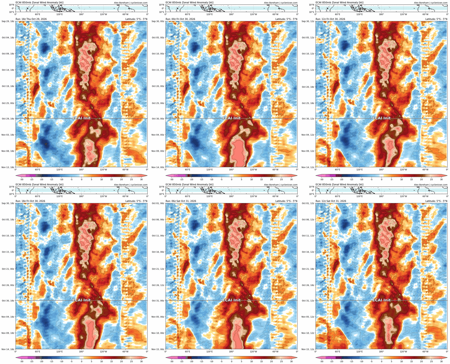
-
Not too long ago, a video clip "suggest for you" popped up my X feed. It is brief segment from Fox Weather, but it could have been any major media outlet. What is shown exemplifies how wx is pushed and micromanaged these days, and things like minimal risk are scrutinized to the max. In this case, a NHC Tropical Wx Outlook for a newly highlighted low prob area for TC development. This is from 6/27/26. First the actual outlook: NWS National Hurricane Center Miami FL 800 AM EDT Sat Jun 27 2026 For the North Atlantic...Caribbean Sea and the Gulf of America: Off of the southeastern coast of the U. S.: A low pressure area is expected to form offshore of the southeastern coast of the United States along the western end of a frontal system early next week. Slow development of this system will be possible thereafter while it moves slowly westward. * Formation chance through 48 hours...low...near 0 percent. * Formation chance through 7 days...low...20 percent. Concise and to the point. Now take a look at the short Fox Wx segment concerning it. https://www.youtube.com/watch?v=fzkWpIth-Po Breaking news for an NHC outlook that is 0/20?? Really? This is what constitutes 'breaking news' these days? Talk about scrapping the bottom of the barrel for content! The amount of time just spent on such low potential area and not in short range here is a lot, more than is necessary really. And at the end of the segment, the grease pan analogy. Huh? If the probability were moderate-high, esp. in the next 2 days, that certainty warrants a segment and discussion, but this? It is more filler than anything. A quick mention of this potential is fine for a wx segment, but surely there were more pressing wx concerns and short-term risks to talk about? In this case, there was. Here is the DY1 SWO for 6/27. A lot of sig svr tstm risk! https://www.spc.noaa.gov/products/outlook/archive/2026/day1otlk_20260627_1200.html And this is what happened for svr wx. https://www.spc.noaa.gov/climo/reports/260627_rpts.html Not every little tiny risk/threat has to be mentioned, hyped, or picked apart to make it sound more important than it really is!
-
Fall 2026 Medium/Long Range Pattern Thread
Carvers Gap replied to John1122's topic in Tennessee Valley
These are the 30d looks for Nov 18-Dec18. Notice how the cold in western/central Europe teleconnects somewhat to a trough over the East of NA. Notice on the control how the cold dumps into Texas which is not unprecedented. Remember the '93 Thanksgiving game between Miami and Dallas(touched FG attempt) w/ ice snow. That control run is a NASTY look for all kinds of mischief over the SE. In NO WAY am I calling for that at this point. I have been watching this for several days(maybe a week). I tend to think Jeff's comments would be wise to listen to and would temper expectations at this point. But that is a wild look on the Weeklies today. I wouldn't say that is bitterly cold. That Hudson Bay block has been a warm look over the past few years, but a southern storm track to accompany that. In short, good storm track but cold source lacking. Honestly, that isn't a terrible look for the Southeast. That cutoff around the Nov 17th time frame could be the first buckle in the jet which ushers in big changes over NA. We will see. -
I'd take that storm verbatim for 11/22. On 1/22....yeah that would suck.
-
I’ve been saying this for quite some time. I don’t buy into the nonsense hype of “oh this never happened before” etc etc….thats total BS. Our record keeping is so dam small…it’s bazaar and comical to think that something hasn’t happened before, just because our 150 years of records may not show it. There is nothing new under the sun…it’s just that we may never have seen it, because we only live a short time, and records only go back a short time. But the hyper’s and doomsday’ers love them some recognition. It’s funny really.
-
 online pharmacy no rx: ApexRx Direct - online pharmacy no prescription
-
Gonna be a lot of zzzzz posts in the near future.
-

2026-2027 Record-breaking El Nino
forkyfork replied to Stormchaserchuck1's topic in Weather Forecasting and Discussion
the hive has been wrong about this event since april and they're still here shamelessly posting away -

2026-2027 Record-breaking El Nino
michsnowfreak replied to Stormchaserchuck1's topic in Weather Forecasting and Discussion
Post of the year -
I predict many of them will be sick and tired of rain/clouds/gloom once this winter is over although that’s much better than remaining in drought:
-
2026-2027 Record-breaking El Nino
michsnowfreak replied to Stormchaserchuck1's topic in Weather Forecasting and Discussion
Even "window" is a highly subjective term imo. If your talking simple snow chances, then theres lots of windows for the Lakes and New England. If your talking a period of sustained winter for a few weeks at a time, id say a few windows. -
Fall 2026 Medium/Long Range Pattern Thread
Carvers Gap replied to John1122's topic in Tennessee Valley
Also, and one can see this on the Weeklies today (ensemble and control), that often SSWs(which eventually find NA) will dump directly into Montana and then race into northern Texas....and then crawl eastward. That sets up the mid-section of the country for snow/ice for late November and early December if true. And that also sets us up for severe per Jeff. -
And this micromanaging of the PV. Our POR is not that long, and the degree of attention we have given it in the last 20 years or so? Some just are making a living taking about the PV and every litte nuance and idiosyncrasy. It is excessive. There is more to the wx and pattern than the PV, and just b/c does something that has not been seen before in the POR does not necessarily mean it will have *any* noticeable on sensible wx outside the norm. It's really more about content now for many on social media to feed the daily media "beast" than practical info one can use for forecasting IMHO. They know by promoting such, they can get media interviews and the like, for 15 sec of "fame."
-
I LOVE winter walks. Took so many the last few years. The crunch of snow underfoot in the cold dry air, absolutely love it. But i know its not for everyone. When there isnt snow for a prolonged period, I 100% would rather take a walk in wad or cad than rain. I never take a walk in rain unless its a necessity.
-
Fall 2026 Medium/Long Range Pattern Thread
Carvers Gap replied to John1122's topic in Tennessee Valley
Yes. They are incredibly tricky. There is a smaller cluster of solutions(over the years) which can hit NA first. "Usually" (in my experience) those occur from late December to especially Feb - March. Now, early strat splits can do some funky stuff. If all of that cold dumps into Asia, then it would take time for it to recharge(meaning prolonged AN temps in NA). Like Jeff said, we really want it to get more jostled than split. I am seeing some colder temps(at times) on LR ext models, especially some(not all) control runs. That could be a false alarm. We have definitely seen models jump on colder solutions for NA during SSWs and be woefully wrong. I tend to think winter will be more of a "second half of winter" deal this year, but...a strat split could upend almost any seasonal forecast right off the bat. -
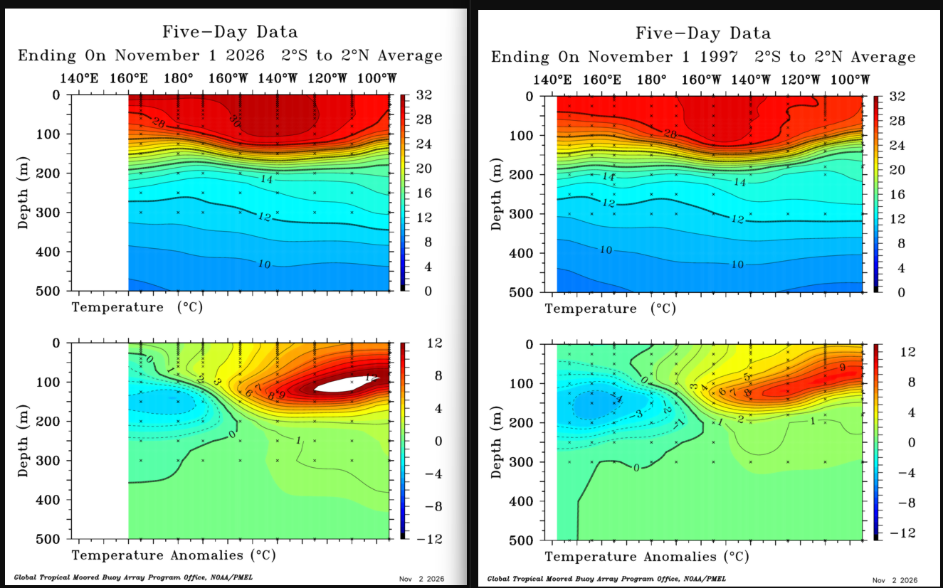
Huh? There have been 4 very strong El Nino prior to this one since 1950. And everything going on so far this cool season has lined up well w/ what to expect. Just b/c the pattern in the NEUS is "boring" and warm? @CoastalWxneeds to set aside his personal predilections about what HE wants for wx! Do I have to bring up the singles/doubles and home run analogy again? And one can slice and dice down super local and find things that have not happened before given the sheer amounts of wx parameters to use and climate locations out there. That's micromanaging to find content to hype. What matters is the large-scale mean.