All Activity
- Past hour
-
Love when the long range weather defies the predictions.
-
https://dd.meteo.gc.ca/doc/genots/2026/05/25/NOCN03_CWAO_251940___18749 NEW VERSION OF THE GLOBAL DETERMINISTIC PREDICTION SYSTEM (GDPS) OF THE METEOROLOGICAL SERVICE OF CANADA (MSC) ON TUESDAY, MAY 26, 2026, STARTING WITH THE 12 UTC RUN, THE CANADIAN METEOROLOGICAL CENTRE'S GLOBAL DETERMINISTIC PREDICTION SYSTEM (GDPS) WILL BE UPDATED TO VERSION 10.0.0, SPECTRALLY NUDGED BY THE GEML (GLOBAL ENVIRONMENTAL EMULATOR) ARTIFICIAL INTELLIGENCE-BASED MODEL. SOME OF THE KEY ENHANCEMENTS TO THE GDPS IN VERSION 10.0.0 ARE: - SIGNIFICANT IMPROVEMENT IN FORECAST ACCURACY OF GDPS 10.0.0 COMPARED TO THE OPERATIONAL GDPS 9.1.0 - IMPROVEMENTS ACHIEVED THROUGH LARGE-SCALE SPECTRAL NUDGING TOWARD AI-BASED GEML FORECASTS - ROBUST AND STATISTICALLY SIGNIFICANT GAINS IN THE FREE ATMOSPHERE, PARTICULARLY IN THE MID- AND UPPER TROPOSPHERE - SIGNIFICANT GAINS BETWEEN DAYS 3 AND 10: MORE MODEST IMPROVEMENTS DURING THE FIRST 2-3 FORECAST - IMPROVED PREDICTED TROPICAL CYCLONE TRACKS FOR DETAILED INFORMATION ON THE INNOVATIONS AND PERFORMANCE THAT ARE ACHIEVED THROUGH THIS IMPLEMENTATION, PLEASE CONSULT THE SECTION ENTITLED: DATA AND PRODUCTS OF THE GLOBAL DETERMINISTIC PREDICTION SYSTEM, WITHIN THE MSC OPEN DATA PAGE AT THE FOLLOWING LINK (IN LOWER CASE): HTTPS://ECCC-MSC.GITHUB.IO/OPEN-DATA/MSC-DATA/NWP_GDPS/ README_GDPS_EN/ PLEASE ADDRESS ANY QUESTIONS CONCERNING THIS IMPLEMENTATION TO (IN LOWER CASE): F.PRODUCTION-INFO.F(AT)EC.GC.CA SIEWE ADM-MSC / SMA-SMC OTTAWA
-
My son in law just took a job as co owner and executive chef at the Mountain Inn Killington Distillery on the Killington access road .Skied Saturday
-
Guidance way off on the timing of this. Much faster than progged. Gonna be raining here by 20z tonight and out by 10z tomorrow.
-

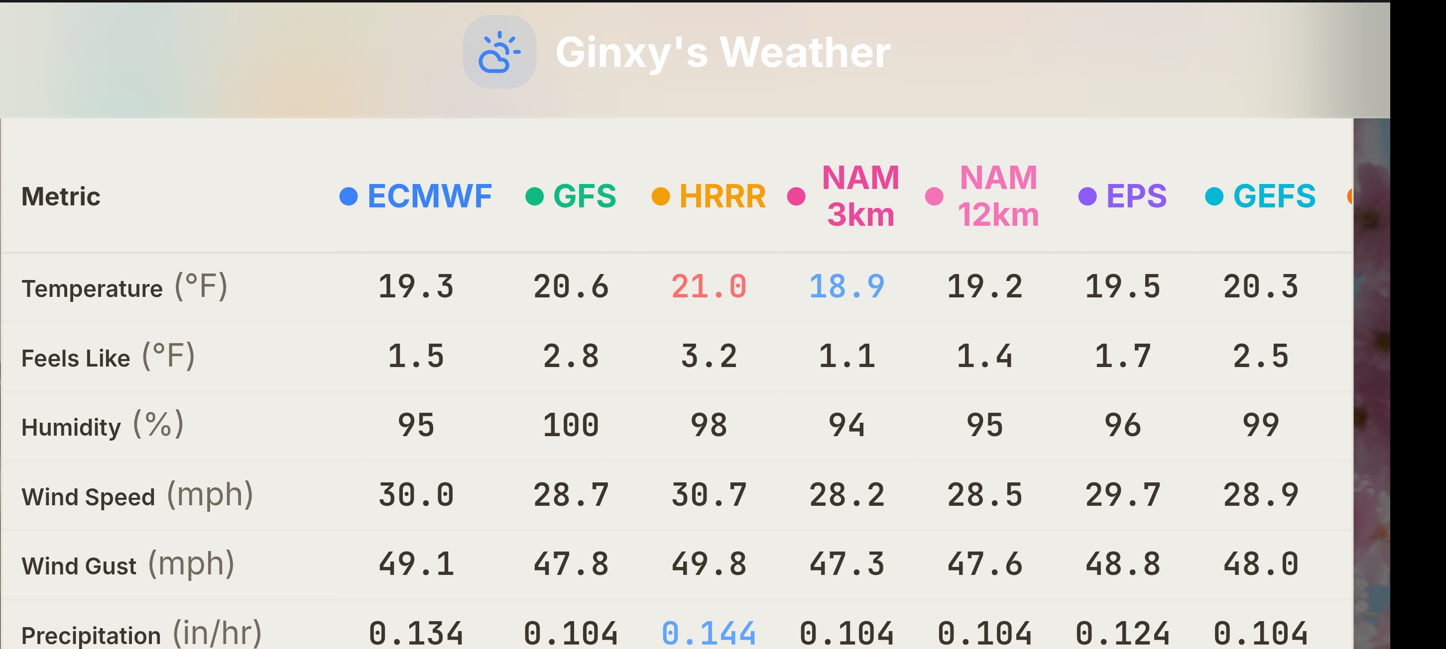
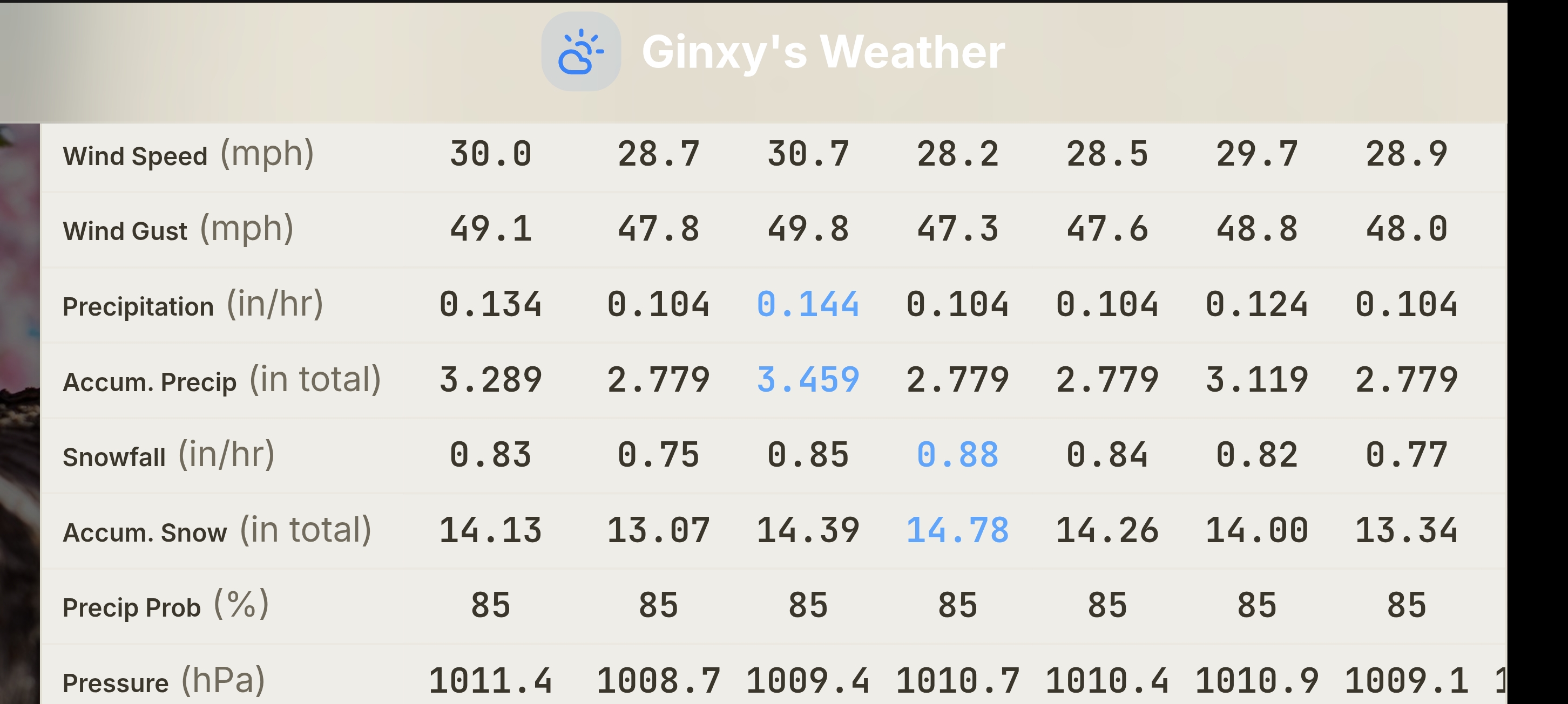
Anomalous Late Spring storm May 30 2026
Damage In Tolland replied to HoarfrostHubb's topic in New England
Gene’s gonna pull 3-6” . And I don’t mean Simmons tongue -
Damn the warministas called for HHH May through September back in early spring. Great luck with that
-
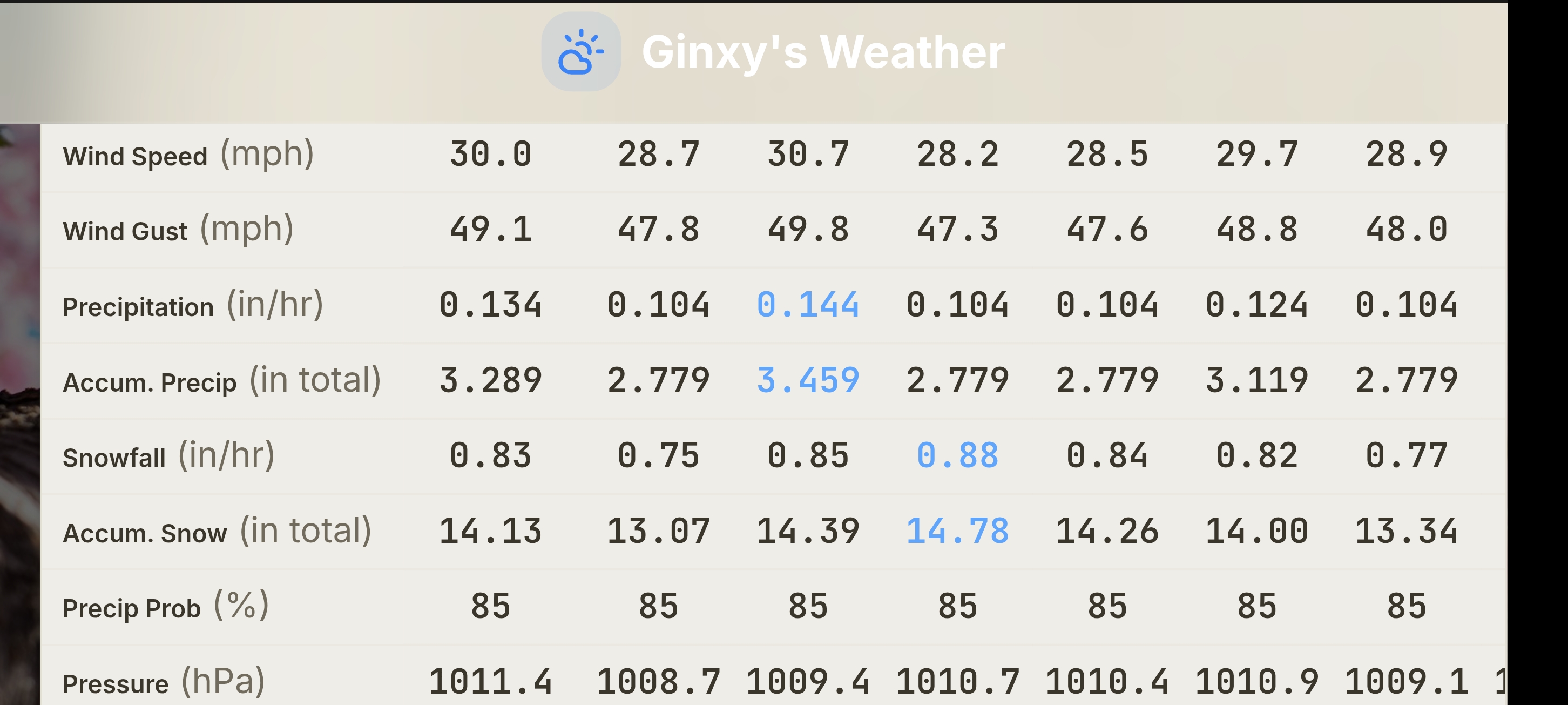
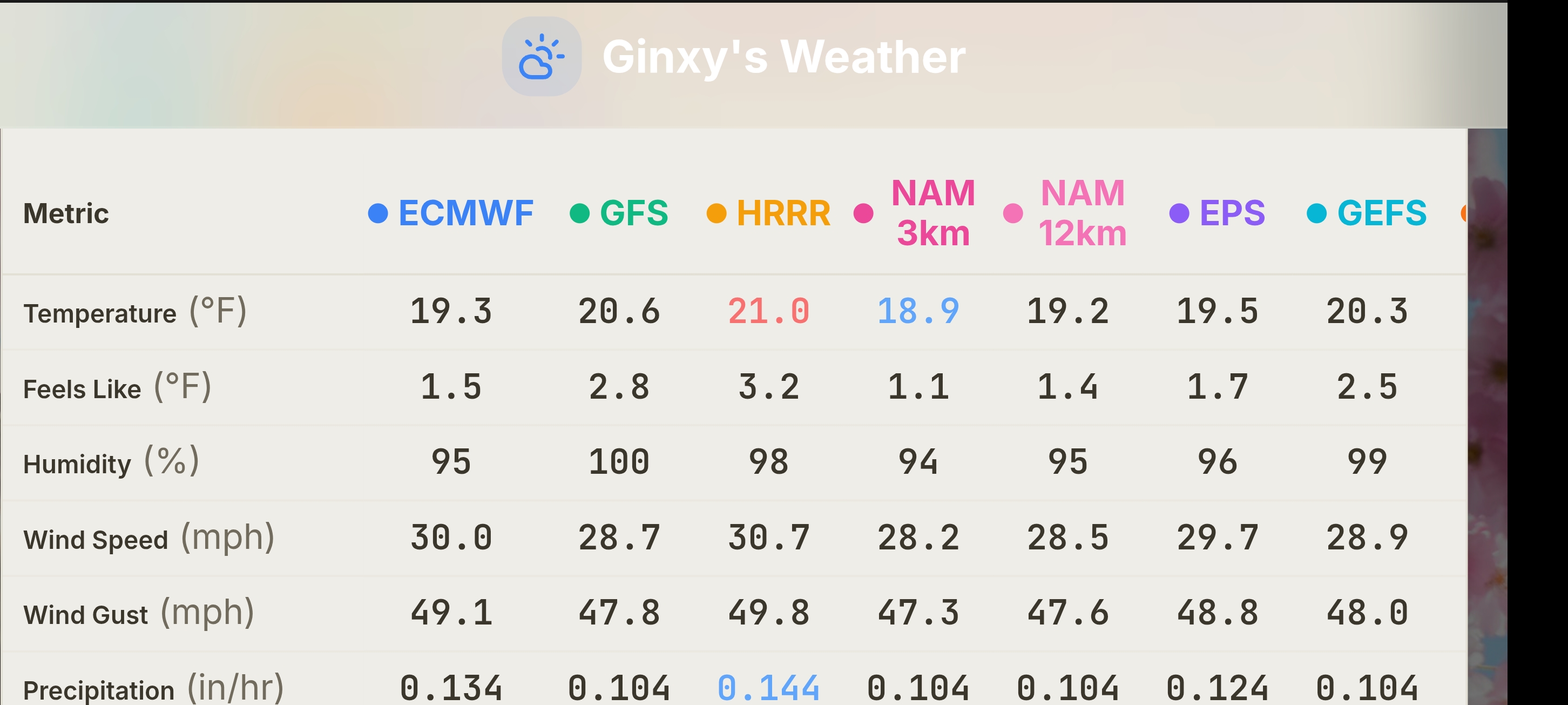
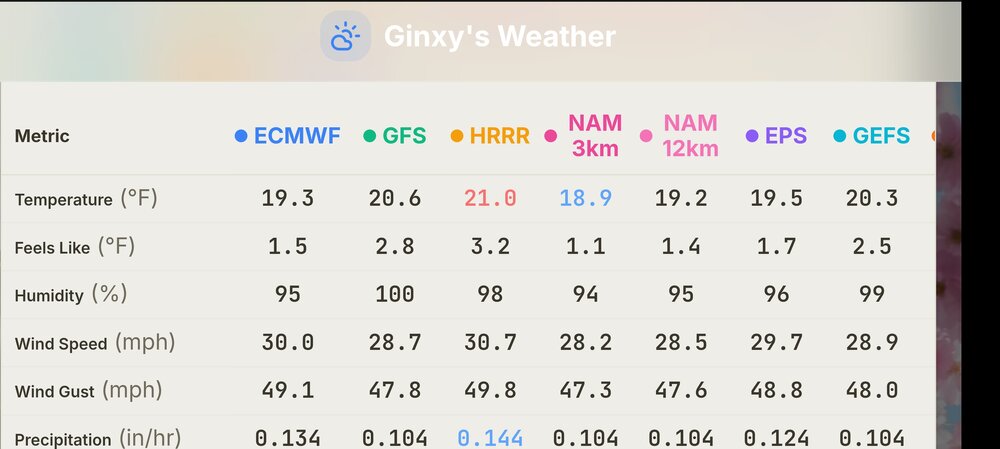
Good! They can get a better snowfall measurement! Maybe snow will not be so wet here. Those are cold temps. Well, GFS now has 850 temps as low as -5 C across NNE so there you go! W/ such cold temps at 6000 ft, you have to think that down to 2000 ft in NNE could do very well w/ super wet glop.
-
Yeah I could see 40-45 from 495 through Tolland.
-

2025-2026 ENSO
michsnowfreak replied to 40/70 Benchmark's topic in Weather Forecasting and Discussion
Lmao. Once again. Over their heads. No one argued that the -2.6° in chicago in Jan 2025 was record cold. It was brought up because maxim said it would be a WARM month days before the months began. Jan 2026 had impressive cold. It was -5.2° at Detroit and both December and January were solidly colder than avg for even the coldest 30 year normals in the period of record. Jan was -4.4 compared to the entire POR and Dec -2.1 to the entire POR. But thats "seasonal" and "normal". It was such a cold winter in the east that the trolls either disappeared or completely fixated on the west. Thats when you know it WAS cold. Jan 15-Feb 9 was 3rd coldest on record for Detroit (I usually dont post intra month data sets like that but hey, they do all the time when it's warm!). And thats already the coldest time of the year. The warmth of march/April was discussed but apparently not enough for the liking of some which is what started a tantrum because its not discussed enough. -

Anomalous Late Spring storm May 30 2026
HoarfrostHubb replied to HoarfrostHubb's topic in New England
Those winds on the Rockpile seem very meh -
-

2026 Atlantic Hurricane Season
WxWatcher007 replied to Stormchaserchuck1's topic in Tropical Headquarters
I posted a few days ago elsewhere that I thought the window would open around mid-June. We certainly do see models rushing the favorable window sometimes, especially early in the season. Hard to believe we’re almost near the official start of the season. -
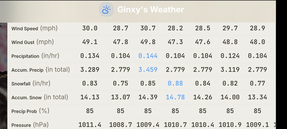
Mt Washington
-
Sure some will. Difference between top 5 and top 15 are tenths in some cases
-
Anomalous Late Spring storm May 30 2026
Damage In Tolland replied to HoarfrostHubb's topic in New England
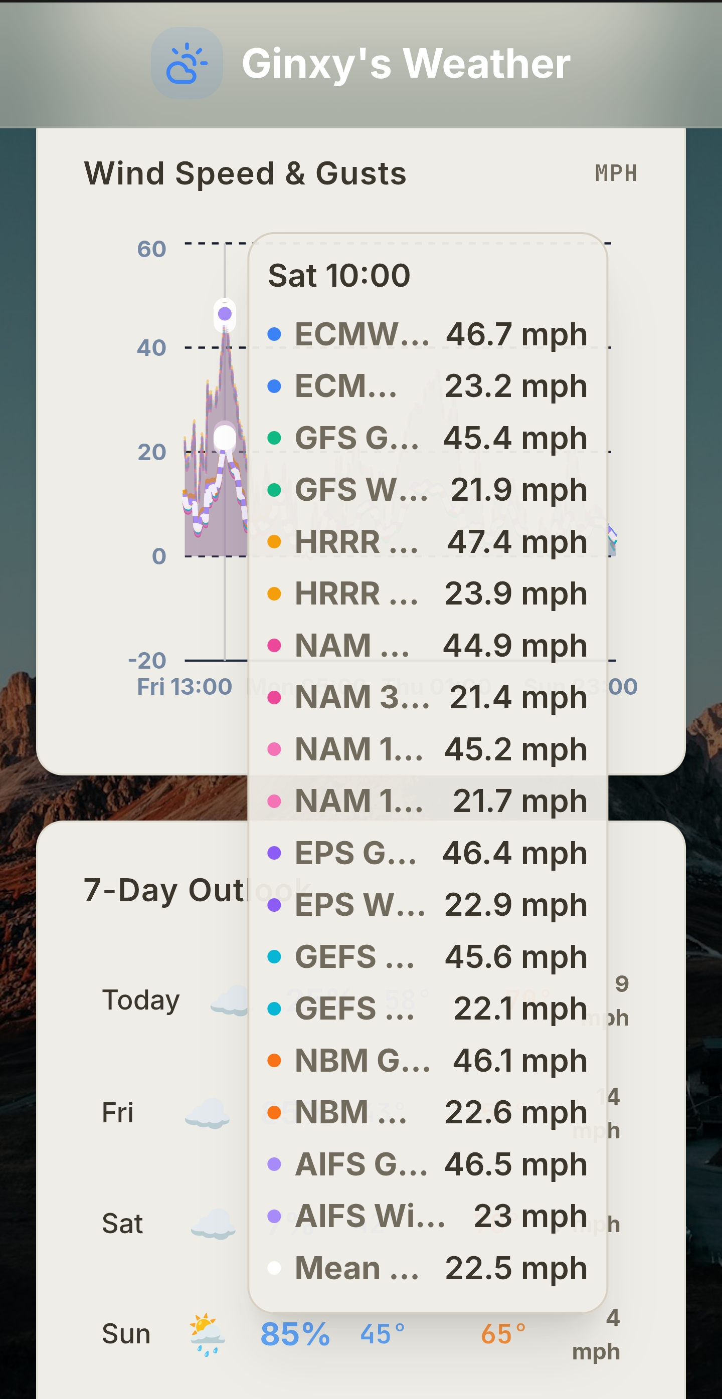
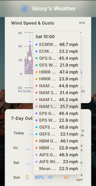
Partly sunny SW of ORH from late morning ion with the jet screaming at 6,000 feet . There’ll be 40-50 mph gusts inland with mixing where sun pops -
Tolland
-

Chester County PA - Analytical Battle of Actual vs. Altered Climate Data
chubbs replied to ChescoWx's topic in Climate Change
I knew you would find some reason to dismiss. My stability assessment is based on comparing Coatesville to NCEI and other regional stations without station changes. Coatesville tracks NCEI closely. Yes there are three stations; but, the three stations are well matched for annual average temperatures; and, there are no major station changes. You would get the same answer if you used NCEI instead of Coatesville.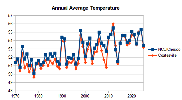
-
(002).thumb.png.6e3d9d46bca5fe41aab7a74871dd8af8.png) Because it is where I live....LOL!
Because it is where I live....LOL! -
 why does chester county matter so much
 -
llvl lapse rates may be steep enough to support gusts 35-40 mph inland. Also, the lack of rain farther inland and even potential for some cloud breaks may allow better than expected mixing (evident by the steep llvl lapse rates)
-
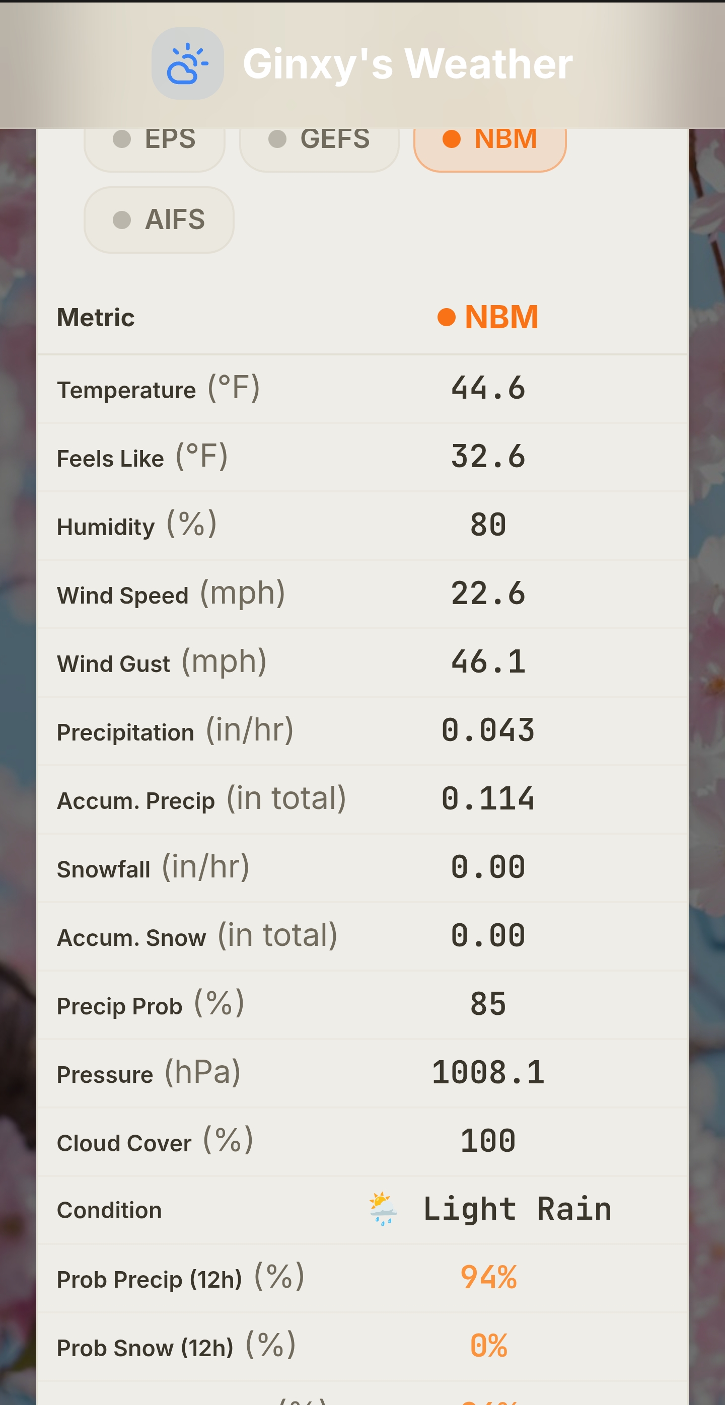
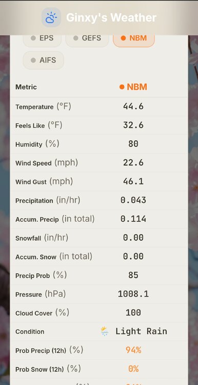
All models give you at least. .11
-
Some of the modeling has 35-40mph gusts down there in ORH county. But this is obviously anomalous and dynamic for this time of year. It does give me 2013 sensible wx vibes for NNE though…albeit a different evolution.
-
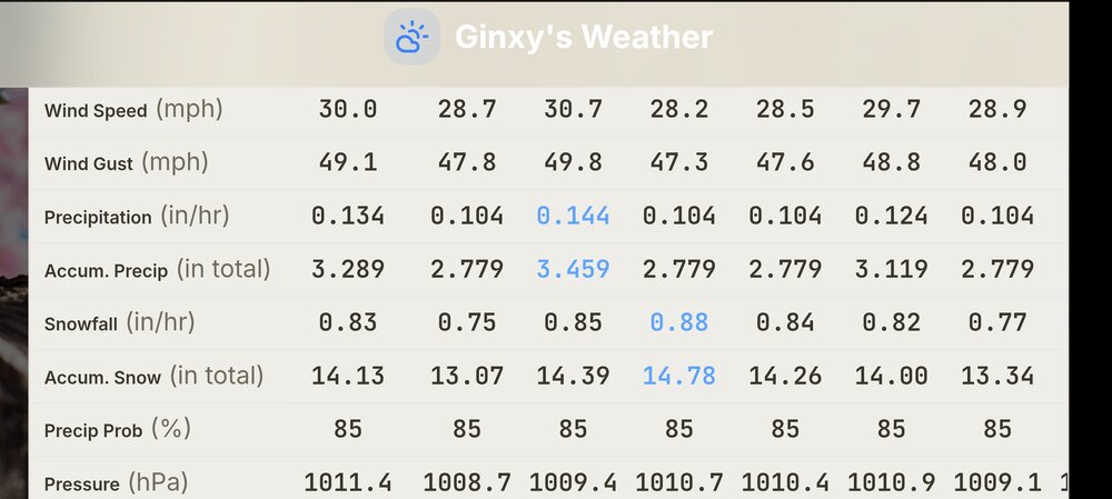
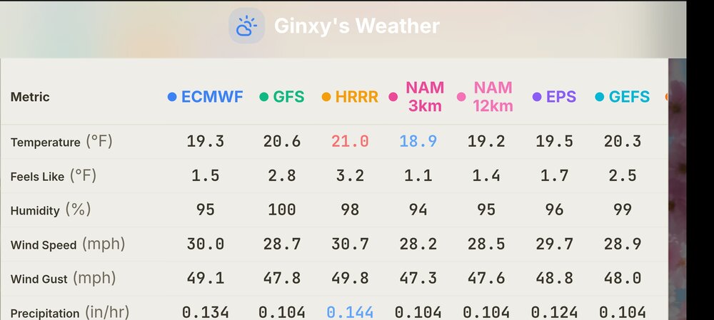
MT Washington
-
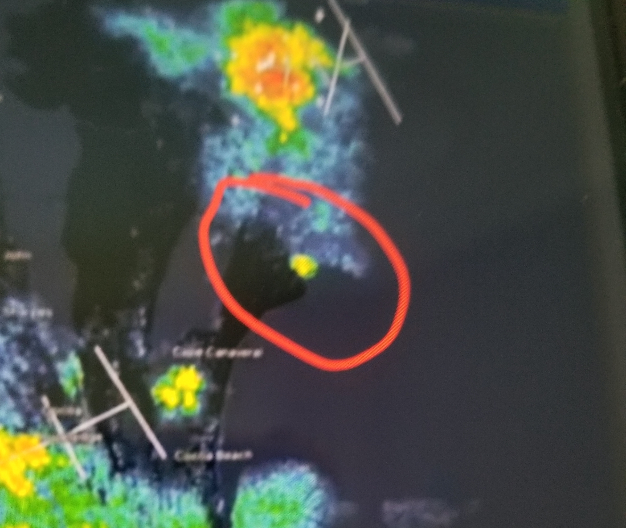
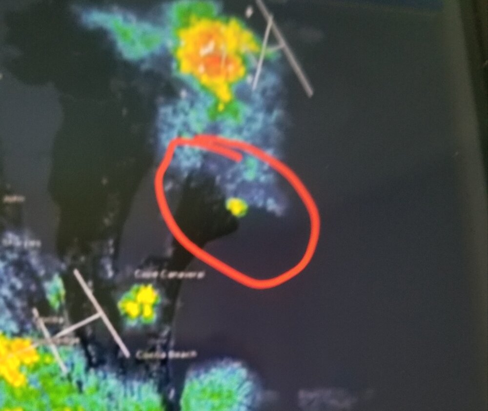
Last night's Blue Origin Rocket explosion on KMLB Radar between thunderstorm complexes to north and southwest.
-

2026-2027 Strong/Super El Nino
snowman19 replied to Stormchaserchuck1's topic in Weather Forecasting and Discussion






.thumb.gif.f92b16c631a1d15d405ed77b33f0710d.gif)