All Activity
- Past hour
-

2026-2027 Super El Nino
bluewave replied to Stormchaserchuck1's topic in Weather Forecasting and Discussion
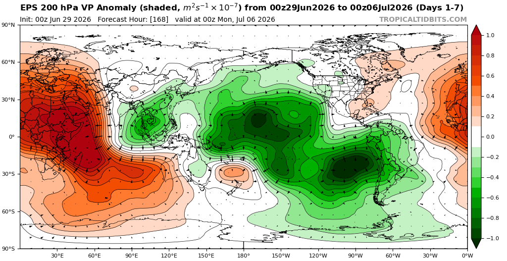
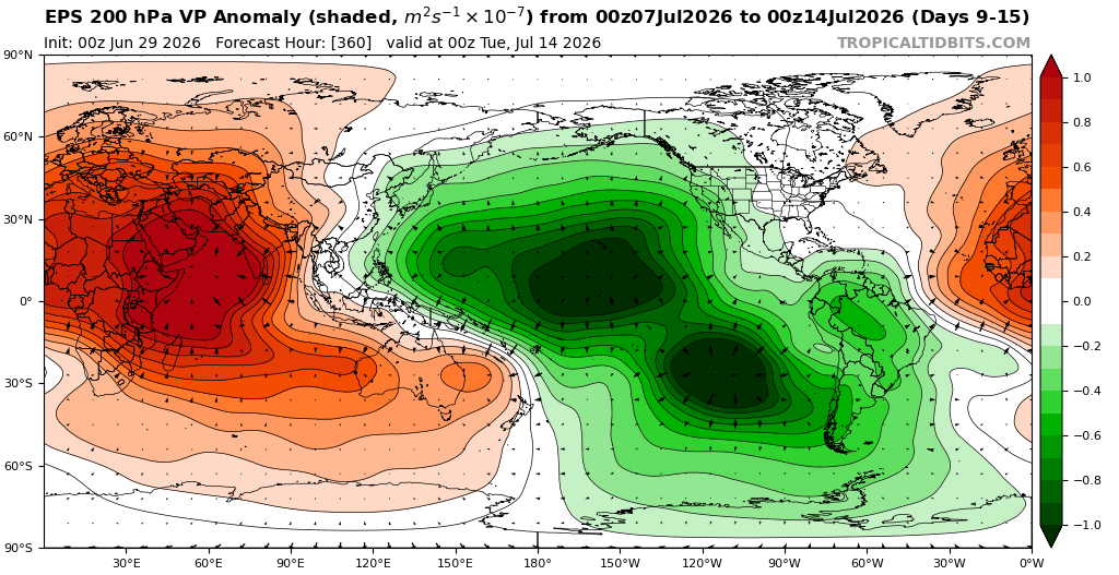
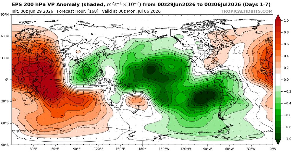
The record heatwave into the 100s to start July is another example of how the seasonal models don’t handle long range Maritime Continent forcing very well especially when it’s out of phase with the ENSO forcing. The long range July forecast was just focused on the developing super El Niño forcing. This has been a common theme as the more recent forecasts show much stronger Maritime Continent forcing than the seasonal long range forecast did. So we often get multiple regions of forcing matching the locations of the warmest +30C SSTs. Old July seasonal forecast New July forecast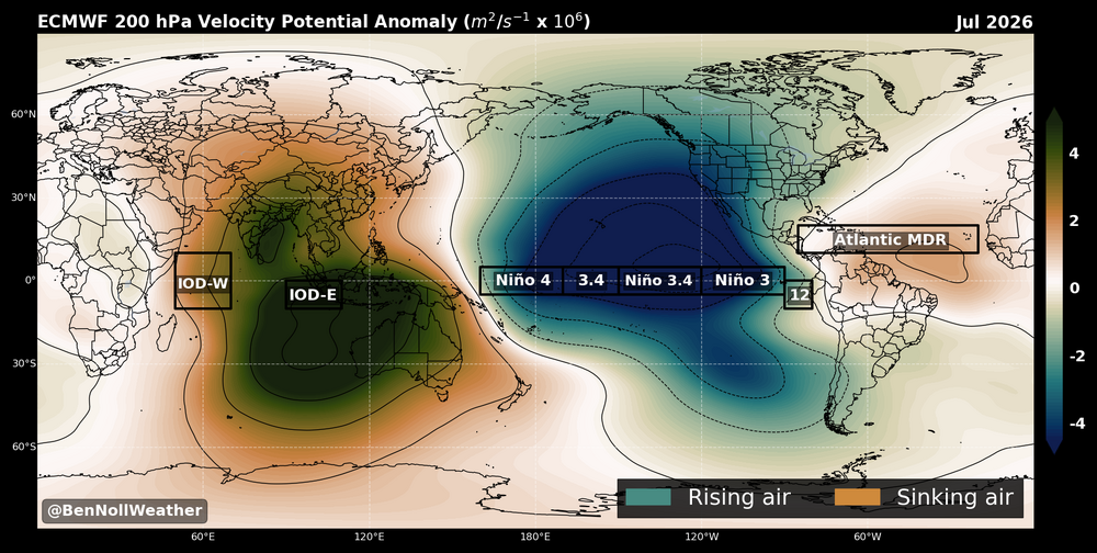

-

Junorch obs and discussion 2026
ChangeofSeasonsWX replied to Damage In Tolland's topic in New England
Any particular reason for this? I would've thought that the westerly flow off the ocean would make it more difficult for Seattle but obviously that wasn't the case in June 2021. But before that event, Boston had a higher record than Seattle. -
One more

-

2026-2027 Super El Nino
40/70 Benchmark replied to Stormchaserchuck1's topic in Weather Forecasting and Discussion
Probably some sort of feedback between the atmosphere and melting ice. -
You just love to see all of this
-
Scattered showers for 4th of July weekend here
-
I don't know how true it is, but i saw on Twitter/X that an Iraqi or Iranian hacker group took down the nws website as well as the ecmwf website
-

Junorch obs and discussion 2026
Damage In Tolland replied to Damage In Tolland's topic in New England
I know . I was inferring the dry ground is helping add a few degrees at BDL -
Deep, deep summer
-
Junorch obs and discussion 2026
Damage In Tolland replied to Damage In Tolland's topic in New England
Derechos Tuesday night and Friday? -
I'll bet you're glad you're retired from H20 work now!
-
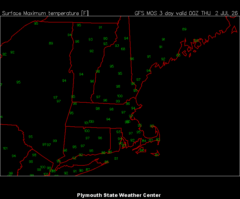
Beer? Wed is in the MOS plotting window on the Plymouth site now
-
Junorch obs and discussion 2026
Damage In Tolland replied to Damage In Tolland's topic in New England
Drought feedback helping? -
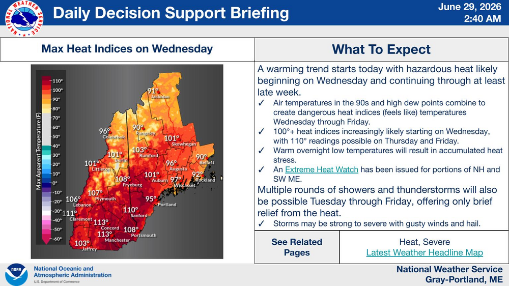
Really wish that MCS exiting stage right tomorrow night would turn a bit and exit the Maine seacoast instead. Slam a door through the region and prevent this heat wave.
-
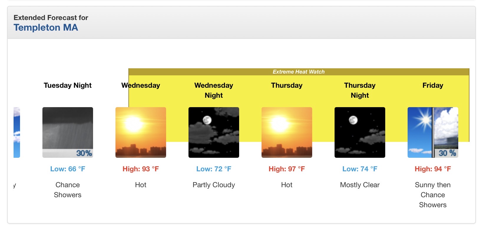
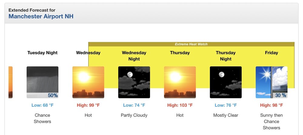
Wow MEX has 3 straight days of 100° for BDL. B2B 100s for MHT 102° for CON, TAN, and BAF
-
IMO, its much more difficult in these parts versus the PAC NW.
-
Was there any explanation as to why the National weather service website was down for like 8 or 10 hours? I found that odd, to say the least.
-
It’s gonna be hot for a few days. Can’t do much about it. All I care about is how long will it last. Hope the models are right and it breaks down the ridge after Sunday
-
Except now he will be Typhoon updates vs snowfall updates
-
Record heat every month starting back in March with new monthly maxes tied or set in May. Newark Area, NJPeriod of record: 1843-05-01 through 2026-06-27DateHighest maximum temperatures (degrees F)Top Record 2nd Record 3rd Record 3/10 82 in 2026 81 in 2016 76 in 2006 3/11 82 in 2026 75 in 2021 71 in 1977 4/15 91 in 2026 88 in 1960 87 in 1941 5/19 99 in 2026 98 in 1962 93 in 2017+ 6/11 97 in 2026 96 in 2000 96 in 1984
-
So will this week be like FL, where storms fire along a Seabreeze if one develops?
-
Hypothermia there, Heatstroke here lol
-
I was very lucky Sunday evening, receiving 1.23" between 6:30 - 8:30. Total for the weekend, 1.89"....
-
He can still post. His and radarman’s temps will fit right in next winter.
-
Junorch obs and discussion 2026
ChangeofSeasonsWX replied to Damage In Tolland's topic in New England
You have to wonder if this area of the country will ever see a synergistic heat event similar in magnitude to what the PNW saw in June 2021. Surely if Seattle can hit 108F then Boston could do the same? If anything I would expect it to be more doable for Boston.