All Activity
- Past hour
-

2026-2027 Fall/Winter Mountain Thread
Tyler Penland replied to BlueRidgeFolklore's topic in Southeastern States
18z HRRR is concerning. Sent from my Pixel 10 Pro using Tapatalk -
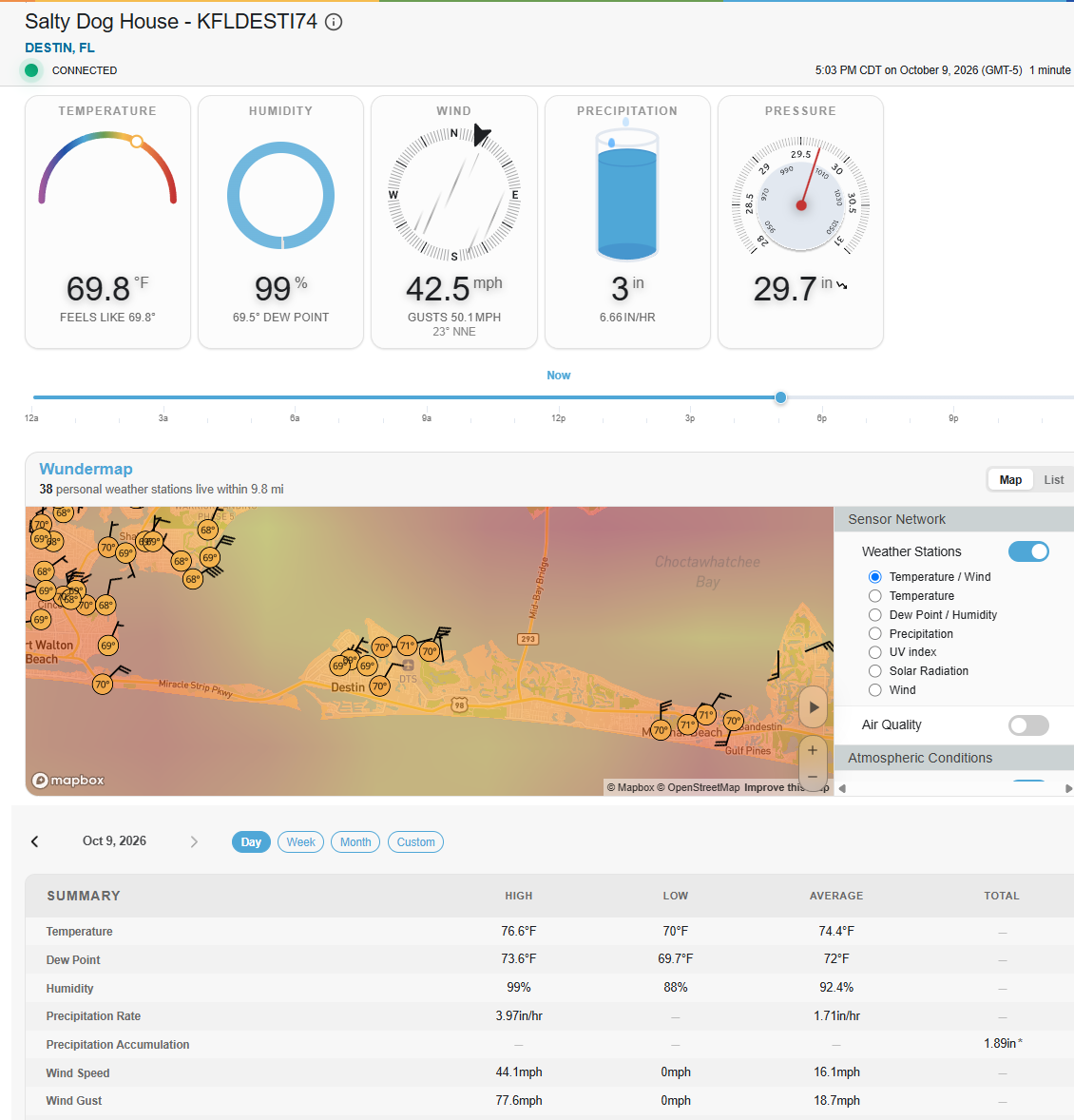
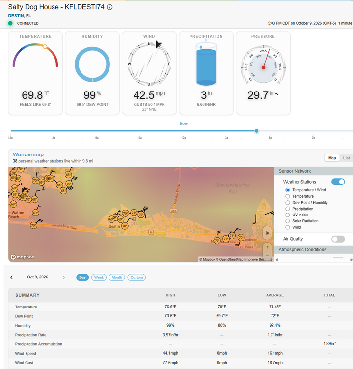
Congrats on more rain! Dale City tallies shall challenge then surpass our meager amounts, 40.7 for the year. Enjoy this autumn, winter and well on into late spring in 2027. Mid Atlantic is right in the Plume! So is Destin, FL, as they are most assuredly finding out right about now. Some Southeastern communities will eclipse 20 inches easy, especially with training tropical thunderstorms.
-
ATL is favored by 3, but I'm not convinced they have a QB. Last year the Ravens only two wins vs >.500 teams were with Huntley as QB and Minter did do a good job in the preseason calling defensive plays, not ready to give up on that yet.
-
The big tor threat is often the day after landfall, when it becomes a baroclinic system w/ low-level tropical dew points and all you needs is just breaks in the clouds for a little CAPE, and look out! 44 tors in FL from Milton on 10/9/24 This is the largest calendar day tor outbreak on record In October and among the top 5 biggest tor outbreaks in Oct in the U.S. Milton also produced the costliest TC tor on record -- $514M from an EF3 that tracked in St Lucie and Indian River Counties.
-
Hard to find the eye now and most of the worst weather appears to be on the north side. Still going to be a dangerous storm
-
Yes, despite the erosion of the low level inner core, there’s still plenty of deep convection and lightning. This will still be a strong hurricane, as the NHC has said for a while now.
-
Doesn’t matter much now. Eyewall moving onshore
-
My guess is Cat 2 at landfall with numerous gusts over 100mph reported.
-
This guy had a good gust.
-
Dry air really getting at the center. Right when models had it. Interesting deep convection on the western side of the western eyewall. Wonder if dry air is causing more instability in the mid levels as it impinges in from the west and southwest.
-
 Subsurface right now does not support it eroding from the east
 -
115–120mph velocities not far offshore south of Pensacola. It’s elevated where the radar beam samples it but still rough impacts incoming shortly.
-
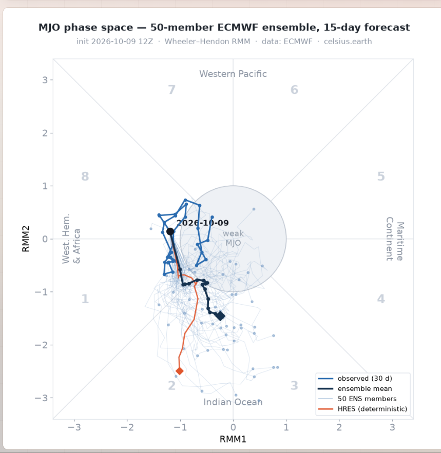
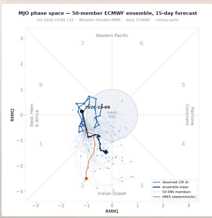
Least we are seeing some changes These EWB'S into the IO with the active MJO into the the WH and AFRICA,should probably stall the MJO signal into the IO by the Bjerknes effect,this should help take out the NINO background out for a a short time anyways,but it looks much cooler still in our parts as we head towards the mid month
-
Agree that radar has suggested a partially open eyewall since late morning…perhaps my phrasing that the inner core has “held up” wasn’t the best way to put it as it hasn’t been able to close off an eyewall for several hours, but overall it’s been a pretty steady robust half eyewall on the northern side. I do think we are starting to see signs on radar of further degradation of the core, but the northern eyewall remains nasty and the most recent dropsonde suggested a ~957mb pressure…so the pressure isn’t rising yet and that eyewall is only 2 or so hours from affecting the coast. As the hurricane’s motion continues bending slightly left and a bit more into the increasing shear and as core starts interacting with the rather chilly/stable air getting pulled into the storm off of land I’m guessing the eyewall slowly degrades through landfall and rapidly falls apart as it pushes inland, though for practical purposes that won’t be enough to significantly change the impacts as landfall occurs. These interactions between shear and storms approaching landfall is fascinating and not the same from storm to storm as you said. I thought the hurricane and global models did a pretty good job of showing the pressure holding steady or falling until some point between 18-0z, before rising rapidly beginning near landfall later this evening. So the guidance seemed to resolve the more positive interaction we’ve seen through most of today before the negative factors finally overwhelm the storm tonight, though the timing of things changing even a few hours makes a difference so close to landfall. The HAFS models were too drastic with last minute weakening, but the HWRF and even Euro were more accurate in showing just some modest last minute weakening before landfall. I think that with Isaias, the storm motion paralleling the shear vector until very recently may have helped stave off its impacts by making it easier for convection to wrap around the up shear side of the storm. The very impressive upper-level divergence/outflow over very warm waters supported robust convection and deepening as well, so long as shear and dry air largely stayed out of the inner core. We’ve probably been near an equilibrium between the increasing shear and favorable thermodynamics/strong eyewall convection since late morning, with the scales gradually tipping towards weakening this evening but not fast enough to help anyone on the coast. In some of the storms you mentioned that weakened much more drastically before landfall, I wonder if an ERC coinciding with increasing shear led to more drastic weakening? An ERC can cause a cat 4 or 5 to weaken pretty notably even in a more favorable environment (at least temporarily)…Isaias didn’t undergo a true ERC at any point today, and I have to wonder if an ERC starting this morning or afternoon would have allowed for the storm to weaken more in the face of the increasing shear today.
-
I thought temps in the 60s along the Gulf Coast while the hurricane is making landfall is a pretty good affirmation for cooler conditions in the wintertime.
-
Yea, many reporting sustained close to 40 now with higher gusts.
-
Some hurricane force gusts starting to show on personal weather stations along the immediate beaches east of Pensacola.
-
Navarre Beach Marina has a Davis station on weatherlink, Reporting sustained 35 and gusts to 52
-
About 12 inches below normal precip YTD and still in D2 down here. Hopefully this knocks about 2 inches or so off the deficit. It is awfully dry in a lot of places.
-
Stalled fronts in the Gulf sometimes lead to sig HU development. One of most notable ones was Alicia in Aug 1983 that struck HOU as a Cat 3.
-
That’s not the northern eyeball. The eyewall is still well offshore.
-
Half canes are very common in these setups due to the downsloaping effect. Essentially the air is comparatively much drier over land and naturally gets wrapped around due to the counter clockwise flow. A very intense tight core sometimes can overcome this. That combined with the shear is why it’s weakening now or at the very least leveling off and that has been clearly in the tropical guidance for a few days now.
-
You can have major HUs in very strong El Nino years. Debby in the western Atlantic was Cat 4 in Sep 1982. Bob in Aug 1991 just off Hatteras was a Cat 3 that went on to hit New England. Erika in the western Atlantic in Sep 1997 was almost a Cat 4. Joaquin near the Bahamas in Oct 2015 was almost a Cat 5. So Isaias occurring here is not atypical overall given the strength of El Nino. The key is that frequency of major HUs in very strong El Nino years is down relative to avg and there is lack of long-tracked Cabo Verde classics.
-
https://x.com/commoditywx/status/2108603993190478158
-
So that is code for you predicting another 2013/14 winter? On an even less serious note, tons of acorns up here, the most in many, many years according to a neighbor who's a life-long Hanover resident in his 70's.