All Activity
- Past hour
-
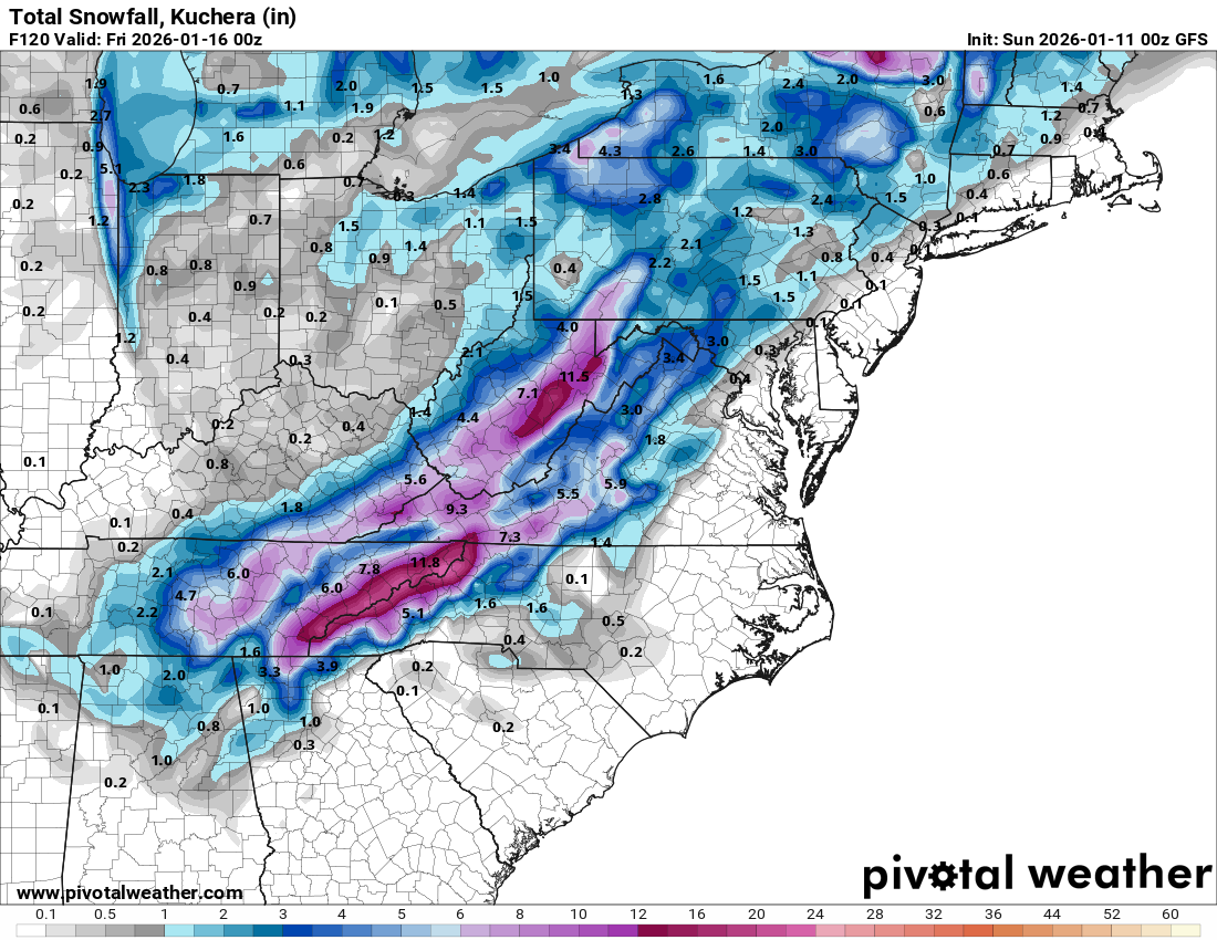
I really doubt that surface low ends up being where it is considering it forms over central NC and not over the usual coastal boundary interaction. Verbatim is an interesting snow map
-
@tnweathernut nailed it. Huge hitter on the first wave there from the gfs.
-

January 2026 Medium/Long Range Discussion
NorthArlington101 replied to snowfan's topic in Mid Atlantic
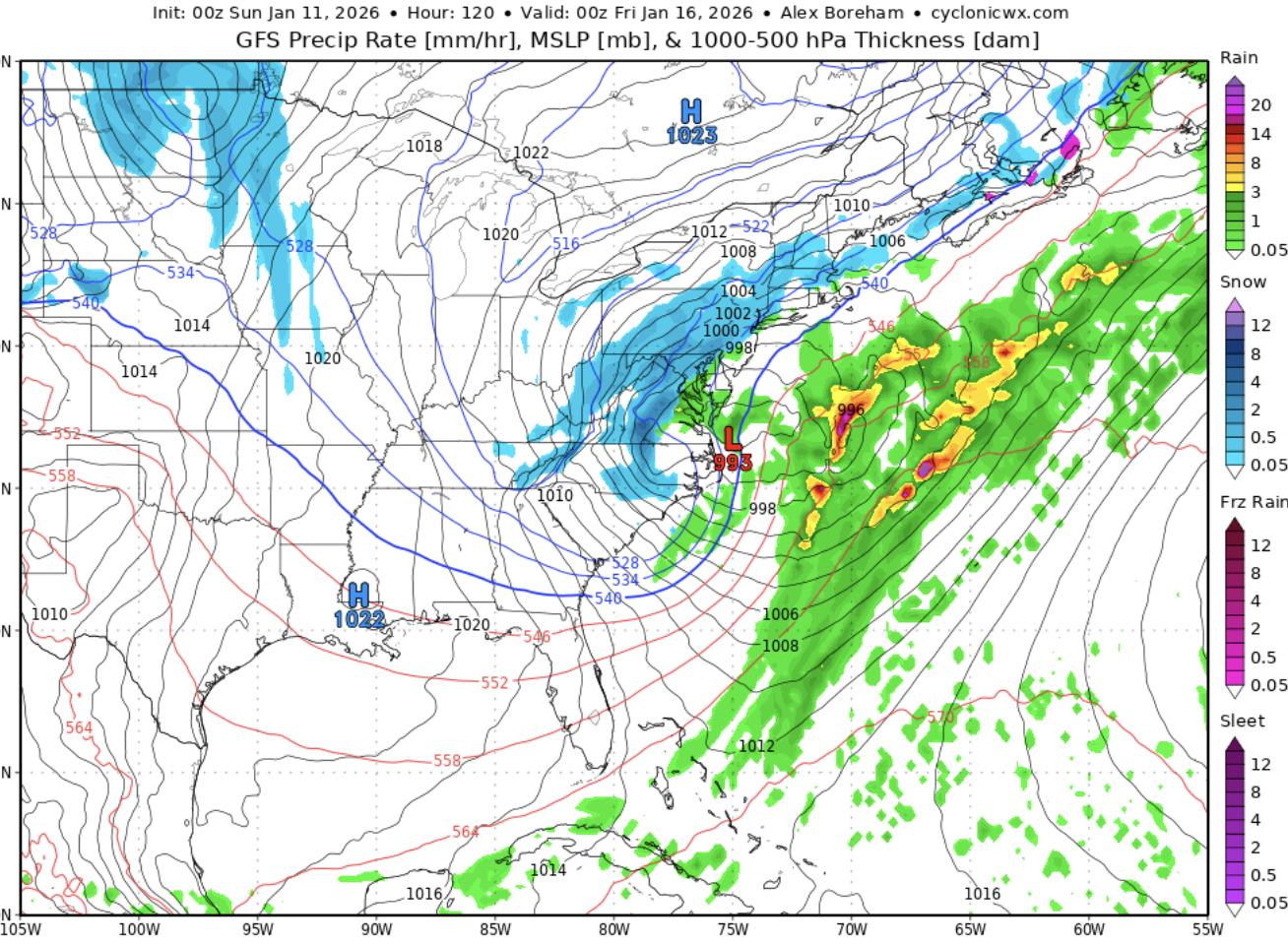
h5 was so good… surface so mediocre. Whatever. We’re alive another run. -
If only the GFS was a good model
-
Good hold by the gfs. I like the h5 vort being further south and west of previous runs, temps be damned. This is the path to victory
-

January 2026 regional war/obs/disco thread
40/70 Benchmark replied to Baroclinic Zone's topic in New England
Well, hr 108..one camp will cave soon. -
Boom goes the dynamite from hour 102 to 108 for the half of the state, especially east TN. Snow map will be pretty for some.
-

January 2026 regional war/obs/disco thread
brooklynwx99 replied to Baroclinic Zone's topic in New England
PVA axis is more N-S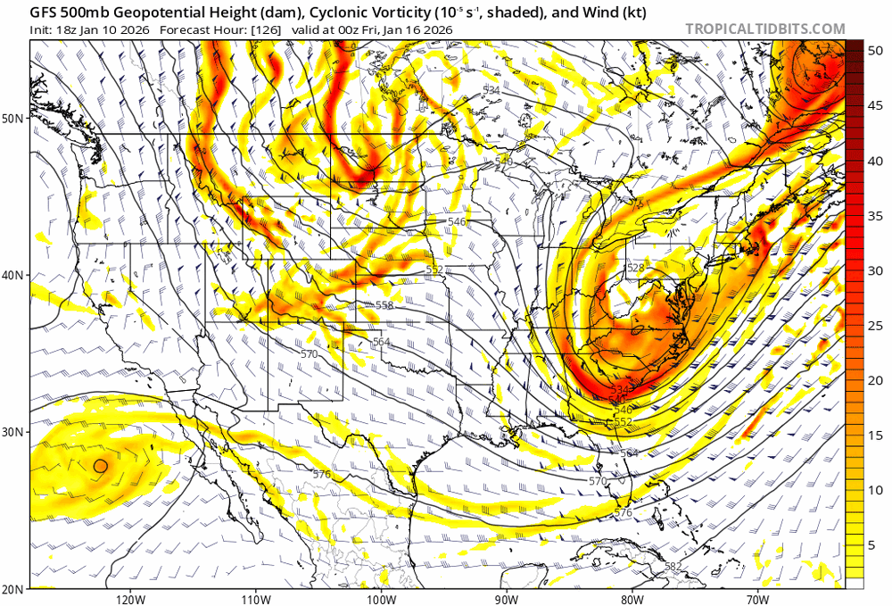
-

January 2026 Medium/Long Range Discussion
Stormchaserchuck1 replied to snowfan's topic in Mid Atlantic
Yikes 41F in DC. The problem is we are just coming out of +epo which keeps the northern stream cutoff somewhat. -
Well I see Southern Maryland is back to its rightful location sweating the rain/snow line, everything is looking like a classic setup - lock it in.
-
Wait for it
-
To my eye, this is very Jan 26, 2011 esque
-
Looking more like 12z .
-
They'll crash
-
No. It’ll start as rain but go to snow as the ull passes
-
January 2026 Medium/Long Range Discussion
NorthArlington101 replied to snowfan's topic in Mid Atlantic
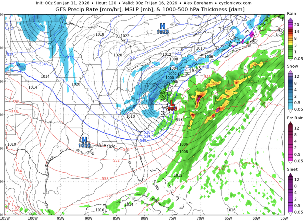
Snow DC and a bit east by 120 -
-
-
Agreed. The tough issue with this potential that can't be changed is the approach of the pacific s/w. Normally, I like the "ribbon" coming through the Yellowstone region in a ESE direction. With the ridge so firmly anchored over Northern California, we're dealing with a wave diving out from the Dakotas to the SSE. But there's more than one way to bake a cake, and this seems to be one of them. Whatever works. lol
-
Anyone else loving the upper levels but worried about lack of cold air?
-
118 temps are iffy
-
Closed 500 low over western/central Tennessee by HR 111. Surface low over western South Carolina. Everyone east of I-81 starts as rain, but the flip to snow seems imminent.
-
January 2026 Medium/Long Range Discussion
NorthArlington101 replied to snowfan's topic in Mid Atlantic
Flipping over… would be a painful wait but hopefully worth it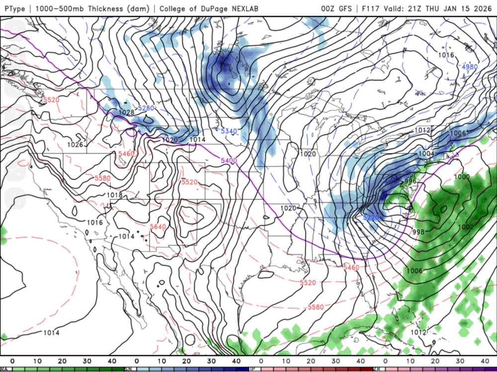
-
I said that 30 minutes ago
-
I'm at HR 108 and the presentation at 500 mb looks good to my eye. Passing through western Tennessee and starting to go neutral.