All Activity
- Past hour
-

Wounded Duck Strikes Back: Dec 26 & 27th Winter Storm Obs
SouthCoastMA replied to WxWatcher007's topic in New England
MV going to get in on that band it seems -

Wounded Duck Strikes Back: Dec 26 & 27th Winter Storm Obs
weatherwiz replied to WxWatcher007's topic in New England
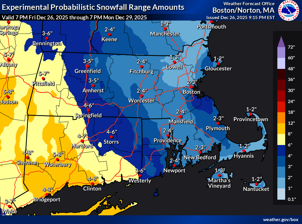
For some reason I thought I went 4-7" here but I checked my map and I am in the 2-4" zone so I will hit that. -

Wounded Duck Strikes Back: Dec 26 & 27th Winter Storm Obs
Hoth replied to WxWatcher007's topic in New England
Hope so. Would love to fend off that slot. -
Beautiful. Thank you!
-
Two photos from this evening:
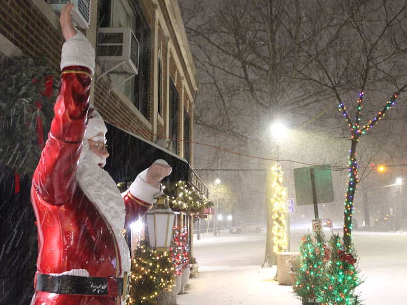
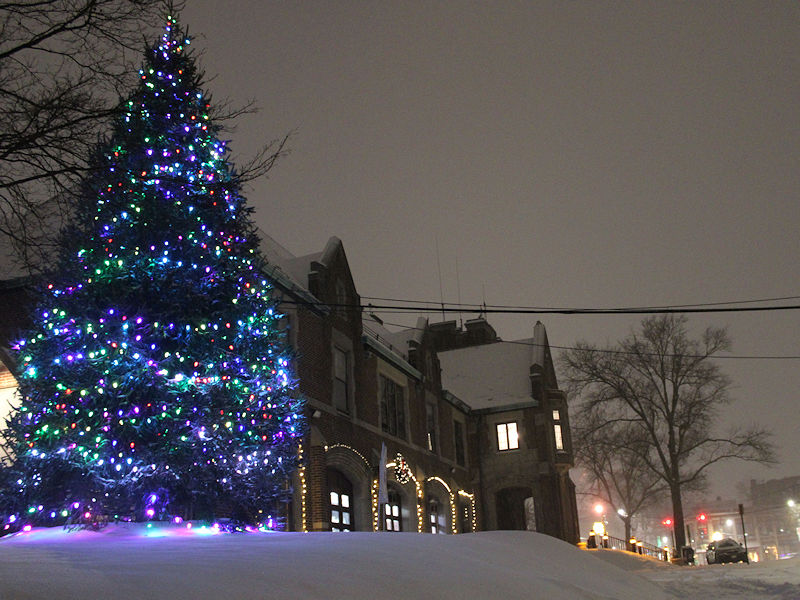
-

Wounded Duck Strikes Back: Dec 26 & 27th Winter Storm Obs
nianticct replied to WxWatcher007's topic in New England
Add 1 more ! -

Wounded Duck Strikes Back: Dec 26 & 27th Winter Storm Obs
Baroclinic Zone replied to WxWatcher007's topic in New England
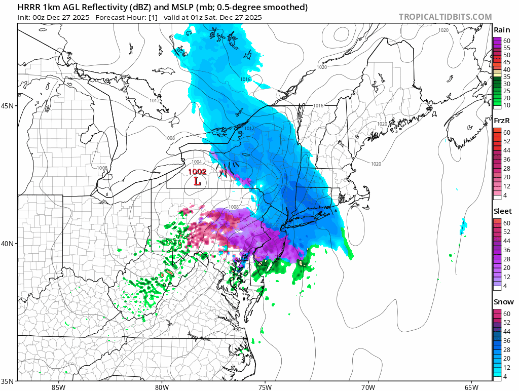
FWIW, the 00z NAMs are locked and loaded for eastern areas. See how this plays out -
I’ve been like 70/30 snow vs sleet.
-

Wounded Duck Strikes Back: Dec 26 & 27th Winter Storm Obs
Damage In Tolland replied to WxWatcher007's topic in New England
Any frontal or backal nudity? -

Wounded Duck Strikes Back: Dec 26 & 27th Winter Storm Obs
bristolri_wx replied to WxWatcher007's topic in New England

-
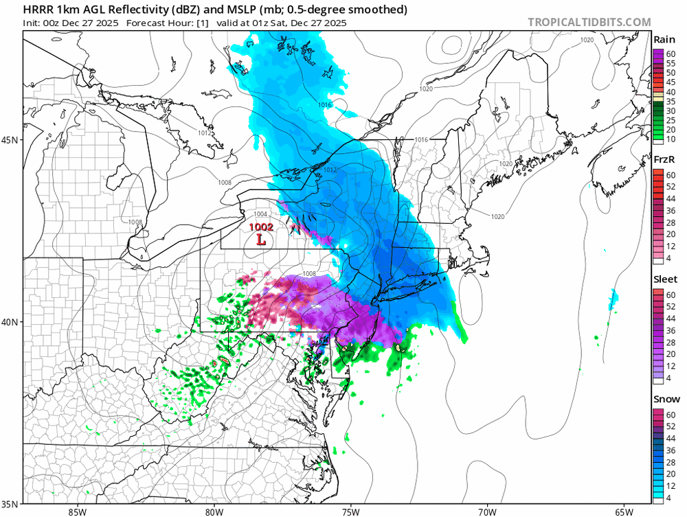
Check out kdix radar, is that ocean effect heading towards south shore?
-
If the precip central ny does comes south I agree Nassau County east best chances of cashing in.
-
Well... snow ending from this part-light stuff/flurries and 3.5" on my tabletop. We'll see what happens later.
-

Wounded Duck Strikes Back: Dec 26 & 27th Winter Storm Obs
moneypitmike replied to WxWatcher007's topic in New England
A new london rarity fir sure. -
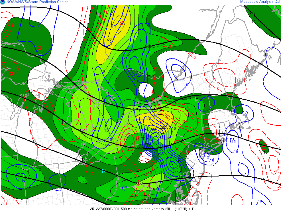
associated with the main vort moving through, makes sense
-
I didn't realize that we are getting nearly a +600dm anomaly over Greenland in 2.5 days. Big -NAO. And it reloads 3x. This is the 384hr prog from the 18z GEFS. I like the progression.. building -NAO (again), and a different Pacific evolving from -PNA
-
I agree but now precip firing up all the way to the PA border
-

Central PA Winter 25/26 Discussion and Obs
canderson replied to MAG5035's topic in Upstate New York/Pennsylvania
Some dude outside has been chipping ice off his car for 20 minutes. -
Subsidence will fill in with precip
-
.thumb.jpg.6a4895b2a43f87359e4e7d04a6fa0d14.jpg)
Central PA Winter 25/26 Discussion and Obs
Yardstickgozinya replied to MAG5035's topic in Upstate New York/Pennsylvania
I saw several close calls and spinouts on my walk down to New Cumberland . Everything looks good down on 83 N and S from the overpass at mile marker 388 but 114 Lewisbarry road in New Cumberland is not in good shape at all In places.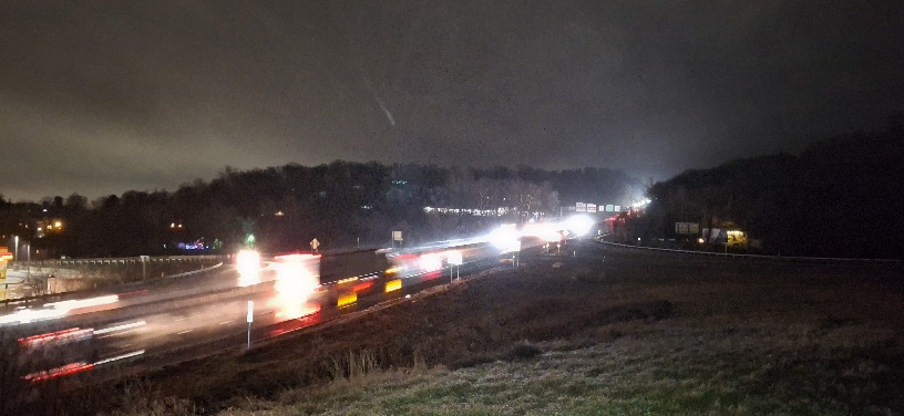
-
Radar filling up fast if you no check out bgm every refresh it’s filling in
-

Wounded Duck Strikes Back: Dec 26 & 27th Winter Storm Obs
OrangeCTWX replied to WxWatcher007's topic in New England
Looks like some precip starting to fill in in NEPA? -

Wounded Duck Strikes Back: Dec 26 & 27th Winter Storm Obs
BrianW replied to WxWatcher007's topic in New England
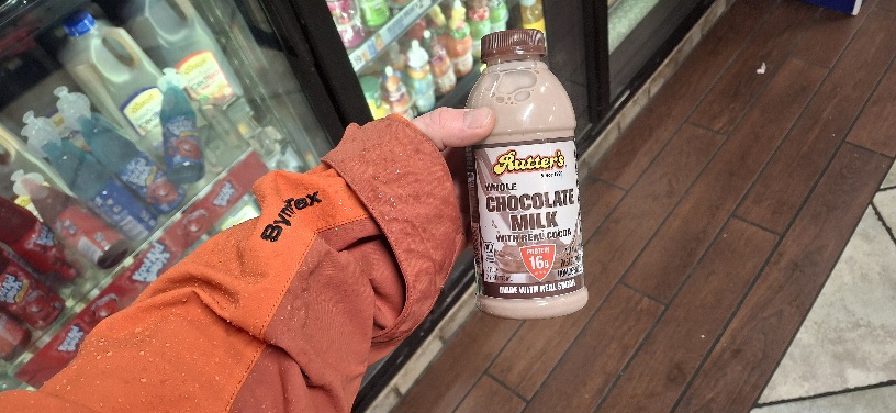
Had to dust off the Ole weenie stick. Been awhile since I've had to measure down here on the shoreline. 6.8 latest measurement here in Branford... -
That area might actually hit LI. I still think places as far west as the Nassau/Suffolk border could do well but I'd think it'll swing too far E for NYC and you have to expect given its coming from the NNW some degree of downslope will happen
-

Wounded Duck Strikes Back: Dec 26 & 27th Winter Storm Obs
WinterWolf replied to WxWatcher007's topic in New England
Yup John..6 plus here already.


.thumb.jpeg.f5c6ba9d911ec96b3b124f8606aee58e.jpeg)

