All Activity
- Past hour
-
Most likely posted to direct visitors from X onto BamWX's app. At least there are no 90's on the horizon.
-

October Comes Early: Late September Multi-Hazard Hybrid Storm
CoastalWx replied to WxWatcher007's topic in New England
Dude it’s bad. I’ve seen the scores. There’s no investment. AI version blows too. Anyways it makes life easier since I don’t need to incorporate it. We only foreign models now. -

October Comes Early: Late September Multi-Hazard Hybrid Storm
JACKASS replied to WxWatcher007's topic in New England
Couldn't confirm your hypothesis as I don't follow the weather in places other than what our subforum covers. -

October Comes Early: Late September Multi-Hazard Hybrid Storm
WinterWolf replied to WxWatcher007's topic in New England
It always blew. The Euro just got worse, so it looked that way. -
-
October Comes Early: Late September Multi-Hazard Hybrid Storm
CoastalWx replied to WxWatcher007's topic in New England
Gfs was catching up to euro and now it’s on the bottom of a barrel. #winning -
So, now that we have a new addition to our family, meet Ms. Jettie. She's never seen snow as she was found in in southern Texas when she was only 2 months old back in the beginning of the year. Brought up here in April. I'm hoping she'll get to see some snow this year for her first winter in the Northeast

-

2026 Atlantic Hurricane Season
vortex95 replied to Stormchaserchuck1's topic in Tropical Headquarters
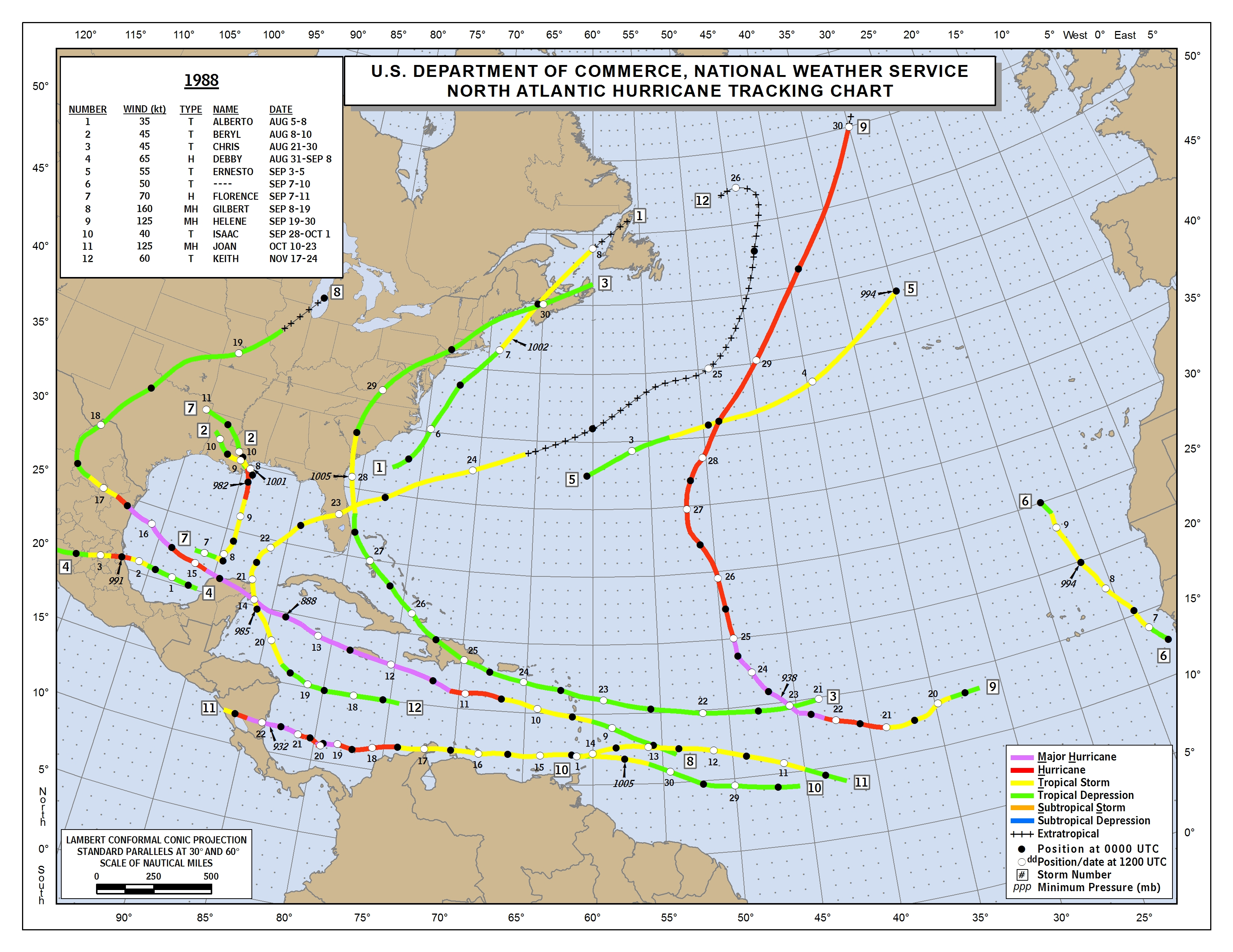
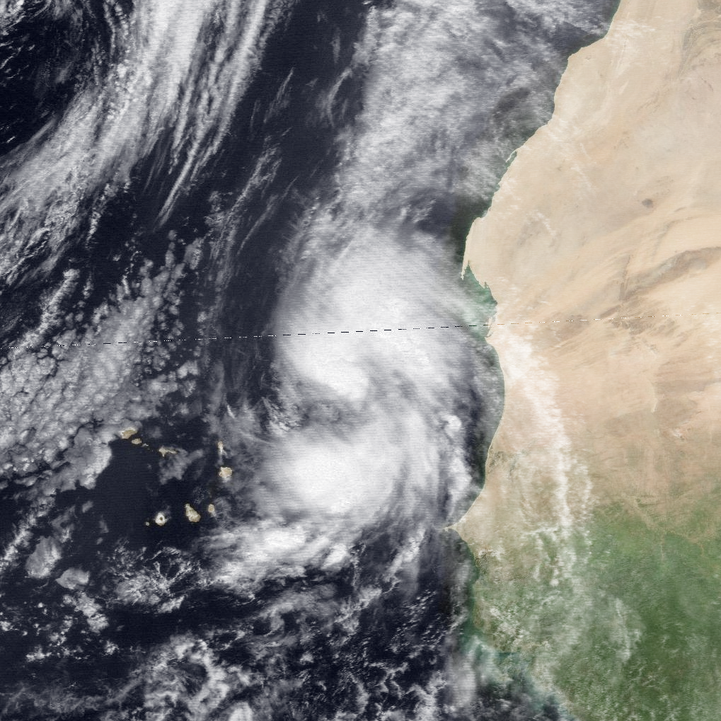
For 90L, it may become a TS briefly from what some models show. It is quite rare to have something named this far E and moving NW and stay E of Cabo Verde. Hermine in 2022 (35 kt) did his. Before 2022 and strongest in the last 60 years was an unnamed TS in Sep 1988 (50 kt) (see attachments). There were several min TS in the 1960s and early 1970s in the area.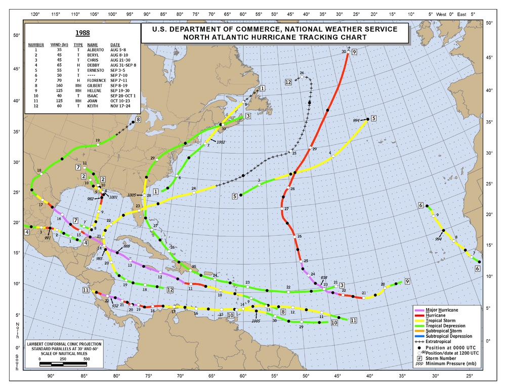
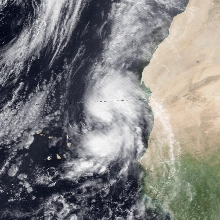
-

October Comes Early: Late September Multi-Hazard Hybrid Storm
H2Otown_WX replied to WxWatcher007's topic in New England
Maybe it is king in Europe now, that's all they care about -
October Comes Early: Late September Multi-Hazard Hybrid Storm
JACKASS replied to WxWatcher007's topic in New England
Euro used to be king, then, glue factory... -
October Comes Early: Late September Multi-Hazard Hybrid Storm
WinterWolf replied to WxWatcher007's topic in New England
It was never good…so F that shit. Get rid of the thing and start over. Or just use the AI…it’s gonna beat all the other models before very long anyway. -
Gfs moved sw at 18z so will keep eyes on it
-
 Remember when Biden said it would improve ? He made it worse
 -
October Comes Early: Late September Multi-Hazard Hybrid Storm
JACKASS replied to WxWatcher007's topic in New England
Should become an AMWX meme. -
October Comes Early: Late September Multi-Hazard Hybrid Storm
CoastalWx replied to WxWatcher007's topic in New England
Man with all that investment into the GFS you’d think it would be a great model…oh wait…… -
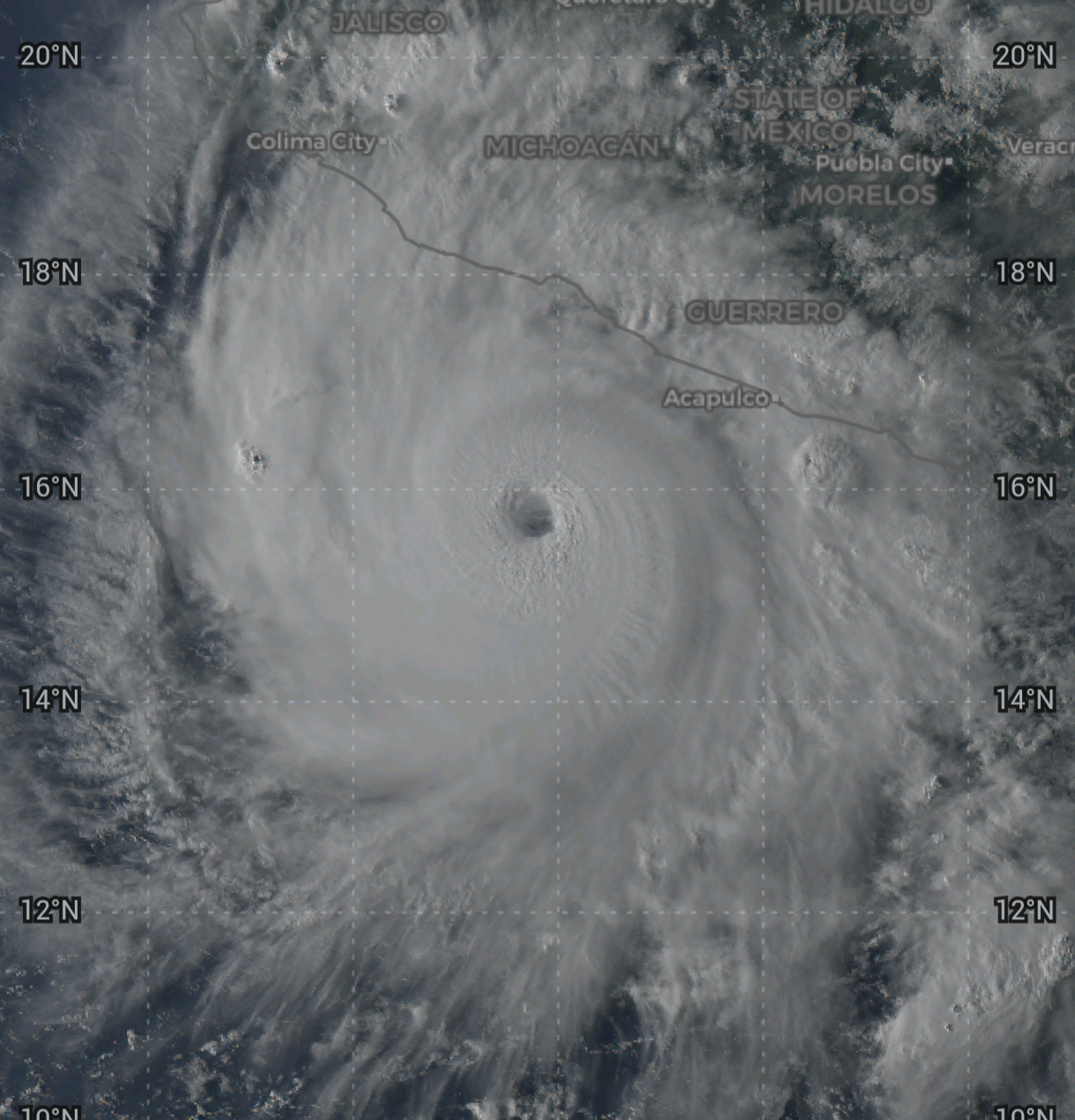
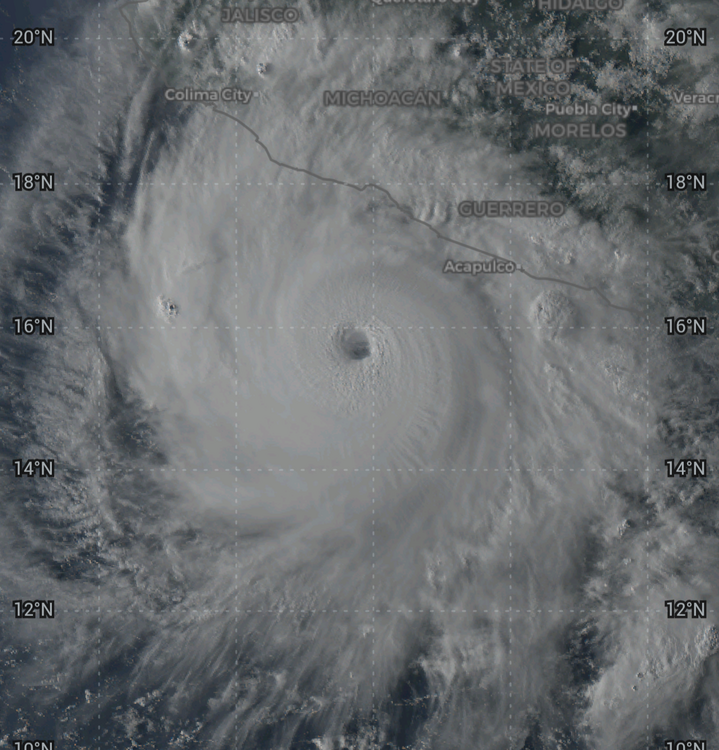
This HI activity jibes w/ the strength of El Nino. We know from other very strong El Ninos, HI is more at risk for TCs. Now, this for one, it is record activity for HI, but we are dealing w/ likely the strongest El Nino on record (since 1950). But the sample size for very strong El Nino is small, and I also would ask, what else is going on at the current time across the globe as to pattern oscillations? Yes, ENSO is the strongest, but does not operate in vacuum. So the state of other oscillations unquestionably play a role here, and sometimes they all line -p well/ideal w/ ENSO for a heck of season/high-end sensible wx in a region of the globe! And of course, you do not need a strong ENSO for wild sensible wx in any given region. The EPAC and CPAC are acting exactly as one would expect for TCs in a very strong El Nino overall. So is the Atlantic. The NW Pacific has not been super active yet for many intense TCs, but ACE is at 125% of avg S-T-D, and the TC season here often has monsters in Oct/Nov and even in Dec, so its "time" may be coming! The E/CPAC total ACE S-T-D is 189% of avg. If we take just what ACE has occured in the CPAC, I think it is at or near record levels w/ the caveat you only have a solid POR (period of record) since the sat era began (mid-1960s). Also, keep an eye on the SPAC season coming up. That is often very active for TCs in very strong El Nino, and you can get HUs well E of Tahiti, so much so you don't need to look at Himawari satellite imagery, GOES-W does just fine!
-
I saw someone reference the El Nino of 1877 to the El Nino for this winter. I looked it up just to see what effects it had on the Northeast, and it was considered the winter that wasn't. I'm just going to go with low end on the snow and if we get anything major it'll be a good surprise. We saw this coming so shouldn't be a surprise if we get, at best, a mediocre winter
-
A combination of Cocorahs and COOP sites. Your area does pretty well and is on par with MPO. It’s too bad they don’t have a contract snowfall observer at MPO. Since there is quite a bit of missing snowfall data there when there weren’t volunteer observers nearby in the past. Data for October 1, 2025 through April 30, 2026 Click column heading to sort ascending, click again to sort descending. LAKE HARMONY 2.4 WNW CoCoRaHS 60.4 PORTLAND 2.7 WNW CoCoRaHS 50.2 BOWMANSTOWN 3.0 WSW CoCoRaHS 41.8 PALMERTON 5.8 ENE CoCoRaHS 41.6 TATAMY 0.2 WNW CoCoRaHS 39.0 SLATINGTON 6.0 WSW CoCoRaHS 38.7 TREMONT 0.4 NNW CoCoRaHS 37.9 MARTINS CREEK COOP 37.7 SCHNECKSVILLE 1.7 ENE CoCoRaHS 37.4 NAZARETH 1.1 W CoCoRaHS 36.8 ALLENTOWN LEHIGH VALLEY INTERNATIONAL AIRPORT WBAN 35.5 Data for October 1, 2025 through April 30, 2026 Click column heading to sort ascending, click again to sort descending. RICHMONDALE 0.1 NE CoCoRaHS 59.1 MILFORD 8.7 NW CoCoRaHS 58.1 MOUNT POCONO 0.7 N CoCoRaHS 57.9 DYBERRY 2.1 W CoCoRaHS 56.7 CANADENSIS EAST COOP 56.1 PLEASANT MOUNT 1 W COOP 53.8 EAST STROUDSBURG COOP 53.5 LORDS VALLEY 2.5 SE CoCoRaHS 52.6 CANAAN - 11 CoCoRaHS 52.3 MOSCOW 4.9 E CoCoRaHS 51.5 EFFORT 3.2 NNW CoCoRaHS 46.9 PROMPTON DAM COOP 42.0 WEST HAZLETON 3.2 NNE CoCoRaHS 38.5 WILKES-BARRE/SCRANTON INTERNATIONAL AIRPORT WBAN 37.8
-
October Comes Early: Late September Multi-Hazard Hybrid Storm
JACKASS replied to WxWatcher007's topic in New England
LMFAO!! -
After tonight, that should pretty much be the axe to the drought and deficit. It made a 4th quarter comeback but it has been an absolute deluge along and west of I-77.
-

October Comes Early: Late September Multi-Hazard Hybrid Storm
Lava Rock replied to WxWatcher007's topic in New England
Would be epic Sent from my SM-S921U using Tapatalk -
October Comes Early: Late September Multi-Hazard Hybrid Storm
WinterWolf replied to WxWatcher007's topic in New England
GFS Op isn’t done shifting west yet…so those amounts will go up on that model. -

October Comes Early: Late September Multi-Hazard Hybrid Storm
SouthCoastMA replied to WxWatcher007's topic in New England
GFS track in February would be like 3-4' -

2026-2027 Fall/Winter Mountain Thread
Met1985 replied to BlueRidgeFolklore's topic in Southeastern States
I hope we get into a much wetter pattern. We need it although this week has been nice. -
 https://canamcrosscare.shop/# canadian pharmacy king