All Activity
- Past hour
-

2025-2026 ENSO
so_whats_happening replied to 40/70 Benchmark's topic in Weather Forecasting and Discussion
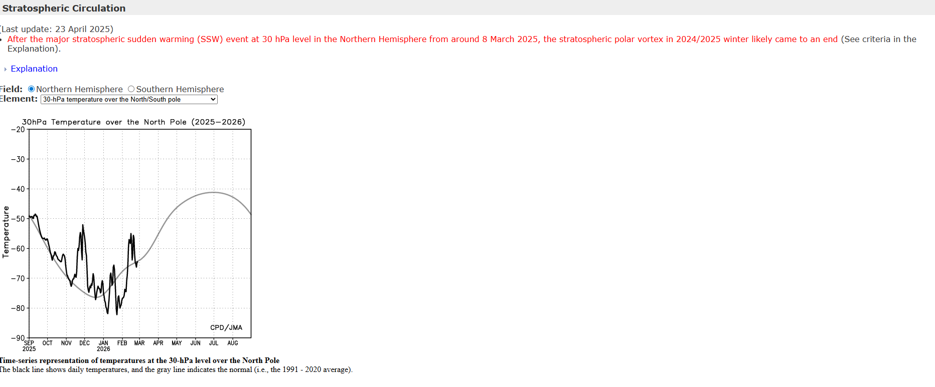
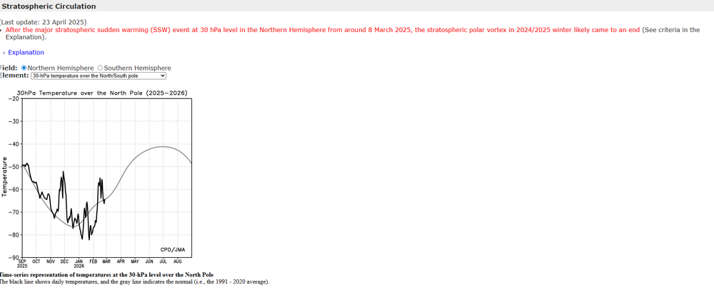
I guess it will finally 'split' coming up here, I feel a little too late anyway for any big fun but whatever Many have gotten solid snows this year. As far as a final warming it does not completely obliterate the SPV coming up here so technically it is still intact in some way. When you start to lose the idea of any cohesiveness of the SPV then it is considered done which does not look like it through at least mid March. Typically the final warming happens from the last week of March through 3rd week of April but as we know can happen before or after that timeframe. Sorry been on vacation starting to bring things back to normal for the work week coming up..thumb.gif.4c1f8572f825f53271d7787e2edf263e.gif)
-
The event I was referring to was the Tues/Wed storm, which looks good for snow. Beyond that VT could be flirting with mix precip and minor freeze thaw
-

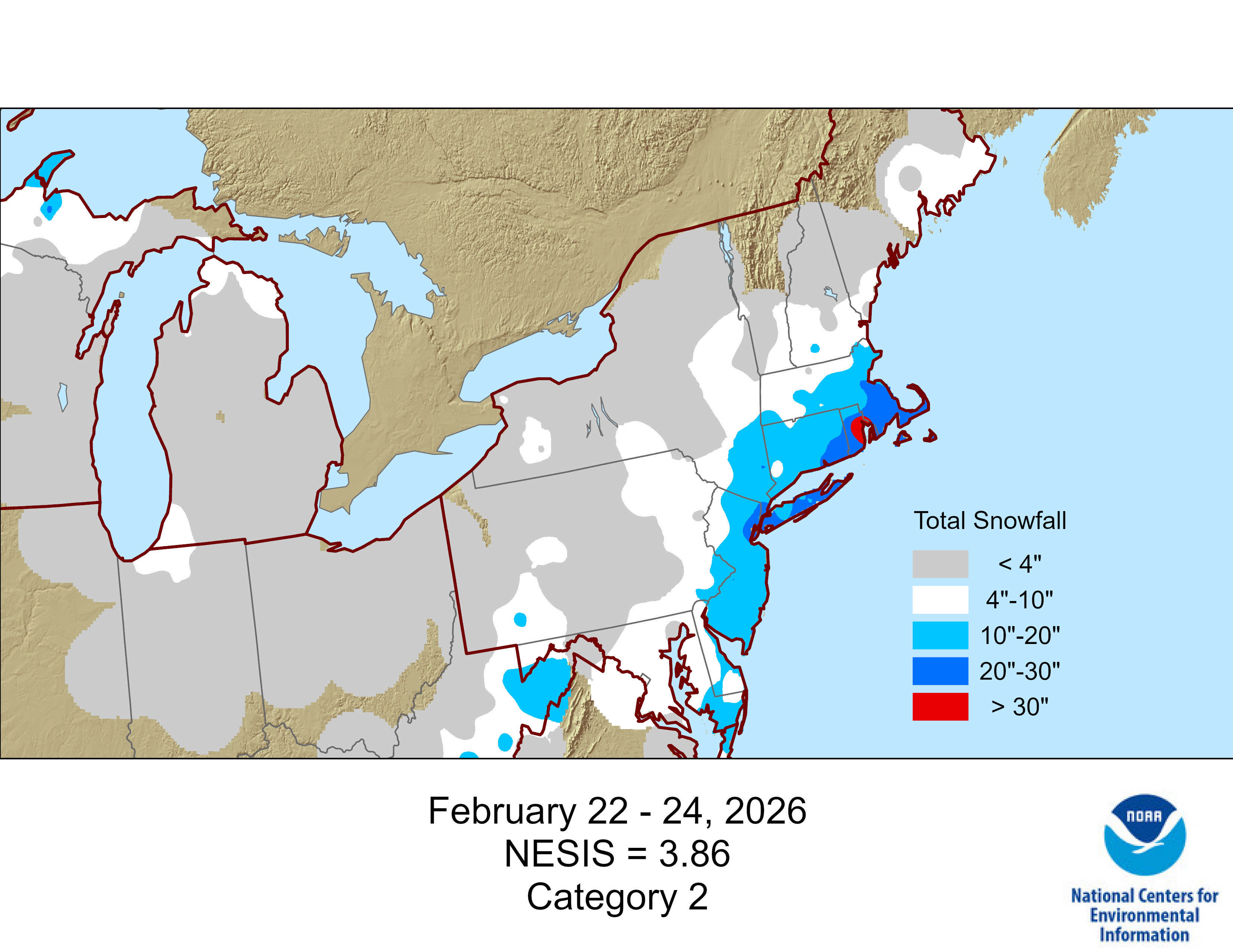
"Don’t do it" 2026 Blizzard obs, updates and pictures.
Baroclinic Zone replied to Ginx snewx's topic in New England
What a shitty representation of snowfall. -
Is this just some freak pattern like last year?The RONI since summer has been quite similar with a moderate NINA,both years it was basically a BN temp Jan.Last year we a had a Major SSWE March 8.,this year its around the same time,if its a Major Sure the wave lenghts are different,we had severe Mid March and a tornado outbreak the end of March The first pic of the tropical forcing is last year,2nd is what the CFS is showing today
.png.69eeea41e85d9196f7671770f6530f62.png)
.png.f797f4692b0f161ffd3137f9fb0e5c7a.png)
-
Hopefully MassWx doesn’t log on
-
Moosup?
-
Looks good for all
-
Take a peak at the east wareham coop? I haven't looked but that probably gives the answer for your hood.
-
-
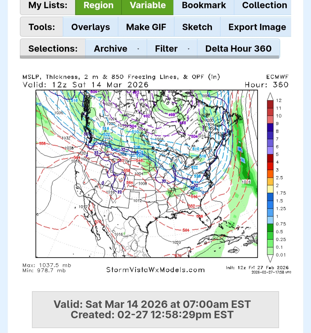
For the end of the week? Gonna be skiing far northern VT 5-7 and been concerned with a warm rainy surge.
-
Here it is

-
Defintely going to happen
-

"Don’t do it" 2026 Blizzard obs, updates and pictures.
MJO812 replied to Ginx snewx's topic in New England

-
I've noticed that of the two, the AI GFS tends to warmer overall synoptics than the AI Euro by smaller to mid options.
-
Its back
-
I agree. Curveball warmup (blunted by backdoor trash) before we squeeze out at least one more winter storm that gets pasty snow down to the coast.
-
Euro also showing the cold returning

-
Yeah I don't think there is even a chance until the 3rd week of March. There is a real possibility we don't make normal if March is very empty for snow.
-
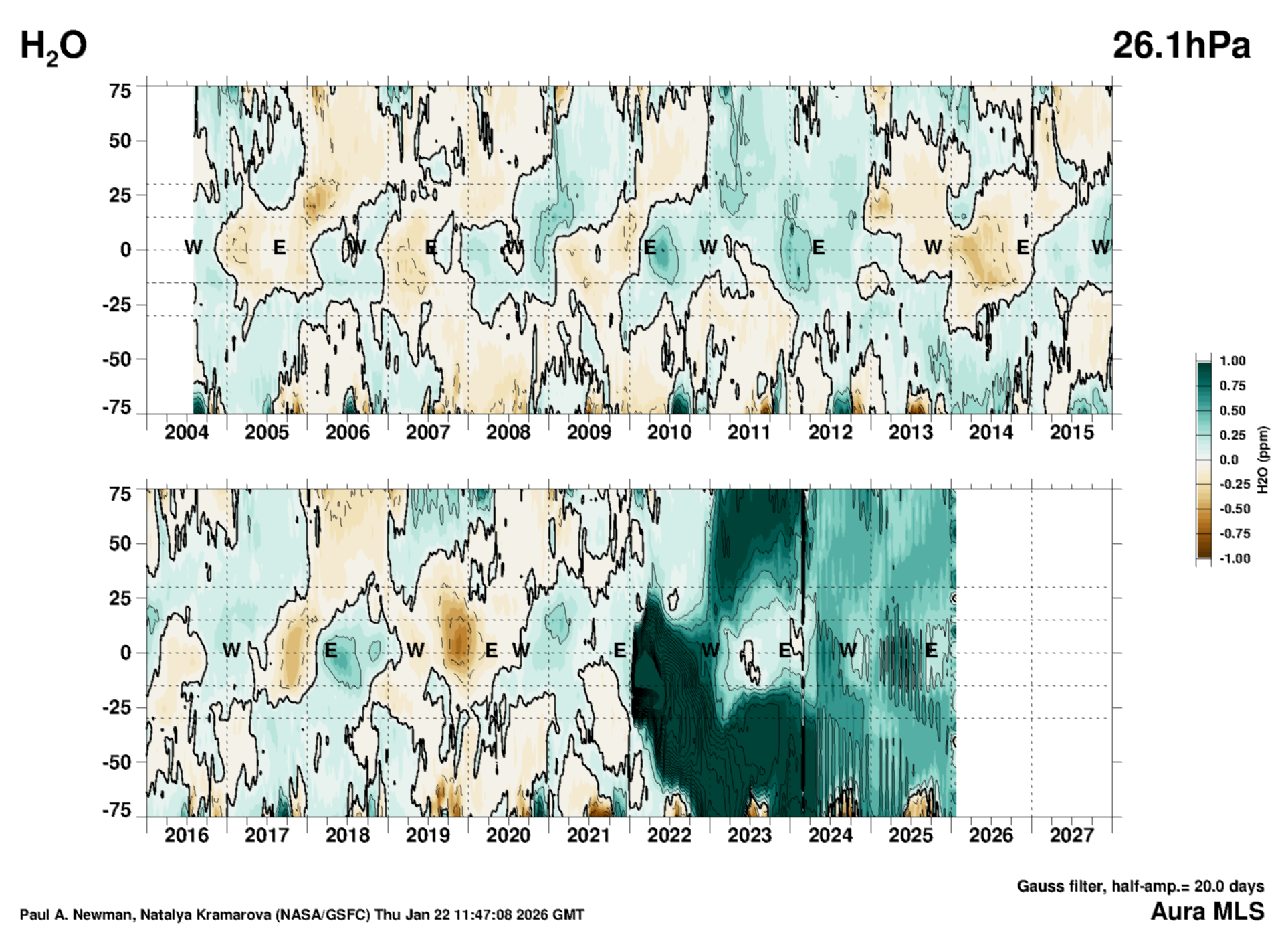
Just thought I'd put this up. Hunga Tonga's massive seawater injection has been hangin tough in the stratosphere. Latest looks like that may be coming to an end this year, tho. We'll see how it progresses.

-
Not saying it couldn't happen. More of a probably won't. Now higher elevations and more north of me, sure 20's are probable.
-

Pittsburgh/Western PA WINTER ‘25/‘26
RitualOfTheTrout replied to Burghblizz's topic in Upstate New York/Pennsylvania
Yeah. Im in that boat, Ill take nickel and dimers all winter, but now I want heavy snow or Ill pass. I mean I guess if we got 2 inches in one hour I could live with that. Lol -
I just looked, I wouldn’t be too excited. Looks great for VT, lol.
-
Pittsburgh/Western PA WINTER ‘25/‘26
RitualOfTheTrout replied to Burghblizz's topic in Upstate New York/Pennsylvania
Ill take it. Best time to torch is early march / april imho. That's basically 60s and 70s. Imagine that map in July... -
Now I’m hungry for some bacon
-
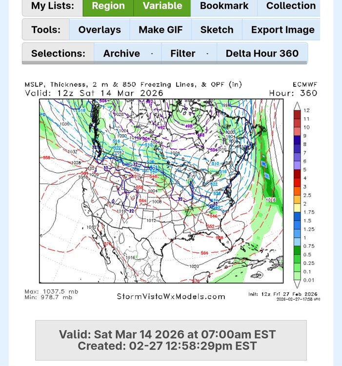
Heh ...that thing for the 4th turned ugly on this Euro. 24 hours ago that was a moderate fast moving snower. Now it's a 48/47 misty rhea sector under a CNE transit. Yuck Rather the fucker shoot up the St L and balm.
.gif.89b9480c8be4a0b413959f5f2ea61089.gif)