All Activity
- Past hour
-
Richmond Metro/Hampton Roads Area Discussion
jlewis1111 replied to RIC Airport's topic in Mid Atlantic
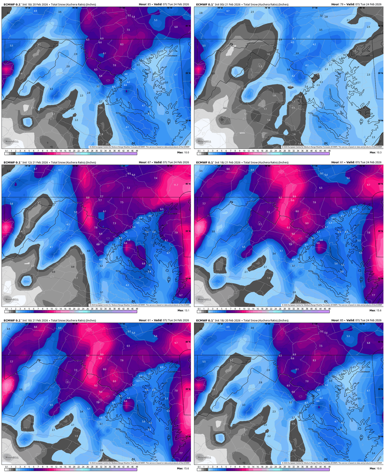
Wakefield better step it up for RIC every model giving us warning criteria -
This is it, nam going nail this big storm as it's last hoorah before being retired soon! It's going out like a wrecking ball!
-

“Cory’s in NYC! Let’s HECS!” Feb. 22-24 Disco
40/70 Benchmark replied to TheSnowman's topic in New England
I agree, but if I get 5", I'll break every single one of my kid's toys. -

“Cory’s in NYC! Let’s HECS!” Feb. 22-24 Disco
SouthCoastMA replied to TheSnowman's topic in New England
Aside from the coastal effects, I think Feb 78 was a dud here, snowfall wise. My family lived in West Medford at the time, so I'm sure they got crushed there. It's going to be wild for a time here..and I'm going to have to rely on the ESandwich Coop for snow totals. -
What’s up with the hyperbole today? We analyze model runs here…even the ones that aren’t the snowiest or the ones that tick SE. No one is saying the large scale features are changing. It’s just IMBY posts. But I do get a kick out of latching onto the roided out mesos yet when they nuke into NNE they get tossed for being over done. Never change weenies.
-
Yeah but it has no discernible impact on the short term forecast, contrary to what some may imply.
-
“Cory’s in NYC! Let’s HECS!” Feb. 22-24 Disco
Henry's Weather replied to TheSnowman's topic in New England
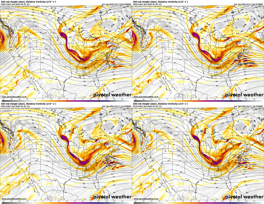
When QPF gets better, we will rarely post upper-levels… -
My thoughts are if you want to sound professional, know the difference between “what” and “why”.
-

2/22-23 "There's no way..." Storm Part 2
Stormchaserchuck1 replied to Maestrobjwa's topic in Mid Atlantic
It's actually a myth that Nina's favor the coastal areas. Randomness from not enough analogs. The La Nina main effect is a stronger North Pacific High, which is a slight SE ridge correlation in the cold season. The patterns aren't always uniform El nino or La nina either, there are many other factors that cause what happens. -
Just got one at Lowes 10 mins ago
-
That is what matters actually
-
steve d earlier said any subsidance would be in western jersey not in nyc
-
What are they going to do? Call the police? Driveways need to be clear.
-
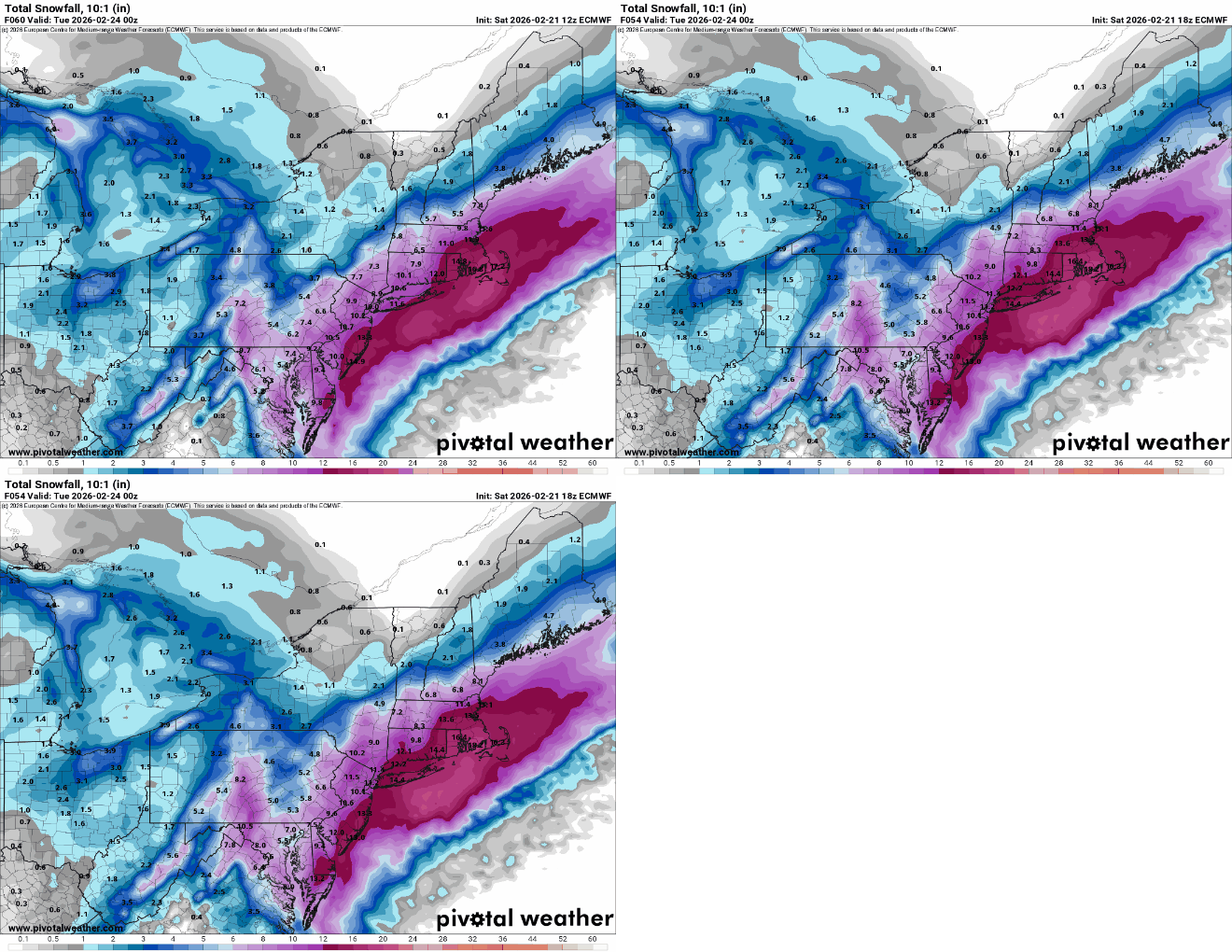
Good test for the AI with such a complicated and dynamic setup. It’s been west of the deterministic at times, but it was jumpy a few days ago. Seems to be locked in now. Still will miss the banding structures, but the orientation of the QPF is probably fairly good in a spatial sense. I’d lean more towards the hi-res tonight moving forward.
-
Screw that I'll run my commercial 2009 ariens track drive monster at midnight full bore if I have to lol
-
And yet...these "improvements" don't seem to be changing much for Balt/DC. Snow maps still end up looking the same while improving west.
-
It's the reason the storm is happening this way so it's completely relevant, imo
-
It'll be too late by then.
-
-
Looks amazing here
-

2/22-23 "There's no way..." Storm Part 2
Stormchaserchuck1 replied to Maestrobjwa's topic in Mid Atlantic
21z RAP has me getting 15-18" -
Could be going somewhere for snow, thunder snow, coastal flooding and wind... I would say montauk or Nassau County..
-
people say you should not wait til the storm ends to clean....but you can't operate a snow blower in most towns before 8 am....
-

