All Activity
- Past hour
-

January 30th- Feb 1st ULL and coastal storm obs
WestCentrlVA replied to JoshM's topic in Southeastern States
Good luck everyone. It's been snowing here since yesterday morning late. Roads didn't cave until sunset and the 40 minute drive home wasn't fun. Temp 15 with a Dp of 12 and 1.5 inches on the board. -

Jan 30th-February 1st 2026 Arctic Blast/ULL Snow OBS Thread.
bearman replied to John1122's topic in Tennessee Valley
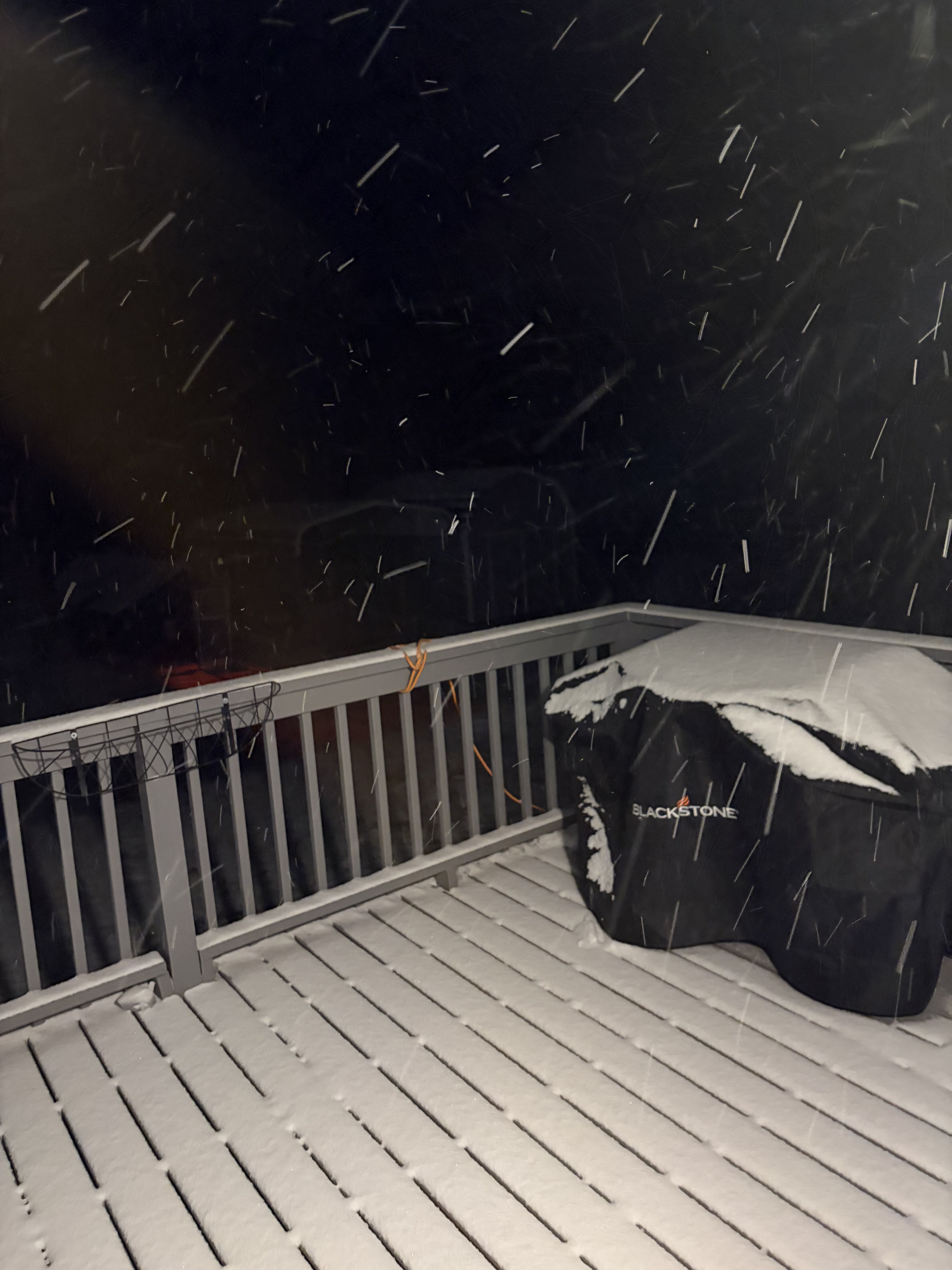
I think I have 4 inches here at my location in the Grass. I woke up at around 2 o'clock and it was snowing the hardest I have seen in terms of flake size, at least since I can remember. Now was it in terms of water content no, but the flakes were huge. If we get more during the day it will bring us over the 4-inch mark. -

Jan 30th-February 1st 2026 Arctic Blast/ULL Snow OBS Thread.
Stovepipe replied to John1122's topic in Tennessee Valley
It's a tiny flaked sand blaster at 15 degrees here and a healthy radar. I don't think my weather station is picking up on the wind speed or gusts. -

January 30th- Feb 1st ULL and coastal storm obs
Upstate Tiger replied to JoshM's topic in Southeastern States
25/22 West Lincoln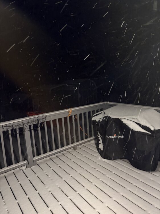
-
IM tracking flurries today, lol
-

Pittsburgh/Western PA WINTER ‘25/‘26
Burghblizz replied to Burghblizz's topic in Upstate New York/Pennsylvania
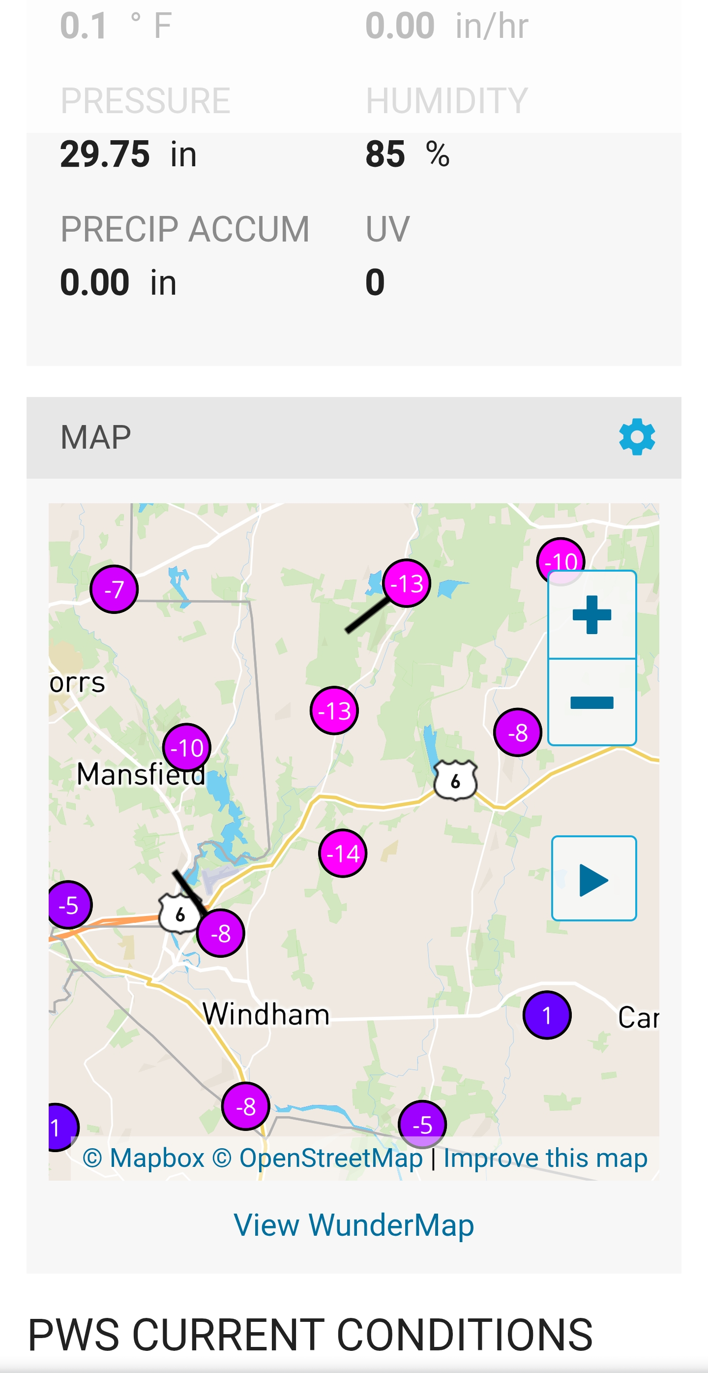
Currently -14 here. I was trying to explain to my wife that we were as close to freezing as a 78 degree day. She was not amused. -
.
-

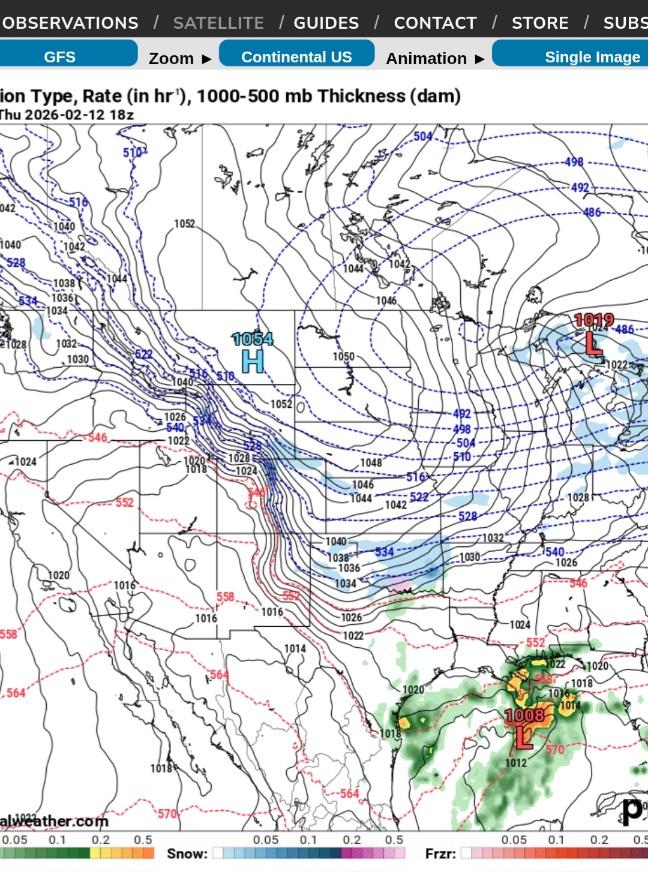
February 2026 Medium/ Long Range Discussion: Buckle Up!
GreyHat replied to Weather Will's topic in Mid Atlantic
If the long range GFS was to be correct, it also shows HP 1054 coming down from Canada. That of course would push that system in the gulf OTS.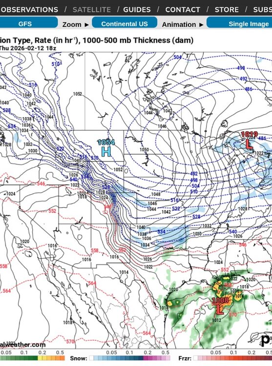
-

Arctic Hounds Unleashed: Long Duration Late January Cold Snap
Ginx snewx replied to WxWatcher007's topic in New England
Difference is 13 degrees now. As the sun rises over the hills there is a rush of wind as it all mixes out. Very cool phenomena -
HRRR agrees with RAP, here's the latest...

-

January 30th- Feb 1st ULL and coastal storm obs
AppalachianWedge replied to JoshM's topic in Southeastern States
Does not seem the column needed very much to saturate to have snow hit the ground. Dewpoints have been high and RH was 75% last night in Advance. Air not anywhere as dry as it was for last week's storm . Sent from my Pixel 10 Pro XL using Tapatalk -
Arctic Hounds Unleashed: Long Duration Late January Cold Snap
Ginx snewx replied to WxWatcher007's topic in New England
-

Arctic Hounds Unleashed: Long Duration Late January Cold Snap
HoarfrostHubb replied to WxWatcher007's topic in New England
-14 in Barre MA -

January 30th- Feb 1st ULL and coastal storm obs
WXNewton replied to JoshM's topic in Southeastern States
22.8/21- Started snowing at 3 o'clock working on a little over an inch at this point. -
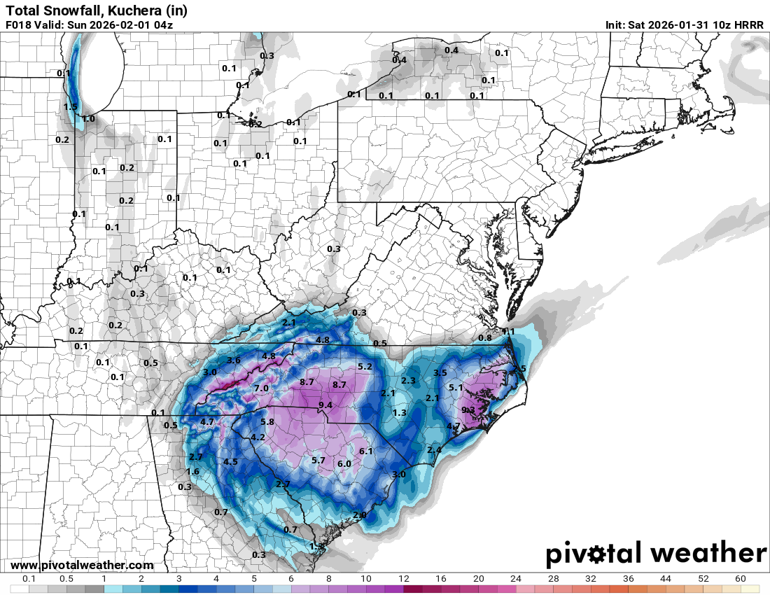
`Solid 8" on the new RAP
-

Arctic Hounds Unleashed: Long Duration Late January Cold Snap
Modfan2 replied to WxWatcher007's topic in New England
Valley cold. Wednesday it was -9F In Killingly, once I got into RI on RT 6 it was 6F -

Arctic Hounds Unleashed: Long Duration Late January Cold Snap
tavwtby replied to WxWatcher007's topic in New England
damn that's crazy -
Arctic Hounds Unleashed: Long Duration Late January Cold Snap
HoarfrostHubb replied to WxWatcher007's topic in New England
-3. Meh again -
Arctic Hounds Unleashed: Long Duration Late January Cold Snap
Ginx snewx replied to WxWatcher007's topic in New England
I am at -2 and literally down my hill 3/4 mile two PWS at-11 -

Arctic Hounds Unleashed: Long Duration Late January Cold Snap
cut replied to WxWatcher007's topic in New England
-1 in Trumbull. -

The “I bring the mojo” Jan 30-Feb 1 potential winter storm
DTP replied to lilj4425's topic in Southeastern States
Given the setup, I don't think this is out of the realm of possibility....banding with theta-e advection is no joke- especially given how deep the cold pool is under the ULL Think of it (in terms of physics) like turning a moisture filled (semi-) linear tube into a funnel from upper levels to lower, then forcing all of the moisture out of the full funnel rapidly via mechanical means...you don't get a setup like this very often in these parts....negative tilt amplifies this effect substantially -
The “I bring the mojo” Jan 30-Feb 1 potential winter storm
Aleksey replied to lilj4425's topic in Southeastern States
I hope so too. I’m getting a little nervous considering the start time has moved back like 3-4 hours and by that point we’d only be looking at 3-4 hours total of snow. Heavier rates could be more widespread due to temps, but this could easily end up being on the lower end with 1-2” out to Athens. Still remaining positive though . -
Arctic Hounds Unleashed: Long Duration Late January Cold Snap
tavwtby replied to WxWatcher007's topic in New England
i figured last night was going to plummet, instead it pretty much flat lined after about 9 or so -

Jan 30th-February 1st 2026 Arctic Blast/ULL Snow OBS Thread.
WintryMixmaster replied to John1122's topic in Tennessee Valley
I wish I lived in the northern part of the county lol, I have around 3 inches on the grass and 2-3 on other surfaces. It looks like most of the accumulation happened before around 4:30 AM, we've had significantly lighter rates after that. HRRR does show another pulse of more moderate snow hitting us later this morning, which may be needed if the total is going to hit 4" in my backyard -

Digital Snow/Ice Thread 2025-2026
WinstonSalemArlington replied to WinstonSalemArlington's topic in Southeastern States
February 13