All Activity
- Past hour
-
 http://zithindia.com/# where to buy zithromax in canada
 - Today
-
The HAFS suites like closing this off and bring a tropical storm into East Texas. As is typical with NGOM genesis, placement and timing remain critical. How fast can a tight vorticity develop? A small system like this has an intertwined advantage and several disadvantages. The main disadvantage is time. We're only looking at a small window of 24-36 hours here. The other is the environmental factor with marginal relative humidity over the adjacent landmass at present combined with dry airmass in the mid-levels countering any rapidly forming convective envelope. This could delay organization by landfall. In most cases, a small system should struggle as mid-level steering flow will mix in that airmass. But small systems can develop faster if the environmental factor is limited. Being so small is also an advantage if rapid development of intense mesoscale convection does occur and can persist. The immediate envelope moistens and persistent convection results in the formation of a small vortex under negligible shear. A large circulation would still be susceptible to pulling in the dry air. Negligible shear prevents dry mid-level airmass from advecting into a small vortex against the mid-level steering flow. SSTs are very high, so this system could outperform the TC models and SHIPs parameters if organization gets going today. Regardless, I do like this getting named by landfall, and I'm going to be a bit bullish with this one. I like a better than a weak TS (40-50 kts) and perhaps even a moderate to strong TS (50-60 kts) by landfall. Too bullish? Yes, it's a tiny system. But I think convection will blossom today and shield off any dry air entrainment. I'll favor any small system over high SSTs and negligible shear with at least marginal supporting environmental factors to outperform versus a broad system when time is the biggest factor. Fortunately, time should limit anything stronger.
-
.thumb.jpg.6a4895b2a43f87359e4e7d04a6fa0d14.jpg)
Central PA Summer 2026 Discussion/Obs Thread
Yardstickgozinya replied to Voyager's topic in Upstate New York/Pennsylvania
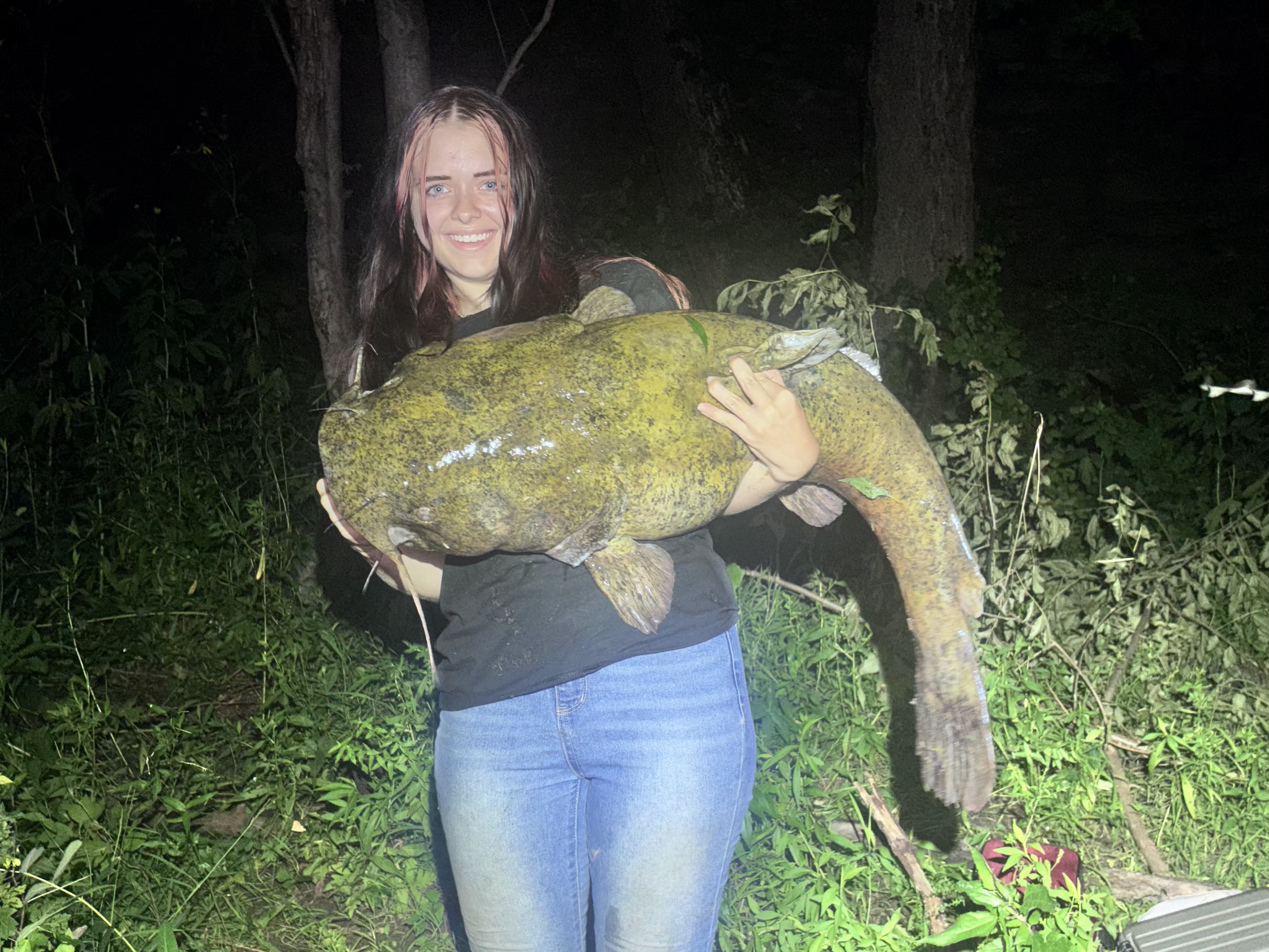
I just got home from quite another adventurous trip down to Colombia area. It's night's like this that truly make me feel alive. I sat on the river bank down there, listening to thunder and watching lightning with my son's girlfriend for hours before I decided we needed to wrap it up. Unfortunately, I waited a little too long for the comfort of my son's girlfriend, but once she felt safe all she could talk about was her catfish. That said, I hope everything's alright for the areas that have been sitting under these Storms. I've had four of my last five catfishing trips in Lancaster, cut short by thunderstorms.
-
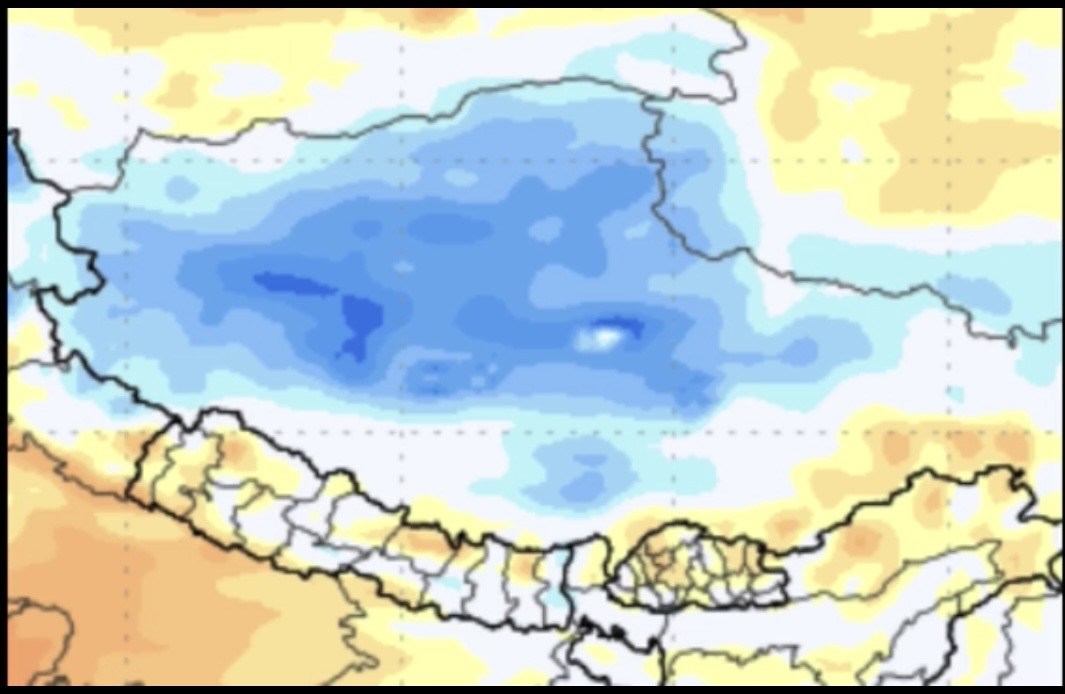
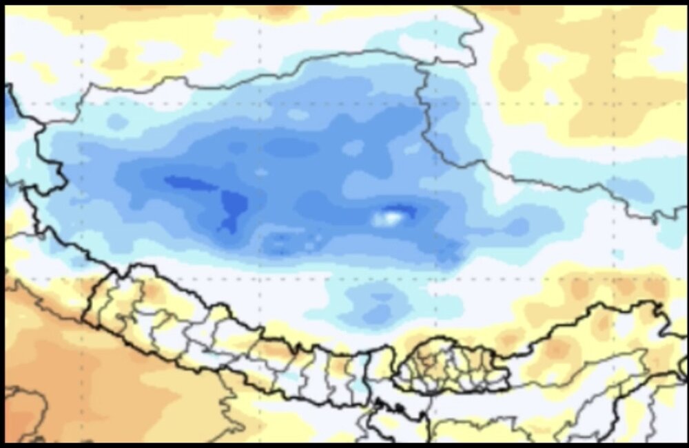
I just watched Joe Bastardi’s free to the public Saturday Summary. He says the Nepal disaster has nothing to do with CC. Why? -He says that there has been no net change in temperature in Nepal in 400 years! -He shows a summer temp. anomaly map that has blue colors all over Tibet including the Tibet-Nepal border. So, I’d like to know whether or not these two things are true. Anyone know? @donsutherland1
-
http://iverindia.com/# ivermectin 12 mg
-
The 0Z UKMET (as an TD) and CMC still have this recurving TC.
-
0Z: UKMET and CMC both dropped the return of Dolly.
-
generic clomid pill: Clo India Pharmacy or clomid without insurance
-
can you buy zithromax online: Zith India : buy zithromax 1000 mg online
-
81 today
-
E PA/NJ/DE Summer 2026 Obs/Discussion
SouthernNJ replied to PhiEaglesfan712's topic in Philadelphia Region
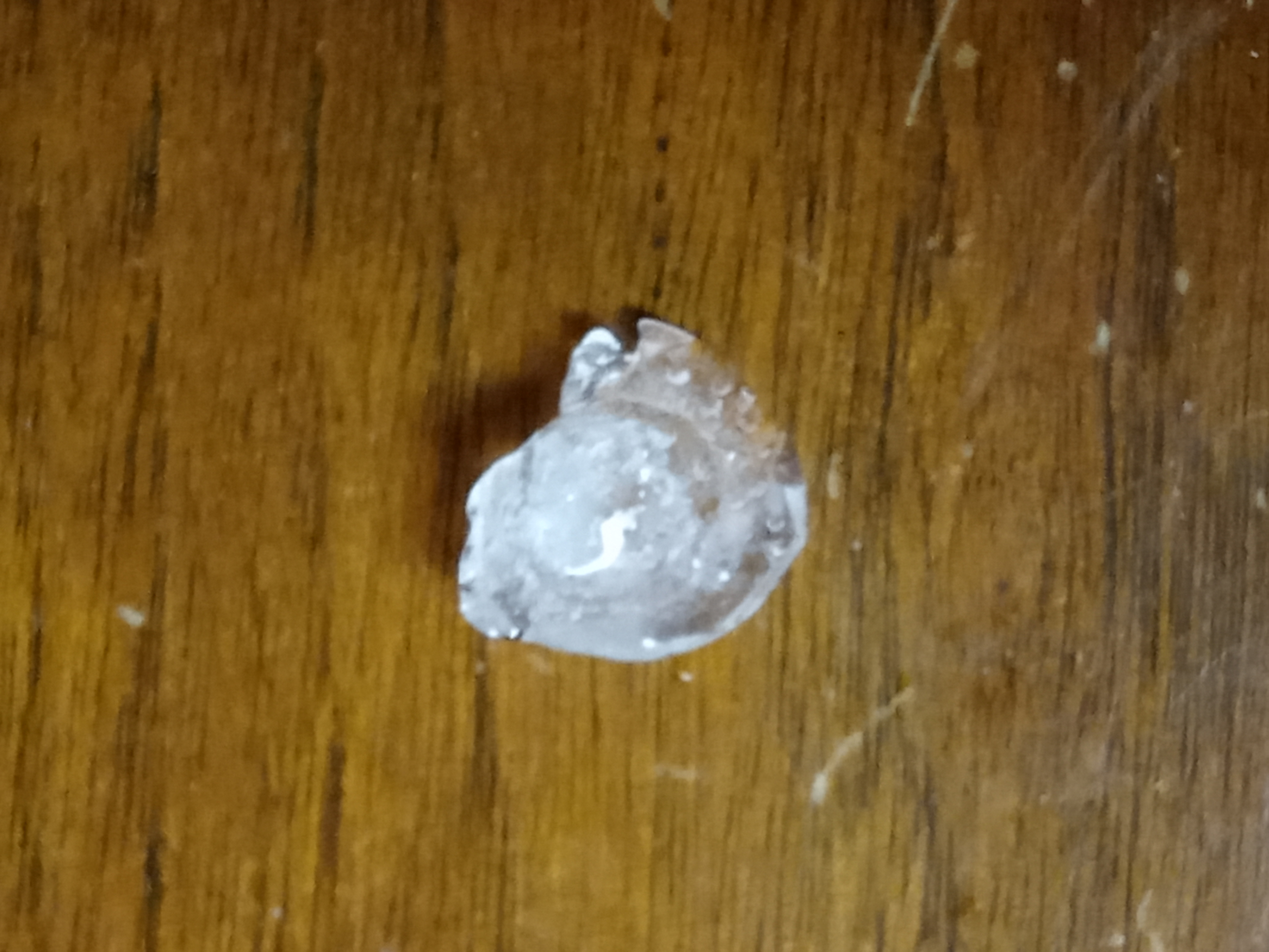
According to the Mount Holly PNS, members of the public reported 6.29 inches of rain in town and 6.41 inches just to the south in adjacent Woolwich township from the series of thunderstorms during August 27th. Those numbers were easily the most from the day on the list, which is not a common occurrence here. Most of that rain fell during a 3-hour timeframe between 12 and 3 PM. The first thunderstorm, which took on some supercell characteristics, produced wind damage with trees and wires reported down near Oldmans Creek on Kings Highway close to the Gloucester/Salem county border. The road access was blocked when going down there to look things over. Additionally, somebody in town saved a hailstone from the first storm as it passed overhead, knowing that I am interested in severe weather. It is just under dime-size in diameter.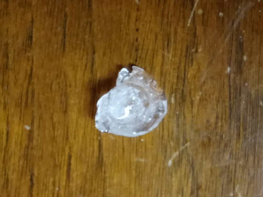
-
http://cloindia.shop/# how to buy cheap clomid price
-

E PA/NJ/DE Summer 2026 Obs/Discussion
JTA66 replied to PhiEaglesfan712's topic in Philadelphia Region
Just had a nasty little cell blow through. Now up to 0.95” for the day. They said there was a chance of showers today, but I wasn’t expecting heavy rain like this. -
buy stromectol uk and ivermectin otc stromectol liquid https://toolbarqueries.google.dj/url?q=https://iverindia.shop ivermectin lotionor https://kamayegaindia.com/user/ifpmgifnja/?um_action=edit stromectol over the counter [url=https://clients1.google.com.py/url?q=https://iverindia.shop::]buy ivermectin pills[/url] ivermectin 4000 mcgor [url=https://act2day.eu/profile/whezmhgqia/]stromectol 3mg[/url] buy stromectol uk
-

super el nino banter thread
Prismshine Productions replied to forkyfork's topic in Weather Forecasting and Discussion
I legitimately went with a +2.5-+4.0 winter w/50-75% seasonal snowfall up here in Vermont, I knew it was going to be bad Sent from my SM-S176V using Tapatalk -
E PA/NJ/DE Summer 2026 Obs/Discussion
KamuSnow replied to PhiEaglesfan712's topic in Philadelphia Region
We've received 0.75" of rain in the last 30 minutes or so. Thunder and lightning earlier from it, but just some heavy rain now. Cooled things off a bit too, from 76 to 72°F. Nice. -

Augdewst 2026: Summer's Last Stand
dendrite replied to Prismshine Productions's topic in New England
3 drops here after he tried to flood us and Stein himself the other day. -

Invest 97L--70% Development Odds
WxWatcher007 replied to WxWatcher007's topic in Tropical Headquarters
Yeah, that’s all true. It makes sense to wait until there’s either another overnight cycle of observations or for recon to confirm. The PTC designation was designed for these scenarios and raising the proverbial alarm tomorrow isn’t a bad call if the ceiling continues to be limited. -
The sensible wx impacts from a strong tropical wave can be just like minimal tropical storm. That's the challenge faced by NHC and other wx services at times b/c the public mostly cares about/sees the impacts, not scientific definitions. But we can't just arbitrarily call something this or that b/c it has wx that appears mimic something else! A typical baroclinic cold core low pressure over the open ocean, many easily have winds of a Cat 1-2 hurricane, and pressures below 920 mb in extreme cases, and overall power as much as a Cat 5, just the wind energy is spread out over a much larger area
-

Augdewst 2026: Summer's Last Stand
HIPPYVALLEY replied to Prismshine Productions's topic in New England
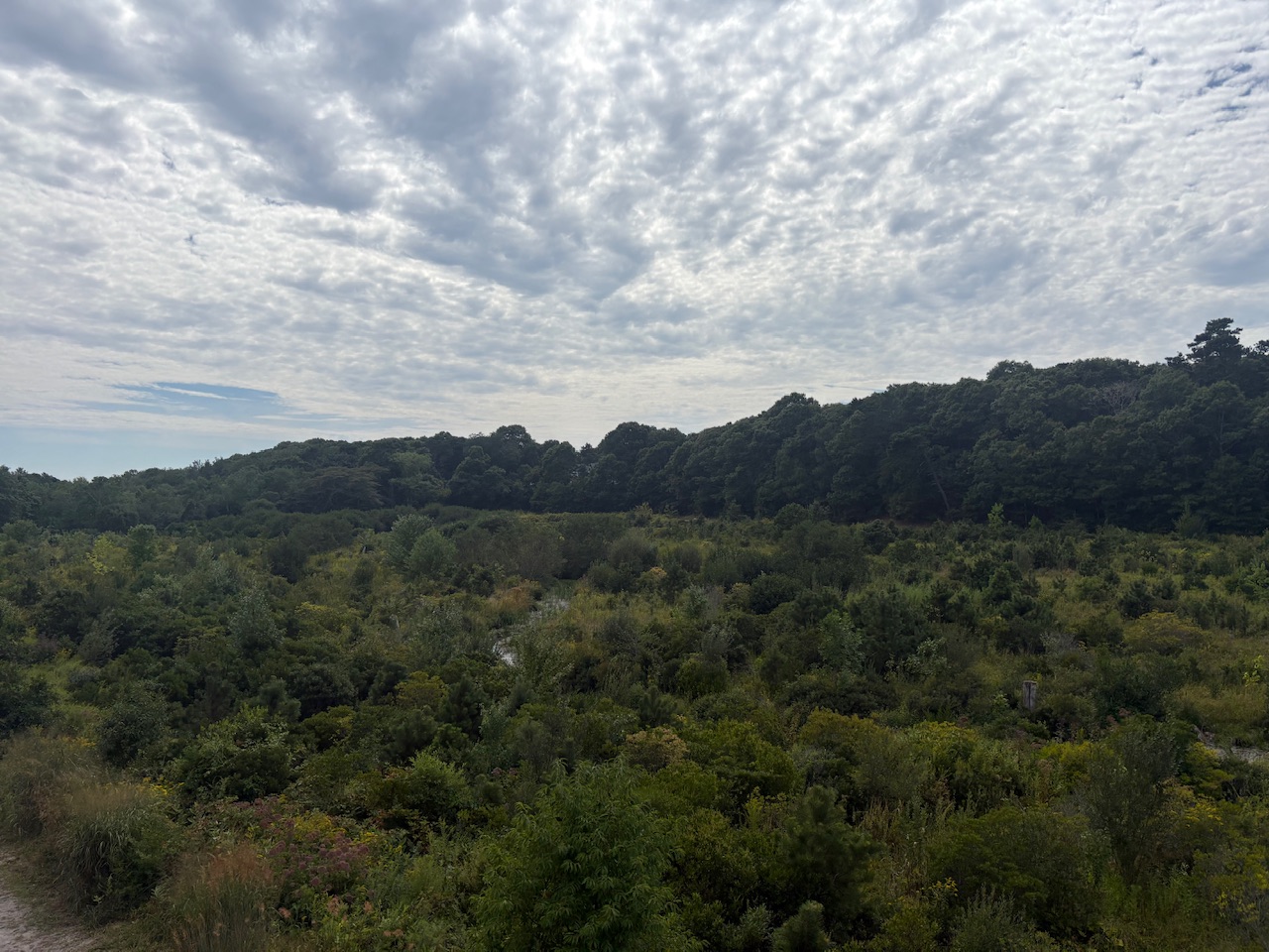
I need to find a way to spend the month of September in Falmouth. Traditionally warm water and nice weather on Buzzards Bay. (I grew up here) Photo of a nature reclaimed cranberry bog in East Falmouth: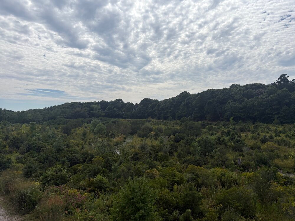
-
Great point you bring up there. Wouldn't hate some LES hits and possible svr chances (depending on how warm the warmth surges are) this winter
-
The convection is still strongly pulsing, and NHC likes to wait to see more persistent and coherent convection or decent circular banding before declaring a TC, which is a good mode IMHO. Quickly waxing/waning convection is a sign of dry air or shear, and pulsing the convection results in cool outflow boundaries that interfere w/ the organization of the LLCC. It is also a very small system, and small systems are more susceptible to environmental factors. In this case, lots of dry air just to the N that can get entrained easily. Looking at the 00z SHIPS output for 97L here, you can see the 700-500 RH is quite low. (below 50%). https://hurricanes.ral.ucar.edu/realtime/plots/northatlantic/2026/al972026/stext/26083100AL9726_ships.txt
-

Augdewst 2026: Summer's Last Stand
CoastalWx replied to Prismshine Productions's topic in New England
Hopefully it’s a miller b east winter and leaves Kevin on west like the Mongolian Desert. -
Augdewst 2026: Summer's Last Stand
WxWatcher007 replied to Prismshine Productions's topic in New England
Pouring here (back in CT) -
Augdewst 2026: Summer's Last Stand
CoastalWx replied to Prismshine Productions's topic in New England
Another half inch for Kev. Go eff yourself.