All Activity
- Past hour
-
Weatherwilly???
-
My hope is that this becomes a Feb 10, 2010 type of a pivot, but from hobbyist experience I will say this is definitely a setup in which you want to temper celebrations until it’s actually snowing. Miller Bs are a mortal enemy for central md. We’re generally not good at them.
-
Weather willy…you don’t say…
-
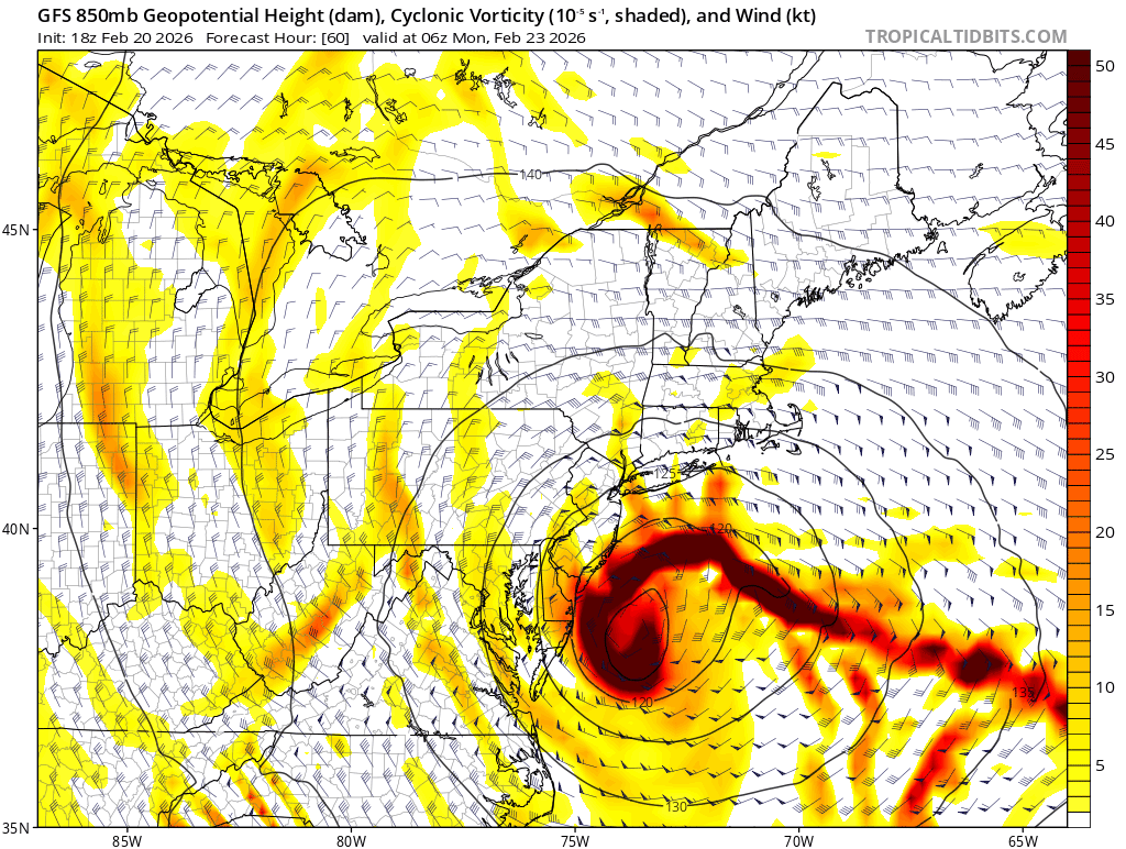
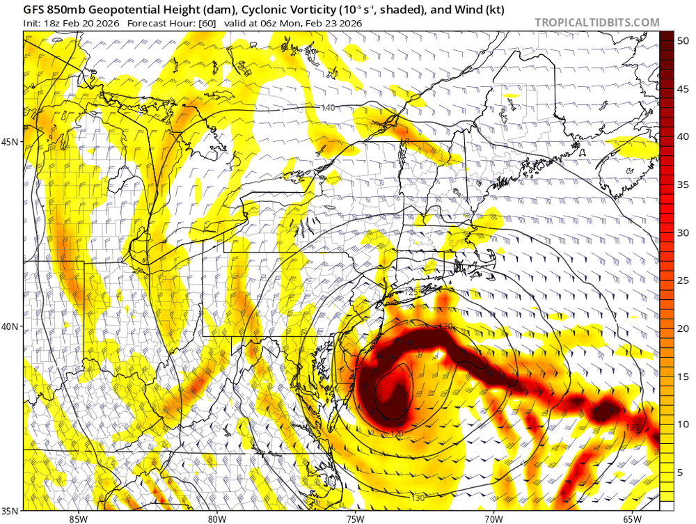
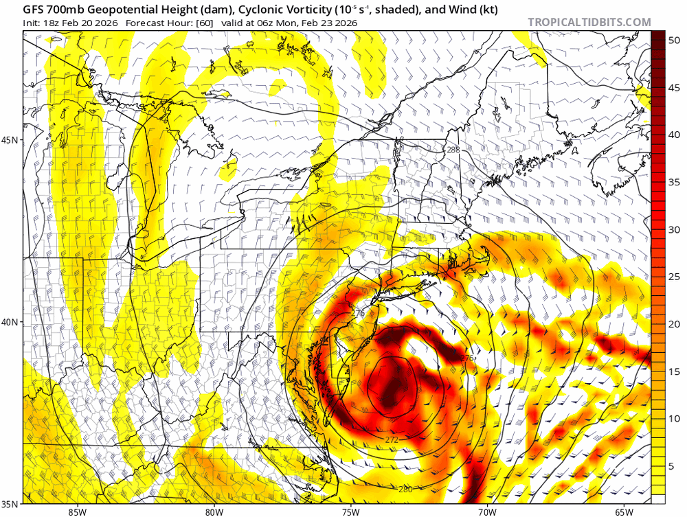
If the 700/850 low tracks over you sure. Again too soon to know where the best banding sets up but that’s what I’m really watching. That and how soon they close off. When you see the closed 700/500mb lows and deepening low not occluded yet you have a great feed of moisture into a healthy CCB.
-
southern stream slower at hour 15
-
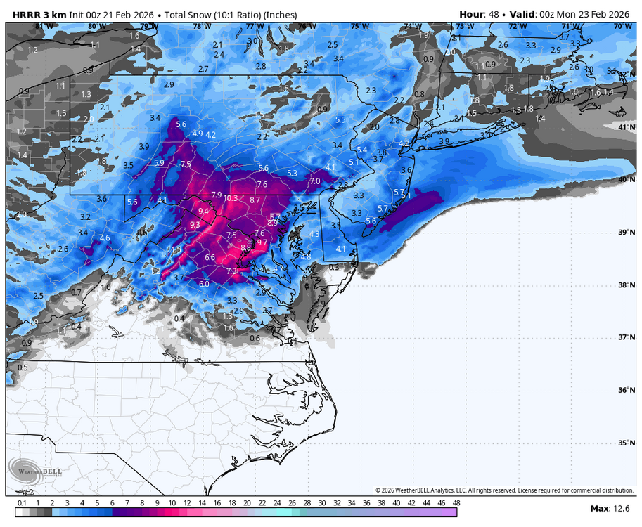
Hrrr is my new favorite model
-

Central PA Winter 25/26 Discussion and Obs
GrandmasterB replied to MAG5035's topic in Upstate New York/Pennsylvania
Still quite a bit of west leaning lows. Love it! -
Do you Think start as rain with a quick change over is possible?
-
That's good info to know, thank you for explaining the math. My engineer brain can sleep now.
-

2/22-23 "There's no way..." Storm Part 2
winter_warlock replied to Maestrobjwa's topic in Mid Atlantic
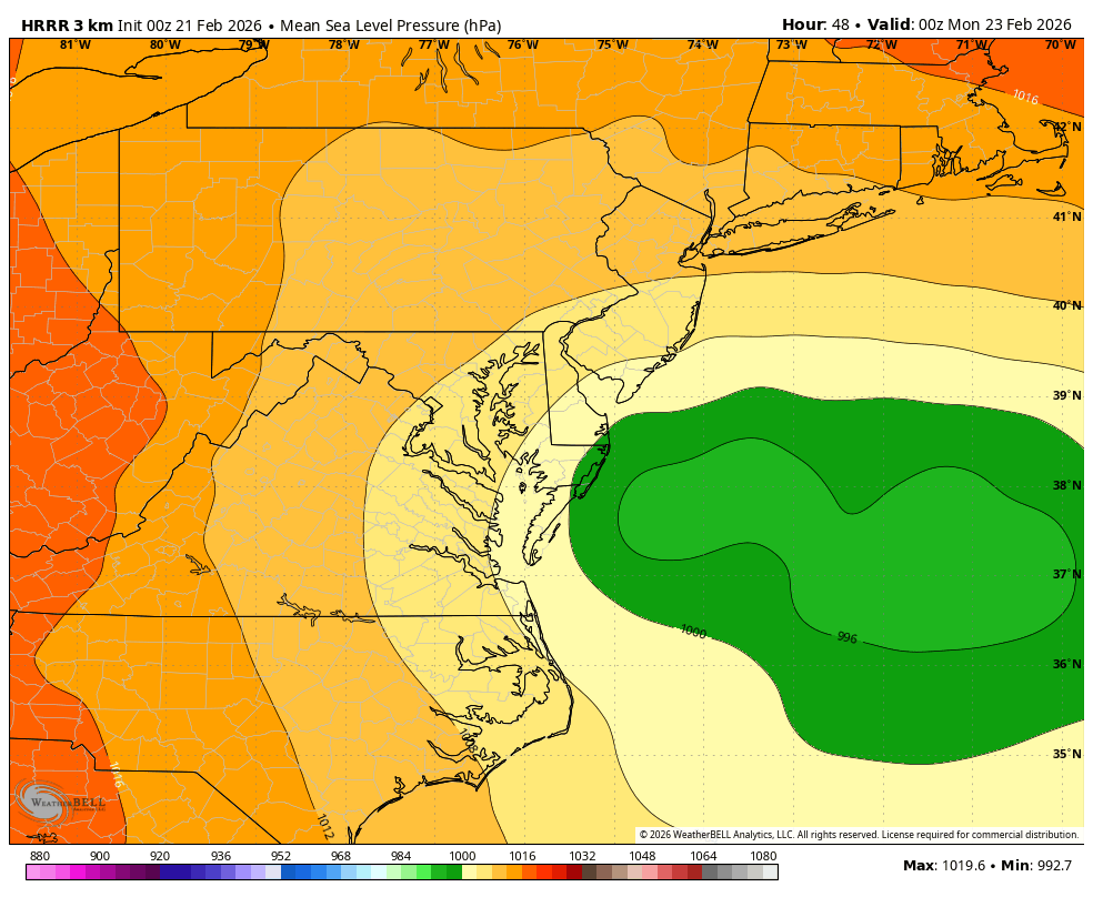
That's only thru hr 48. Probably 12 more hours to go !! -
Boxing Day jackpotted west of NYC since it tracked right across Cape Cod. https://www.weather.gov/okx/Meteorology12262010
-

“Cory’s in NYC! Let’s HECS!” Feb. 22-24 Disco
Damage In Tolland replied to TheSnowman's topic in New England
I’ve seen hundreds of maps already . I’d say this is the best depiction I’ve seen that matches my thinking. I do think there will be 24+. But that has to wait until tomorrow to nail down areas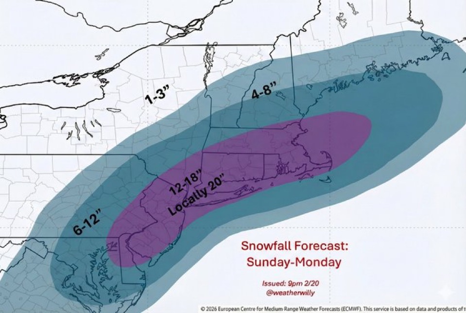
-
Same here but then again everything today has surpassed my expectations.
-
Mixing wont be an issue imo
-
That’s all before the real show even starts lol.
-
You want the mod-level lows to travel through this slot like the gfs shows

-
I think as long as the 500/700/850 lows are all closed off and go SE of us we’re fine in terms of mixing being an issue. If we start seeing those trend to tracking over us we have a problem.
-

2/22-23 "There's no way..." Storm Part 2
Weather Will replied to Maestrobjwa's topic in Mid Atlantic
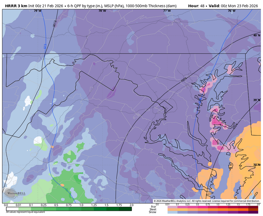
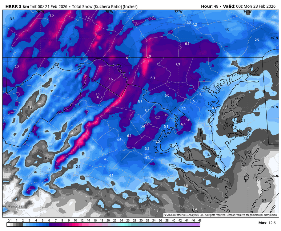
WB 0Z HRRR 7pm Sunday and more to go. We are bring HRRR'D!!!!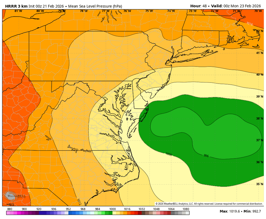
-
The "Point" map is the official NWS snowfall forecast in inches during the time period shown on the graphic. This snowfall amount is determined by NWS forecasters to be the most likely outcome based on evaluation of data from computer models, satellite, radar, and other observations. The "Range" map is the 25th percentile (lower number) to 75th percentile (higher number) of possible snowfall amounts based on the Weather Prediction Center (WPC) Super Ensemble output during the time period of the graphic. The official NWS snowfall forecast influences this range of values either up or down depending upon how closely they match.
-
Already digging the 250mb jet more into Arizona.
-
Nam a bit more amped plus less confluence out ahead...
-
HRRR btw \ also @NVAwx that's only for my backyard, and it's pretty conservative. Please look at soundings, surface temps, and upper air temps and make your own assesment
-
Boy, they're really narrowing it down on these totals, aren't they.
-
oh yeah Miller As dry slots suck
-

February 22-23 Storm Thread/OBS
MickeyTim6533 replied to Mikeymac5306's topic in Philadelphia Region
nam an incoming bomb