All Activity
- Past hour
-
Do not need. Keep that core away.
-
Cooling off nicely on that sea breeze. 72F. Probably kill off any storms that try to get close.
-
That was very fast, like poof.
-
Just North of Worcester looks good.
-
70dbz
-
That was a big reversal from Mount Holly, from Mostly sunny skies on Saturday after morning clouds to mostly cloudy all day. Saturday saturday A chance of showers, with thunderstorms also possible after 2pm. Mostly cloudy, with a high near 80. Calm wind becoming southwest around 5 mph in the afternoon. Chance of precipitation is 50%. New rainfall amounts of less than a tenth of an inch, except higher amounts possible in thunderstorms.
-
1.5 since 3:30
-
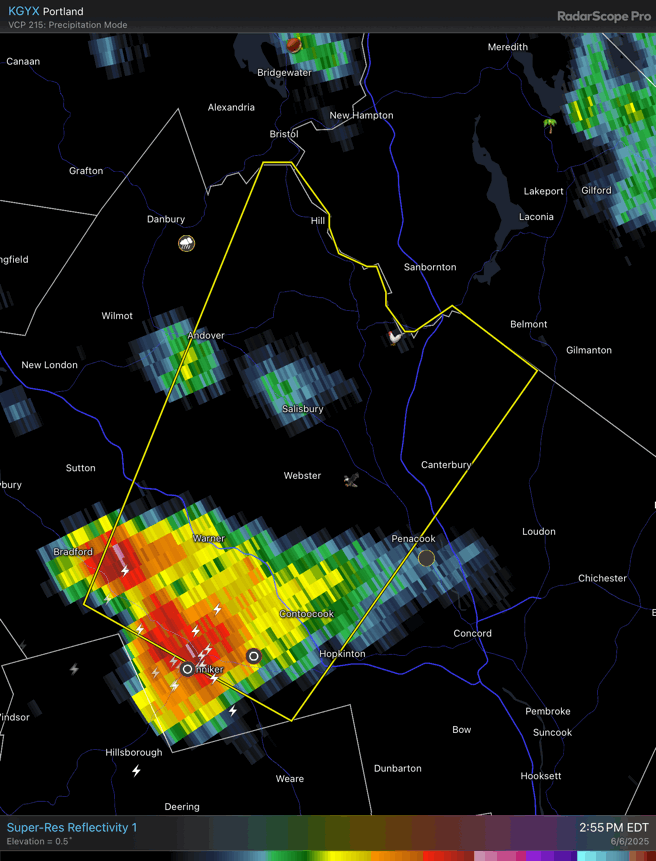
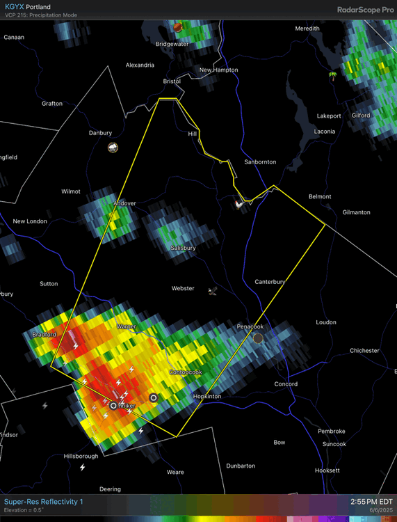
Effing Hennicker and Warner.
-
Crapped out
-
.31 with that batch
-
Tip with second severe storm of day . Unreal
-
Looks like one went right over my house. 1.3" in 1/2 hour https://www.wunderground.com/dashboard/pws/KVTNORWI10
-
Two days in a row with severe thunderstorm trains that missed me by a couple miles.
-
We river on our road
-
NH FTW today
-
This rain is nuts!!!
-
Shocking…
-
Considering headed south towards Amherst and see if that southwest stuff spikes but have to act quickly
-
.
-

2025-2026 ENSO
40/70 Benchmark replied to 40/70 Benchmark's topic in Weather Forecasting and Discussion
Yea, I think that is applicable more for your area through the LES belts and into NNE....but I do agree with Chris that CC maybe starting to infringe on SNE snowfall climo....at least a portion of SNE, anyway. That said, we are simply in a hostile pattern for SNE that is les so for your area over to NNE. -
Intense storm developed right overhead. In last 25 minutes picked up 1.01” of rain. Temperature down to 69F. .
-
Let’s get them some more with that next cell split going north. Hail on hail.
-
Only 0.02" in the stratus since last night here. Have managed to dodge literally everything.
-
Not bad at all
-
Take some pictures of clouds if you're in an open area. Please.